YPRES SALIENT - Bayernwald Trenches - Wijtschate

  • by Pierre Grande Guerre
  • 20 Mar, 2019

SPECIAL Photo Impression - Years of visit: 2005, 2016

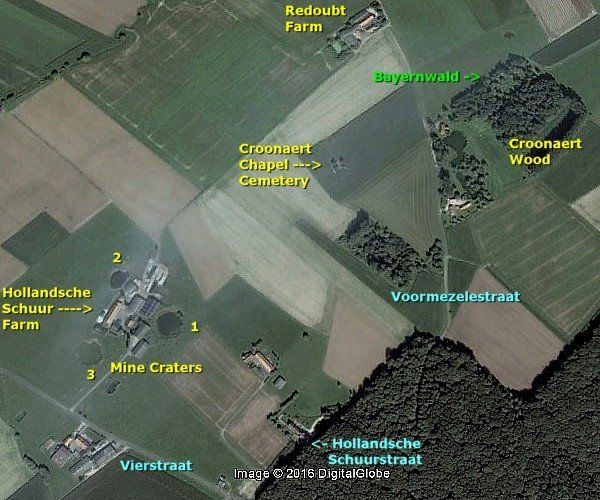
We are north of Wijtschate and east of the hamlet of Vierstraat, along a side road of the Vierstraat-road, the Voormezelestraat, on the edge of Croonaert-Wood.
If you are not familiar with the back ground of the Ypres Salient, start with the Ypres Salient part 1 .
The origins of the name Bayernwald
“Kronprinz”, Rupprecht von Bayern, chief in command of the 6th Bayern Army, conquered this low hill (40m) after fierce fighting in November 1914. He gave the hill it’s name “Bayernwald”. From then on the Germans constructed a stronghold on this hill.
Amongst his Bayern troops there was fighting a soldier, who would later be rather infamous. This soldier of the “Kronprinz” was “Meldeganger”, messenger, Adolf H. Adolf H. had already earned his Iron Cross Second Class at Geluveld a few weeks before. 
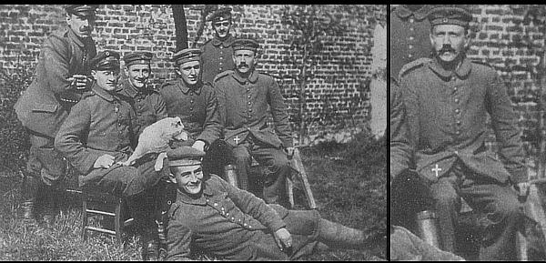
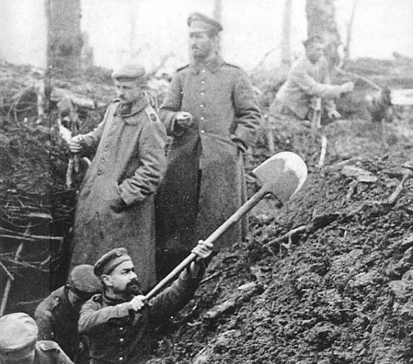
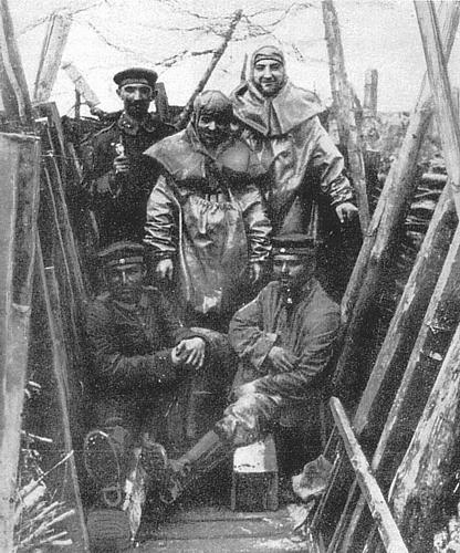
The British troops were only some 750 yards away from here. From 1915 until 1917, day and night, there were constantly fights going on in this sector. Night patrols and, during the day, artillery bombardments and machine gunfire, man to man fighting in underground tunnels, and ofcourse on the surface of the ground.
During the Battle of Messines Ridge, on June 15, 1917, the British forced the Germans to leave this position. So, the Germans occupied this sector from November 1914 until the summer of 1917.
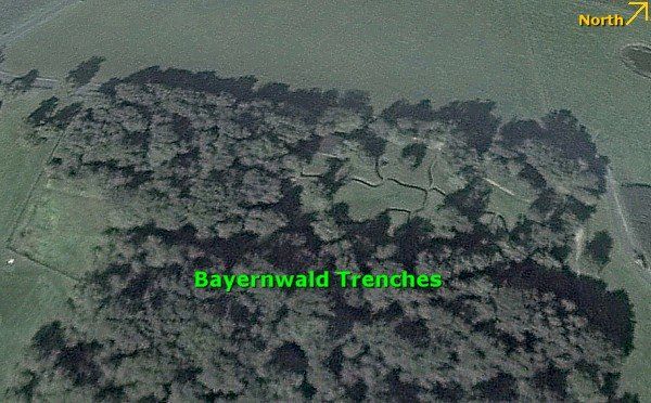
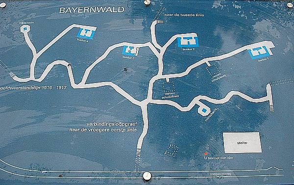
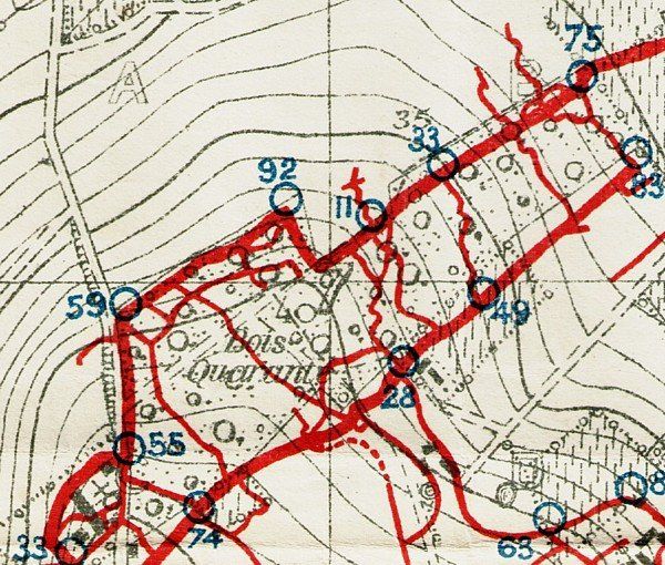
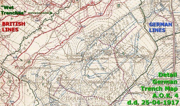
Map of the Bayernwald Trenches

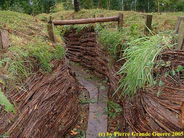
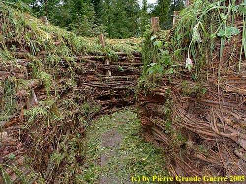
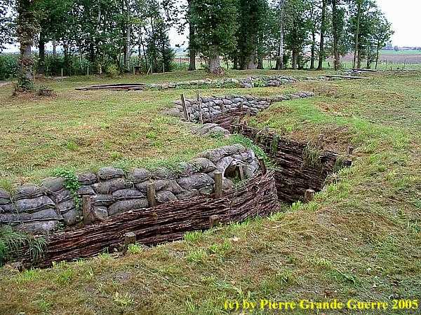
This terrain is a carefully made reconstruction of German trenches of the first line. The reconstruction followed the excavations of the exact situation of 1916 and 1917. The terrain contains respectfully 4 restored bunkers and 2 tunnel shafts. These tunnel shafts gave entrance to a German underground listening post, Berta 4.

We explore these trenches starting at the "left", at Bunker no. 4 and the left mine shaft. Then we will continue to bunker 3, the left mine shaft and bunkers 2, and 1. My lines between the pictures will tell you where you are in this labyrinth.
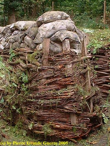
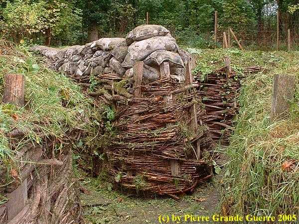
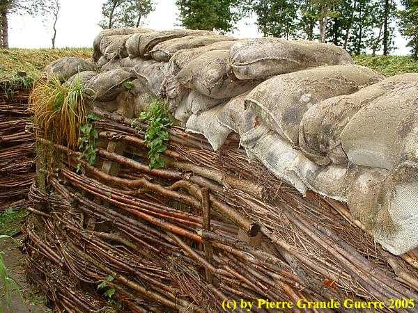
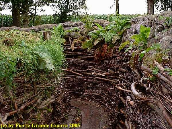
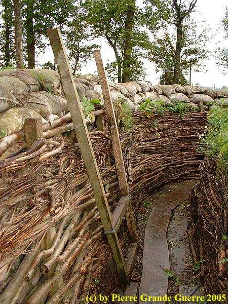
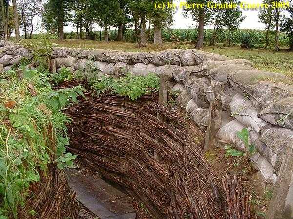
German A-frames covered with wicker-work, like braid willow twigs.
German soldiers digging a trench
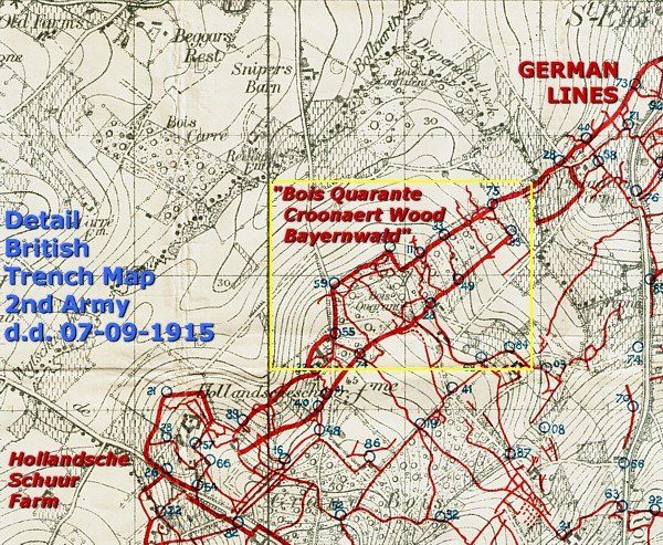
Below I show you three period trench map details of the Bayernwald Trenches: two British map details of September 1915 and one German map detail of April 1917.

At the fork shaped junction between Bunker no. 4 and the shaft to the tunnel. We go on to the right.

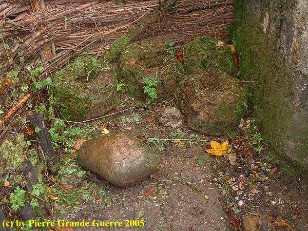
Bunker no. 4, a view from the surface.
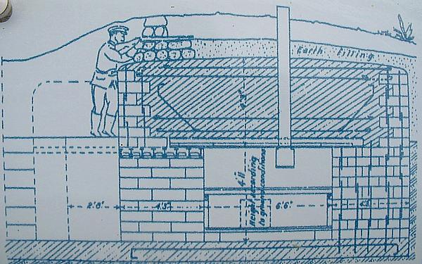
These bunkers were only 1.20 m high.
A sketch of the measurements of the bunkers.
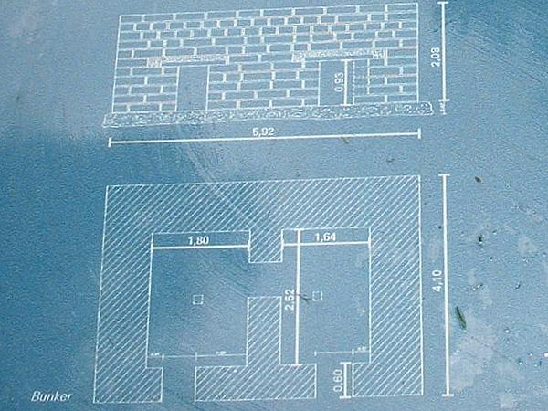
The purpose of these bunkers was only to give shelter during shelling.
We return to the junction to zig-zag our way to the tunnel shaft near Bunker no. 4...
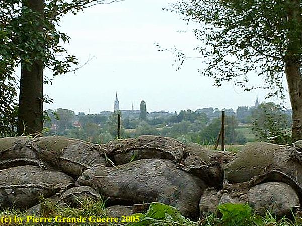
... as we come across this marvellous view...
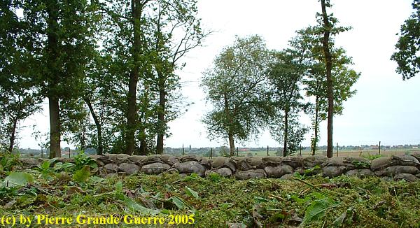
... at the church towers of Voormezele and St. Eloi, in the direction of the British lines.
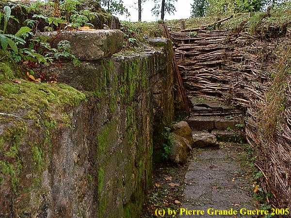
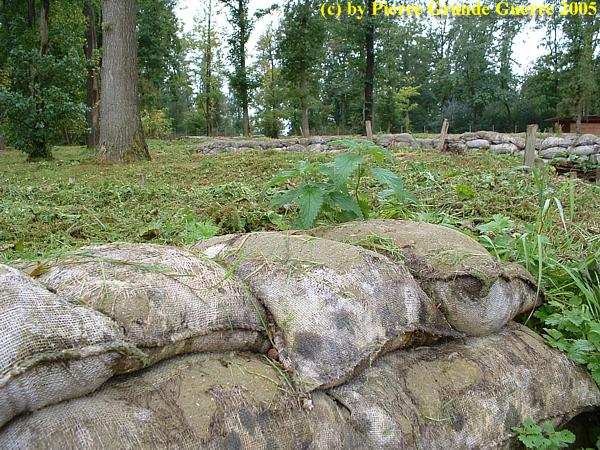
The parapet of the trench is covered with jute sandbags.
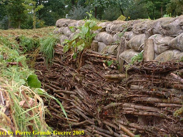
On higher grounds like here there was no need for sandbags lowering down to the duckboards.
We move on to the tunnel shaft near Bunker no. 4
The "A-frames" like this one formed the base of a trench.
View from the parapet of the location of the tunnel shaft.
German "Mineure", photographed on the moment just before they enter the shaft.
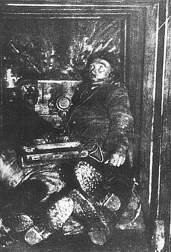
The entrance to the tunnel shaft, where used to be a windlass above the shaft.
These 25 m. deep tunnels and underground posts were used to prevent British mining activities by listening with stethoscopes.
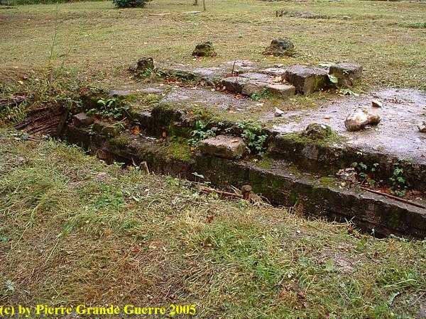
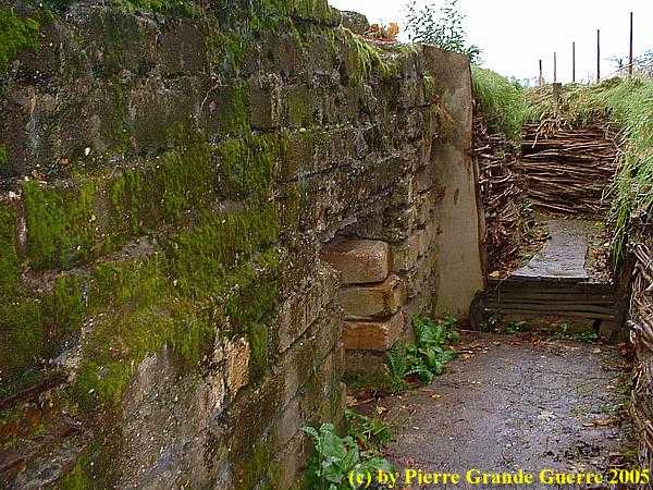
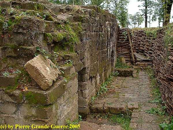
We zig-zag backwards and move on to Bunker no. 3. The entrance of Bunker no. 3.
This sketch shows the structure of the bunker and how the Germans would defend it.
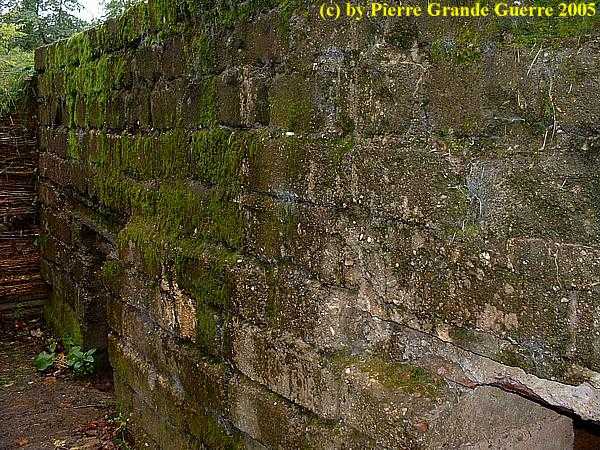
The interior of Bunker no. 3, the two separated rooms.
We walk on to Bunker no. 2. 
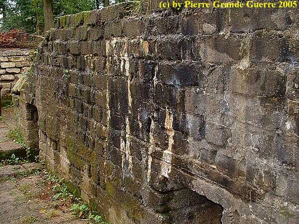
The entrance to the almost identical Bunker no. 2.
Continuing to the tunnel shaft near Bunker no. 1
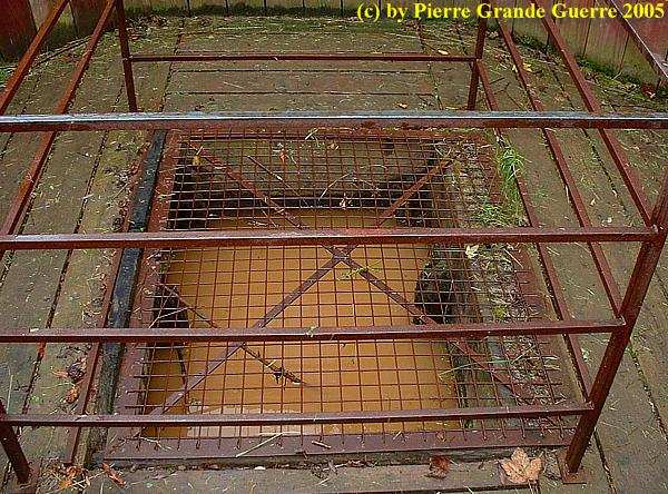
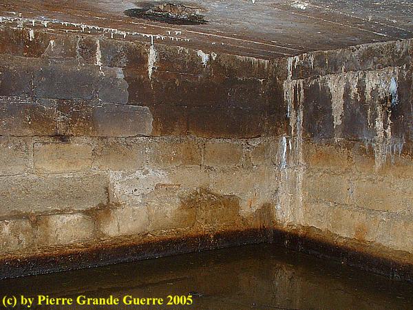
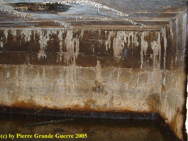
The flooded entrance to the "right" tunnel shaft near Bunker no. 1, also meant for listening and countermining.
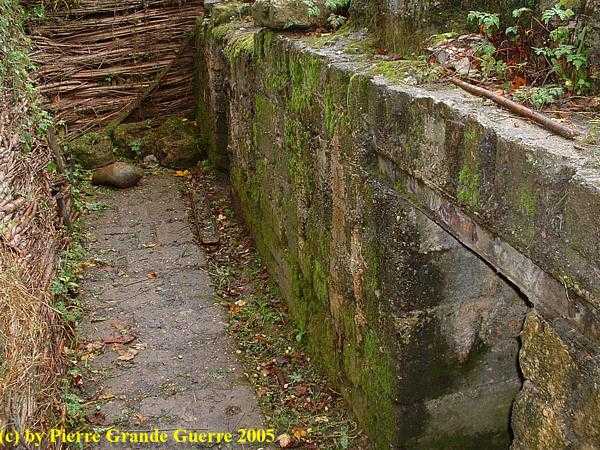
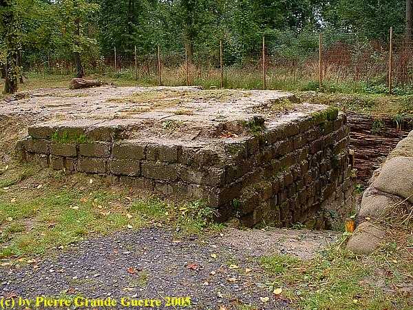
The entrance to Bunker no. 1.
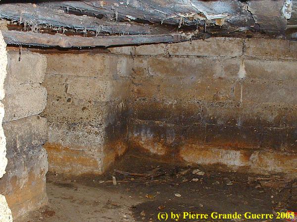
The interior of Bunker no. 1. 
Surface view of the entrance to the staircase of Bunker no. 1.
With this overview of the Bayernwald Trenches we finish our visit.
Continue to the next SPECIAL Photo Impression about the Ypres Salient: Traces of Bairnsfather - The Christmas Truce - St. Yvon
by Pierre Grande Guerre 29 Nov, 2019
by Pierre Grande Guerre 14 Nov, 2019

Inleiding: Franz Von Papen & Werner Horn; schaker en pion

Onlangs stuitte ik in een oud boek (1) van 1919 op een opmerkelijk verhaal over een Duitse Luitenant, die in begin februari 1915 een half geslaagde bomaanslag pleegt op een spoorbrug over een grensrivier tussen de Verenigde Staten en Canada. Ook al staat de bekentenis van de dader, Werner Horn, deels in het boek te lezen, de naam van zijn opdrachtgever zal Horn blijven verzwijgen. Na wat verder zoeken vond ik ook de naam van Horn’s opdrachtgever, Franz von Papen, een van de aangeklaagden van het latere Neurenberg Proces in 1946.

In een Grote Oorlog als de Eerste Wereldoorlog  is Horn’s aanslag op de brug uiteraard slechts een bescheiden wapenfeit. Toch vermoed ik dat dit relatief onbekende verhaal, dat de geschiedenis is ingegaan als de “ Vanceboro International Bridge Bombing ”, nog interessante kanten kent. Het is onder andere een spionageverhaal over hoe in een groter plan een sluwe schaker zijn naïeve pion offert.  

Beknopte situatieschets Canada en de Verenigde Staten in 1915

by Pierre Grande Guerre 01 Oct, 2019

This trip we start at the Léomont near Vitrimont and we will with some exceptions concentrate on the Battle of Lorraine of August-September 1914 in the area, called, the “Trouée de Charmes”, the Gap of Charmes.

After the Léomont battlefield we continue our explorations to Friscati hill and its Nécropole Nationale. Next we pay a visit to the battlefield of la Tombe to go on to the Château de Lunéville. There we cross the Vezouze to move on southward to the Bayon Nécropole Nationale. At Bayon we cross the Moselle to pass Charmes for the panorama over the battlefield from the Haut du Mont. North-west of Charmes we will visit the British Military Cemetery containing 1918 war victims. From Charmes we go northward to the battlefield of the First French Victory of the Great War, the Battle of Rozelieures of 25 August 1914. North of Rozelieures we will visit the village of Gerbéviller. From there we make a jump northward to visit the ruins of Fort de Manonviller to finish with an interesting French Dressing Station bunker, west of Domjevin.

by Pierre Grande Guerre 18 Sept, 2019
Though we depart from Badonviller in the Northern Vosges , we make a jump northward to the east of Lunéville and Manonviller. We start at Avricourt on the border of Alsace and Lorraine. From the Avricourt Deutscher Soldatenfriedhof we explore the southern Lorraine battlefields ; the mine craters of Leintrey , the Franco- German war cemetery and Côte 303 at Reillon , and some German bunkers near Gondrexon , Montreux , and Parux.
by Pierre Grande Guerre 13 Sept, 2019
We depart from Raon-l’Etape to drive northward via Badonviller to Montreux to visit the  "Circuit du Front Allemand 14-18", the  Montreux German Front Walk 14-18,  with its trenches , breastworks , and at least twenty bunkers.
by Pierre Grande Guerre 08 Sept, 2019
North-east of Nancy, east of Pont-à-Mousson, and south-east of Metz we visit the battlefields of the Battle of Morhange of 14 until 20 August 1914. We follow mainly topographically the route of the French advance eastward over the Franco-German border of 1871-1918.
During this visit, we try to focus on the day that the momentum of the battle switched from the French side to the advantage of the Bavarian side: the day of 20 August 1914, when the Bavarians rapidly re-conquered the territory around Morhange , being also the day of the start of their rather successful “Schlacht in Lothringen”.
We will visit beautiful landscapes of the "Parc Naturel Régional de Lorraine", memorials, ossuaries, and cemeteries. Sometimes we will divert to other periods of the Great War, honouring Russian and Romanian soldiers, who died in this sector. We start our route at the border village of Manhoué, and via Frémery, Oron, Chicourt, Morhange, Riche, Conthil, Lidrezing, Dieuze, Vergaville, Bidestroff, Cutting, Bisping we will finish in Nomeny and Mailly-sur-Seille, where the Germans halted their advance on 20 August 1914, and where they constructed from 1915 some interesting bunkers.
by Pierre Grande Guerre 05 Sept, 2019
South of Manhoué we start this trip at Lanfroicourt along the French side of the Franco-German 1871-1918 border, marked by the meandering Seille river. We visit some French bunkers  in Lanfroicourt, near Array-et-Han and in Moivrons. From there we go northward to the outskirts of Nomeny and the hamlet of Brionne to visit the ( second ) memorial, commemorating the events in Nomeny of 20 August 1914. We continue westward to finish at the Monument du Grand Couronné at the Côte de Géneviève, a former French artillery base, which offers several panoramic views over the battlefield.
by Pierre Grande Guerre 28 Aug, 2019
North of Pont-à-Mousson and south of Metz, we explore the relics of German bunkers and fortifications along the Franco-German 1871-1918 border. We start at Bouxières-sous-Froidmont to visit the nearby height of the Froidmont on the front line. This time we will show only a part of the Froidmont, focusing on its military significance.  From the Froidmont we continue via Longeville-lès-Cheminot and Sillegny to the “Forêt Domaniale de Sillegny” to explore some artillery ammunition bunkers. Next we continue to Marieulles for its three interesting bunkers and to Vezon for its line of ammunition depot bunkers. From Vezon we continue to the “Deutscher Kriegsgräberstätte Fey – Buch”. From Fey we go eastward, passing 6 bunkers near Coin-lès-Cuvry to finish our trip at the top construction of the “Feste Wagner” or “Fort Verny”, north of Verny.
by Pierre Grande Guerre 25 Aug, 2019

From Badonviller or the Col du Donon we continue north-eastward for a visit to an extraordinarily well restored sample of German fortifications:  the Feste Kaiser Wilhelm II, or Fort de Mutzig,  lying on a height, some 8 km. away from the 1871-1918 Franco-German Border.

by Pierre Grande Guerre 23 Aug, 2019
We concentrate on the German side of the front around "Markirch", Sainte Marie-aux-Mines, the so-called "Leber" front sector . We first pay a visit to the Sainte-Marie-aux-Mines Deutscher Soldatenfriedhof, and next to the southern side of the Col de Ste. Marie for the many interesting bunkers of the German positions at the Bernhardstein, at the north-eastern slopes of the Tête du Violu. On the next photo page about the Haut de Faîte we will continue with a visit to the northern side of the pass and the "Leber" sector.
More posts
Share by: