LORRAINE - Montreux - German Front Walk
Year of visit: 2010, 2011

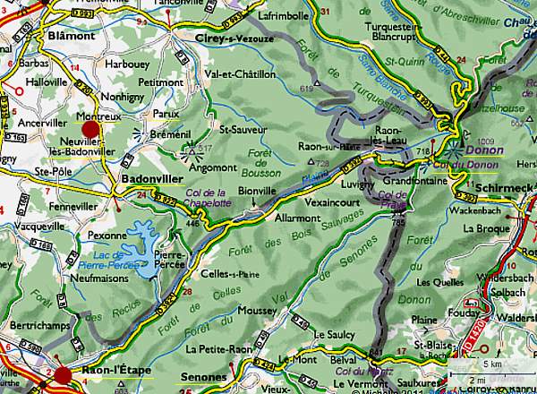
We depart from Raon-l’Etape to drive northward via Badonviller to Montreux to visit the " Circuit du Front Allemand 14-18", the Montreux German Front Walk 14-18, with its trenches , breastworks , and at least twenty bunkers.
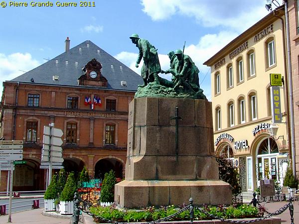
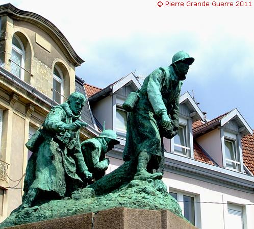
Our point of departure is in the town centre of Raon-l'Etape , where in front of the Town Hall stands this sculpture group of Gaston Broquet.
The German Occupation of Raon-l'Etape
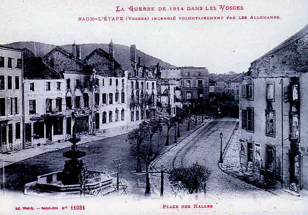
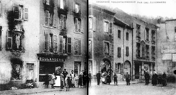
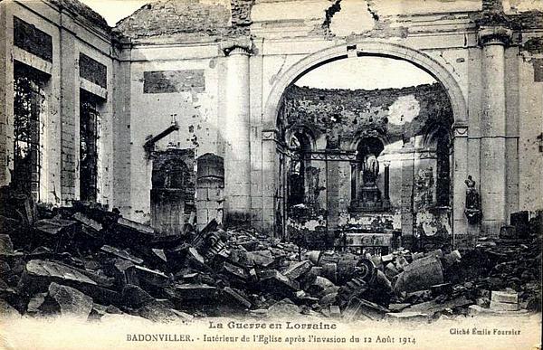
From 24 August 1914 until 12 September 1914 the Germans occupied Raon-l'Etape . During this 3 weeks occupation the Germans deliberately set fire to buildings and houses in the town .
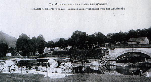
After the German occupation , during the rest of the war the town suffered many artillery bombardments , and consequently more fires .
During war times Raon-l'Etape was the garrison town of the 21e Régiment de Chasseurs à Pied.
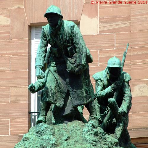
The interior of the " Raon-l'Etape Monument aux Morts " contains an urn with a sample of soil of the battlefield of Douaumont near Verdun. The bronze monument has been designed by Gaston Broquet , a famous Lorraine sculptor , being also a war experienced Poilu , a member the 94th R.I. The sculptures of Gaston Broquet often show soldiers in a realistic battle situation . See also on this website photos of other examples of Broquet's sculptures ; of the wounded Sergeant Maginot near Fort de Souville and the horrified Poilu with gasmask of Samogneux .
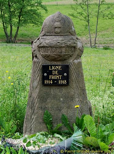
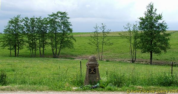
We pass Badonviller and cross the former front line ...
... to continue northward via the D 20 ...
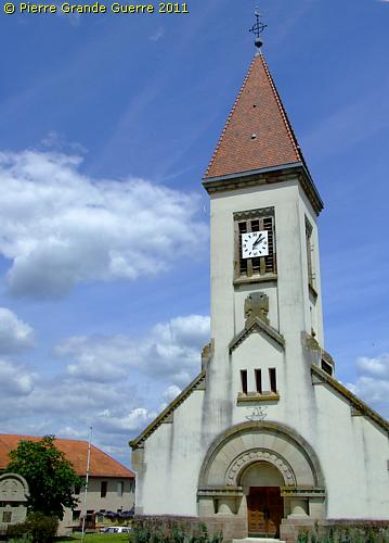
... to the village centre of Montreux , where we park our car near the village church.
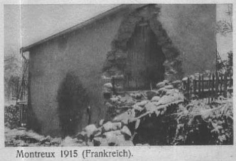
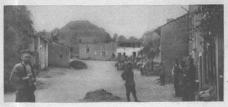
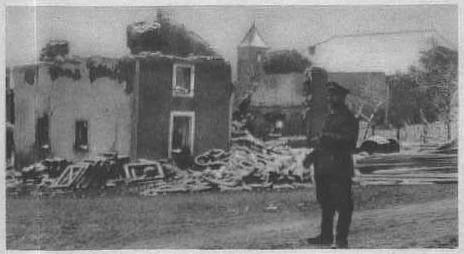
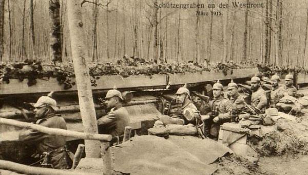
Three 1915 period photos of the damaged village of Montreux during the German occupation .
On foot we leave the village southward for some 200 m. ....
... to the point of departure of the Montreux German Front Walk, ...
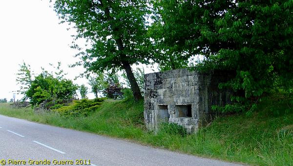
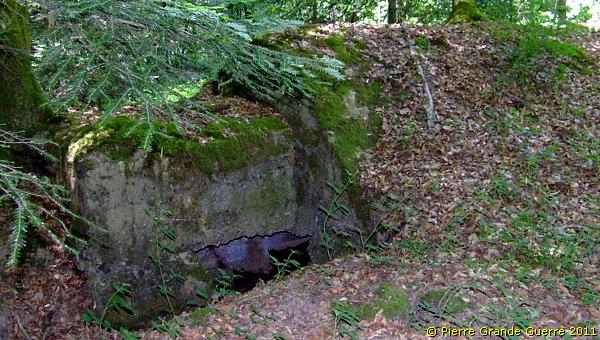
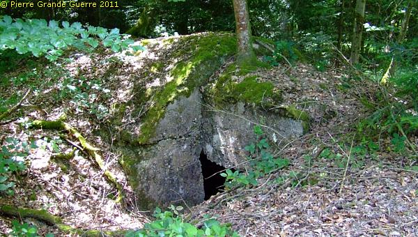
... which is marked by three German bunkers along the D 20.
The second bunker.
The third bunker.
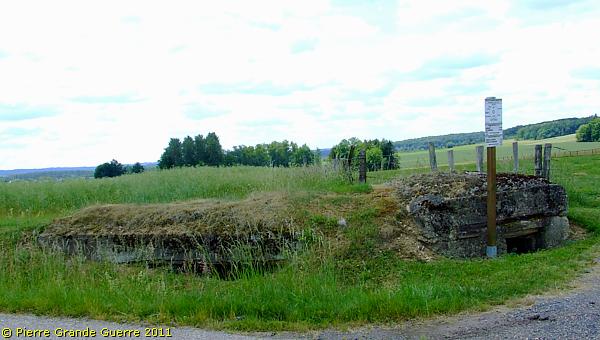
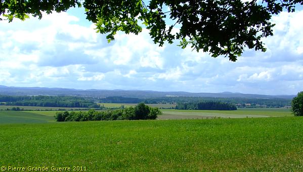
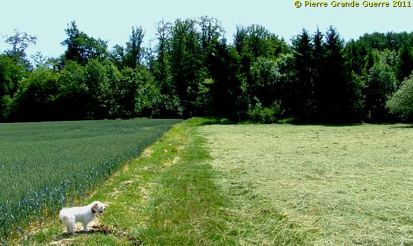
Panorama view from this bunker south-westward into the direction of the French lines at the horizon around Neuvillers-lès-Badonviller. Left the D 20, right; the Grand Bois.
On both sides of the D 20 were German lines , with bunkers on the hill tops left and right, guarding the D 20 for an eventual French breakthrough.
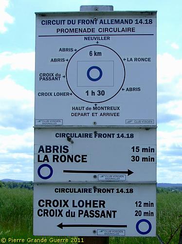
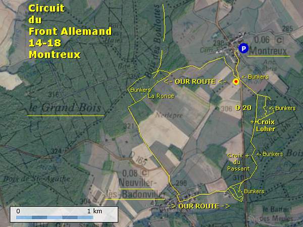
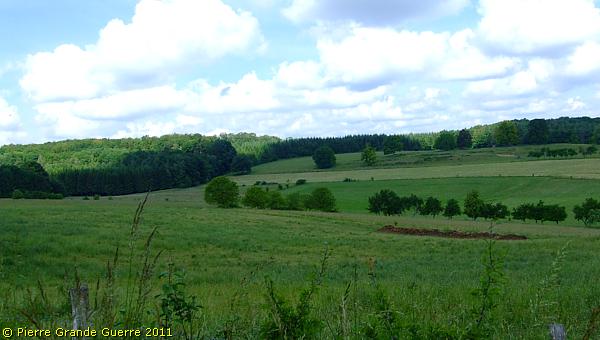
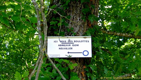
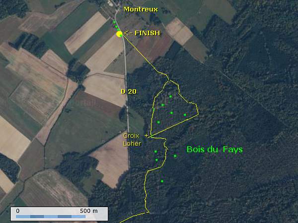
The official sign of the “Circuit du Front Allemand 14-18” is rather misleading. The length of the walk is almost 7 km. and the duration of time of 1.5 hours is only correct, if you are not interested at all in the landscape, the bunkers and the trenches , and if you perhaps would run this distance . If you are really interested in the German relics here, we estimate that you need at least 4-5 hours to do this walk. It is common with these walking route signs in the Vosges , that the announced duration times are always way too optimistic . My late wife, Chris, and I walked the route “anti- clockwise ”, at first southward . The first stage of our walk is to la Ronce via the Bois des Boulottes and the Côte de Montreux . Before every next stage of the walk I added a satellite map of the detail of the route. Halfway , near Neuviller-lès-Badonviller , the route returns northward .
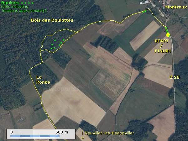
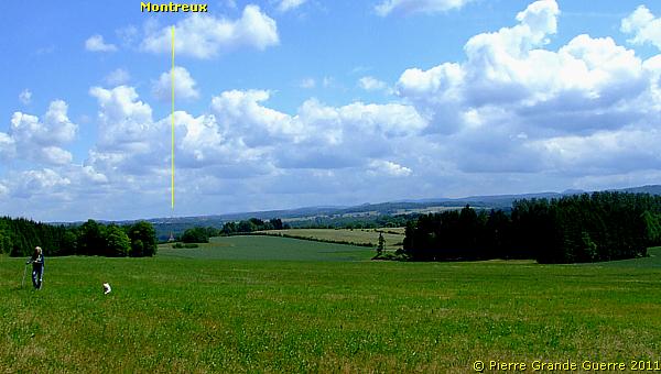
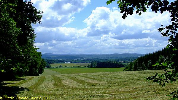
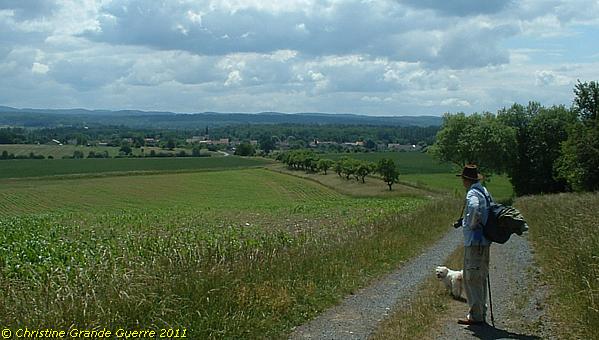
View from the departure point towards our first goals: the Bois des Boulottes and the Côte de Montreux.
At the western outskirts of the village we detect by poking around...
... my cane and its sound two bunkers hidden by vegetation.
We continue our walk south-westward at first in open field ...
... into the direction of the Bois des Boulottes.
Before we continue finding trenches and bunkers, I will explain in the frame below the wartime background of this location, and I try to sketch for you an impression of the wartime daily life here.
The Montreux Font Sector - The situation of 1915
The Opponents
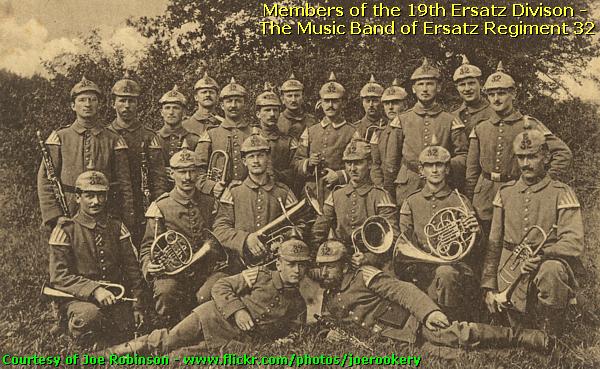
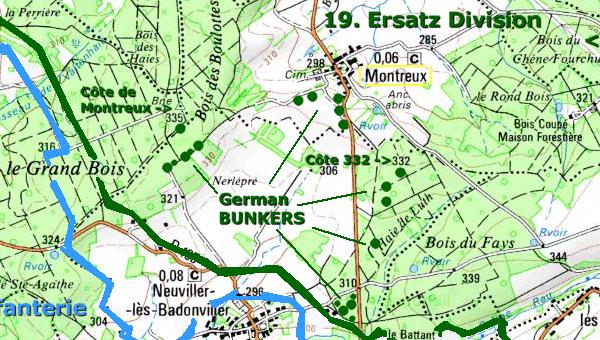
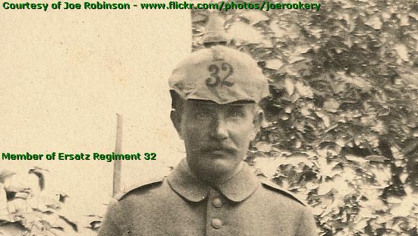
The 19th Ersatz Division
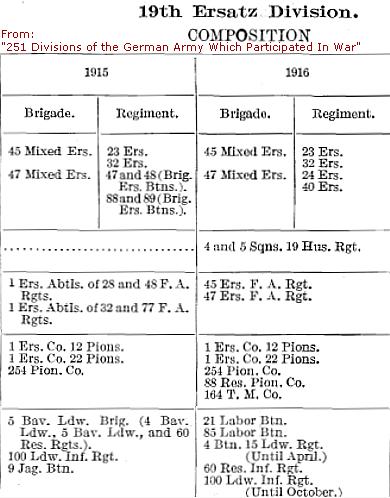
The 19th Ersatz Division covered the right flank of the " Donon "-Brigade (later called the 84. Landwehr Brigade) and it covered the left flank of the Bavarian 1. Landwehr Division .
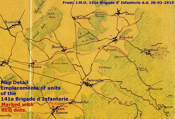
The units of the 19th Ersatz Division occupied the Carrière de Badonviller in the east and from there a line westward along the villages of Angomont , Brémenil and Montreux .
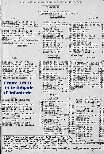
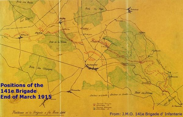
The French opponent: the 141e Brigade d'Infanterie
|
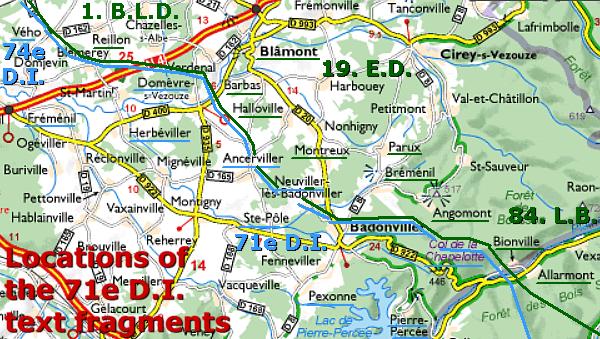
The units of the French 141e Brigade d'Infanterie, a component of the 71e Division d'Infanterie , opposed the units of the 19th Ersatz Division. The 5th and 6th battalions and two machine-gun sections each of the 349e R.I., of the 358e R.I. and the 370e R.I. formed together the 141e Brigade. The 71e D.I. was active in the area from Badonviller and the Col de Chapelotte until Domèvre in the north, covering the right flank of the 74e D.I., positioned at the Reillon area, Lorraine. |
Artillery positions
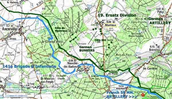
The Germans installed an artillery base "of all calibres" in the Bois du Chêne Fourchu , "Forked Oak Wood", west of Parux and east of Montreux.
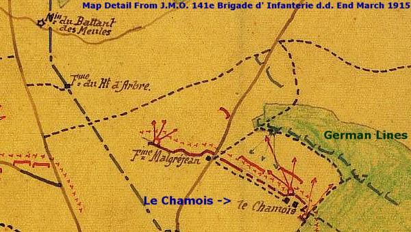
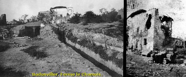
In answer to the German artillery bombardments the 71e D.I. installed an artillery battery of 58 mm. guns at a location , called " le Chamois ", north of Badonviller near la Chapelotte . Both artillery positions " duelled " regularly .
Situation sketch of text fragments of the French J.M.O.'s
To get an impression of the events in this front sector near Badonviller and Montreux I consulted the " Journaux des Marches et Opérations", the handwritten war journals of the 71e D.I., to sketch you with my translations of some text fragments the situation of 1915 and 1916 of the Badonviller-Montreux sector.
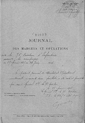
At first sight it may look odd that I approach these period events of this German Montreux front sector from French sources. Only for the simple reason that I unfortunately did not have access to any German period accounts, I studied the interesting war journals of the French 71e D.I. and the 141e B.I. to present you the following text fragments . My translations of these "clips" are merely meant to give you an impression of the daily routine of war life here at Montreux at “ both sides of the barbed wire ”, be it French or German .
Compared to other front sectors in this period this “ almost forgotten ” front sector was considered as a rather quiet sector with “ calm days and nights ”. These war journals tell us also that there still was quite a lot of action going on in this sector: ...
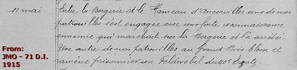
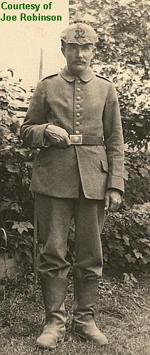
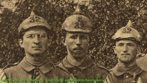
"11 May 1915. Between le Bergerie and le Hameau d' Ancerviller (nearby, north and west of Montreux (P.G.G.)) one of our patrols came in contact with a strong enemy reconnaissance unit, which marched to le Bergerie and halted there . One of other patrols wounded in the Grand Bois (immediately west of Montreux) a Feldwebel of the 40th Ersatz (Regiment) and took him prisoner .”
(The bold links in the texts refer to locations of the previous Photo Impression about Avricourt - Leintrey - Reillon - Domèvre - Montreux - Parux .)
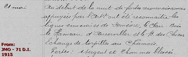
“21 May 1915. At the beginning of the night strong reconnaissance units, supported by our artillery, have explored the enemy lines of Domèvre , le Clair-Bois, le Hameau d’Ancerviller and the Bois des Chiens (between le Hameau and northwest of Montreux) . Exchange of torpedoes at le Chamois ( south of Montreux, north of Badonviller) . Casualties: one Sergeant and two men wounded.”
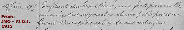
“12 June 1915. Making use of the fog a large enemy patrol approached one of our small posts in the Grand Bois and fell back from our fire .”
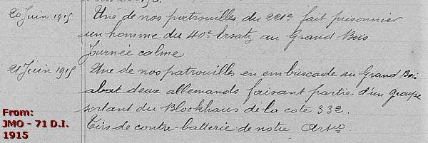
“20 June 1915. One of our patrols of the 221e (R.I.) made prisoner a man of the 40th Ersatz in the Grand Bois. Calm day .
21 June . One of our patrols killed in an ambush in the Grand Bois two Germans , belonging to a group , which came from the bunker at Height 332. ( Near and south -west of Montreux ; we will later visit this bunker at the end of this page) . Contra battery fire of our artillery .”
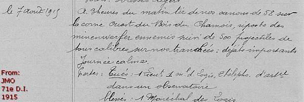
“7 August 1915. At three o’clock in the morning fire of our 58 mm. guns at the west corner of the Bois du Chamois (east of Badonviller) , answered by the enemy Minenwerfer firing 500 projectiles of all calibres on our trenches ; important damage . Calm day . Killed : 1 Lieutenant , 1 Maréchal de Logis (mostly cavalry equivalent of a staff-sergeant or sergeant) , 2 telephone operators in an artillery observation post. Wounded : 1 Maréchal de Logis .”
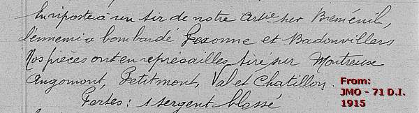
“28 August 1915. The enemy returned our gunfire on Brémenil ( south-east of Montreux and north of Badonviller ) . The enemy bombarded Pexonne and Badonviller . Our pieces fired in revenge on Montreux , Angomont , Petitmont , Val et Chatillon . Casualties : 1 Sergeant wounded .”
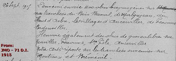
“26 September 1915. The enemy fired 400 teargas grenades on our trenches at the Bois Banal , de Maljean , du Haute d’Arbre , the villages of Ancerviller , Pexonne and Badonviller . Also fired grenades of large calibres on Neuviller ( near and south of Montreux ) , Pexonne , Ste . Pôle , Ancerviller . Our artillery hit back on the enemy trenches near Montreux and Brémenil .”
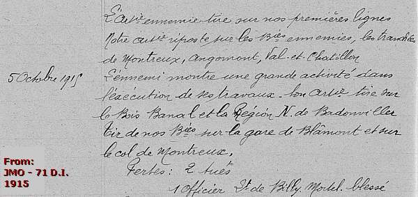
“4 October 1915. (…) The enemy fired on our first lines . Our artillery returned fire on the batteries of the enemy (near Parux) , the trenches of Montreux , Angomont , Val-et- Chatillon .
5 October 1915. The enemy shows an enormous activity during the execution of their works (fortifying barbed wire, trenches, possibly constructing dug-outs) . His artillery fires on the Bois Banal and the region north of Badonviller . Fire of our batteries at the station of Blâmont and on the Côte (Height of) de Montreux (335 m. at the Bois des Boulottes) . Casualties : 2 killed . 1 Officer , Lt. de Billy, mortally wounded .”
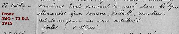
“28 October 1915. A lot of noise during the night in the German lines in the area of Domèvre , Halloville , Montreux . Medium activity of the two artilleries . Casualties : 1 wounded .”
February - March 1916
In February and March 1916 the fights in this front sector intensified , as the records of the 71e D.I. tell us . The " calm days " were temporarily over.
In February 1916 the Oberste Heeres Leitung ordered the German units in the Vosges to execute a series of operations as diversionary actions of the Battle of Verdun to prevent that the French would send troops as auxiliaries from the Vosges to Verdun. These operations continued in this front sector around Montreux until 23 March 1916.
The battle culminated on 18 March 1916.
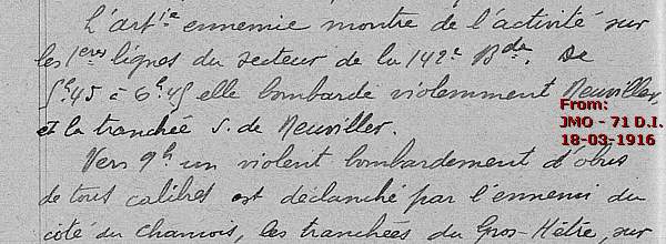
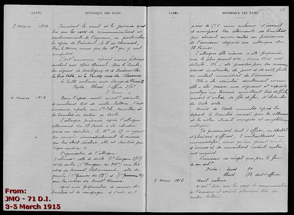
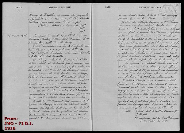
“18 March 1916. The enemy artillery shows activity on the 1st lines of the 142e Brigade (sic) . From 5.45 hrs . until 6.45 hrs . he bombarded violently Neuviller and the trench south of Neuviller . Around 9 o’clock a violent bombardment of grenades of all calibres was launched by the enemy on the height of le Chamois and of Gros- Hétré .(...)”
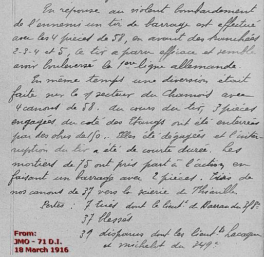
“(…) In response to a violent bombardment of the enemy a fire barrage was executed by the four 58 mm. pieces in front of the trenches 2-3-4 and 5. This fire looked to be effective , and it seemed to have shaken up the German 1st line. At the same time a diversionary action was undertaken in the sector of le Chamois with four 58 guns . During the fire three pieces, engaged from the height of les Etangs , were buried by grenades of 160. They were excavated and the interruption of fire took only a short time. 75 mm. Mortars have taken part in the action creating a barrage with two pieces. Fire of 37 mm. guns into the direction of Thiauville . Casualties : 7 killed amongst them Lt. Barrau of the 358th. 37 Wounded . 39 Missing in action, amongst them the lieutenants Lacage and Michelot of the 349th.”
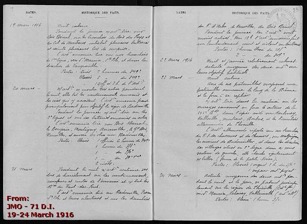
But the fights petered out from 23 March 1916 to the “ normal ” situation and daily routine of alternating " calm days " of working on trenches with days of patrols , reconnaissance parties , and days of mutual reprisal bombardments .
With all these dry and factual info but also with these atmospheric impressions of the " Journaux des Marches et Opérations" in our mind we start the Montreux German Front Walk.
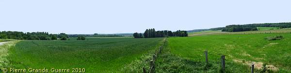
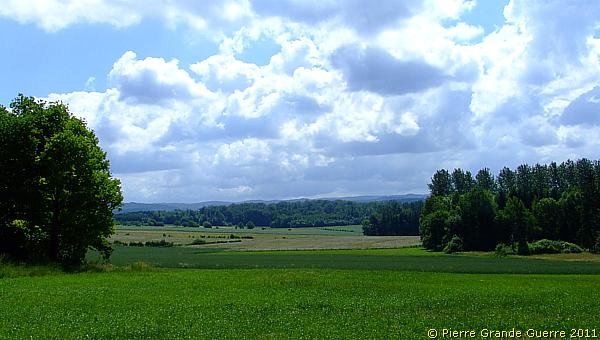
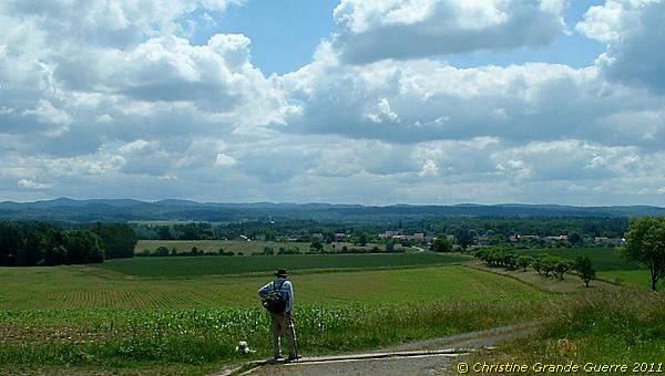
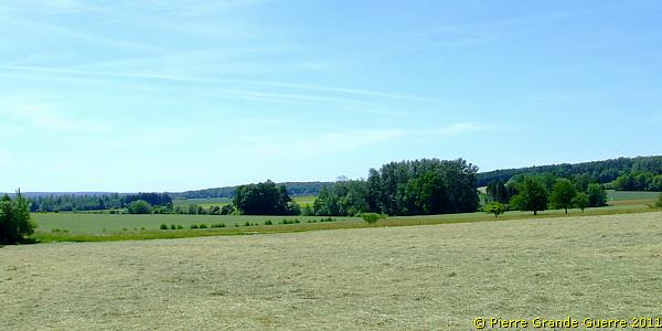
A view eastward from the edge of the Bois des Boulottes in the direction of the D 20 in the valley.
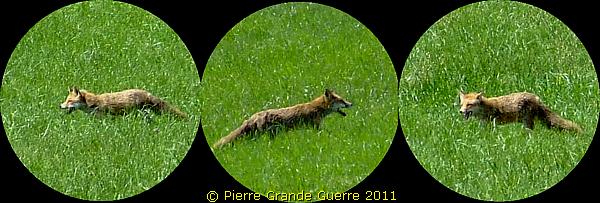
During our "bunker hunting " walks we often see a lot of wildlife. By exception this fox offered me enough time to photograph this beautiful example of the Vosges wildlife.
View south-eastward.
We are nearing the location of the Côte de Montreux...
... detecting some elephant shields , ...
... and the first relics of German trenches.
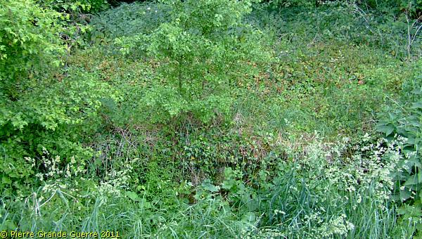
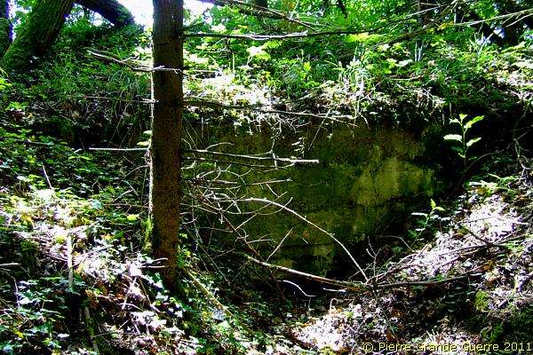
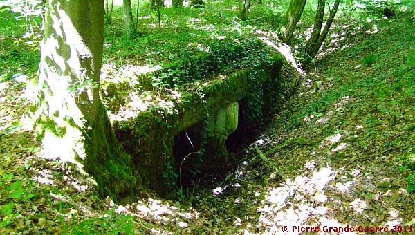
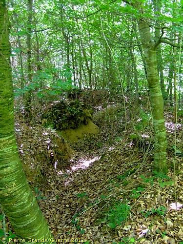
We stumble on some concrete relics of a dug-out.
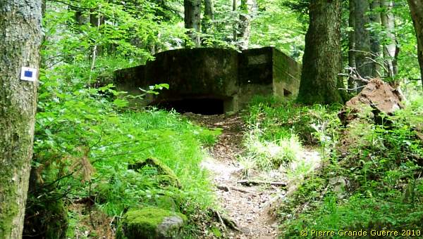
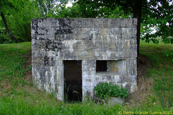
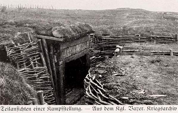
On the edge of the Bois des Boulottes , just some 75 meters below Height 335, we find this shelter bunker.
A few meters more southward are standing 2 bunkers next to each other. Left a machine gun bunker, right an observation post.
Let us first have a look at the machine gun bunker.
The entrance of the bunker.
The field of fire of this machine gun bunker, guarding the valley and the road. The Donon , the highest peak, left. La Chapelotte and le Chamois are at the horizon right.
The observation post bunker.
The entrance of the observation post.
Notice the extraordinary concrete round arch.
The field of sight of this observation post, directed slightly more north-eastward.
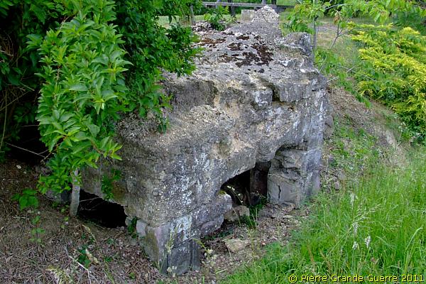
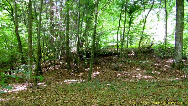
We continue our walk along the edge of the wood to find another damaged concrete shelter.
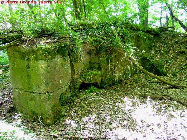
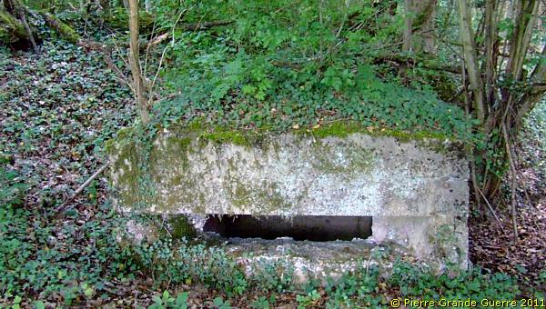
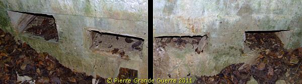
Some 20 metres southward. An interesting bunker with two purposes; offering shelter and a machine-gun post.
The entrance to the shelter part of the bunker.
The entrance to the machine-gun part of the bunker.
In the bunker are niches in the wall for storing ammunition.
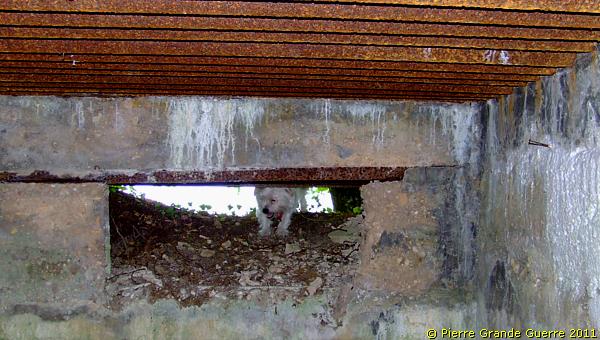
Bobby is peeking through the fire hole of the machine-gun bunker, which is directed south-eastward.
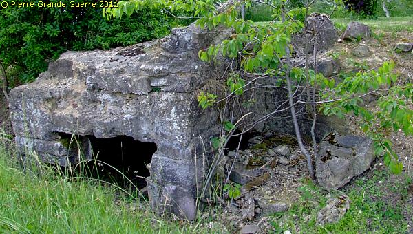
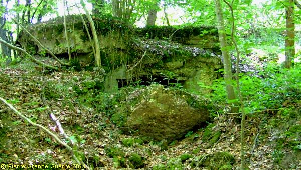
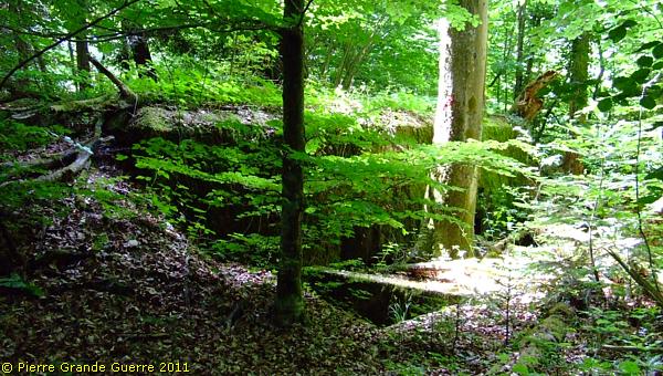
More into the wood we find relics of a damaged bunker ...
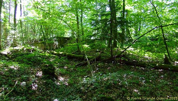
... on the Côte de Montreux (335m.).
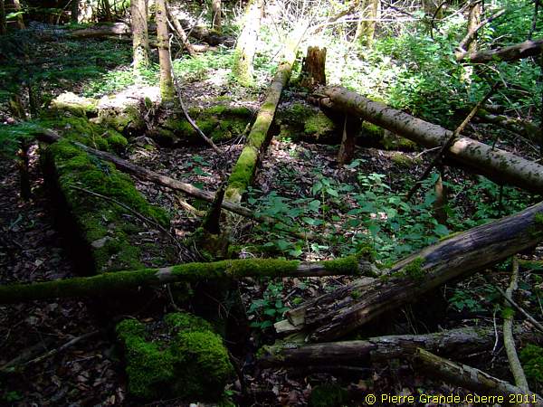
Again along the edge of the wood ; ...
... another machine-gun bunker directing southward.
Then we find another rare construction along the Western Front; concrete breastworks with an open room beneath it, ...
... offering the soldiers some modest shelter from artillery fire.
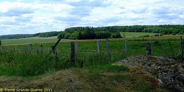
Another breastwork. The field of fire is directed at the road and Neuviller.
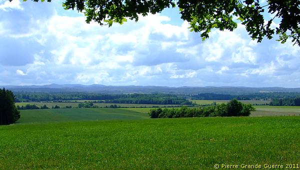
We leave the wood for the open spot of la Ronce , ...
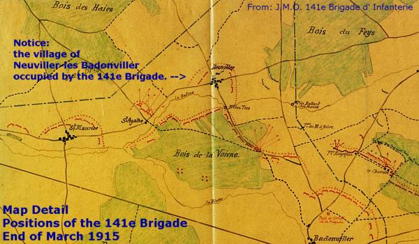
... with a view at Neuviller-lès-Badonviller. The village formed a small French salient opposite Montreux.
We pass Neuviller to continue east of the village to a western corner of the Bois du Fays, just next to the west side of the D 20.
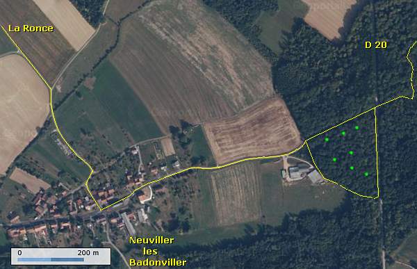
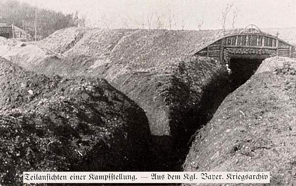
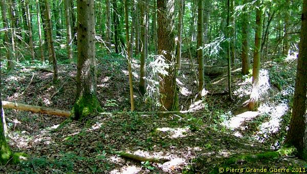
The trenches and bunkers we will find here, were part of the first German line.
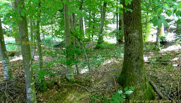
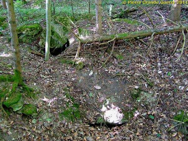
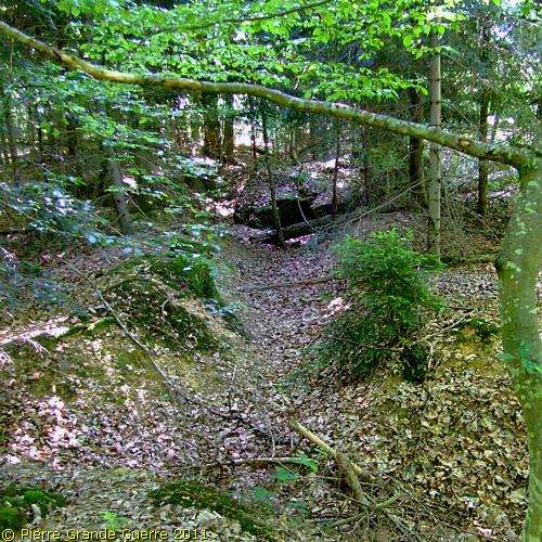
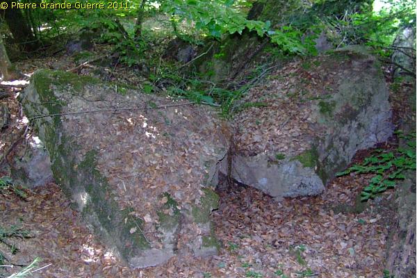
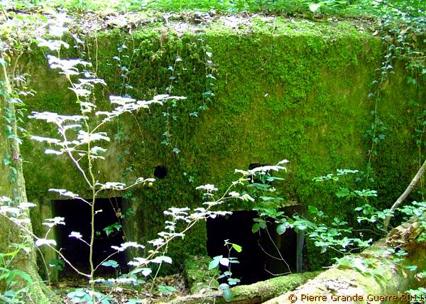
Relic of a trench running to a concrete shelter.
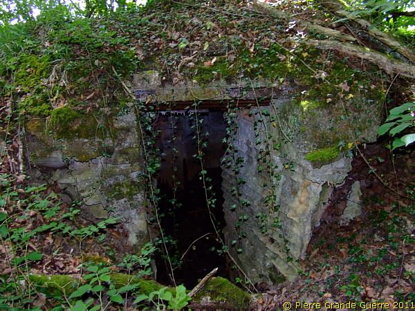
Another concrete shelter with an old tree growing on top of it.
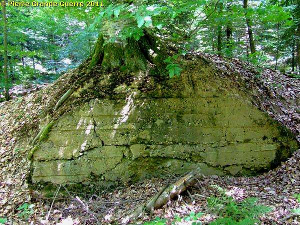
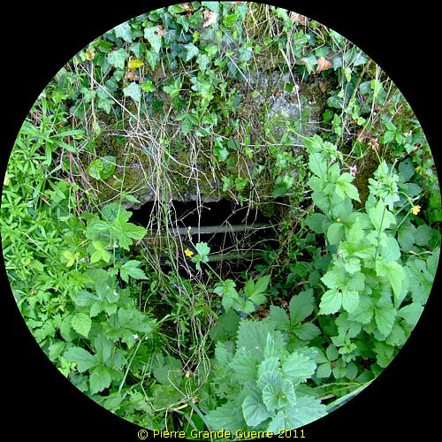
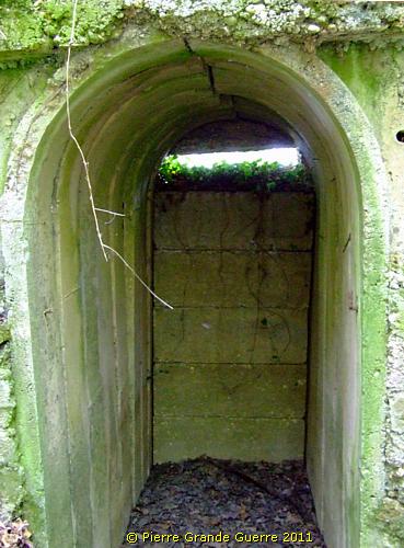
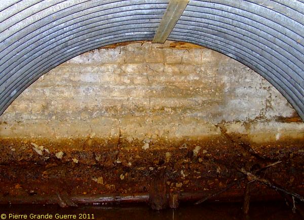
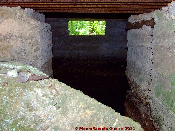
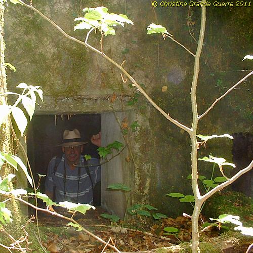
The entrance of this "tree" bunker.
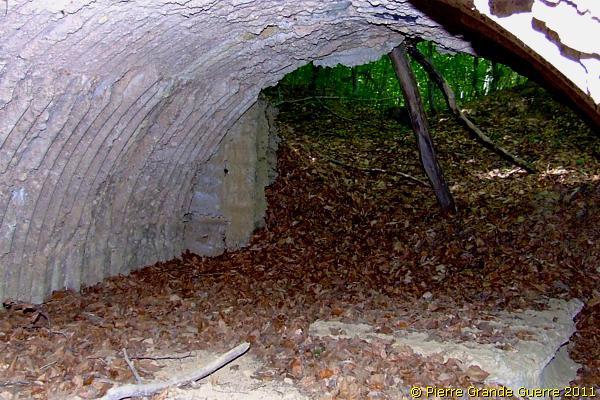
The interior of this "tree" bunker, flooded a foot high.
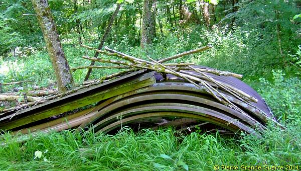
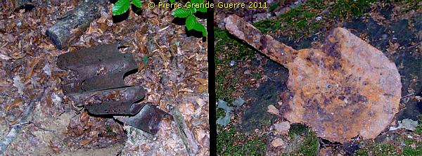
Some loose relics we find in this wood ; Corrugated iron and a "Pioniere" spade.
The roof of this bunker collapsed.
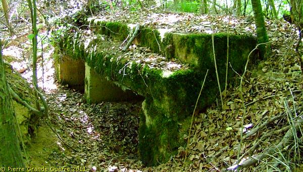
Also here we find concrete breastworks , which are directed southward, ...

... or breastworks guarding the nearby D 20 road.
On the edge of the wood and the road stands an interesting machine-gun bunker with two openings.
The interior is blocked by a large piece of broken concrete.
One fire window ( left ) faces southward , the other directs eastward to the road.
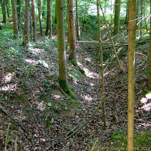
We continue finding another breastwork and relics of ...
... communication trenches between the bunkers and breastworks.
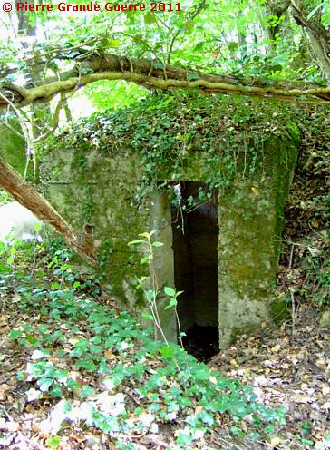
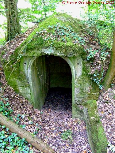
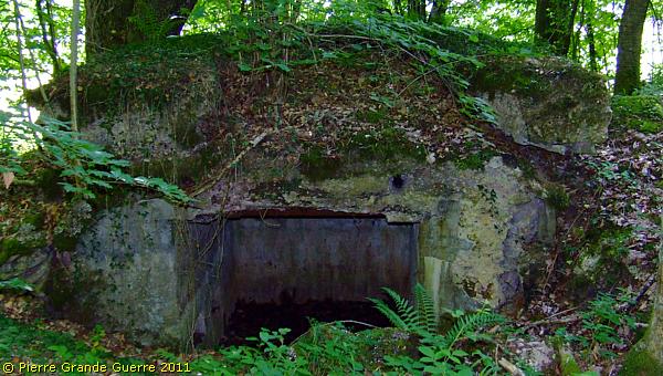
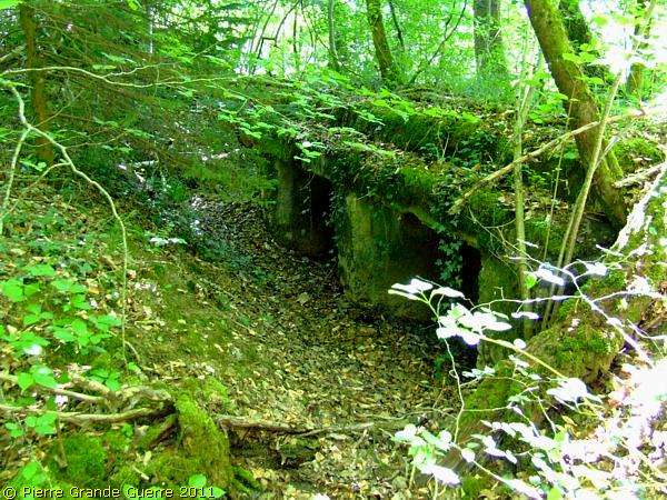
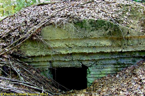
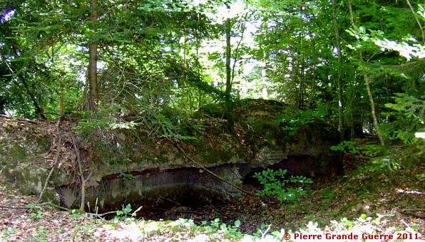
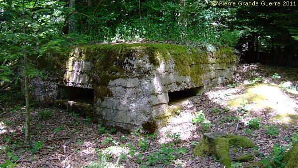
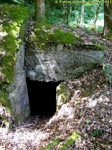
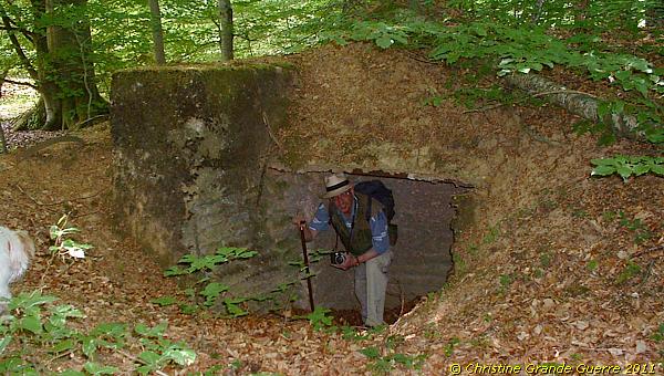
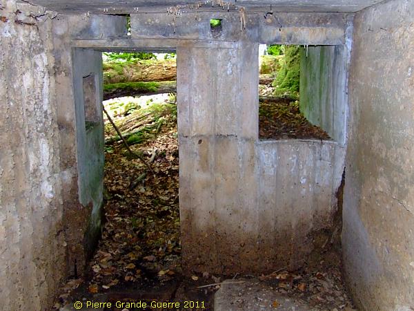
The last bunker we will visit on this location is an " Unterstand ", ...
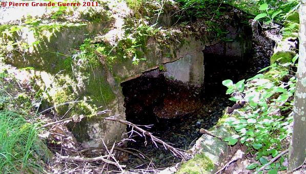
... a shelter bunker with two entrances.
The interior was flooded with 1 foot of water. The other, northern exit.
From here we cross the D 20 and continue northward in the Bois du Fays to a location, called Croix Loher.
While Chris and Bobby take a rest, I photograph , ...
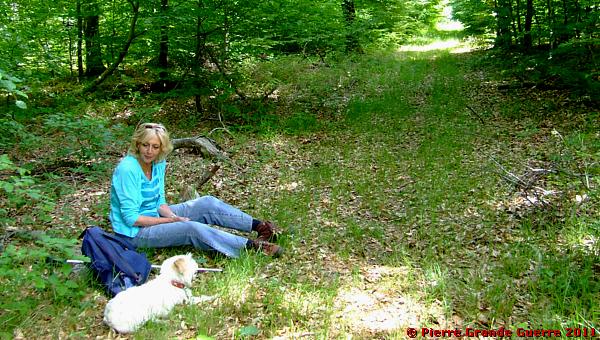
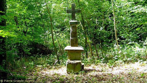
... the Croix Loher , a French memorial, commemorating the killing of an officer, J. Loher, on this spot during the Franco-Prussian war of 1870-1871.
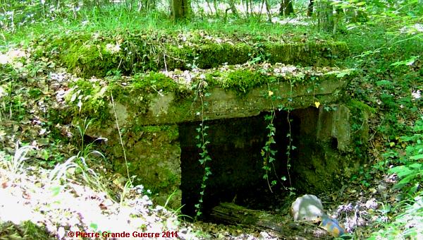
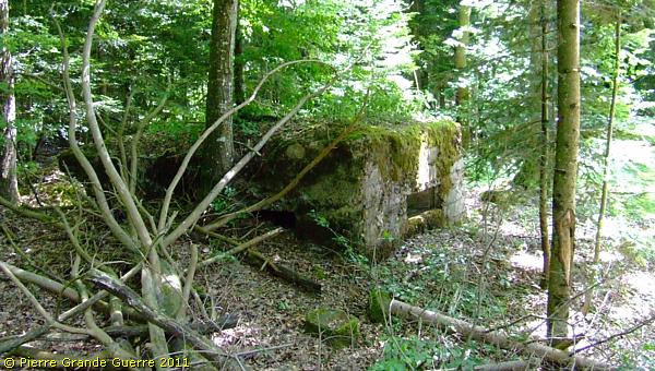
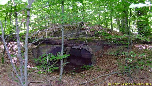
Some 30 metres away from the Cross we find this shelter bunker.
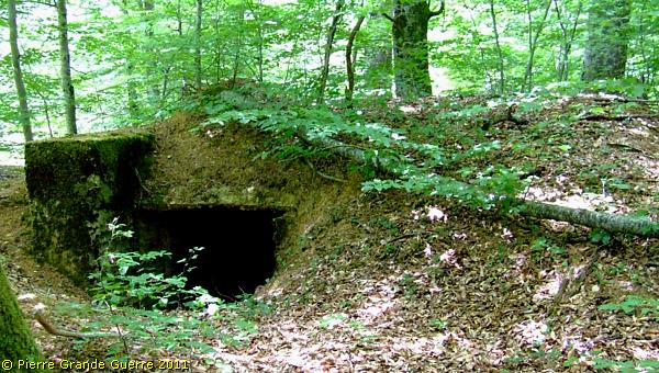
The northern entrance of the same bunker.
Breastworks directed south and westward to the road.
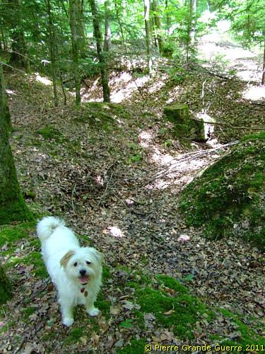
We follow a trench northward , running parallel to the road , some 100 m. away from here.
This trench leads us to Height 332.
We will find the bunker here, which is mentioned in the 71e D.I.'s war journal.
Reminder quote: "21 June 1915. One of our patrols killed in an ambush in the Grand Bois two Germans, belonging to a group, which came from the bunker at Height 332."
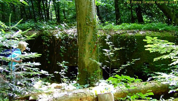
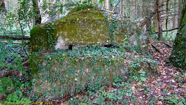
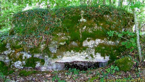
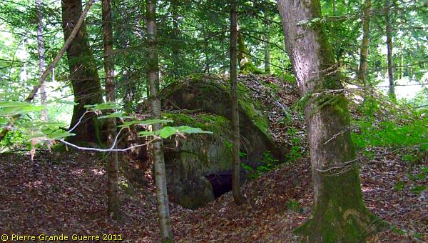
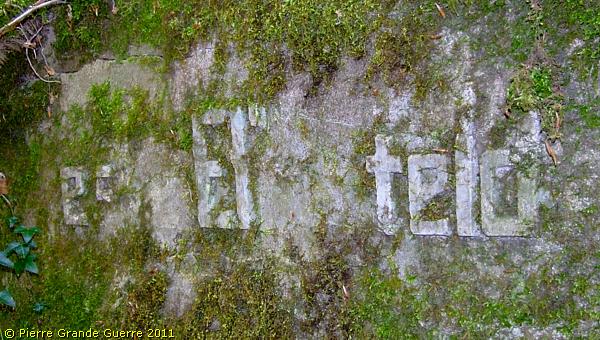
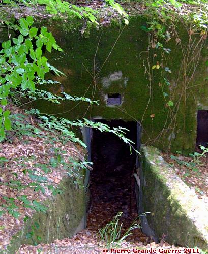
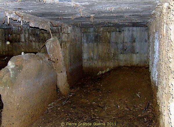
It is a twin bunker. Unfortunately we can not read anymore the name of the unit, which constructed it. The bunker's name is "Feste Elberfeld".
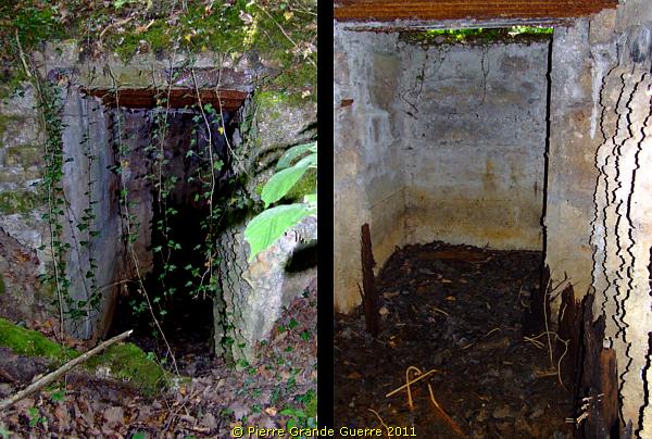
The east or left entrance to the bunker.
The interior of the eastern room.
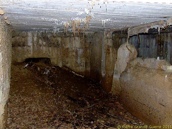
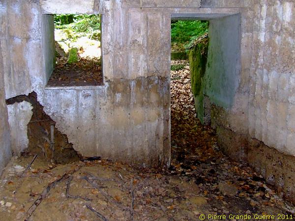
The interior of the western room.
A fallen tree is blocking the second entrance.
Considering its size , and the better construction with windows than all the other buildings, we have seen during this walk, I presume this bunker probably may have served as the local command post here, or at least as an "Offiziersunterstand".
The second entrance.
At the northern edge we leave the Bois du Fays , while Bobby is offering you a few panorama views westward ...
... to the Grand Bois ( left ), the Height of Montreux , and the Bois des Boulottes.
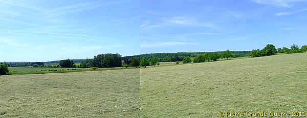
Again this panorama in two overlapping steps in more detail. Left and south-westward.
Right and north-westward.
Back at the Montreux village church we change our shoes and we enter, tired but satisfied, our car.
Continue to the next Lorraine chapter , " The Battle of Morhange - August 1914 "