
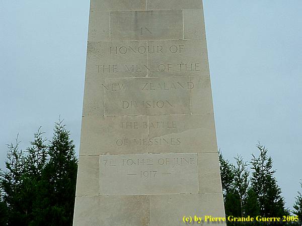
YPRES SALIENT - Messines Ridge - The Battle of Messines - 4 Mine Craters
Years of visit, 2005, 2006, 2016
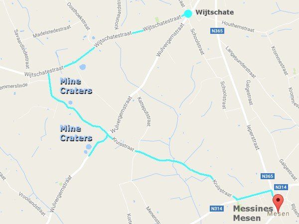
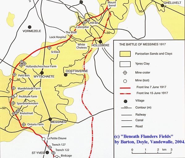
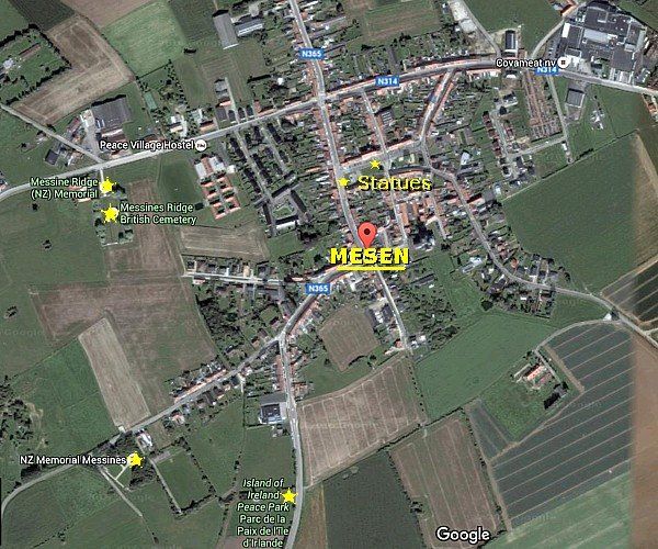
We depart from the village centre of Wijtschate to drive southward over the former German lines to visit first 4 mine craters out of 19, ponds caused by explosions blown on 7 June 1917. From there we continue to the village of Messines to visit some 2014 statues and interesting sites just outside of the village. Messines Ridge was the centre point of the Battle of Messines of June 1917. We finish our trip at the bridge over the Douve brook south of Messines, a site of action in 1915.
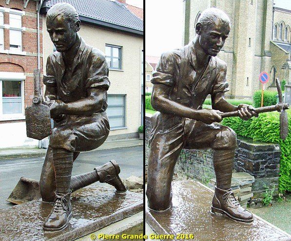
We depart from this 2014 statue of a British miner at the foot of the St. Menardus church in the village centre of Wijtschate. The sculptor of this statue is Jan Dieusaert.
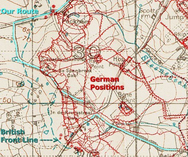
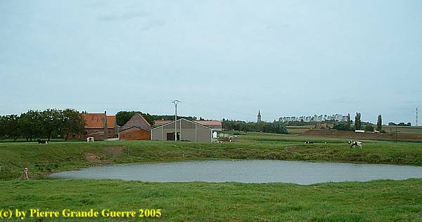
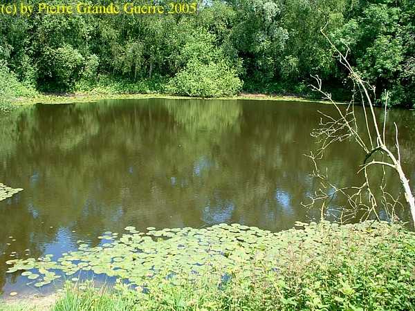
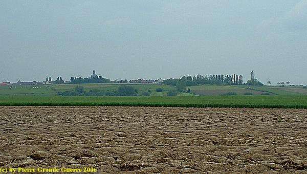
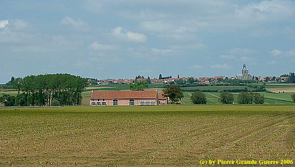
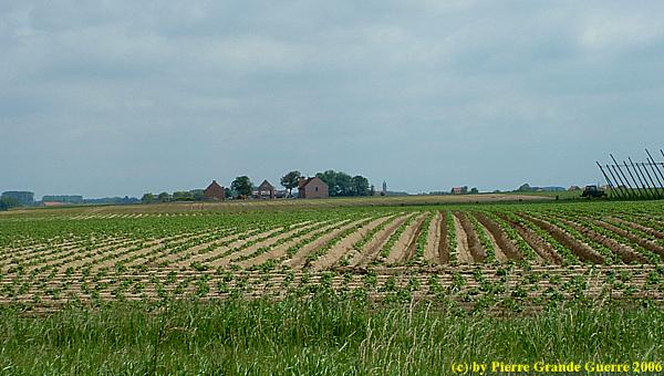
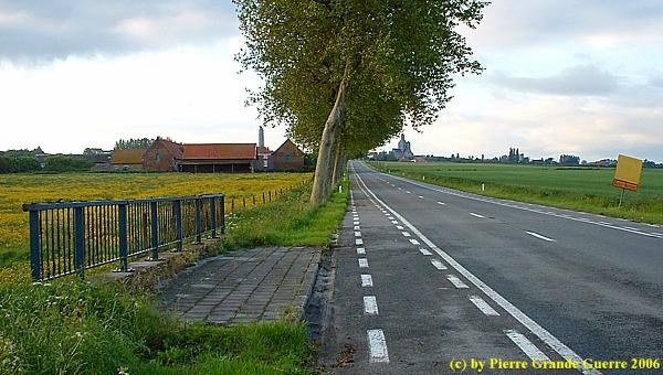
Our first stop is at the Wijtschatestraat on the site of the German forward positions near Peckham Farm. A mine explosion created this pond on 7 June 1917.
The 19 Mine Explosions of 7 June 1917
After 18 months of tunnelling, like for instance the Australian 1st Tunnelling Company did north of Messines, ...
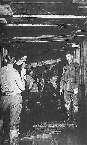
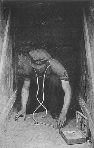
... digging underground chambers to store a huge amount of explosives ...
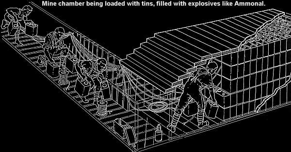
... nineteen huge mines were blown at Zero Hour, 3.10 AM on 7 June 1917, under German positions like the mine under Peckham Farm. The 19 mines erupted from Hill 60 southward to Ploegsteert. Almost 1 million pounds of explosives were blown. The shock had the force of an earthquake, and according to legend, it was felt in London and Paris.
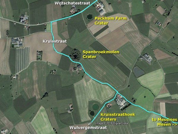
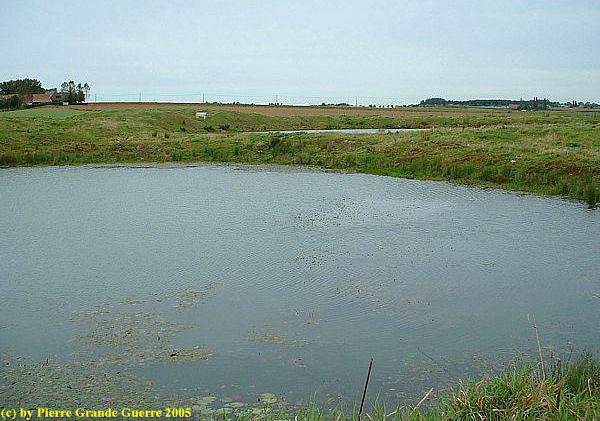
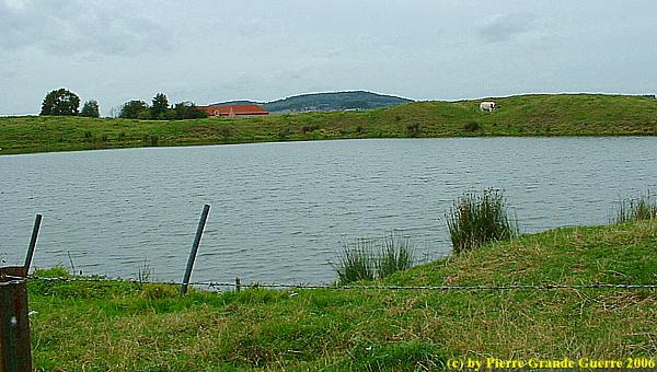
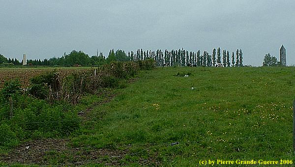
We turn left at the Kruisstraat to continue southward to the Span Brook Mill or Spanbroekmolen mine crater, nowadays called the Pool of Peace.
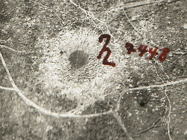
The "Lone Tree Crater"
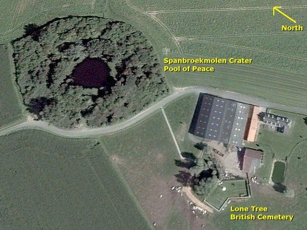
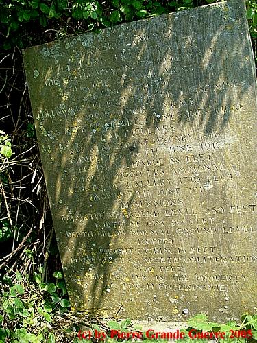
One of the biggest mines was laid under the knoll of Spanbroekmolen, named after the windmill, that stood there until 1 November 1914. The "Lone Tree Crater" was formed by the blast of 91,000 pounds of ammonal in a chamber at the end of a tunnel running 27 m. below ground with a length of 520 m. The Spanbroekmolen mine went up a few seconds after Zero Hour. Some numbers about the water filled "Crater 11": Diameter : 76 m. Depth of crater: 12 m.
After detonating the 19 out of the 21 planned mines, the 36th (Ulster) Division attacked the German positions at the site of the former Spanbroek Mill.
Memorial for the Ulster soldiers at the Pool of Peace.
We continue via the Kruisstraat south-eastward to go right in the Wulvergemstraat for a short detour to the twin craters of Kruisstraathoek.
Crater no. 1 and Crater no. 2 were created by huge 33,000 pound mines. Some shells on the lips of crater no. 1.
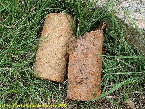
Mine crater no. 2
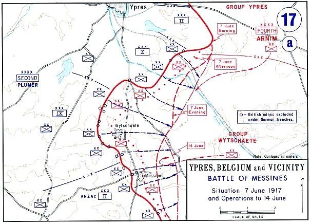
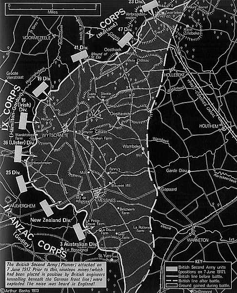
The Battle of Messines (7–14 June 1917)
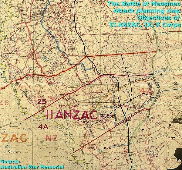
The 19 mines beneath the German lines destroyed the German front line defences. Immediately after the detonation 9 Divisions of the British Second Army, under the command of General Sir Herbert Plumer, started the Battle of Messines.
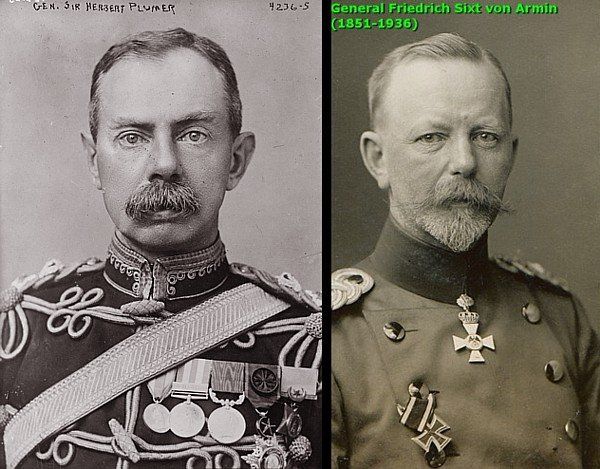
Five German Divisions of the “Gruppe Wijtschate” of the 4th Army under General Friedrich Sixt von Armin defended the front sector on the heights, later reinforced by a division from the “Gruppe Ypern”. The "Gruppe Wijtschate" comprised units of the IX Reserve Corps, the 204th, 35th, 2nd, 3rd Bavarian and 4th Bavarian divisions, supported by the 7th Division and 1st Guards Reserve Division.
The objectives of the attack at Messines were to capture the high ground south of Ypres from the German defences on Messines Ridge and to shorten the allied front line, and so to gain a better starting position for the follow-up of the Third Battle of Ypres.
Preliminary Artillery Bombardment

On 8 May 1917, a month before the mine detonation, the British preliminary artillery bombardment had already started on the front between Hill 60 in the north and Ploegsteert in the south. From 23 May the bombardment intensified. During the week before the attack, 2,230 British guns and howitzers bombarded the German trenches, cut wire, destroyed strongholds and conducted counter-battery fire against 630 German artillery guns, using 3,561,530 shells.
On 7 June at 2:50 AM, the preliminary artillery bombardment ceased. The German defenders left their dug-outs and returned to their forward trenches, awaiting a customary follow-up of an infantry attack.
At 3:10 AM the mines exploded, killing some 10,000 German soldiers and paralysing the astonished survivors.
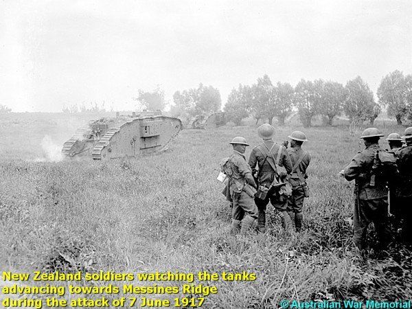
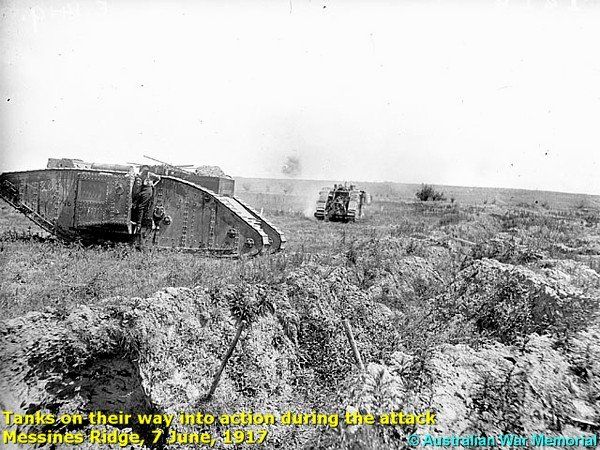
Creeping Barrage - Infantry Attack - Tanks - Air Support
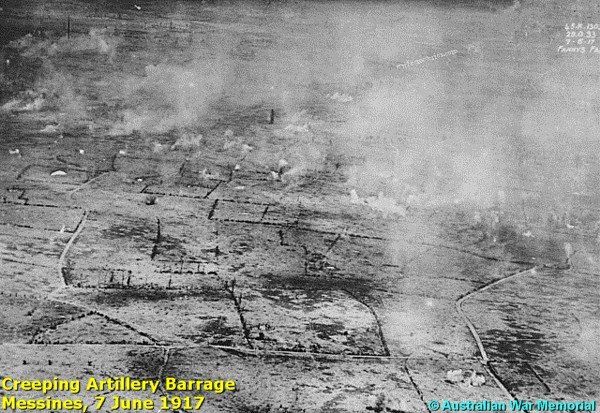
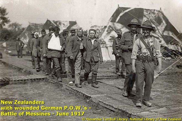
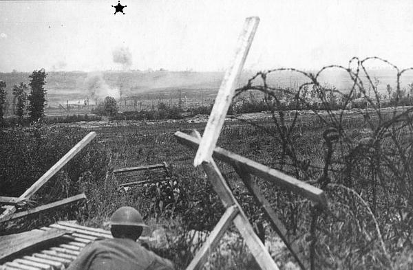
A creeping artillery barrage of 640 m. deep followed the mine detonations. This barrage covered the infantry units of New Zealand, Australia, and Ireland as they attacked the front line with support from 72 Mark IV tanks and 300 aircraft.
In the north, the 16th (Irish) Division attacked between Maedelstede Farm and the Vierstraat–Wijtschate road . In Wijtschate and near St. Eloi, some German units held out, waiting to be relieved by counter-attacks which never arrived.
In this area of Messines the 36th (Ulster) Division was helped by the mine at Peckham Farm, which devastated the area. The survivors were stunned by the mine explosion. The 36th (Ulster) Division’s attack was also supported by the 2 mines at Kruisstraat and the mine at Spanbroekmolen.
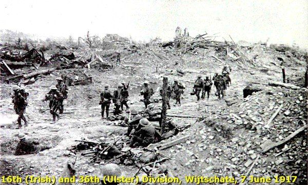
Members of both Divisions captured the German lines hardly without resistance and occupied the village of Wijtschate.
II Anzac Corps
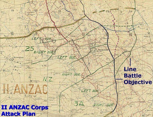
The II Anzac Corp’s objective was the southern part of the ridge and Messines village. In the sector of II Anzac Corps mines detonated at Ontario Farm and near Ploegsteert and St. Yvon at Trench 122 and 127. The British 25th Division, attached to II ANZAC Corps, advanced on the left flank of the Corps.
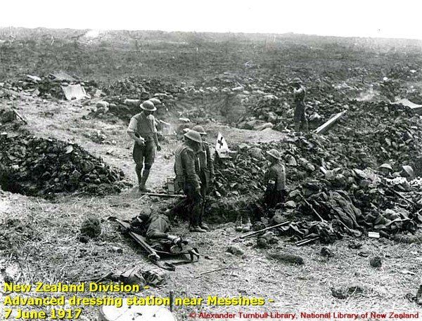
On the right flank, the 3rd Australian Division attacked between St. Yvon and the Douve brook. The New Zealand Division approached in the middle from the south-west over Hill 63 and avoided a German gas bombardment.
The attacking brigades crossed the Steenbeke brook and the Douve brook and took the German front line at La Petite Douve Farm. From there the brigades advanced towards Messines village.
During the creeping barrage the German defenders only saw dust and smoke, being simultaneously under fire from British tanks and artillery and being machine-gunned from aircraft. Still the German defence on Messines Ridge answered these attacks with heavy machine gun fire causing many British casualties, soldiers from Ulster, Ireland, New Zealand and Australia. Finally the resistance in the south collapsed, forcing the Germans to retire to the east, to the “Sehnen Linie” or Oosttaverne line running from Hollebeke in the north to Warneton in the south.
The Aftermath
On 14 June, after the battle, the British had 24,582 casualties. The Germans counted about 35,000 casualties, including 10,000 soldiers Missing In Action or made Prisoner Of War (7,200).
Military historians do not agree on the strategic significance of the battle. Although the casualty numbers of wounded and killed soldiers of both parties are roughly in balance, after all the British operation was a success. The British divisions reached almost all their battle objectives and gained terrain on strategic heights. The operation shortened the allied font line to facilitate the next battle in the area. The Battle of Messines was a rather short prelude to the much longer offensive of a month later, the Third Battle of Ypres of July 1917.

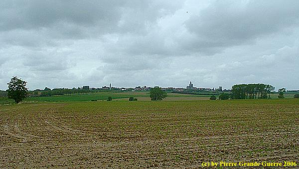
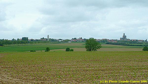
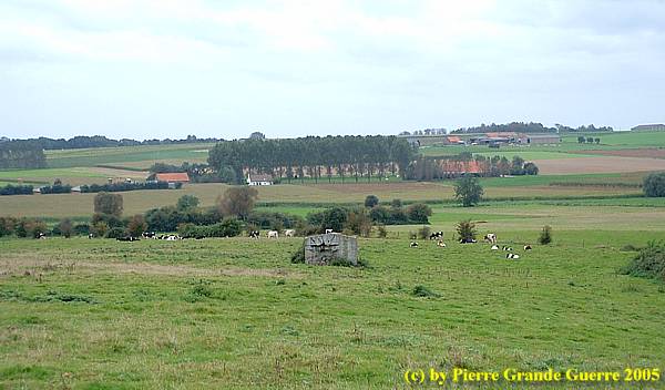
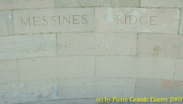
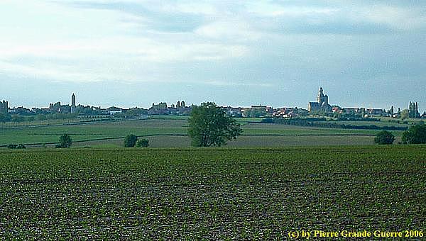
We continue to the village of Messines, Flemish "Mesen". A view on Messines Ridge from the south.
Messines - Mesen
On 1 November 1914 the Germans captured Messines Ridge and its village Mesen.
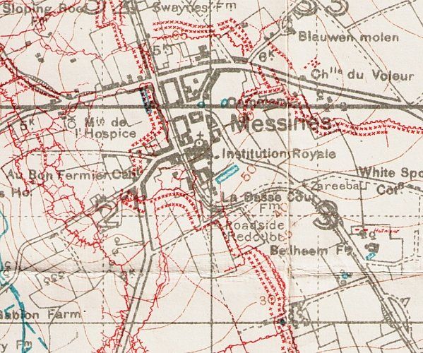
The Germans transformed the hill into a stronghold, with an extensive system of barbed wire networks, trenches, and dug-outs.

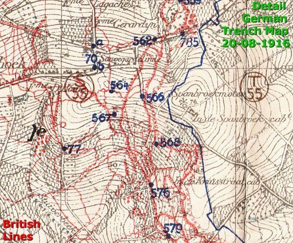
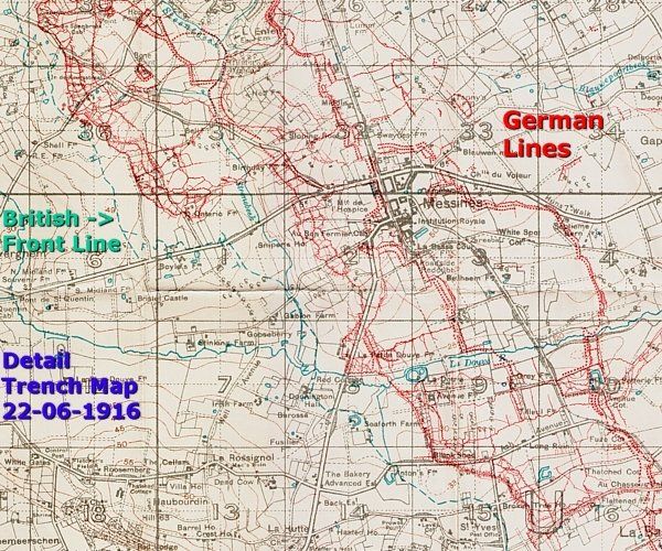
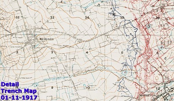
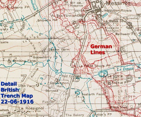
Below, a trench map detail of the situation at Messines after the battle, on 1 November 1917. Again the British front line trenches in blue and the German lines of the "Sehnen Linie" in red.
| On 10-11 April 1918, the Germans captured Messines Ridge again after a stubborn defence by the South African Brigade. The British conquered Mesen for the last time on 28-29 September 1918. |
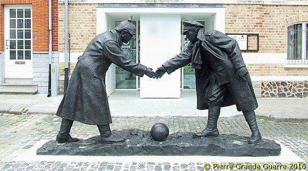
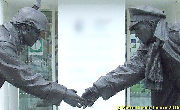
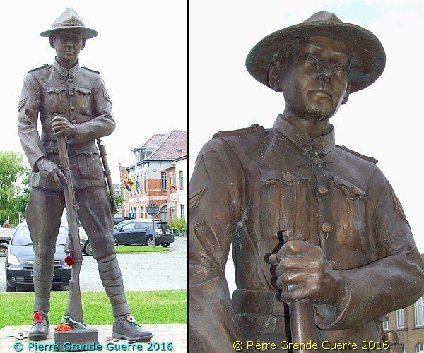
In the centre of the village of Mesen we visit first on the "Markt" two 2014 statues.
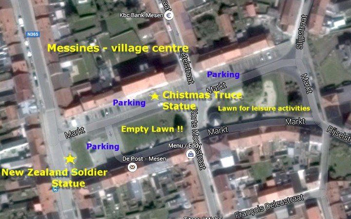
This statue of the sculptor Andrew Edwards commemorates the 1914 Christmas Truce football event near the hamlet of St. Yvon, 3 kilometres south of Messines.
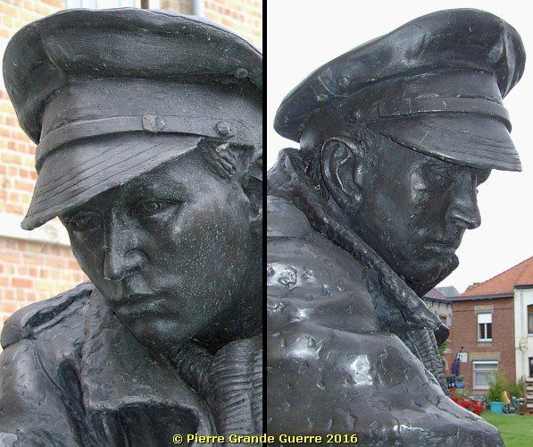

On the west side of the Markt stands this statue of the sculptor Jean Dieusaert of a New Zealand soldier to commemorate the 1917 Battle of Messines.
Next we will visit some sites just outside the village.
The Memorial for the Irish soldiers on Messines Ridge. The 36th (Ulster) Division fought at the Battle of Messines alongside the 16th (Irish) Division.
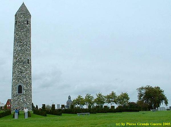
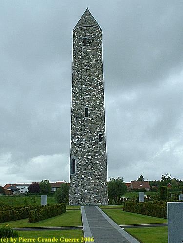
Island of Ireland Peace Park
"The Island of Ireland Peace Park is dedicated to the soldiers of Ireland, of all political and religious beliefs, who died, were wounded or missing in the Great War of 1914-1918. Irish men and women served with the Armies of Australia, Britain, Canada, New Zealand, South Africa and the United States.
The memorial site is also known as the “Irish Peace Park” or the “Irish Peace Tower”.
The tower was built as a symbol of reconciliation by An All-Ireland Journey of Reconciliation Trust and the support of the people of Messines (now called by its Flemish name Mesen). The design is that of a traditional Irish round tower dating back to the 8th century. It is 33.5 metres (110 feet) high. As part of the design the inside of the tower is lit up by the sun only on the 11th hour of the 11th day of the 11th month. This is the time at which the Armistice was declared and the guns fell silent on the Western Front after four years of fighting."
Source: http://www.greatwar.co.uk .
A panoramic view southward from this Irish memorial park. Australian and New Zealand divisions attacked Messines Ridge directly, from Ploegsteert Wood (left) and La Plus Douve Fram (right) on the horizon.
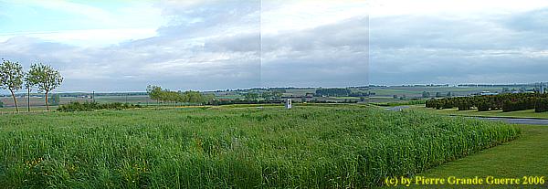
View southward, in the direction of St. Yvon and Ploegsteert Wood from the road along the Memorial Tower, N 365.

Behind the agricultural sheds on the horizon: the Christmas Truce Football Field of 1914, north of St. Yvon.
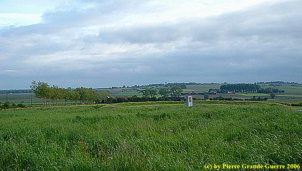
... and La Plus Douve Farm and Neuve Chapelle.

We continue from the Irish Tower, ...
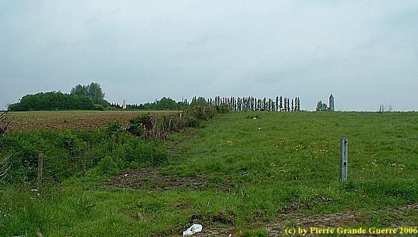
The New Zealanders came from these hills on the horizon...

... and La Plus Douve Farm, south west of Messines.
View from near La Plus Douve Farm in the direction of Messines Ridge.
From these hills and valley the soldiers had to climb and fight up this steep slope ...
... under heavy German machine gun fire from these bunkers, ...
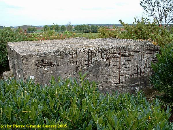
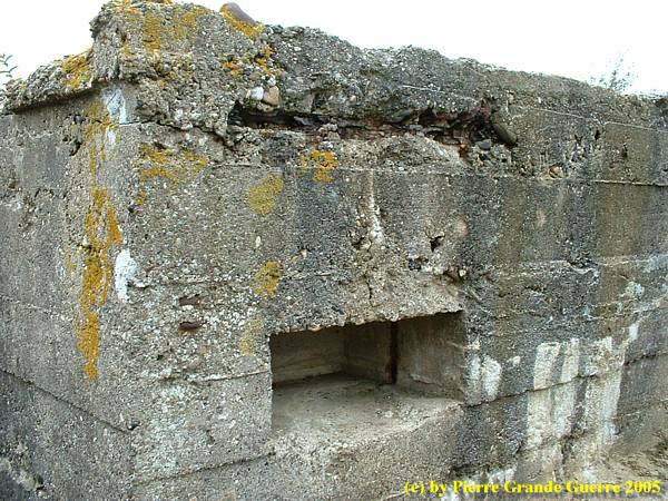
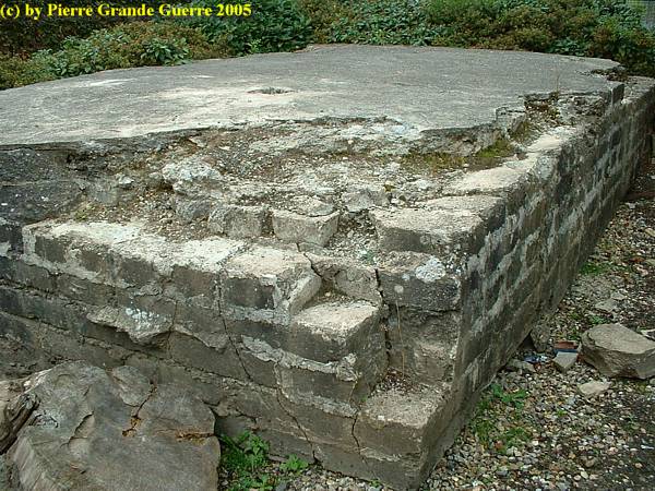
... which are now still on the grounds of the Memorial for the New Zealand Division .
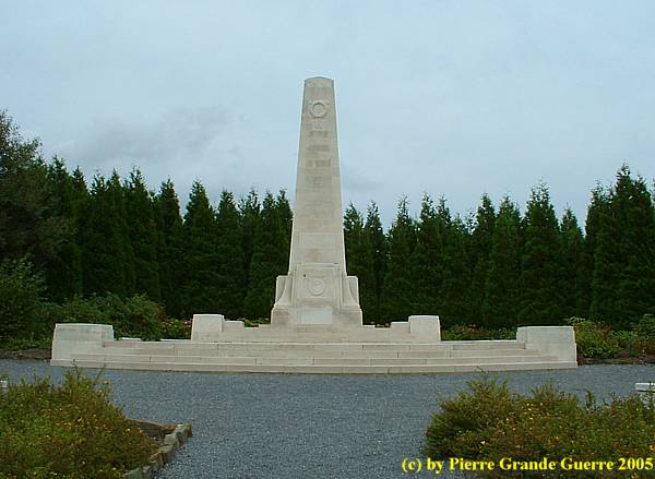
The Memorial commemorates over 800 soldiers of the New Zealand Expeditionary Force who died in or near Messines in 1917 and 1918 and who have no known grave.
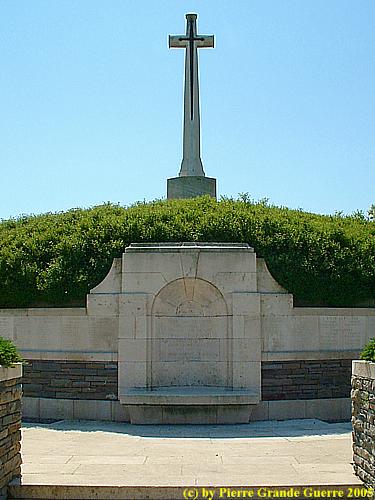
Next to the New Zealand Division Memorial lays the British Cemetery of Messines Ridge .
MESSINES RIDGE BRITISH CEMETERY was made after the Armistice when buried remains were brought in from the battlefield around Messines and from small burial grounds.
There are now 1,534 Commonwealth servicemen of the First World War buried or commemorated in the cemetery. Of these burials, 957 are unidentified, but special memorials commemorate a number of casualties known or believed to be buried among them, or who were buried in other cemeteries where their graves were destroyed by shell fire. The New Zealand Division Memorial belongs to this cemetery.
The dates of death of those buried here range from October 1914 to October 1918, but the majority died in the fighting of 1917.
Source and more details: Commonwealth War Graves Commission
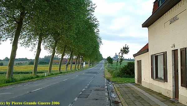
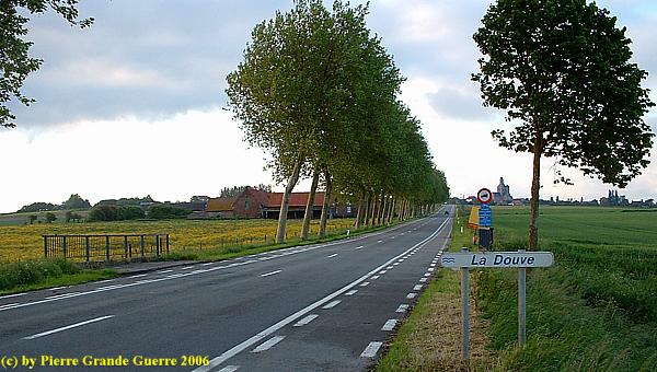
We continue via the N 365 to the southern outskirts of the village.
| La Petite Douve Farm / Weihnacht Hof |
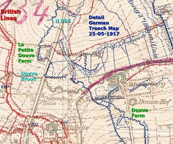
Before 1917 there were constantly raids and attacks along the front sector of Messines Ridge; e.g., on La Petite Douve Farm, south-west of Mesen, which used to be a German stronghold with machine gun posts.
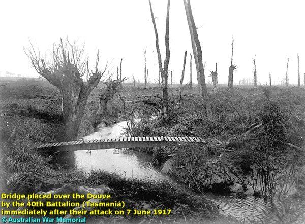
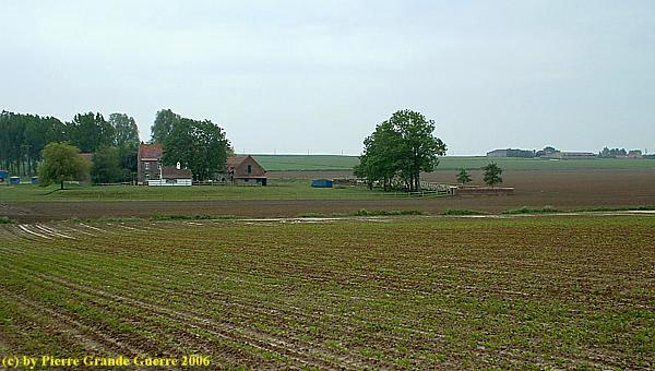
About 1,2 km south of the village we visit a modest bridge over the Douve brook, which forms an example of these fights, a site of action in November 1915.

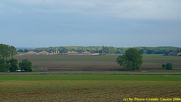
The modern version of la Douve Farm, east of the N 365, seen from the south, at the horizon Mesen.
View eastward from the N 365 to the modern farm, built on the same spot.
On 17 November 1915 the Canadian Lt. H. Owen and troops of the 5th and 7th battalions C.E.F. raided La Petite Douve Farm on the left, west side of the road.
They had to cross the Douve brook to raid the farm.

The modern version of La Petite Douve Farm.
The Canadian 7th battalion crossed the brook left of the bridge, the 5th crossed the Douve at the east side of the bridge to create a diversion.
From this photo impression page I suggest two options to continue: Continue south to the site of the Christmas Truce
at St. Yvon OR continue north to Pilkem Ridge
and the Battle of Passchendaele, or Third Ypres.
Note: The Special Photo Impression about St. Yvon will be transferred in the near future.


