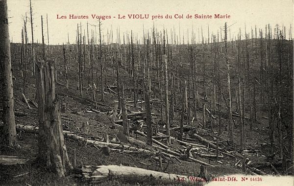
VOSGES - Ste. Marie-aux-Mines - Tête du Violu / Bernhardstein
Year of visit: 2008, 2010

We concentrate on the German side of the front around "Markirch", Sainte Marie-aux-Mines, the so-called "Leber" front sector . We first pay a visit to the Sainte-Marie-aux-Mines Deutscher Soldatenfriedhof, and next to the southern side of the Col de Ste. Marie for the many interesting bunkers of the German positions at the Bernhardstein, at the north-eastern slopes of the Tête du Violu. On the next photo page about the Haut de Faîte we will continue with a visit to the northern side of the pass and the "Leber" sector.
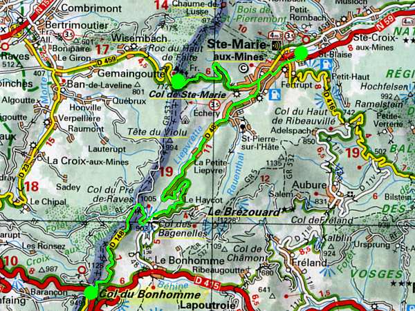
This time we depart from the Col de Bonhomme, to the left, northward along the D 48, the former D 148.
Attention: The pages about the Central and Southern Vosges start also with the Col du Bonhomme !
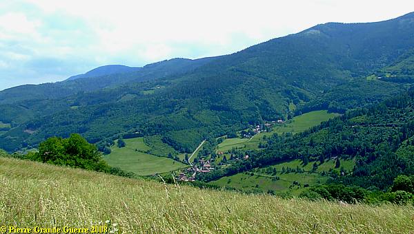
We pass the Col des Bagenelles , ...
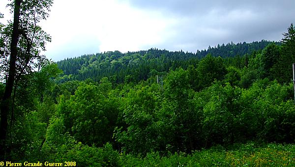
... which offers this panorama view northward over the valley of the Lièpvrette-river, into the direction of Ste. Marie-aux-Mines.
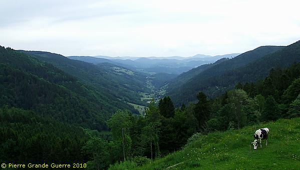
Passing the No Man's Land of the Col de Bagenelles we enter the German "Leber" Front Sector.
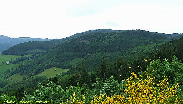
View from south-west to north-east over the Val d'Argent, the "Silver Valley". The valley got it's name after it's 18th century silver and mineral mines. Right: Echery. In the valley at the horizon; Sainte-Marie-aux-Mines.
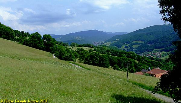
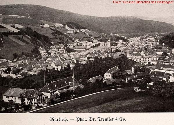
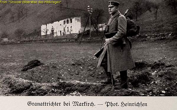
During the period of 1871-1918 Sainte-Marie-aux-Mines was a German border town, called Markirch. Markirch was only 4 kilometres away from the Col de Ste. Marie border crossing in the west.
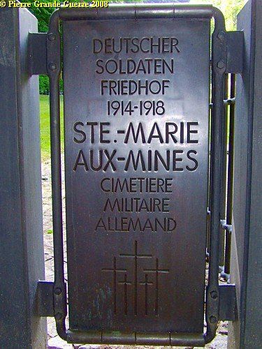
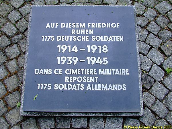
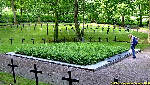
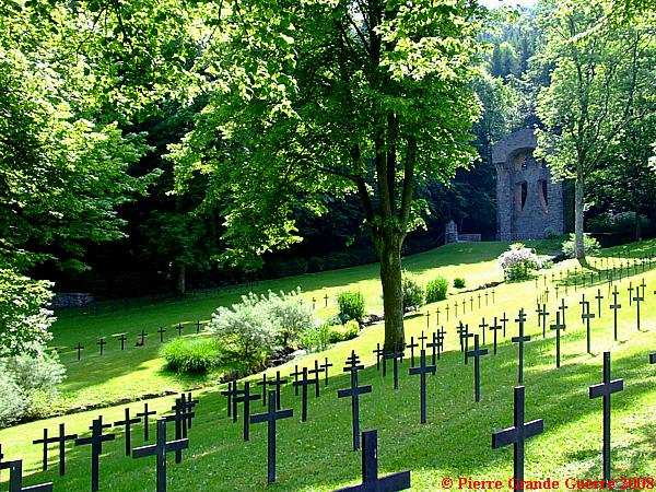
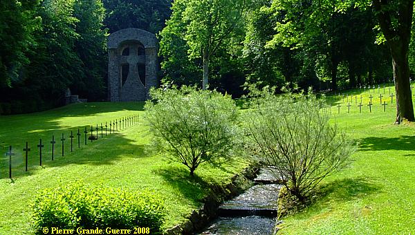
To get in the right mood for the day, and to get an impression of the German units, defending the front sector around Sainte Marie-aux-Mines, we start with a visit to the Sainte-Marie-aux-Mines Deutscher Soldatenfriedhof . The cemetery is situated at the eastern outskirts of Ste. Marie-aux-Mines.
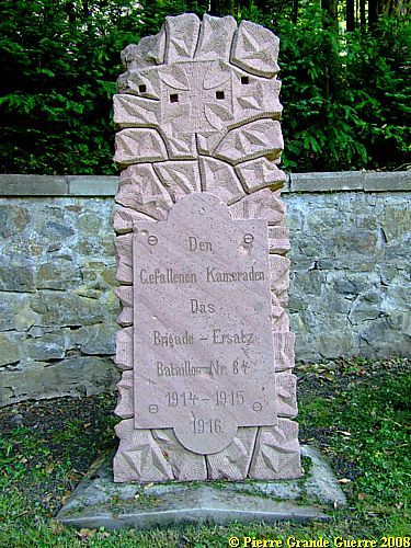
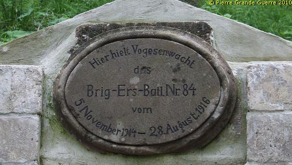
Along the eastern wall some memorials. The Memorial for the Brigade Ersatz-Battalion 84.
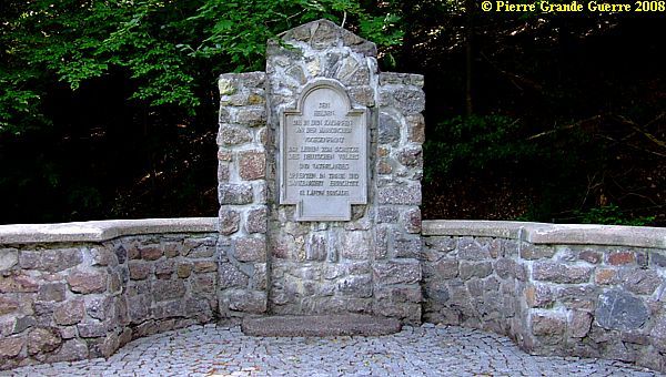
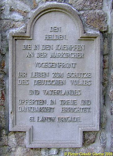
Some 15 meters beyond: the memorial for the 61. LANDWEHR BRIGADE.
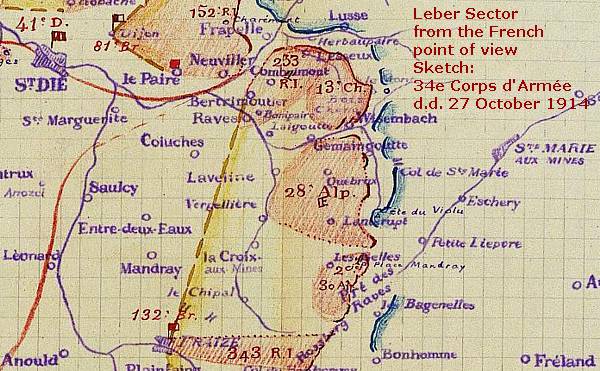
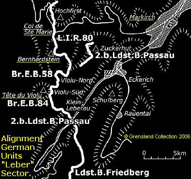
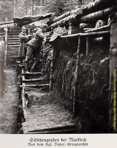
The German "Leber" Front Sector
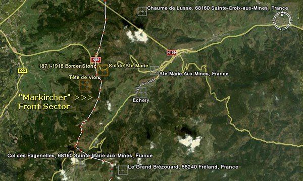
The German front sector, the
"Leber" Sector, west of Markirch, had a length of 15 km. The
sector stretched from the summit of the Chaume de Lusse (838m.) in
the north, via the eastern slopes of the Bernhardstein (856m.),
southward to the summit of the Grand Brezouard (1229m.), north of Le
Bonhomme.
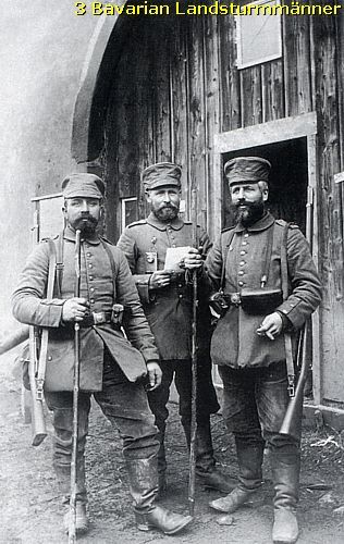
The 61. Landwehr Brigade
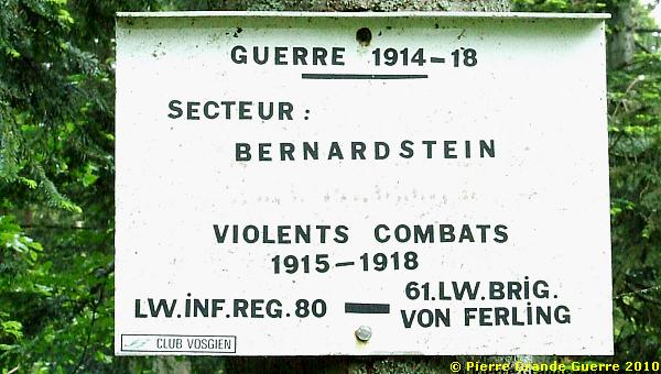
With intervals this front sector has been defended by the 61st. Landwehr Brigade, a Prussian reserve unit, consisting also of Hessian and Bavarian units, under command of General Freling, from 1914 until 1917.
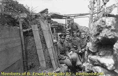
Other important German units, which were also active in this sector, were: Infanterie Regiment 126 and 132; Jäger Bataillon 8; the 1. Bayerisches Ersatz Brigade, including Landwehr Infanterie Regiment 80 und 81; Brigades-Ersatz Bataillons 81, 58, and 84; Bayerische Pioniere Bataillon 15, Minenwerfer-Kompanie 409; the 2. Bayerische Ersatz-Regiment; Feld Artillerie Regiment 66 and 80; the Württemberger Infanterie Regiment 180; and Landsturm-Infanterie Battalions from several German towns, like Weilheim, Friedberg, Kempten, Bonn, Passau, Landshut, Düren, and Augsburg.
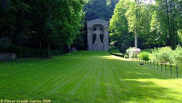
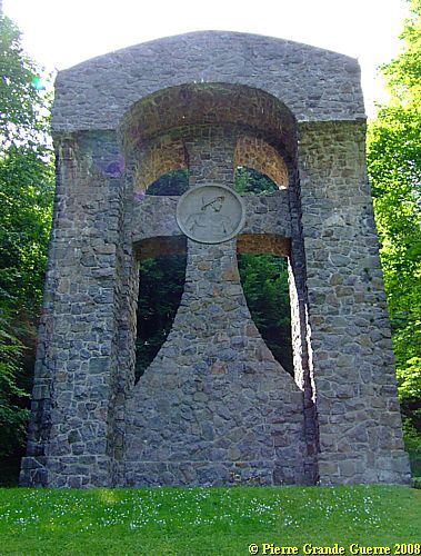
At the south-east corner of the cemetery towers this Maltezer Cross.
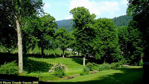
View from the Maltezer Cross over the cemetery.
A brook is meandering through the cemetery.
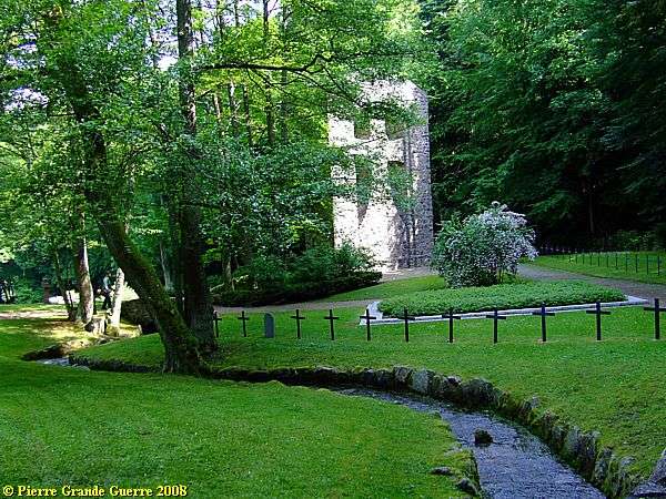
The mass grave has a triangular shape.
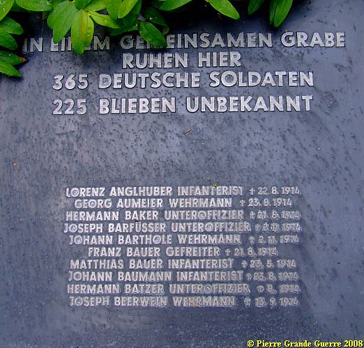
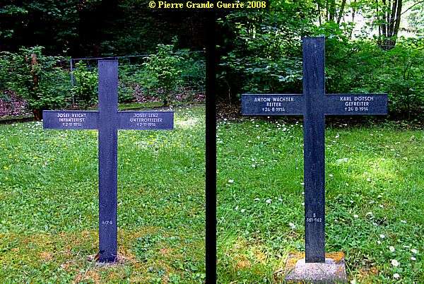
Six bronze plates with lists of names of Landwehrmänner, ...
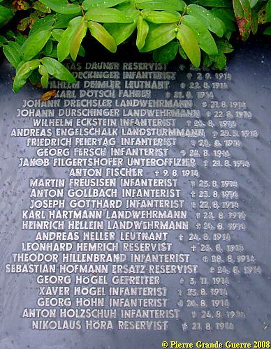
... Infanteristen, Landsturmmänner, Reservisten, soldiers, NCO's, and officers.
From left to right: An infanterist, a NCO, a horseman, and a corporal.
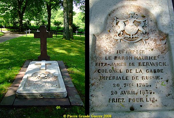
At the centre of the cemetery lies the grave of Baron Maurice Fitz-James de Berwick. The land on which the "Soldatenfriedhof" was founded in 1916, belonged to the father in law of Baron Maurice, who died on 20 April 1835 in the house of his father in law.
View from west to east over the cemetery.
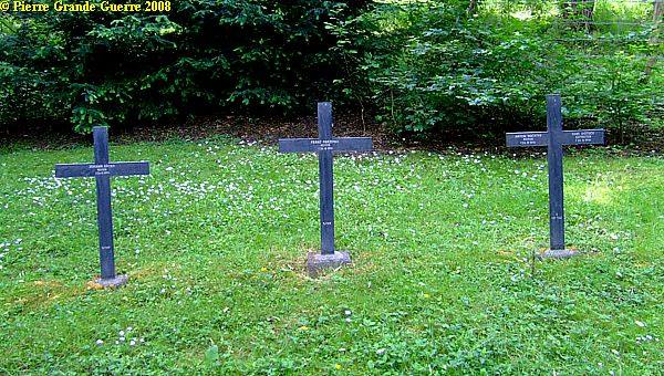
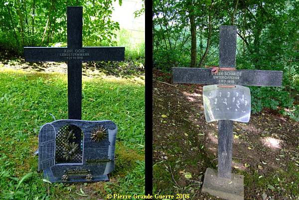
Left: the grave of a Landsturmman.
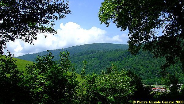
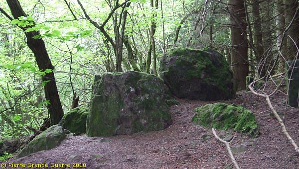
View from the western edge of the cemetery to the Tête du Violu and the Pain du Sucre (centre).
With a last view over the cemetery, ...
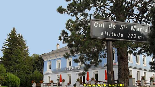
... we depart for the Col de Ste. Marie, some 4 km. to the west.
The mountain pass, Col de Ste. Marie , lies west of the town, at a height of 776 meter.
At the southern side of the pass we park our car, ...
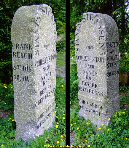
... and we find under the trees, left of this hotel, this 1871-1918 German border demarcation stone.
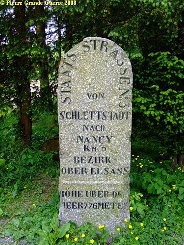
It served also as a road information sign. "Schlettstat" is nowadays Sélèstat, France.
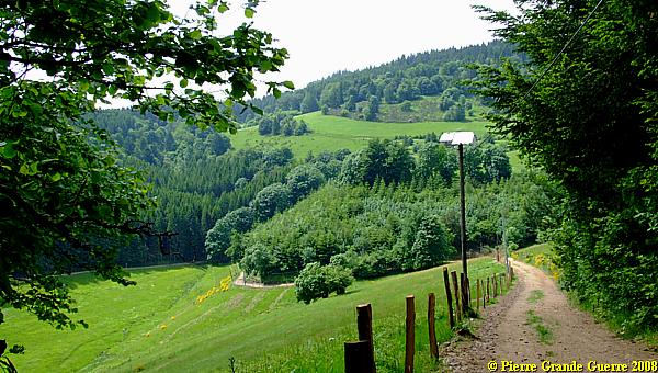
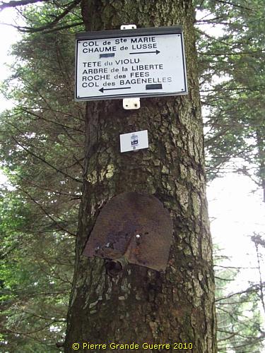
Three walking routes
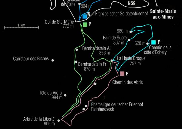
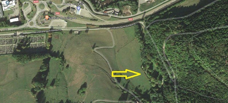
From here you have the option of walking three routes southward.
In 2008 we based ourselves on the east side of the Green Route, but we allowed ourselves a shortcut southward; see our Yellow Route below.
In 2010 we concentrated ourselves on the west side of the Green Route, but again, we choose to deviate south-eastward, marked as the Turquoise Route below.
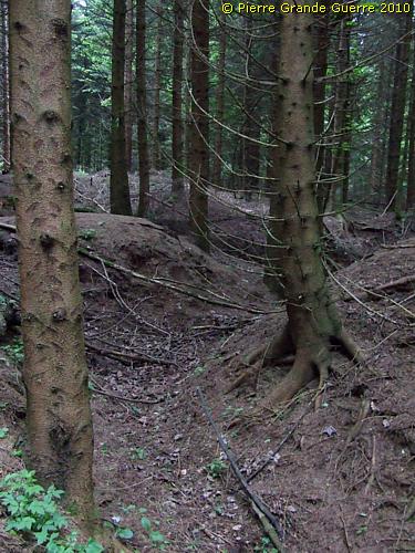
Though this wooded terrain with steep slopes might sometimes be confusing to orientate yourself, but the ultimate distance in bird's flight between these two routes is not more than 300 m.
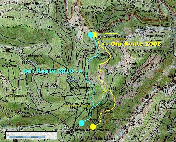
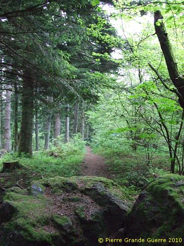
We prefer both times staying along the German lines of the Bernhardstein.
We pass the border demarcation stone to follow a path, southward, along the eastern slopes of the Bernhardstein (870 m.).
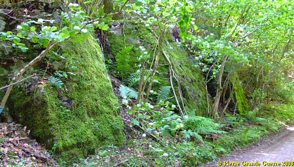
This path bears the name "Landwehrstrasse", or "Chemin des Abris".
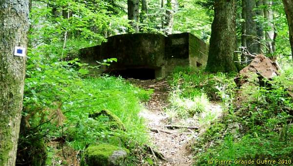
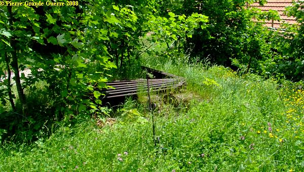
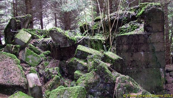
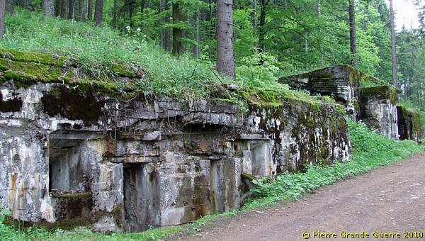
Along the path we find huge bunkers with entrances to filled in, mined caves, "Stollen".
The Bernhardstein Sector
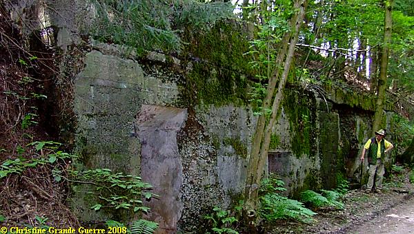
In this sector of L.I.R. 80 the Germans constructed a téleferique cable car connection for transport of supplies and ammunition from the valley of Hergauchamp. There was also a mini railway connecting the east and west side of the Bernhardstein. Along the Landwehrstrasse the Germans built cable car stations, bunkers for electrical generators, a water pumping station, a forgery, dressing station bunkers, dugouts in mined caves, canteens, kitchens, ammunition bunkers, and bunker pits for "Minenwerfer" and "Ladungswerfer". Of course this sector of the Landwehrstrasse, behind and close by the summit of the Bernhardstein attracted series of French artillery bombardments.
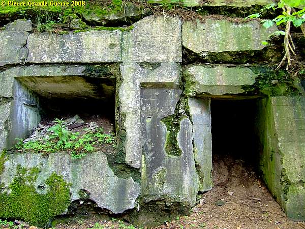
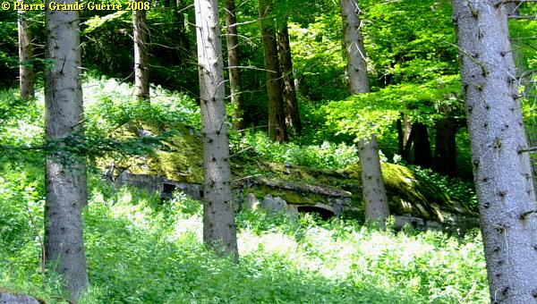
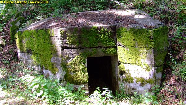
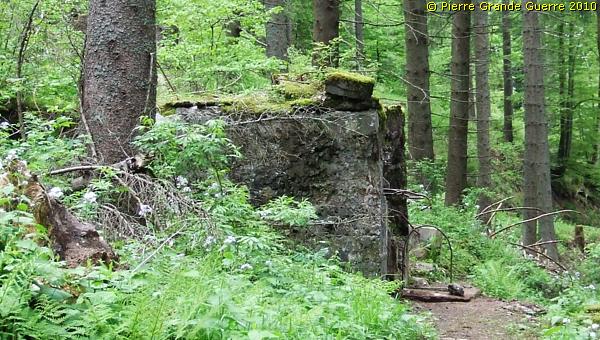
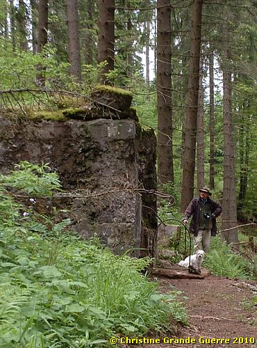
Also on the steep slopes below the path, we see some masonry buildings, sometimes fortified with concrete.
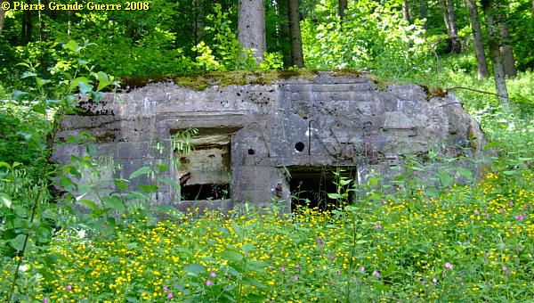
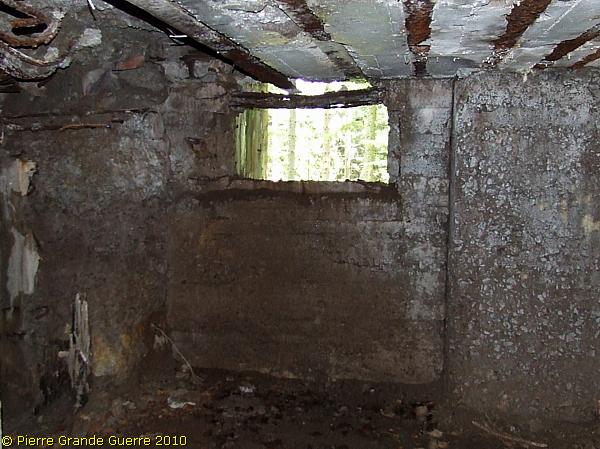
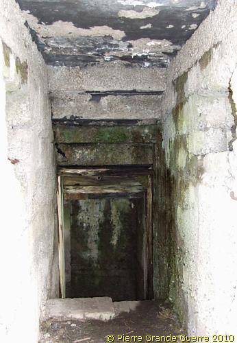
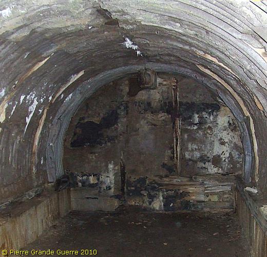
" Sanitätsunterstand Hessen ", the Hessen Dug-out, served as a dressing station.
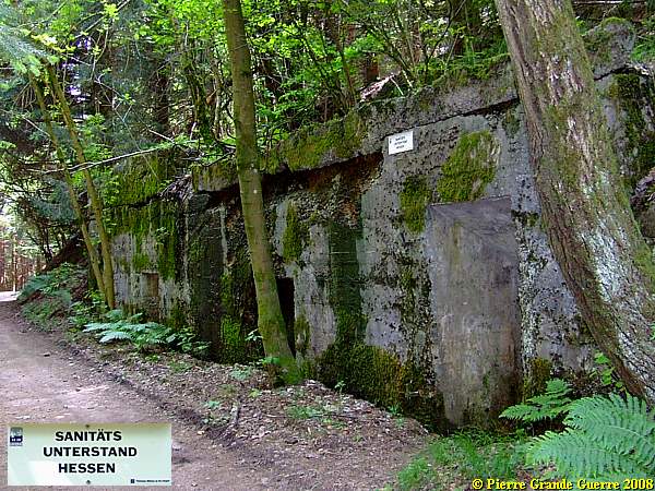
The interior of the "Sanitätsunterstand Hessen".
The front of the bunker, photographed by my late wife Chris from the south.
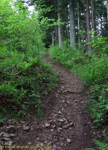
We continue our walk along the Chemin des Abris, the "Bunker Path", southward.
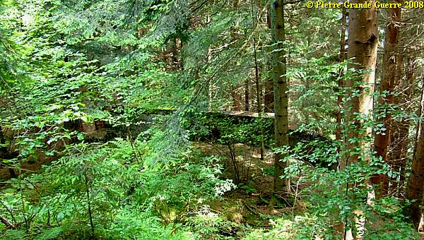
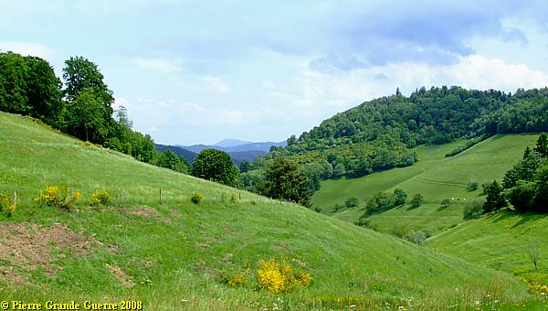
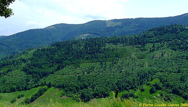
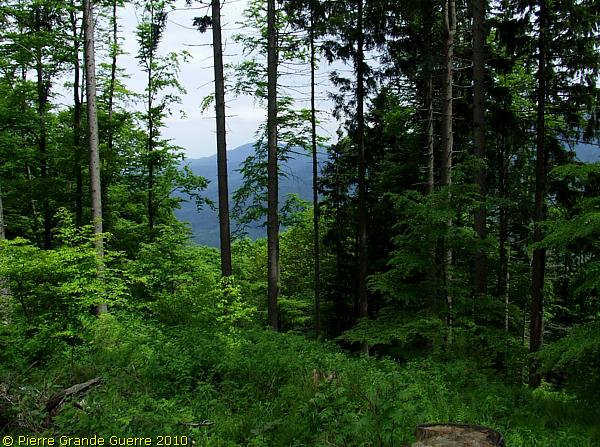
I can not resist to offer you some views of the landscape during our walk; eastward over the valley of Hergauchamp..
And a view backward, northward, to the wood of the "Hessen Bunker".
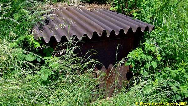
Passing a farm, we see some corrugated steel boards, and a pigtail shaped barbed wire pole.
View eastward over the Val d'Argent and Echery.
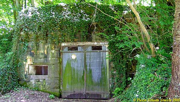
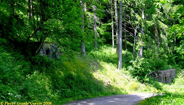
This farmer uses this German bunker as his shed.
We continue to walk southward over the eastern slope. View eastward over the valley of la Lièpvrette-river, in German the "Leber" river.
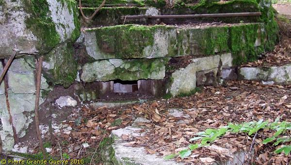
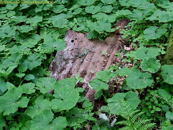
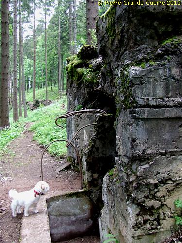
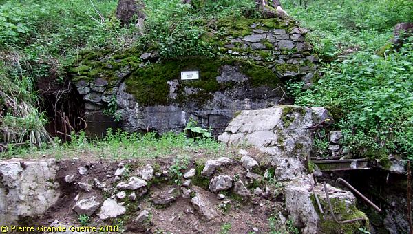
A source, important along the front, covered with corrugated steel, and a steel plate, which looks 90 years old.
At a curve in the path, I find this stone with a German inscription: "Feste Heimat"
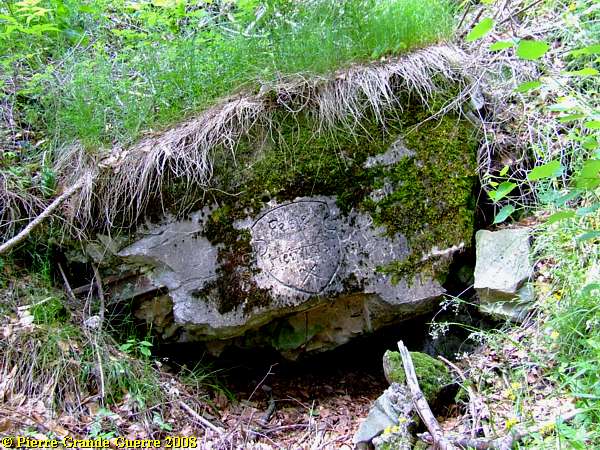
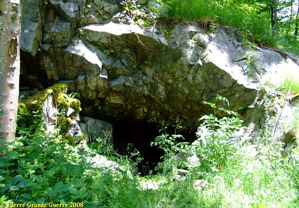
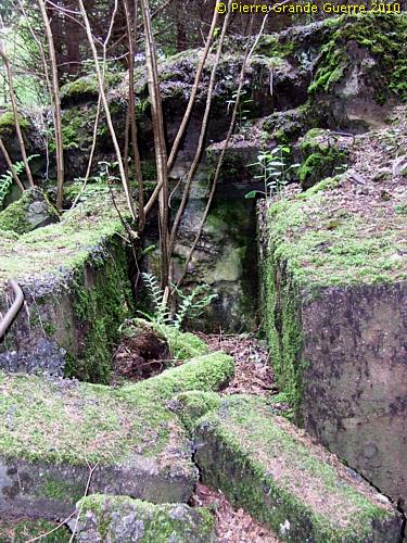
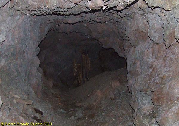
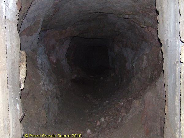
It is near this entrance to a mined cave of a "Stollen"-system.
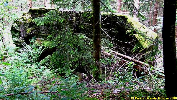
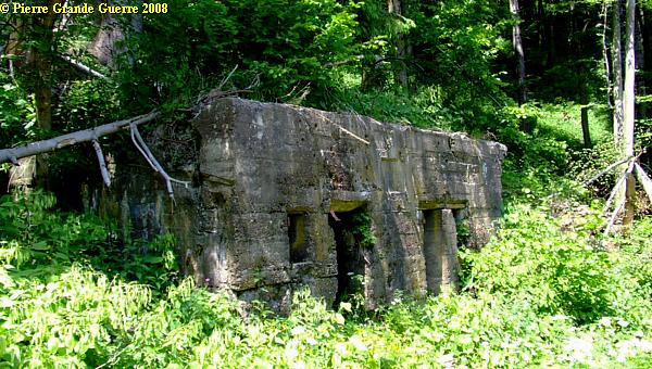
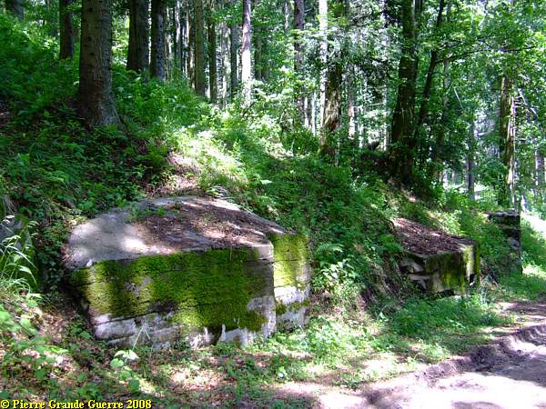
The verges of the path are densely vegetated again. I detected 3 bunkers along the west side of the path.
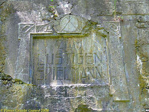
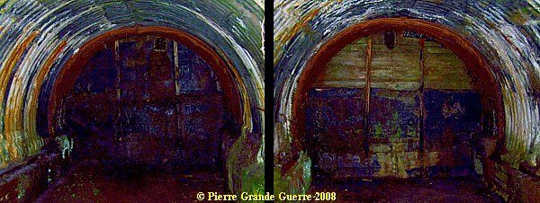
The interior of the " Lustigen Spielmann ", view to left and view to right.
Another view of the "Lustigen Spielmann", which may have served as a canteen bunker.
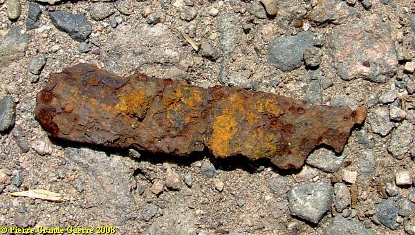
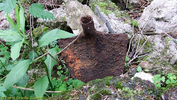
In front of the bunker and around it, I did find some fragments of shells, like this one.
On the densely vegetated slope above the "Lustigen Spielmann" lies another bunker, which I unfortunately could not reach.
Some 50 meters southward, along the path; another bunker.
View from the south of the 3 bunkers. The "upper" bunker is hard to be seen.
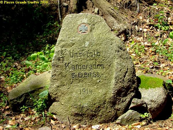
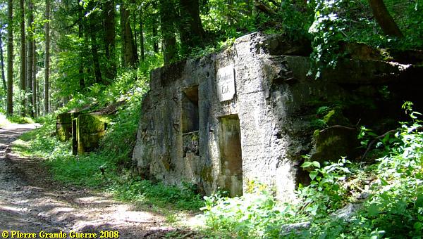
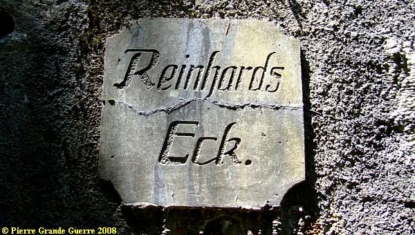
We continue southward to a point, which is called Reinhard's Eck, Reinhard's Corner. Here we find a relic of a wartime cemetery, a lonely stone, and a silent witness of the presence of the Bavarian Ersatz Bataillon 58 in 1914.
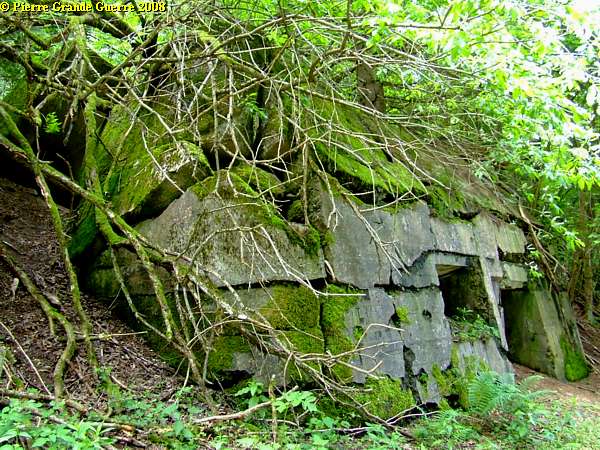
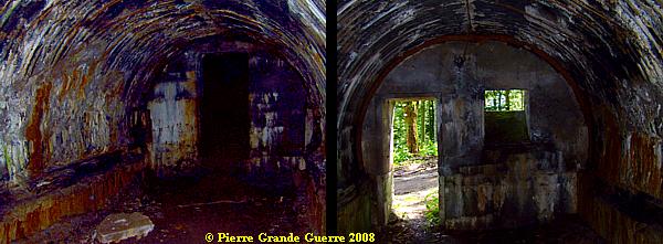
Reinhard's Eck looks like a small street, three bunkers on a row.
The interior of the Reinhard's Eck-bunker.
The next two bunkers with the cupola shaped roof are of 1917.
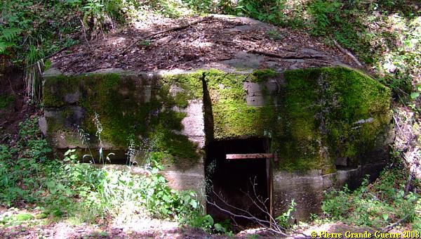
This is a type of pillbox shaped bunker, which you will find more often along the Vosges front.
Another view from the west at Reinhard's Eck.
Route of 2010, along the first and second lines
In 2010 we returned to the Col de Ste. Marie to explore the Turqoise
Route under various wheather conditions.
We climb the track upward to 875 m., following the former 1871-1918 borderline.
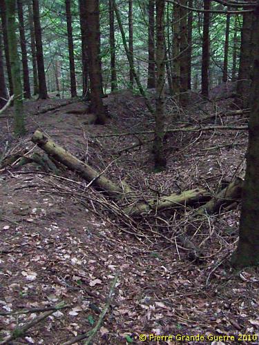
In the wood we detect traces of trenches.
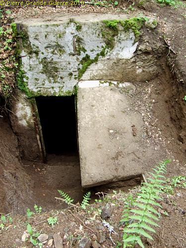
A concrete breastwork, facing west...
... with a dug-out entrance.
We are now in the first German front line.
We continue upward along a difficult track, seeing more traces of trenches.
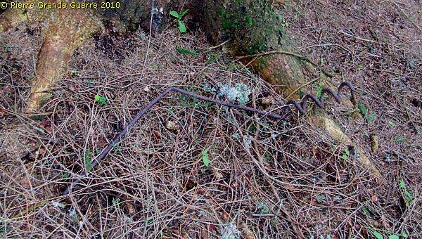
A rusty Pioniere spade confirms us ...
... that we are on the right track in this rocky wood.
Another pigtail shaped pole of a barbed wire entanglement.
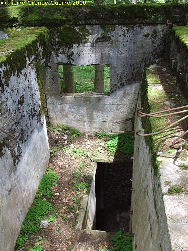
At the west side of the track we arrive at two bunkers next to each other; ...
... a bunker in a badly ruined condition, ...
.. and a bunker in a rather good condition.
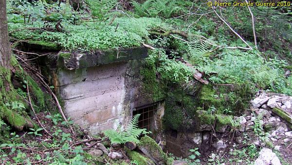
Though the bunker might not look very spectacular, before our trip my Dutch friend and fellow front explorer, René, tipped me rightly to visit this peculiar bunker.
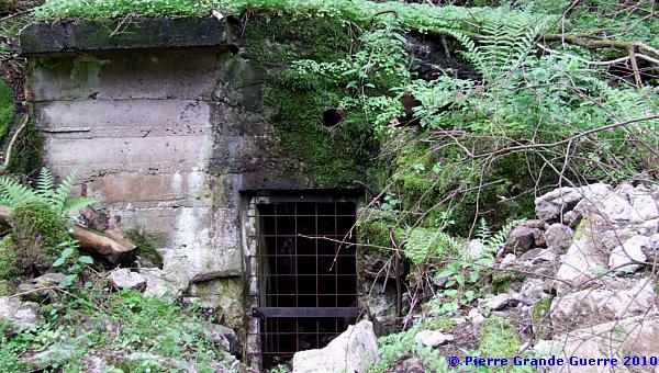
The stairway downward in the right corner makes this bunker so interesting.
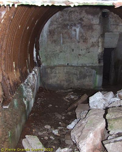
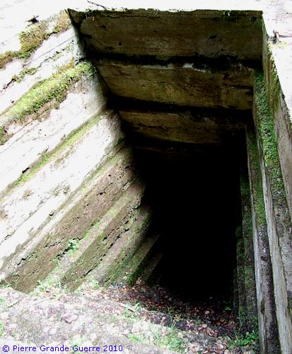
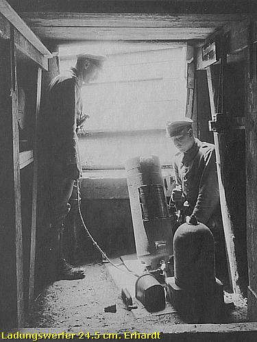
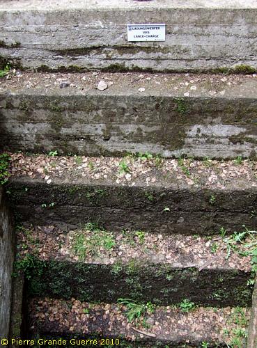
The stairs run to a tunnel, which connects to 2 concrete pits of a "Ladungswerfer", a heavy trench mortar.
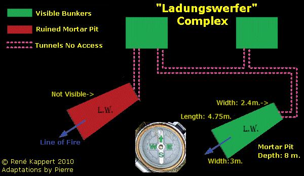
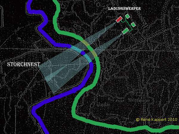
Later on this page I will explain more about this Ladungswerfer.
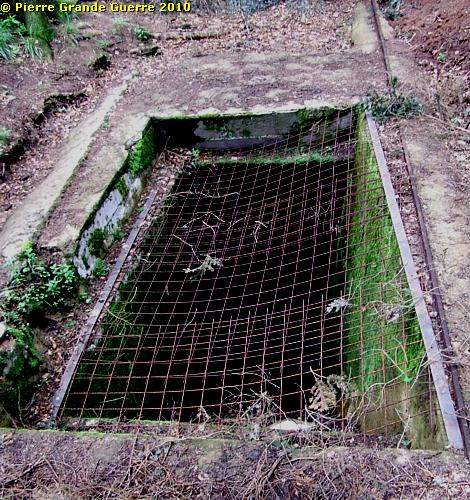
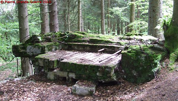
The visible Ladungswerfer pit, some 15 m. away from the bunker, covered with an ugly grill for your safety.
We return to the east side of the track for another bunker.
The top construction has collapsed by an explosion.
The relic of the concrete entrance trench.
As local fellow passionates told us later; in many cases the Germans exploded themselves these bunkers at the end of the war. So this is probably not caused by war damage.
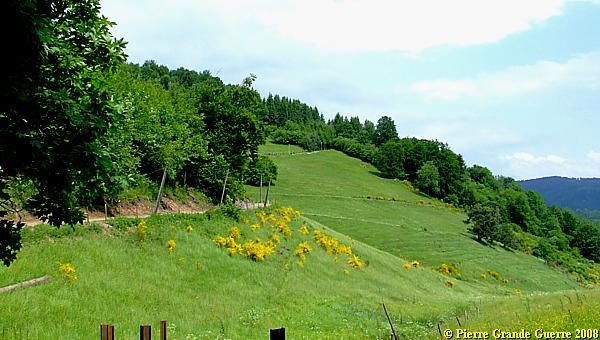
We continue upward along a beautiful open spot.
If you look more carefully on the ground, you will see relics of barbed wire entanglements.
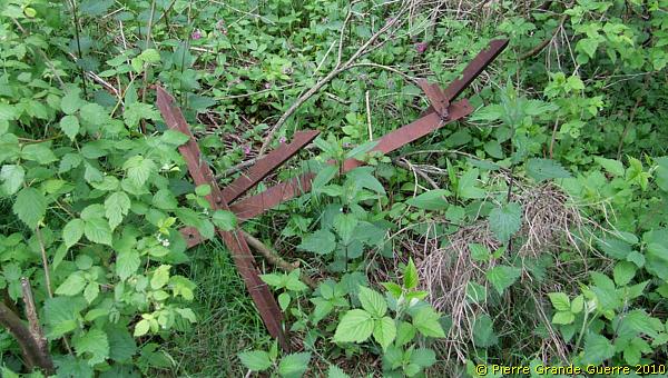
“ Friesian Horse ”
This “ Friesian Horse ” reminds me of a quote of a 1918 service note of the 33e Corps d'Armée I read. It is about the high voltage wire network, which the Germans had constructed along the front line:
The network is constituted by an electrified fence of conductive wire and barbed wire, carefully protected from the ground and strung on poles or frames, coated with insulating material (pitch and tar). (...)
The current sent into the network is about 1.500 volts: the human body can not withstand the physiological effects of such tension.(...)
“The usual characteristics of the electrified network, which the enemy established between the Aspach Bridge and the region of the Violu are: (...)
b. The electrified network itself looks like
a normal network of two or three rows of stakes, it consists of
smooth wire or barbed wire. The stakes are treated in part or in
whole with tar. Sometimes it's replaced by barbed wire obstacles
of the usual type of the " Friesian Horse
", but with
tarred bases."
Source : a service note of General Leconte of the 33e Corps d’Armée d.d. 23 May 1918
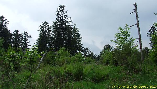
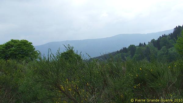
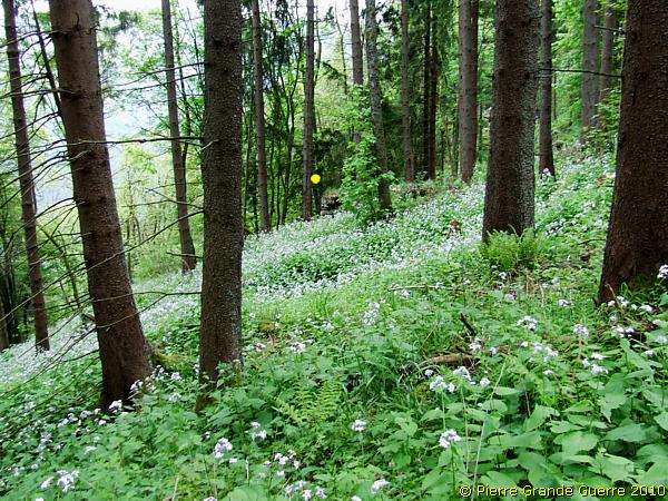
Sometimes the wood opens for a short marvellous view.
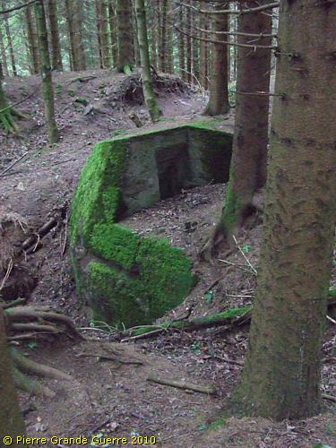
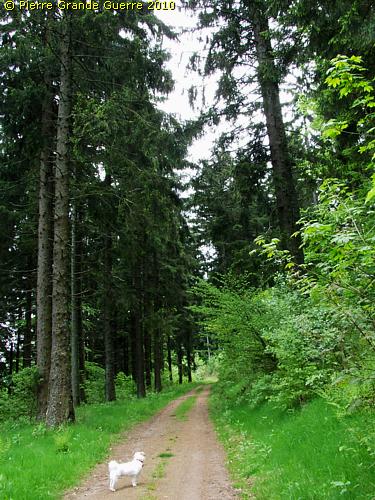
Near the summit of the Bernhardstein (870 m.) we change to a more comfortable forest road.
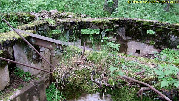
This bunker guards the forest road facing north and west.
The bunker belongs to the stronghold of the "Betonturm", the Concrete Tower.
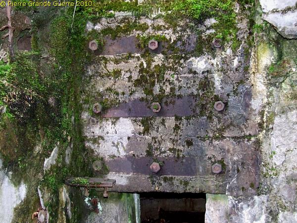
Steel armour plates fortifying the concrete entrance.
Loop holes facing west.
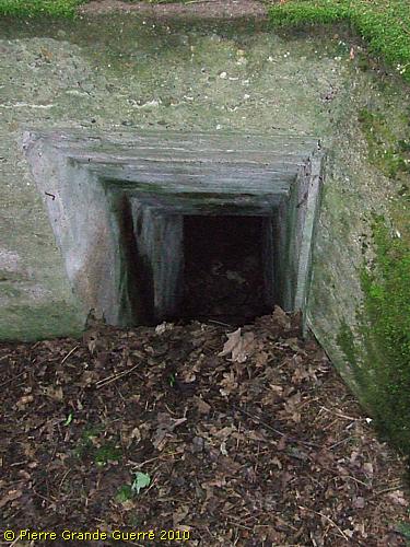
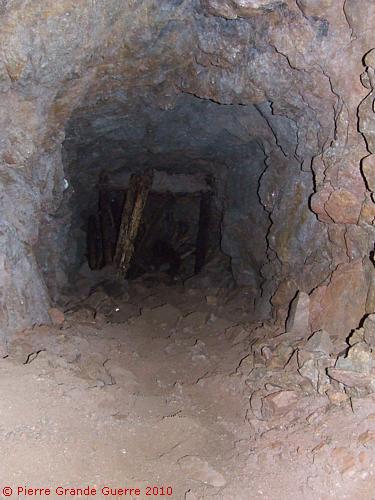
The bunker served also as an entrance to a "Stollen"-system, ...
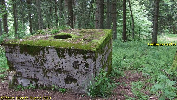
... and a tunnel, running to another "Ladungswerfer" pit.
This concrete mortar pit of 8 m. deep is protected by a wooden railing, but it is not covered with a safety grill.
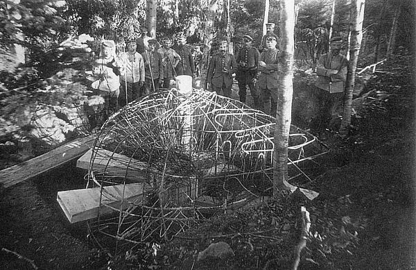
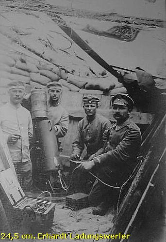
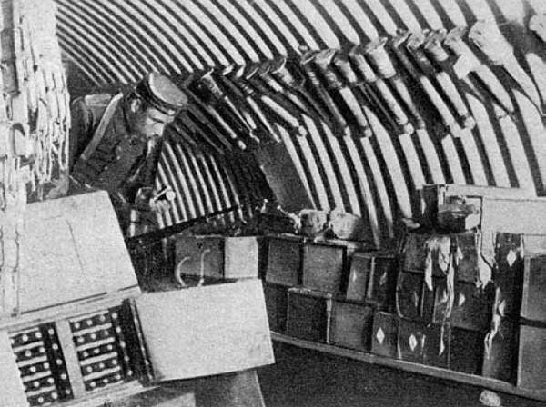
As promised earlier; in the frame below I offer you some more detailed information about the " Ladungswerfer 24,5 cm. Erhardt ".
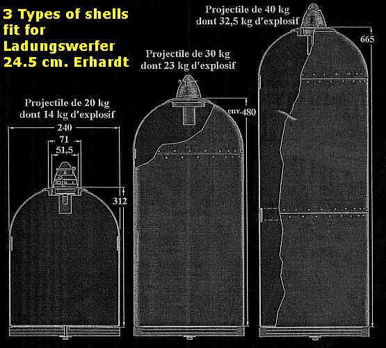
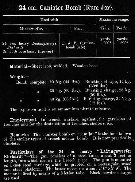
Source : Grande Guerre Culture Forum.
Remark the step shaped wall.
I climb up to the concrete block at the top left of the photo.
This served as a concrete armoured observation post.
Only the periscope binoculars of the observer would emerge.
I continue over the track some 40 m. southward.
I follow the slope eastward along the northern wall ...
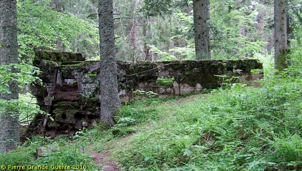
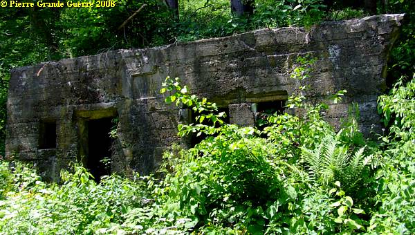
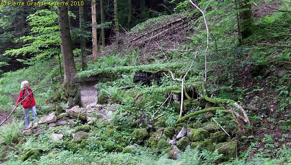
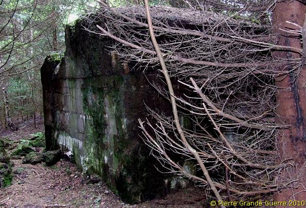
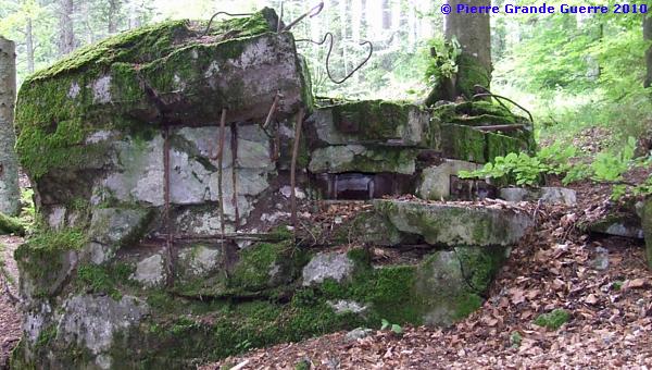
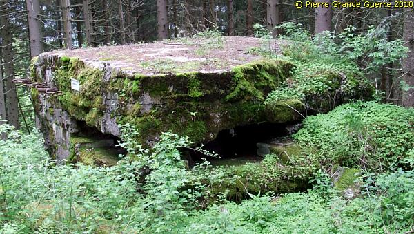
... of a huge bunker.
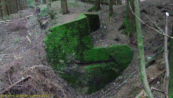
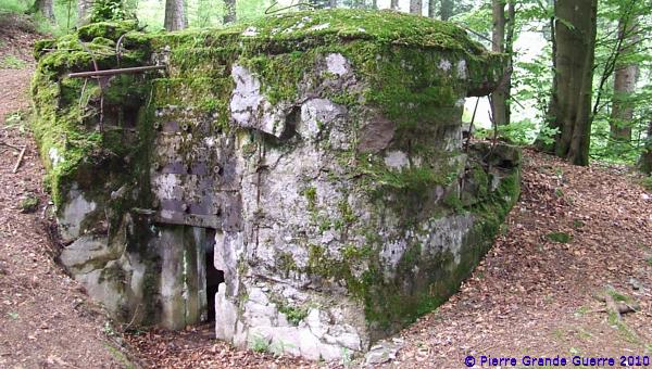
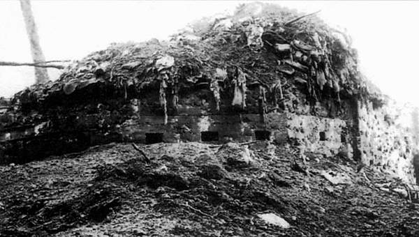
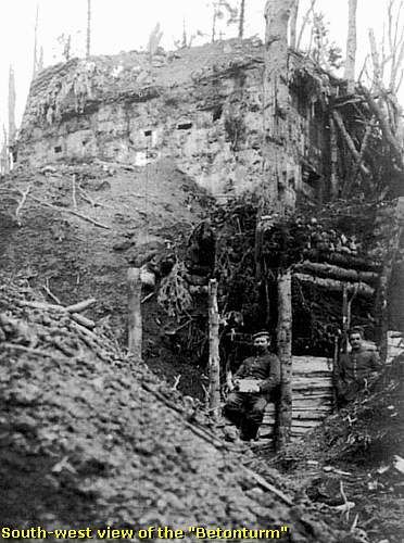
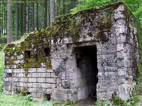
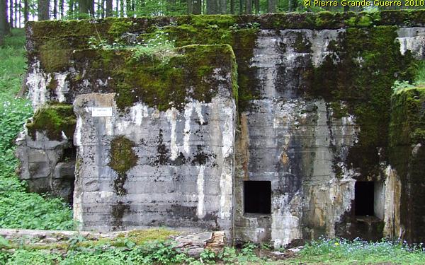
The wall belongs to the " Betonturm ", the Concrete Tower.
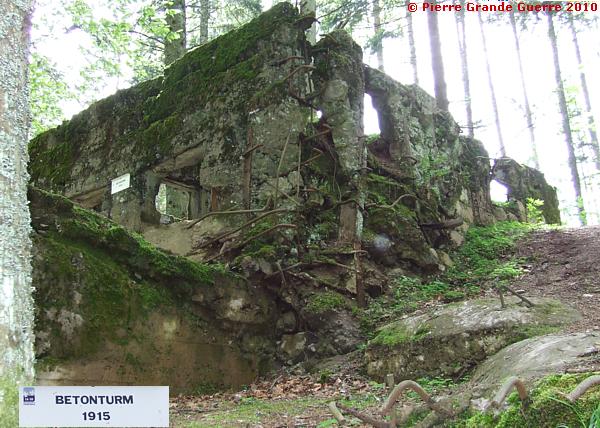
For the French troops this "Betonturm", "le Grand Blockhaus", formed their main target for their attacks and artillery bombardments.
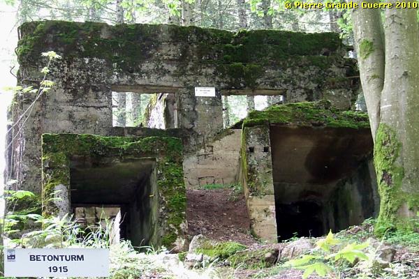
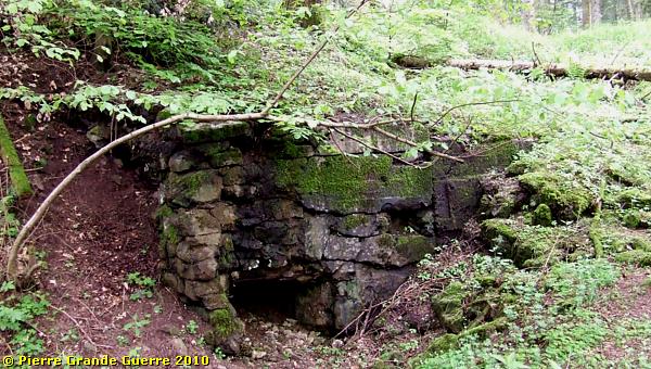
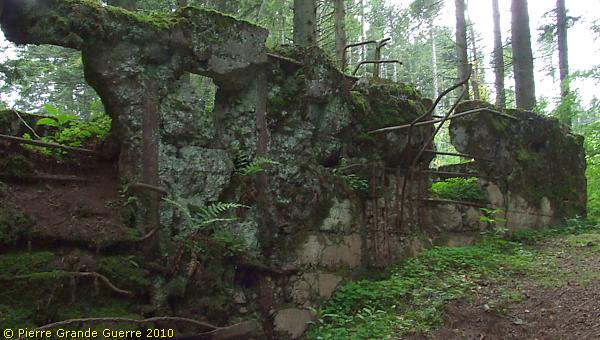
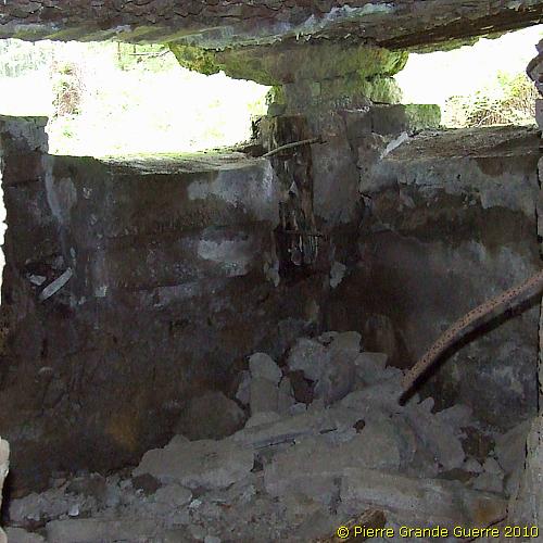
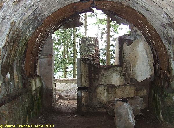
View from the east side at the entrance. We save a visit to the roof of this 3-floors bunker for some moments later.
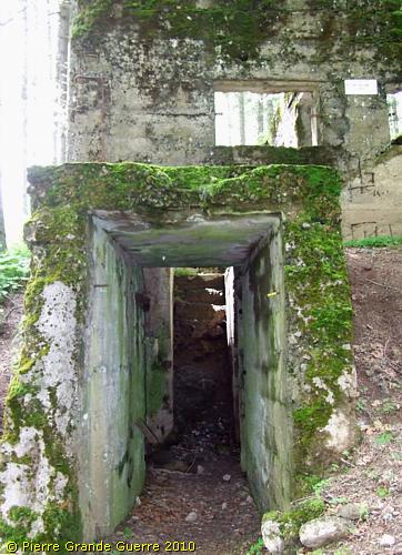
We prefer to enter it first and go to the right.
A window facing west.
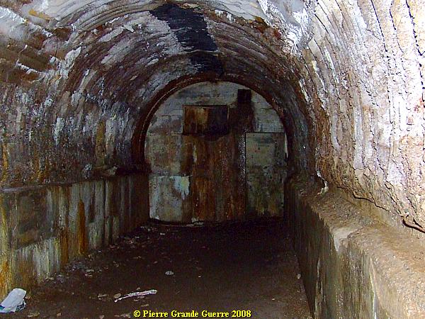
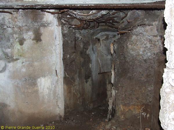
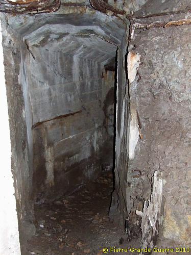
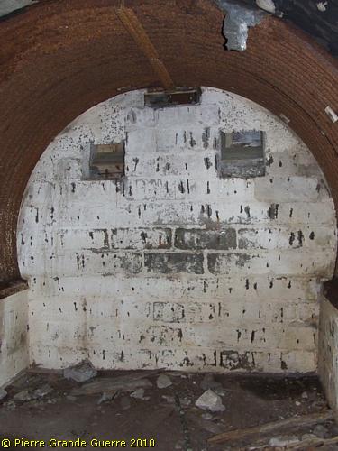
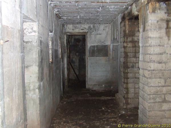
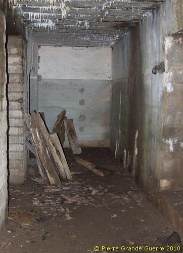
Curved corridors and stairs downward to tunnels and "Stollen".
Next we climb up the staircase to the top construction.
In the in wartimes almost barren wood the roof of the Betonturm must have served as an excellent observation post, ...
... but foremost it served as a fire gallery westward, ...
... for several riflemen, able to fire in three directions.
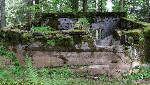
We leave the impressive "Betonturm", back to the forest road.
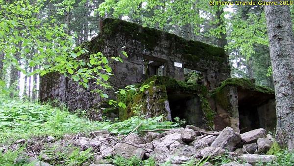
Some 50 m. to the south on the left verge of the road stands this machine-gun bunker.
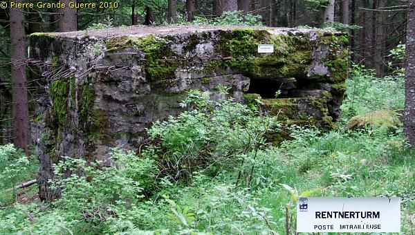
The fire windows of the " Rentnerturm " (Pensioner Turm) guard the forest road, ...
... facing west and south.
From the Betonturm stronghold we deviate from the forest road, ...
... along a track south-eastward to the second and third lines.
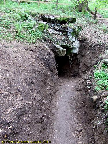
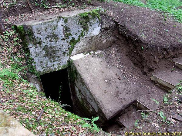
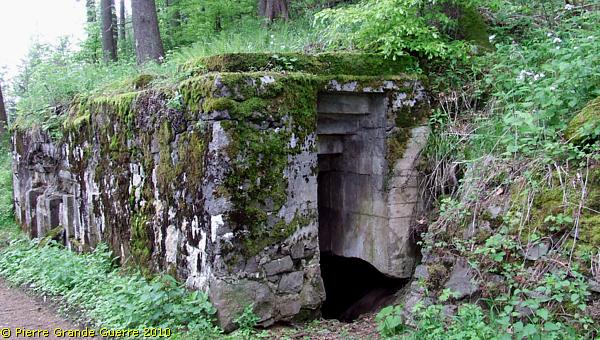
On an eastern slope we detect this remarkably well preserved dug-out entrance of the “ Zähringer Löwe ”.
Following a recently cleared trench we find another entrance.
This industrious Monsieur invites us warmly in...
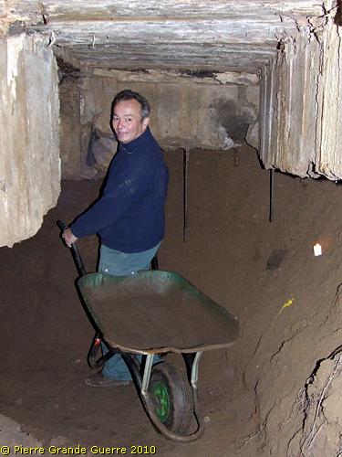
... into the tunnel and the "Stollen".
In this dug-out we meet the admirable team of locals, amateur and professional historians, who spend all their free time with digging, clearing, cleaning, and respectfully restoring these bunkers of the "Leber" sector. Chapeau, Messieurs, et merci pour votre travail admirable!
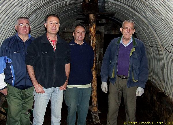
The Monsieur on the right side of the photo tells us, that there are in this sector about 400 bunkers, dug-outs, and tunnelsystems, hidden and to be found here. In this particular "Unterstand" the team did even found bed spirals, untouched by rust!
Remark the lack of rust on the corrugated shelter ceiling above these industrious gentlemen. Being closed off for almost 100 years of open air, the metal is hardly touched by rust.
Grateful for the work of these local volunteers, we say this team of industrious workers goodbye, and we leave the “Zähringer Löwe”.
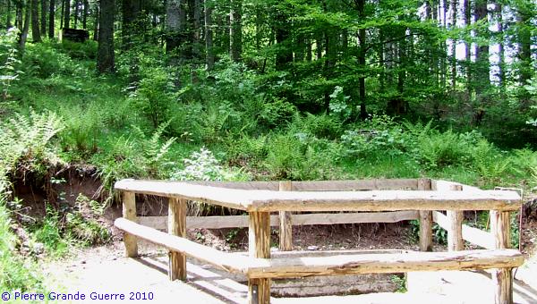
A ground plate of a trench mortar lies in front of an interesting wartime memorial.
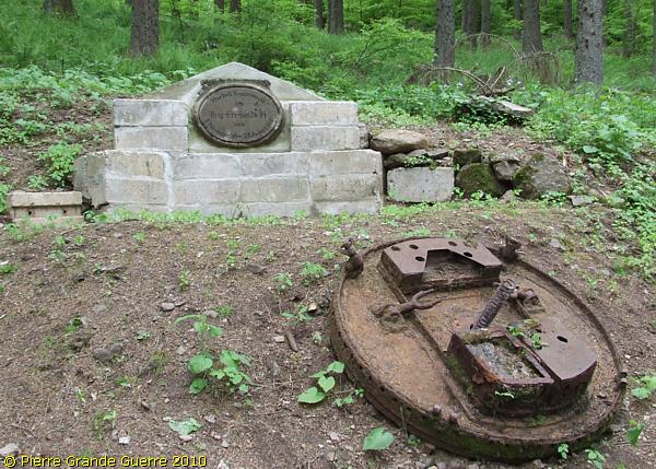
The plaque is a silent period witness, which confirms the presence here of the Brigade Ersatz Bataillon Nr. 84.
A reminder of the Ste. Marie-aux-Mines Deutscher Soldatenfriedhof:
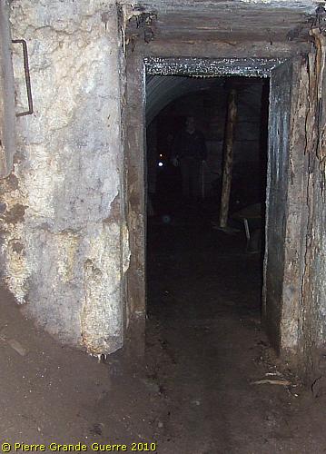
After this intermezzo we continue to other nearby bunkers.
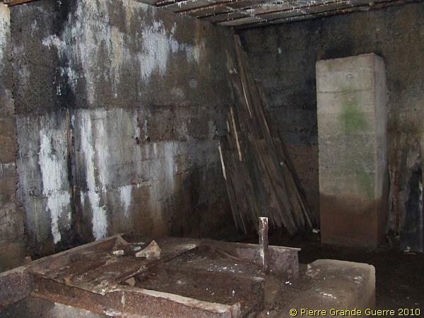
Being in contact with open air this corrugated ceiling shelter is rusted.
Stairs downward a tunnel inside the mountain.
I prefer to leave these bats undisturbed; another reason to always wear a hat or a cap visiting bunkers.
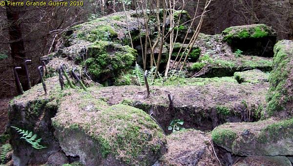
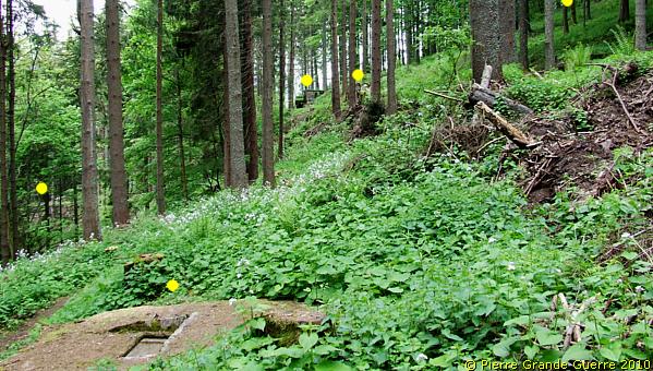
Again outside. The yellow dots mark other hardly visible buildings in the vicinity.
View from a concrete armoured well upward.

Another interesting bunker, where the local restoration team has been busy.
Bobby the Trench Dog (+ 20-07-2015) only looks curiously inside.
The inside of the mountain, underground, ...
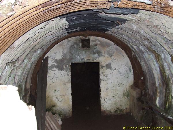
... must have been like the structure of a Swiss cheese.
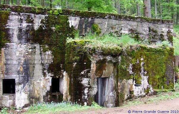
Some meters lower we arrive on another forest road, which used to be a kind of a street with workshops.
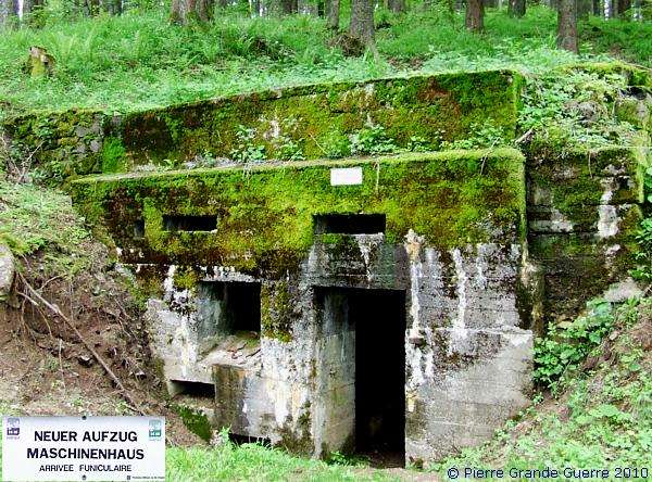
This bunker served as the machine house of a cableway arrival station.
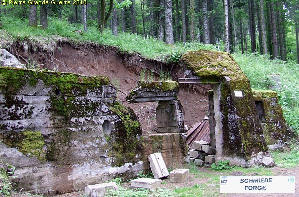
This collapsed bunker housed the forge.
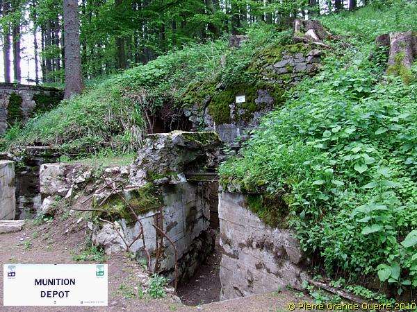
Next to the forge stands an ammunition depot bunker.
Next to it we visit this Guild Shelter, "Zunfthaus I", ...
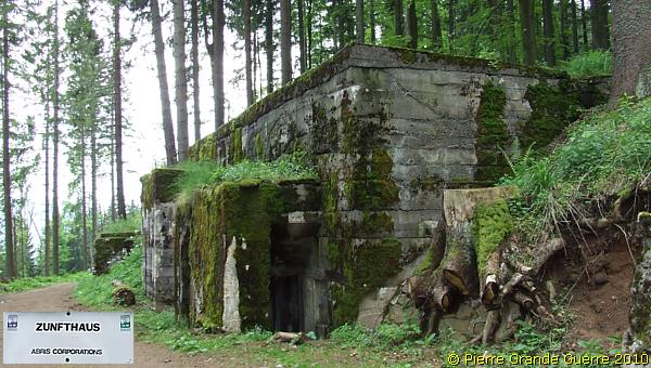
... a large shelter bunker, offering enough room for all kinds of workshops.
These workshops were housing teams for repairing weapons, ...
... and other usefull disciplines, ...
... concerned with the maintenance ...
... of this underground bunker village and it's fortifications.
Though I did present you only a fraction of what you could possibly see on the Bernhardstein, ...
...we have to close off our day here with this last shelter bunker, "Zunfthaus II", ...
... at the end of this factory street on the slope of the Bernhardstein.
From a slope of the Haut de Faîte a last view of the "German side" of the Tête du Violu.
Our exploration of the northern side of the "Leber" sector continues on the next photo page about the Haut de Faîte and a southern slope of the Chaume de Lusse, north of the Col de Ste. Marie.
Continue to: " Wisembach - Le Haut de Faîte "