
ARTOIS - Loos-en-Gohelle
Year of visit: 2010
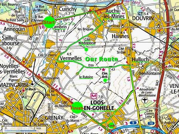
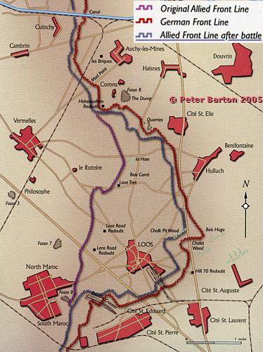
An impression of our visit to the battlefield of the Battle of Loos of 1915. Starting in the north with Quarry Cemetery and the site of the Hohenzollern Redoubt. Next in the centre of the battlefield; le Rutoire, St. Mary ADS Cemetery and two other cemeteries nearby. In the south; Loos British Cemetery, the former location of the Tower Bridge in Loos, and Dud Corner Cemetery & Loos Memorial.
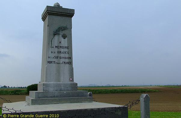
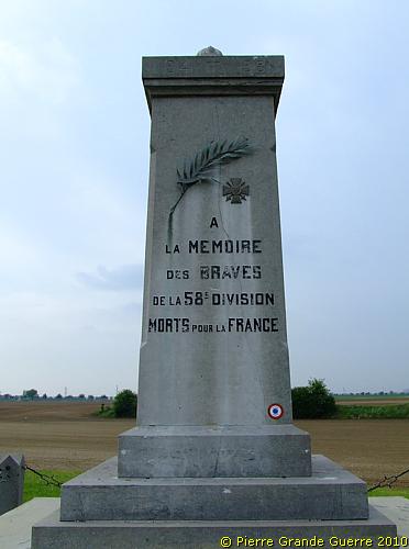
We start at the D 941 on the right side of the road, with this memorial for the French 58th Division.
"The French trenches looked like latrines."
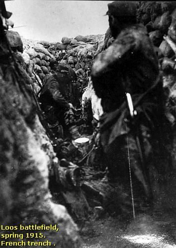
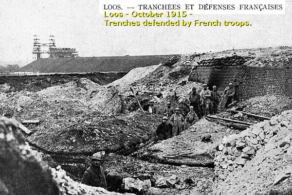
| Until 15 May 1915 the French 58th Division defended this front sector, running from Cuinchy in the north to Grenay in the south. On 15 May the British troops took over this sector. About the state of these French trenches the author, Robert Graves, who served in the Battle of Loos as a Lieutenant of the Royal Welch Regiment, quotes in his book, "Goodbye To All That", a certain, battle experienced Captain Dunn: "When I came out here first, all we did in trenches was to paddle about like ducks and use our rifles." Another British veteran remarked in a 1964 television documentary about these trenches: "The French trenches looked like latrines." When the British took over this sector, they widened and improved the trenches according to their own British standards. |
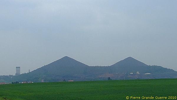
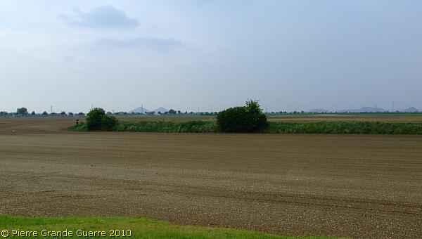
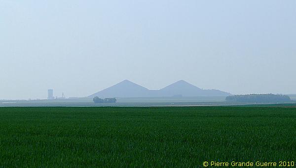
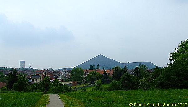
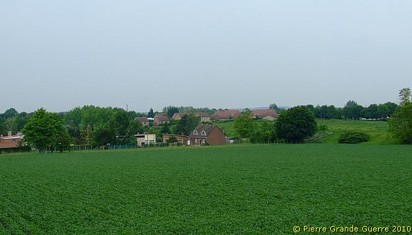
... over the Loos battlefield. On the horizon; the silhouettes of the Double Crassier of Loos.
The Battle of Loos - 25 September-15 October 1915
Introduction - The Third Battle of Artois
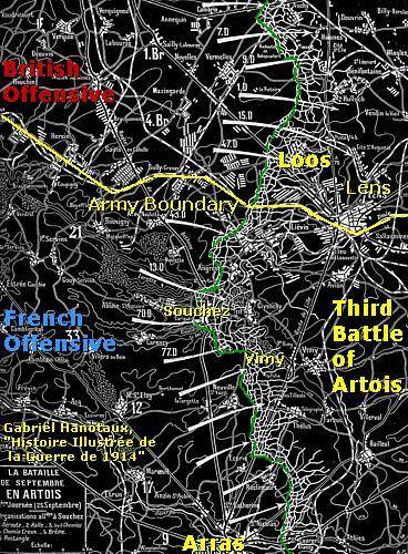
The Battle of Loos was the major British offensive of 1915 on the Western Front. The battle was the British component of the combined Anglo-French offensive, known as the Third Battle of Artois. The French attacked the area south of Lens, at Vimy Ridge.
During the battle it was for the first time during the war that the British Army used poison gas.
Despite the efforts of the fresh Minister of Munitions, Lloyd George, to increase the supply of artillery shells, the battle is also infamous for the shortage of shells, and for the first deployment of the new, inexperienced units of " Kitchener's Army ".
The Battlefield
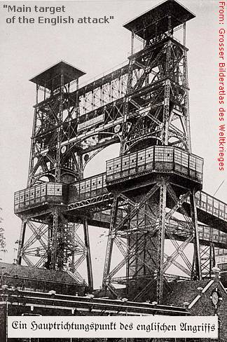
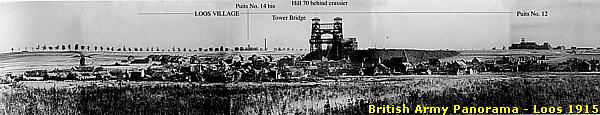
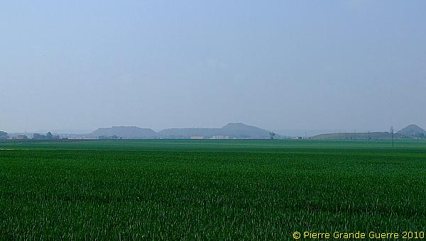
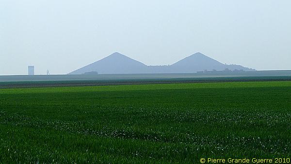
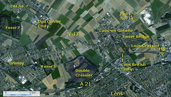
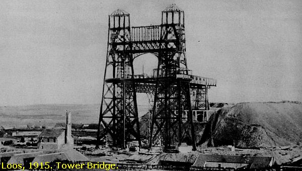
The battle was fought in an industrial, coal mining area on a rather limited battlefield of not more than approximately 10 x 10 km. The Gohelle Plain offers an open, flat country, offering no cover at all, partly surrounded by slag heaps, and dominated by the Double Crassier, west of Loos. In wartimes another landmark dominated the landscape; a steel construction of a mine winding gear in the centre of Loos, which the British soldiers called the Tower Bridge.
The German Defenders
From November 1914 the German 14. Infanterie Division, commanded by General von François, defended the frontline in the north with the Hohenzollern Redoubt, south-east of Auchy-les-Mines and the Haisnes, as its most important stronghold. The German 14. Infanterie Division consisted of the 27. Brigade with I.R. 16 and I.R. 53, and of the 79. Brigade with I.R. 56 and I.R. 57. It was assisted by the 7th and 43rd Field Artillery Regiments (F.A.R.) and Feld Pioniere Kompagnie 7.
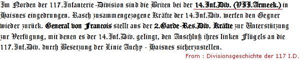
The German 117. Infanterie Division was based in the south of this front sector and defended the area around the village of Loos-en-Gohelle. The 117. Infanterie Division, commanded by General der Infanterie Kuntze, was a triangular Division, composed of three regiments, I.R. 157, R.I.R. 11, and R.I.R. 22. The division was supported by 7 batteries of F.A.R. 233 and Pioniere Kompagnie 233. During the battle of Loos the 117. Infanterie Division suffered the most of all German units with many casualties; 109 officers and 6.463 men. The Battle of Loos is known in the German language as “Die Herbstschlacht bei La Bassée und Arras”.
The British attackers
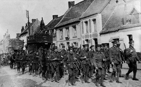
General Douglas Haig, then still commander of the British First Army, directed the battle. In the north Haig deployed I Corps, under command of Lt. Gen. H. Gough, consisting of the 2nd, the Scottish 9th, and the 7th Divisions. In the south Haig deployed IV Corps, under command of Lt. Gen. H. Rawlinson, consisting of the 1st , the Scottish 15th, and the London Territorial 47th Divisions.
Battle preparations - Mine warfare
Before the battle Royal Engineers Tunneling Companies dug tunnels and placed at the end large amounts of explosive charges. These charges were meant to explode at Zero Hour to destroy German positions.
Sorties Royal Flying Corps
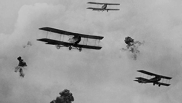
As the British had a limited amount of heavy ammunition the Royal Flying Corps, under command of Brigadier-General Hugh Trenchard, flew prior to the battle target identification sorties to ensure that shells were not wasted. During the first few days of the attack the Flying Corps' target-marking squadrons assisted the British artillery to fire successfully at the German targets. Later in the Battle, Flying Corps pilots carried out the first successful tactical bombing operation in the history of war. Aircraft of the Second and Third wings carried out multiple sorties, dropping many 100-pound bombs on German troops, trains, and rail lines. As the ground offensive stalled, British pilots and observers flew low over enemy positions, again providing targeting information to the artillery.
Preliminary artillery bombardment
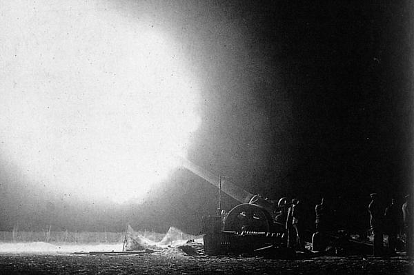
At first light in the morning of 21 September the British artillery launched a preliminary bombardment with 110 heavy guns, 84 guns and howitzers. This introducing bombardment continued day and night and lasted until Zero Hour of the 25th.
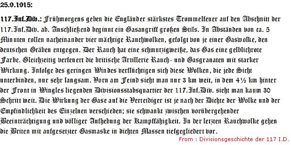
Gas
In the morning of 25 September, at 5.50 hours, Haig ordered to release 140 tons of Chlorine gas. For 40 minutes on the gas emissions, interrupted by smoke emissions, were continuing.
The ground offensive
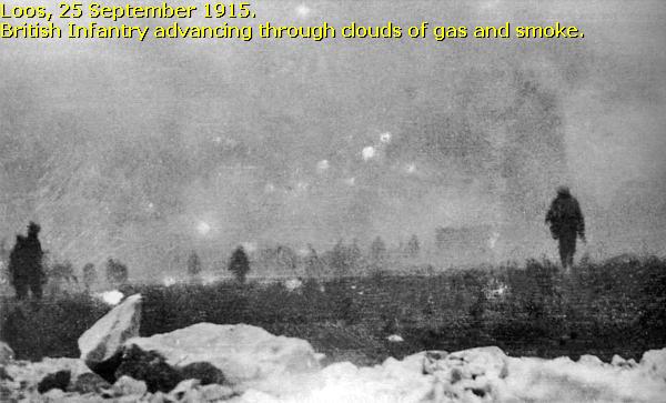
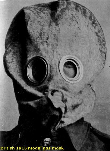
The battle opened on 25 September at around 6:30 AM. In the northern sector of the battlefield the gas was blown back into British trenches. Due to the inefficiency of the gas masks at the time, many British soldiers removed them, as they could barely breathe or could not see through the fogged-up goggles. Many British soldiers were being gassed by their own chlorine gas.
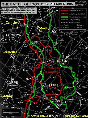
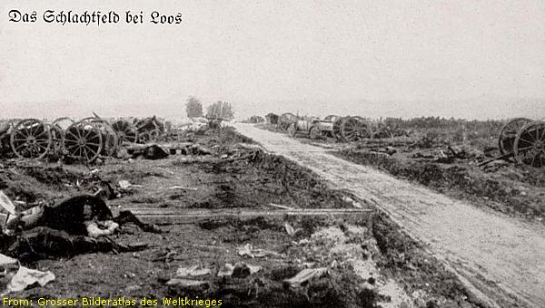
In the southern sector the British were rather rapidly able to break through the German trenches and to capture the village of Loos. Problems of transport, supplies and communications, combined with the late arrival of reserves, caused that this breakthrough could not be exploited further.
Another complication for many British soldiers was the failure of their artillery to cut the German barbed wire obstacles. The use of shrapnel shells instead of high explosive shells on barbed wire had no effect. Advancing over open fields in full range of German machine guns and artillery, the British losses on the first day were already devastating.
German counter-attacks
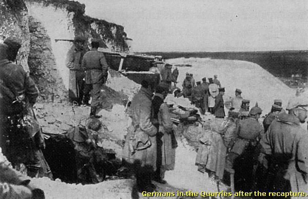
When the battle resumed the following day, the Germans had regrouped and had rapidly formed a special “ad-hoc” fighting force under command of Oberstleutnant Anton Staubwasser, a Lieutenant Colonel of the Bavarian Infantry Regiment 9 (B.I.R. 9), consisting of units of B.I.R. 17 , B.I.R. 18, and of course B.I.R. 9. Together with units of 14. I.D. these units counterattacked the British in the night of the 25th to the 26th; first at the Quarries, later at the sector of the Dump.
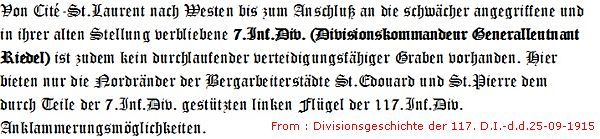
In the centre of the front units of the 2. Garde Reserve Division and the 7. Infanterie Division, under command of Generalleutnant Riedel, came to assist the the German troops in danger. In the south, in the sector of Lens and Loos, the 8. Division auxiliated the 117. Infanterie Division.
28 September 1915: 20.000 British casualties
The fighting subsided on 28 September. The British still held the town of Loos. But on the 28th the British also counted more than 20.000 casualties, including three killed divisional commanders; Major-General George Thesiger, Maj-Gen. Thompson Capper, and Maj-Gen. Frederick Wing. During these first days the death toll on other British officers was also very high.
On 28 September, after the successes of the French 10th Army at Vimy Ridge, General Haig received from his Commander in Chief, General French, two new divisions, the 12th and the 46th, to replace the decimated and exhausted 21st and 24th Divisions. Two French Divisions were on their way to reinforce the British in the Loos sector, and would only arrive five days later, at 3 October, south-west of the Double Crassier.
More German counter-attacks
The "Regiment Staubwasser" made continuously attempts to recapture the Hohenzollern Redoubt, and succeeded to conquer it on 3 October.
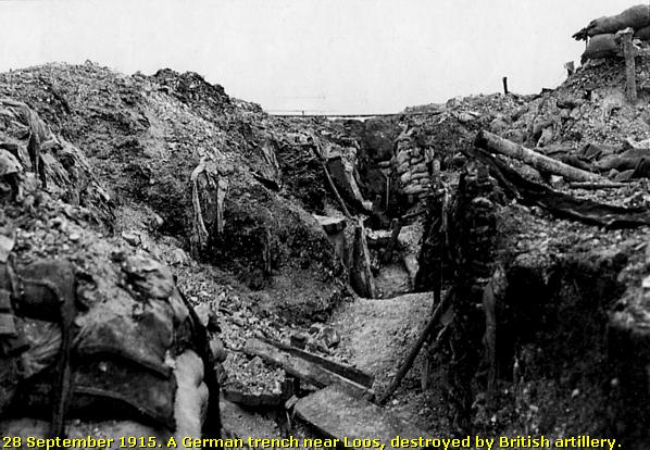
On 8 October the Germans attempted to recapture much of the lost ground by launching a major offensive along the entire front line sector, but abandoned the effort by nightfall, due to heavy losses and also to the ineffectiveness of the artillery to destroy barbed wire obstacles. In the sector of Loos the success was also limited. Loos stayed in British possession, but the Germans succeeded to conquer some French trenches at the Double Crassier.
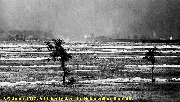
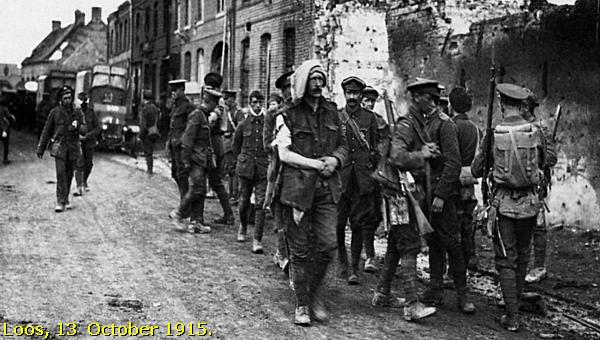
Final of the Offensive, 13 October
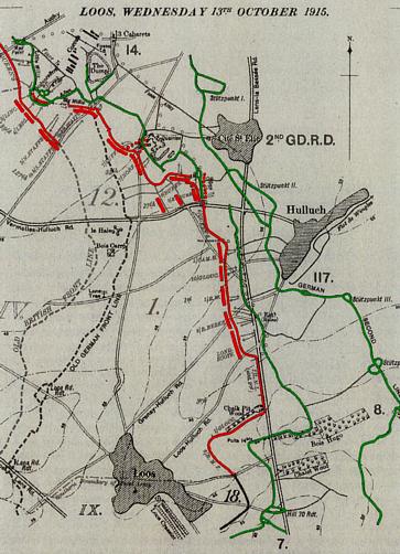
On 13 October the British attempted a final offensive, including again a preliminary bombardment and the use of poison gas. The attack failed completely, amongst others due to a lack of hand grenades.
General Haig planned another attack on 7 November. The combination of heavy rains and accurate German shelling during the second half of October convinced him to abandon this plan.
Total numbers of casualties
As always: several sources mention different numbers. According to one of my sources, after the Battle of Loos the British counted as casualties 2.013 Officers and 48.367 soldiers, of whom 6.343 men were killed.
German army units counted as casualties 441 officers and 19.395 men, of whom almost 5.000 men were killed.
Because all German War Cemeteries are laying east of this battlefield, and outside the topographic range of this page, I only mention you the names of locations of German cemeteries in this region, where the German victims of the Battle of Loos are buried: Billy-Berclau, Carvin, Courrières, Dourges, Lens-Sallaumines, and Meurchin.
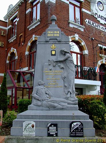
The north-east of the battlefield, the town hall of Auchy-les-Mines, ...
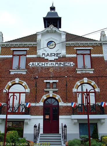
...a town in 1915 occupied and fortified by the Germans. The Memorial for the Auchy war victims.
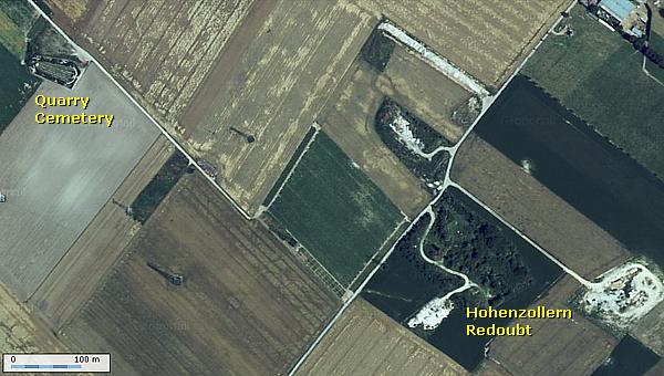
From Auchy we go along the road southward to Cité Madagscar and Vermelles. Just after Cité Magascar, we go left, on a country track, to the area of the Hohenzollern Redoubt.
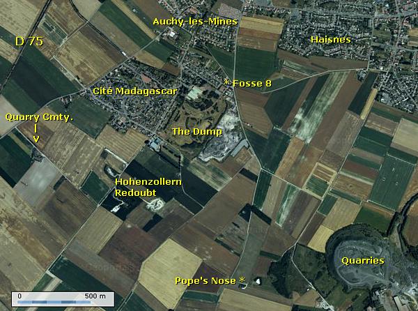
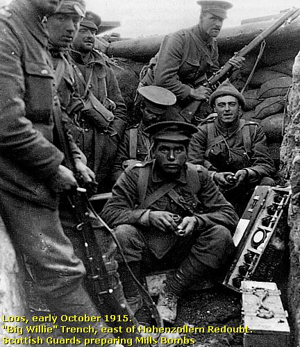
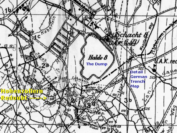
Attacks and counterattacks for the Hohenzollern Redoubt
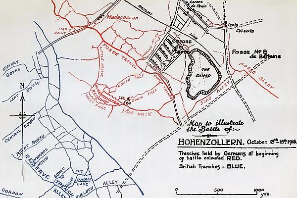
| We are now in the area of the attacks and
counterattacks for the Hohenzollern Redoubt, The Dump, and Fosse
8. The 7th Battalion Seaforth Highlanders, took this area on
the 25th around 7.30 hrs. At the same time their partners on the left,
the 5th Cameron Highlanders, received heavy German machine-gun fire
from Cité Madagascar and counted many losses.
On 3 October the German Regiment Staubwasser recaptured the Hohenzollern Redoubt with exception of Big Willie Trench. From 13 until 15 October the Scottish units were involved in heavy fighting, trying unsuccessfully to capture again the Hohenzollern Redoubt and the Dump. |
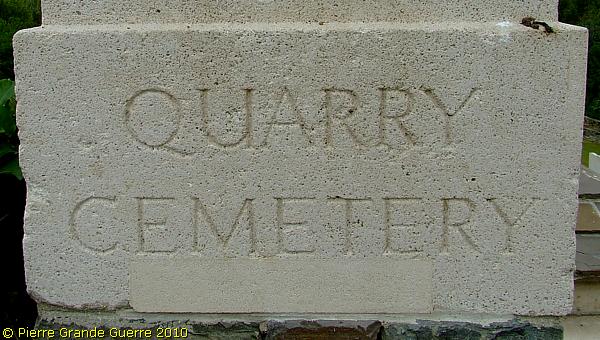
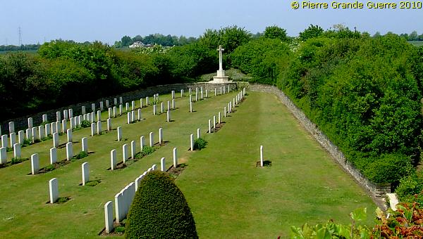
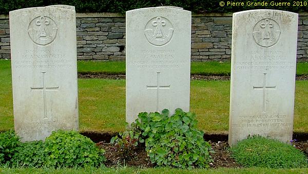
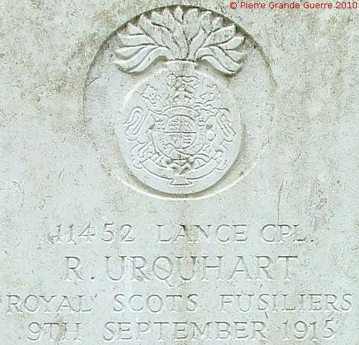
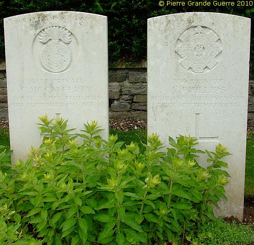
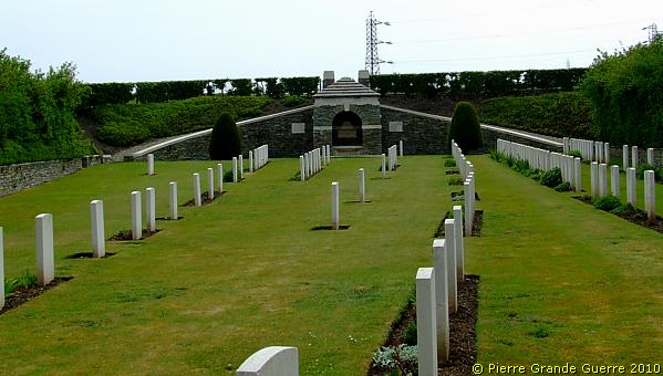
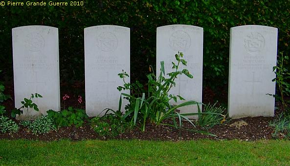
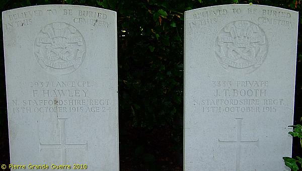
Quarry Cemetery
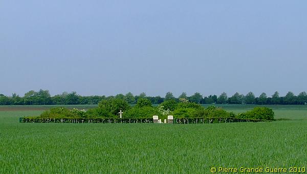
| Quarry Cemetery is not visible from the main road as it is below ground level, lying in a chalk pit 3 metres below the ground level. Quarry Cemetery was used from July 1915 to June 1916, and (for two burials) in August 1917. Its existence is due chiefly to the fighting at Fosse 8 and at the Hohenzollern Redoubt, and it contains many graves of the dismounted Cavalry, who occupied this sector in 1915-16. The cemetery, was severely damaged by shell fire. There are now over 100 war casualties commemorated in this site. Of these, 10 are unidentified and many of the graves, identified as a whole but not individually, are marked by headstones bearing the additional words "BURIED NEAR THIS SPOT". Source of all the information about the cemeteries, mentioned on this page: Commonwealth War Graves Commission. |
In the walls of the quarry and already existing wartime cemetery, the soldiers digged for cover tunnels and dug-outs.
In September 1915 the quarry also served as an advanced dressing station.
Enough words for now...

"BURIED NEAR THIS SPOT"
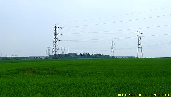
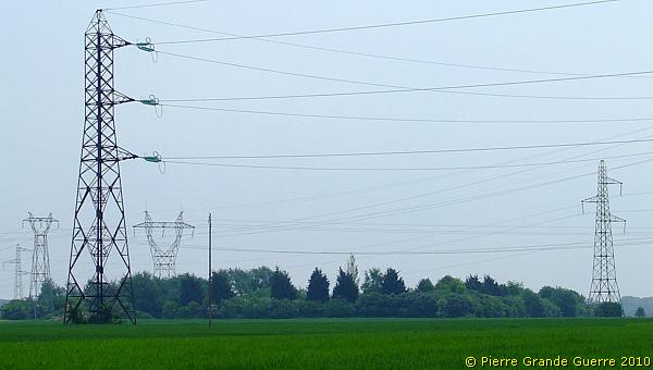
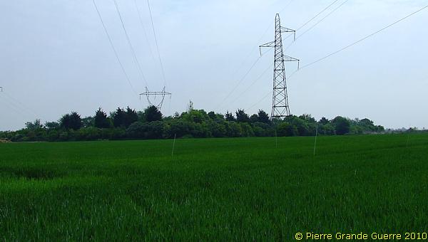
A view south-eastward. On the horizon: one of the power pylons, marking the former location of the Hohenzollern Redoubt.
View from the edge of the cemetery entrance over the 150 m. wide No Man's Land of 25 September 1915, which runs until the wooded height at the horizon, the Mont d'Auchy (36 m.).
We continue down the track...
... to the site of the Hohenzollern Redoubt .
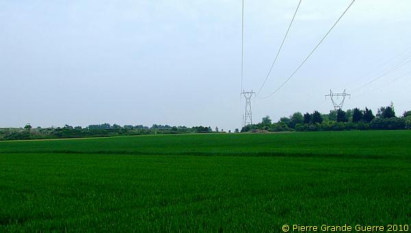
Out of respect for the farmer's crop and being close to the site, I did not go any closer than this. With all these unevitable modern pylons; it is alas not a grand view of this site.
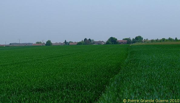
View from the Hohenzollern Redoubt site southward over the battlefield.
View westward into the direction of Vermelles.
We leave the Hohenzollern Redoubt, ...
... returning via the track to the cemetery. A view north to Cité Madagascar, from where the Germans spread a murderous machine-gun fire.
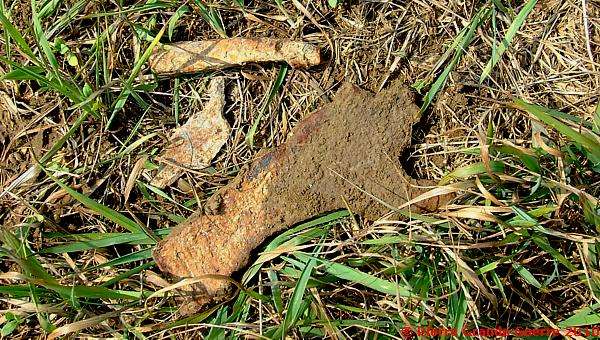
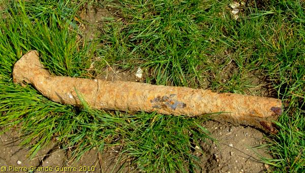
From the verges of the track, we collected within 5 minutes, without any digging or any other effort than looking, these war relics, lying randomly around on top of the soil.
We continue to the centre sector of the battlefield, ...
... to halfway the road between Vermelles and Hulluch, to Le Rutoire Farm .
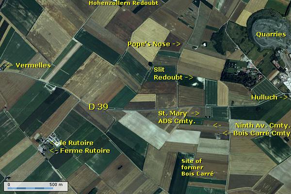
Attacks at the Quarries, the Pope's Nose, and Gun Trench
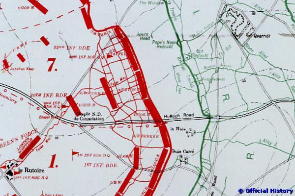
We are now in the centre of the battlefield, at the Plain of Gohelle, marked by the west-east, Vermelles-Hulluch road.
The 22nd Brigade of 7th Division attacked
with two battalions the northern side of the road. The 1st Brigade of
the 1st Division attacked on the south side of the road.
In the north German machine-guns of R.I.R 11 fired in the blind through
the gas and smoke clouds and made many victims. After many losses the
1st Battalion South Staffordshires, and the 2nd Royal Warwickshires,
supported by the 2nd Borders, succeeded to capture the Pope’s Nose
Redoubt, the Slit Redoubt and the Quarries. During the night of the
25th to the 26th the Germans recaptured the Quarries. All other British
attempts to capture the Quarries again failed.
South of the Vermelles-Hulluch Road the 1st Brigade of the 1st Division attacked Hulluch, passing Bois Carré, and captured the first German line, defended by I.R. 57. Next they captured Gun Trench, south of the Quarries. They advanced further to the Lens-La Bassée road, where they stopped waiting for reinforcements.
La Ferme Rutoire
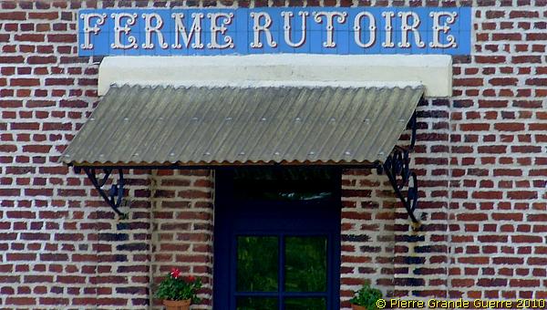
During the battle La Ferme Rutoire, or Le Rutoire Farm, served as the headquarters of the 1st Brigade and as a dressing station. Next to the dressing station used to be in wartimes the Le Rutoire British Cemetery. The wartime cemetery was used in 1915, and contained the graves of 82 soldiers from the United Kingdom and six French soldiers. After the war and after the reorganization of war cemeteries these burials have been transported to the Dud Corner Cemetery.
Le Rutoire Farm
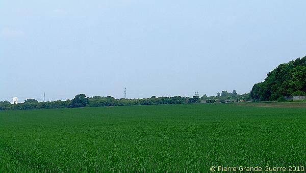
View from the D 39 northward to sites of the Pope's Nose Redoubt and the Slit Redoubt. The copse on the right side is hiding the Quarries.
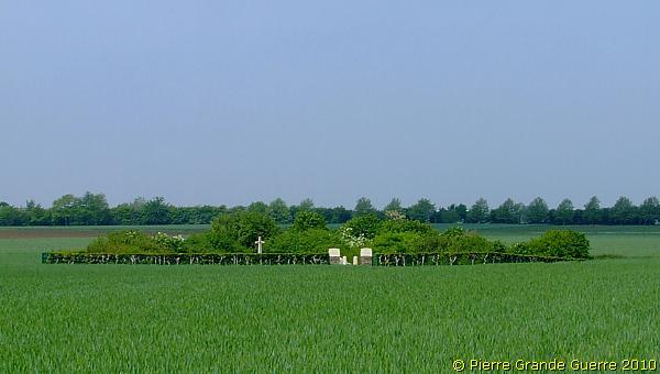
About 1,5 km. to the east, we visit three cemeteries, located close to each other.
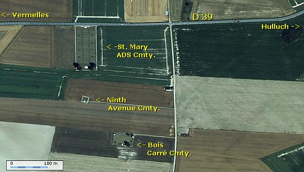
We will first visit St. Mary's Advanced Dressing Station Cmty., next Bois Carré Cmty., and we will finish with the middle one, Ninth Avenue Cmty..
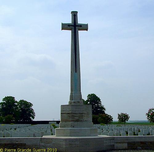
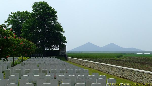
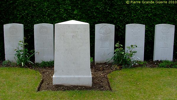
St. Mary's Advanced Dressing Station Cemetery
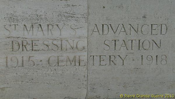
St. Mary's Advanced Dressing Station Cemetery
is located in
the vicinity of Haisnes and Hulluch. These villages were nearly
reached, by the 9th (Scottish) and 7th Divisions on 25 September, 1915,
at the first day of the Battle of Loos. This area was the scene of
desperate fighting for the Hohenzollern Redoubt (13 October 1915). No
further advance was made in this sector until October 1918, when the
Germans withdrew their lines.
St. Mary's Advanced Dressing Station was established, during the Battle
of Loos, and the cemetery, named from it, is at the same place. The
cemetery was made after the Armistice, by the concentration of graves
from the battlefield of Loos; the great majority of the graves are
those of men, who fell in September and October 1915. There are now
nearly 2.000 war casualties commemorated in this cemetery. Of these,
over two-thirds are unidentified and Special Memorials are erected to
23 soldiers from the United Kingdom, known or believed to be buried
among them. Six other special memorials record the names of soldiers
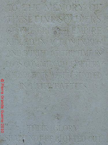
from the United Kingdom, buried in Loos Communal Cemetery, whose graves
were destroyed by shell fire.
Again, enough words said. Let the pictures tell
their own story...
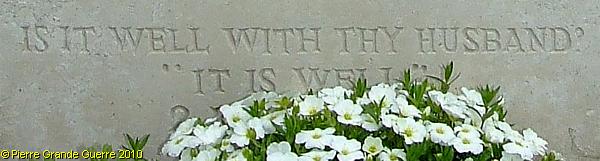
"BELIEVED TO BE BURIED IN THIS CEMETERY"
A memorial "FOR THESE FIVE SOLDIERS KILLED IN ACTION IN 1916".
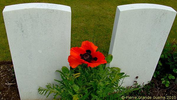
A giant poppy rises out of the soil.
A view northward.
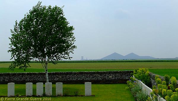
From St. Mary's (right), we pass Ninth Avenue (centre-left), to visit next the Bois Carré Cemetery (left).
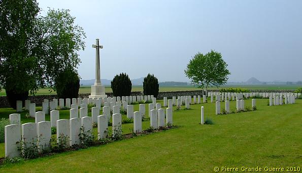
Bois Carré Cemetery
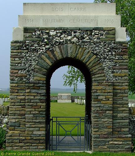
Bois-Carré Military Cemetery is named from a small copse about 275 metres to the south-west. It was begun in September, 1915, and used, largely by the 16th (Irish) Division, until August, 1916. One more grave has been added in March 1918. There are now over 200 casualties commemorated in this site. Of these, nearly a quarter are unidentified and the graves of 47, destroyed by shell fire, are now represented by special memorials. The irregular arrangement of the rows is due to the difficult conditions under which these burials were carried out.
A view from the cemetery north-westward to Ninth Avenue Cmty. (left), ...
... and St. Mary's ADS Cmty. (right).
View southward. At the horizon the Double Crassier.
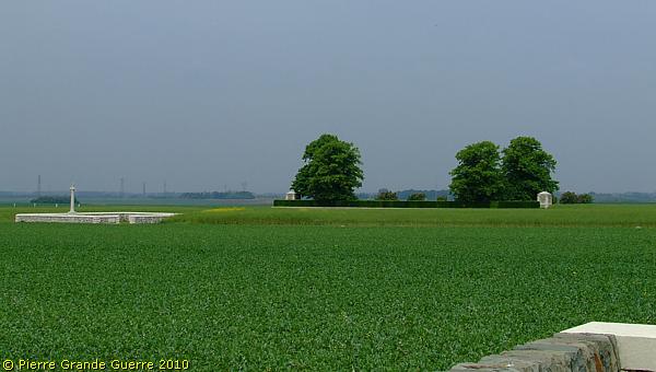
From Bois Carré Cmty. we walk to Ninth Avenue Cemetery.
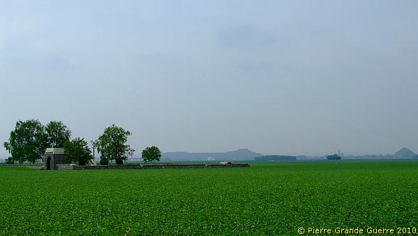
The spotless mown grass of the access path running westward to ...
... Ninth Avenue Cemetery .
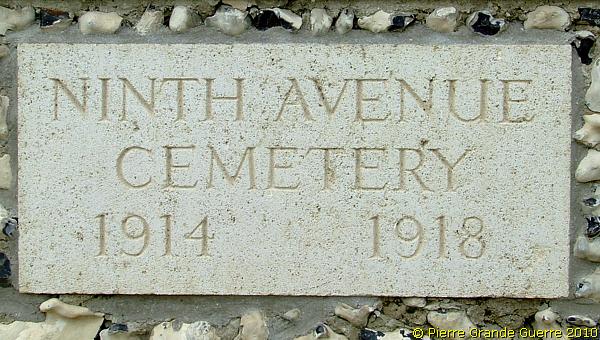
Ninth Avenue Cemetery
was named from a trench, which ran across the north end of it. It consists of one large grave. There are now over 40 war casualties commemorated in this site. Of these, a small number are unidentified. The headstones of the Cameron Highlanders are all erected in the form of a square. Like Bois Carré Cmty. this cemetery is also enclosed by a flint wall.
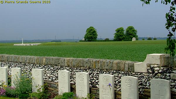
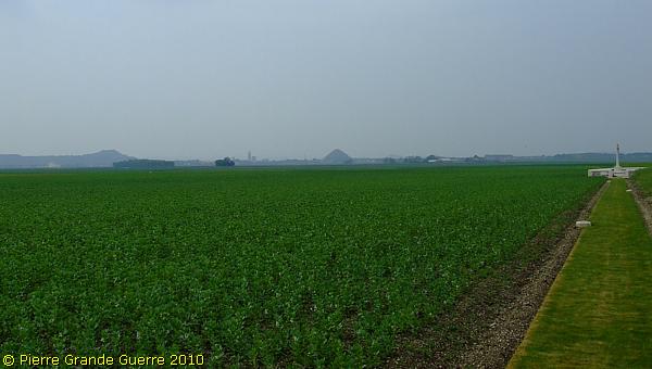
The walls around these cemeteries here are made of masonry of flints.
The soil here is composed of chalk and flints.
For underground mine warfare these flints made tunneling a noisy, and for that reason, an extra dangerous activity.
View south-westward.
Next we pay a visit to the village of Loos-en-Gohelle.
The Attack at Loos and Hill 70
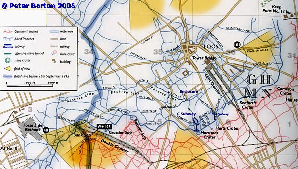
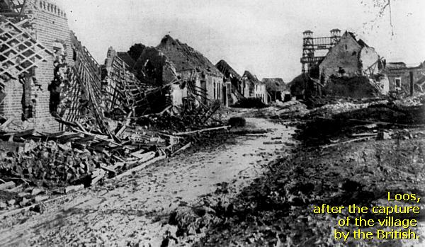
We are now in the southern area of the battlefield. The village of Loos has given its name to the battle. The 15th Scottish and 47th London Divisions captured Chalk Pit Wood and the village rather rapidly.
Only one and a half our after Zero Hour, at 8.00 AM, they already conquered the village, which would stay in Allied possession after the battle.
The Germans of I.R. 157 in the village of Loos were quite surprised by the fast progress of the attack. For a few days after the capture of Loos the British made a lot of prisoners of war; German soldiers, who were not able to timely flee and who were hiding in the ruins. From 8 October French troops defended the village.
The attack of the Scottish soldiers at the Redoubt of Hill 70, north-west of Loos, failed by fire of R.I.R. 22 from the second line in the east, and from the south by fire of I.R. 178. Two years later, in August 1917, 4 Canadian Divisions would conquer Hill 70 at the cost of more than 9.000 killed men.
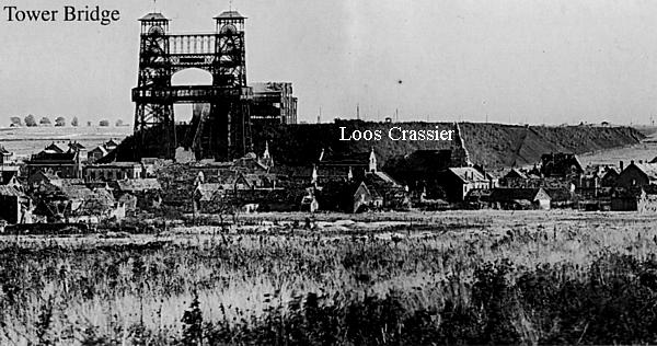
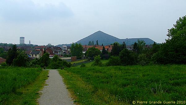
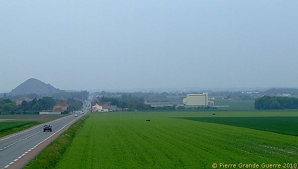
View from the Loos Crassier at the Double Crassier.
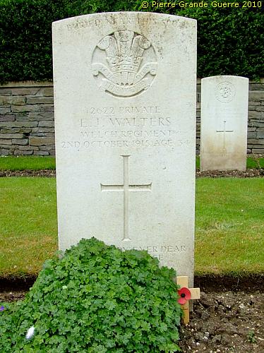
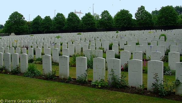
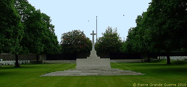
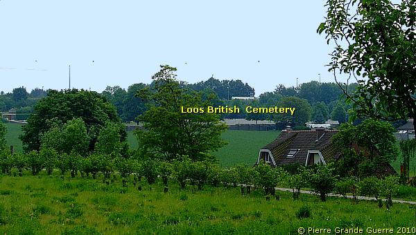
First we visit the Loos British Cemetery .
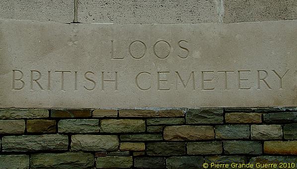
Loos British Cemetery
was begun by the Canadian Corps in July 1917, and the graves then made are contained in Rows A and B of Plot I and Row A of Plot II. The remainder of the cemetery was formed after the Armistice by the concentration of graves from the battlefields and seven smaller cemeteries over a wide area north and east of Loos-en -Gohelle. The great majority of the soldiers, buried here, fell in the Battle of Loos. There are nearly 3.000 war casualties and a small number of 1939-45 war casualties commemorated in this site. Of these, two-thirds from the Great War soldiers are unidentified and special memorials are erected to two soldiers from the United Kingdom and four from Canada, who are known or believed to be buried among them. Other special memorials record the names of 44 soldiers from Canada and 12 from the United Kingdom, buried in other cemeteries, whose graves were destroyed by shell fire. The cemetery is enclosed by a rubble wall.
This cemetery is alas not a silent site. One can hear continuously the steady, noisy traffic of the A 27, running close to the cemetery on the southern side.
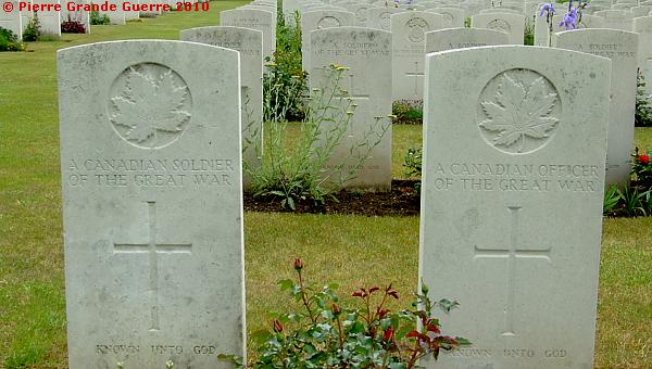
Graves of an unknown Canadian soldier, and an unknown officer, killed in the summer of 1917, during the battle for Hill 70.
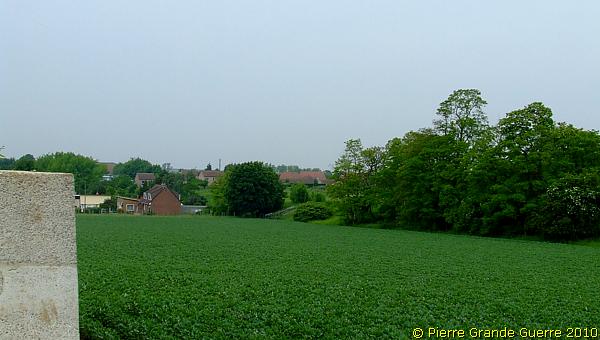
From the cemetery I detect the height of the Loos Crassier, nowadays turned into a vegetated park for the Loos inhabitants.
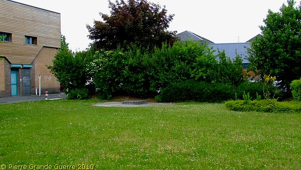
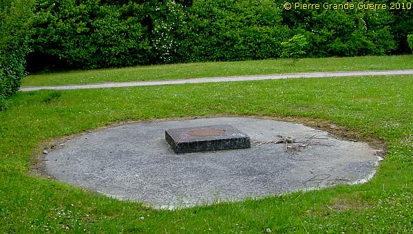
The bases of Tower Bridge
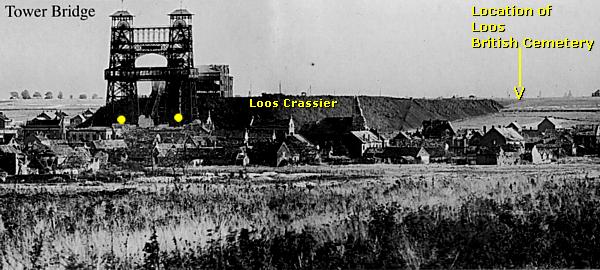
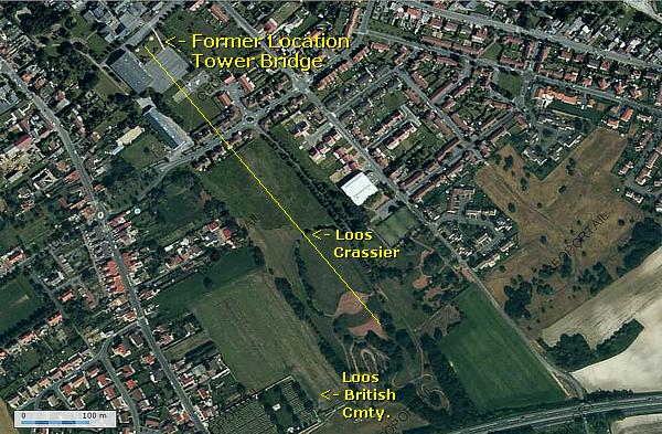
During the preparation for this trip I was already curious to find the original location of this important landmark of the Battle of Loos, the Tower Bridge. At home I studied also the satellite photo below. But over a period of more than 90 years, the topographic situation of Loos has drastically changed. The Tower Bridge mine shafts, mine shaft 15 and 15 bis, were respectively closed down in 1962 and 1972. There is nothing left anymore of the 1905 built steel construction than the trapezium shape of the ground plan and the 2 concrete bases of the front pylons. As you can see from the photo’s, locating the large Loos Crassier is rather easy. To find the bases of the pylons on the ground is a little more complicated, as I have to explore the built up area of Loos.
First we make some steps on the rectangular-shaped Loos Crassier.
View from the Loos Crassier to the Loos British Cemetery.
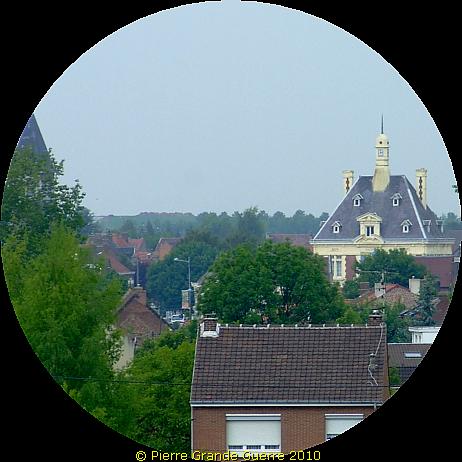
From the crassier we go into the village, ...
... not far away from the Loos town hall.
Behind a hedge at the private premises of ...
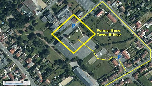
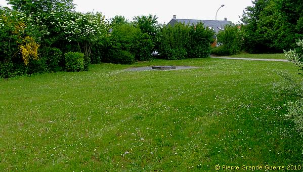
... the Collège René Cassin lays a trapezium shaped lawn.
The left concrete base of Puits No. 15 bis.
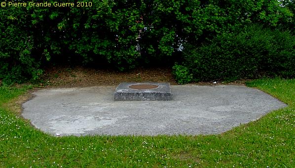
The trapezium formed the base of the complete steel construction.
The right base of Puits No. 15.
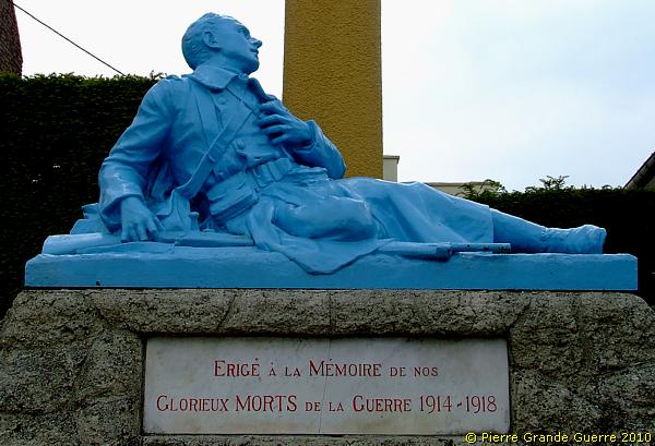
We leave Loos...
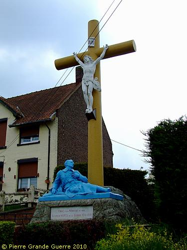
... passing this memorial with a wounded Poilu.
We leave the village at the north-west, on the heavy traffic road, N 43, to Vermelles and Beuvry...
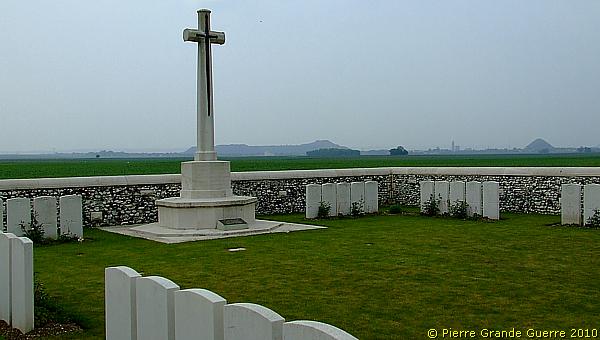
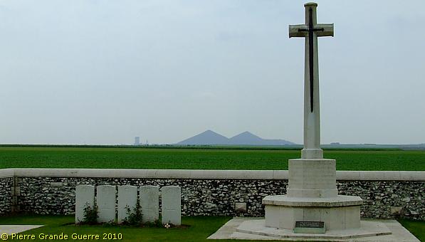
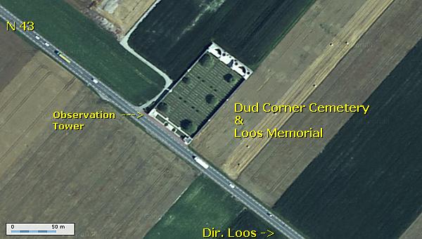
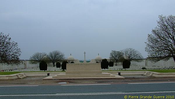
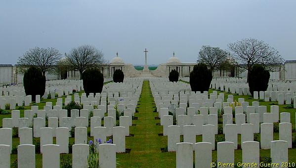
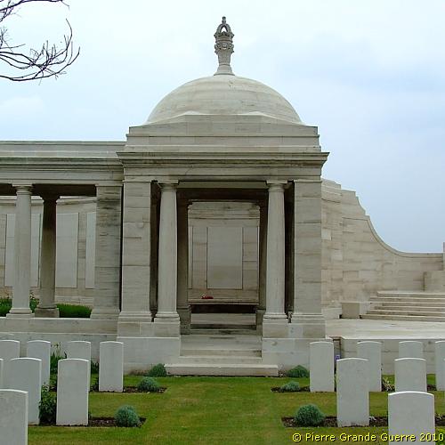
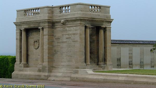
... to visit the Dud Corner Cemetery & Loos Memorial .
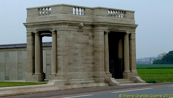
The front of the Cemetery and the Memorial from left to right, in 3 steps. The north-west pier.

The south-east pier.
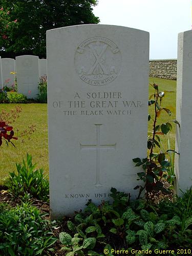
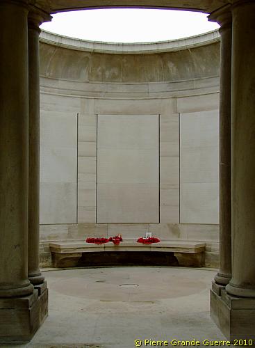
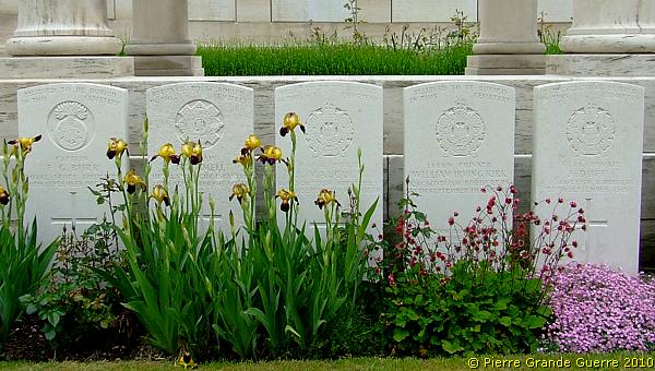
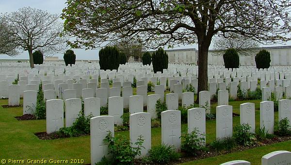
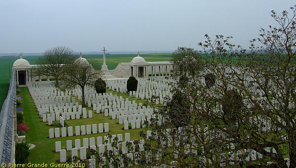
Dud Corner Cemetery & Loos Memorial
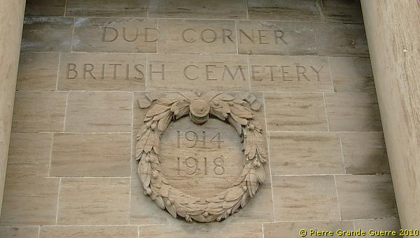
| The name "Dud Corner" is believed to
be due to the large number of unexploded shells found in the
neighbourhood after the Armistice. The only burials here during
hostilities were those of four Officers of the 9th Black Watch and one
Private of the 8th Royal Dublin Fusiliers, close to Plot III, Row B;
the remainder of the graves were brought in later from isolated
positions near Loos and to the North, and from certain small
cemeteries, including Tosh Cemetery, Crucifix Cmty., and Le Rutoire
British Cmty.
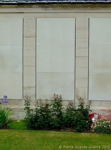
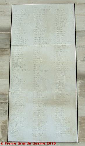
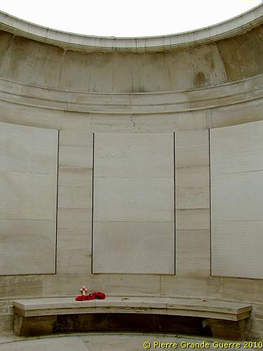
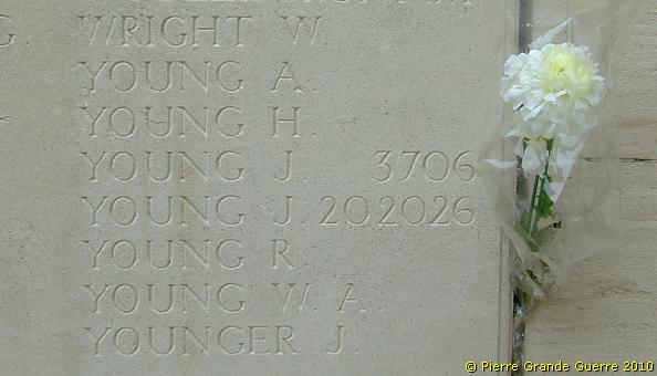
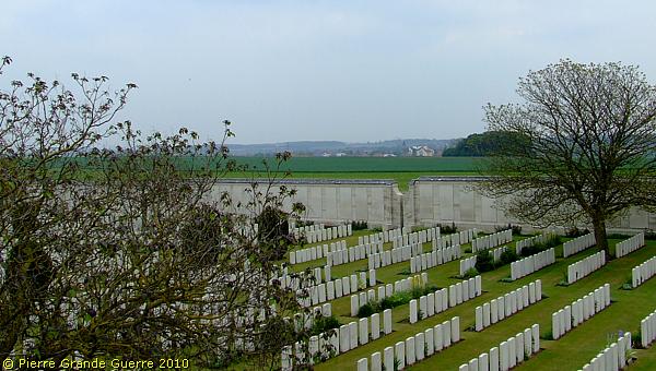
Loos Memorial The side walls and back wall of the Dud Corner Cemetery form together the Loos Memorial. Endless lists of names are engraved on plaques on these walls commemorate over 20.000 officers and men, who have no known grave. These men fell in the area from the River Lys to the old southern boundary of the First Army, east and west of Grenay. |
Before we visit the cemetery, ...
... we study some of the endless lists of names on the walls.
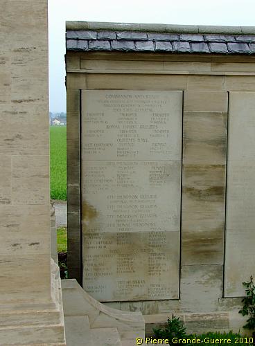
Again: during the battle the death toll on British officers was very high.
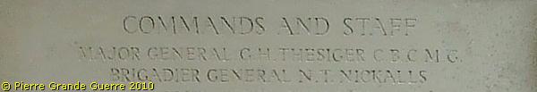
Even a Divisional Commander and a Brigade Commander don't have a known grave.
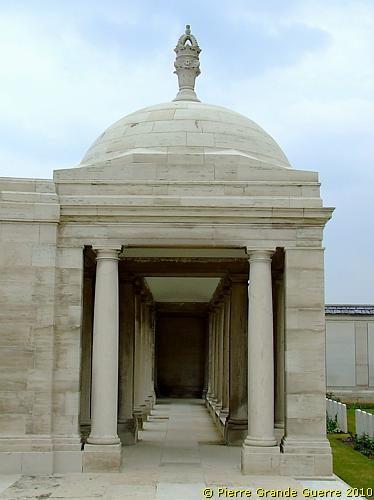
The north-east wall possesses two collonaded loggias.
The western loggia with a cupola.
And beyond; again endless lists of names.
Next to the Cross of Sacrifice: the entrance to the eastern loggia.
We leave the memorial walls and visit the cemetery.
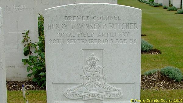
2.013 British officers of all ranks died in the Battle of Loos. The grave of a Lieutenant Colonel, ...
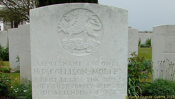
... of an artillery Brevet Colonel, ...
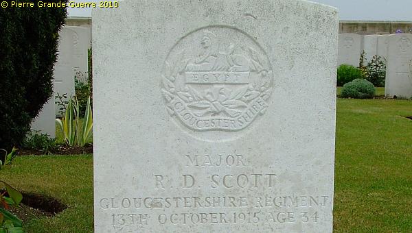
... of a Major, ...
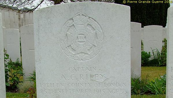
... of a Captain, ...
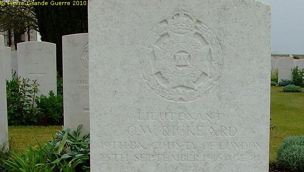
... and of a Lieutenant.
Of course the large majority of graves are of Private soldiers, ...
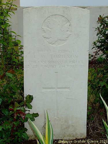
... like this Canadian victim of the 1917 Battle for Hill 70.
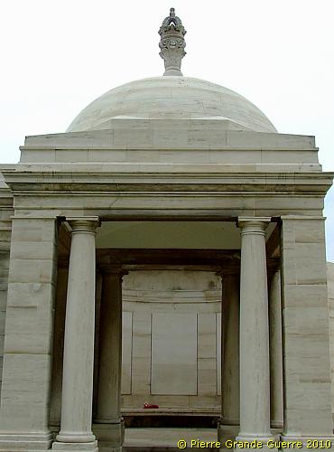
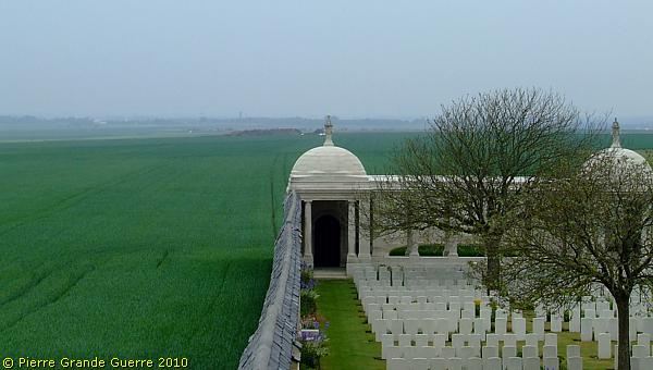
We climb the stairs of the viewing platform of the north-west pier, at the entrance of the Memorial.
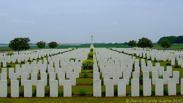
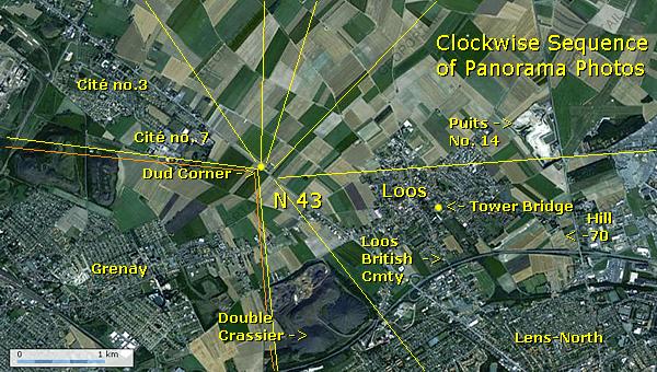
Panorama over the Loos battlefield

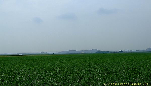
The viewing platform of the north-west pier of the Loos Memorial offers an impressive panorama over the battlefield. I present you this panorama in 7 overlapping steps, going clockwise from north-west, via north and east, to south.
View north-west. At the horizon Vermelles.
View north into the direction of le Rutoire.
View north-east to Auchy-les-Mines.
View into the direction of Hulluch.
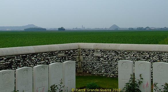
A teleview over the Dud Corner Cemetery north-eastward.
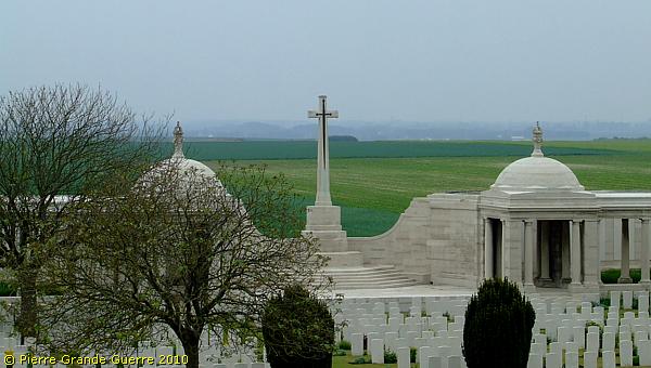
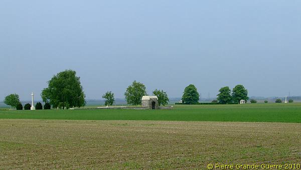
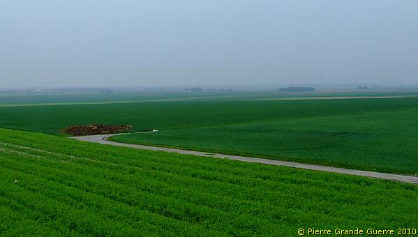
We continue with the panorama shots, eastward.
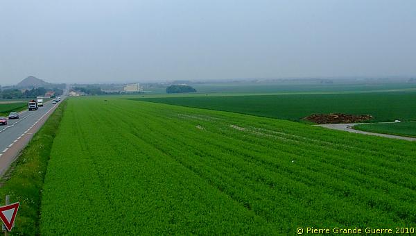
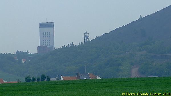
View over the N 43 to the Double Crassier.
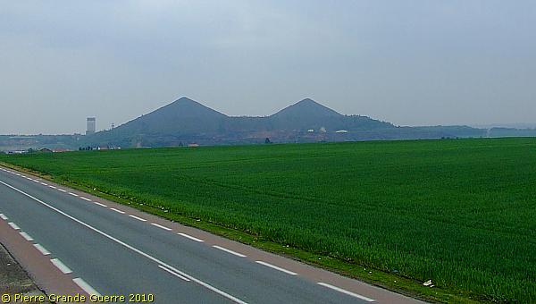
With a teleview at this landmark, ...
... a modern version of the Tower Bridge, I close this impression about the Battlefield of Loos.
Continue to the next Artois Photo Impression: " Arras - Wellington Quarry "


