
ALSACE VOSGES - Route des Crêtes - Hohneck - Grand Ballon - Sudel
Year of visit: 2004, 2007, 2009, 2012
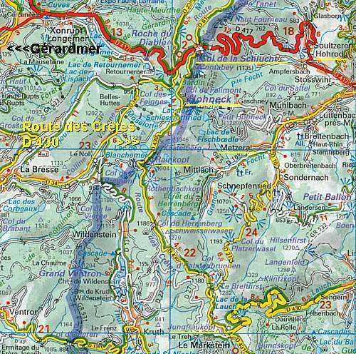
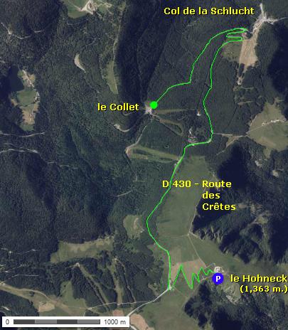
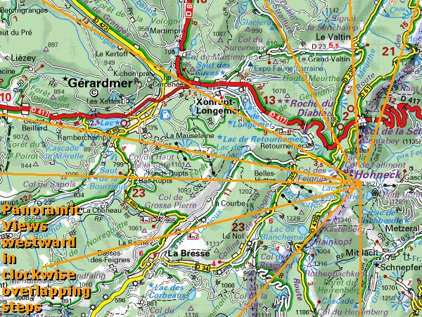
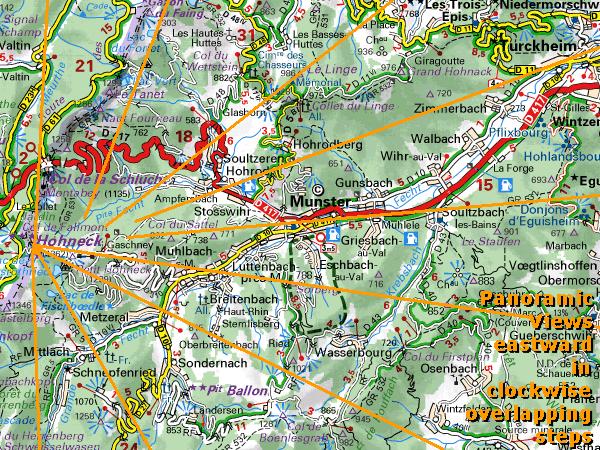
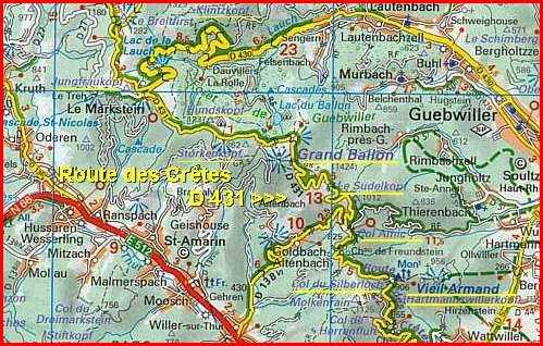
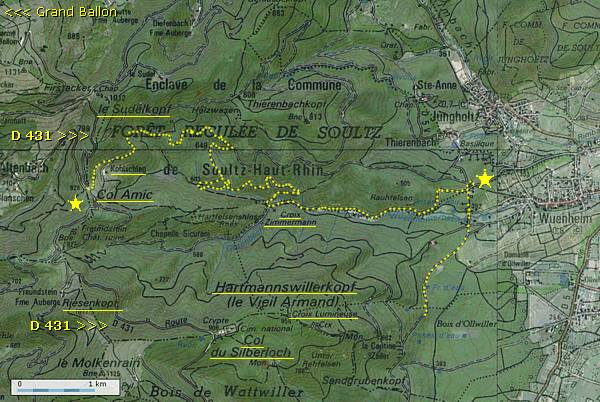
We follow the Route des Crêtes, (Road of the Ridges), D 430, southward, from the Col de la Schlucht until the Markstein. After a short visit to the touristic Col de la Schlucht, we make a detour of only 2 km. to visit le Collet. From there we continue our route over the Road of the Ridges to the summit of the Honeck with its wide panorama over this front sector. Then we continue southward to the Markstein. From the Markstein, where the Route des Crêtes changes to the D 431, we visit the summit of the Grand Ballon, the Memorial Chapel at le Sudel, and the memorial to Capitaine Amic, then make a detour to some concrete relics of the German positions on the slopes of the Sudel (Sudelkopf) to finish our route at the Riesenkopf.
In between you will find some frames with illustrated background information about the amazing story of the import of Alaska sled dogs and their deployment at the Vosges front, and about the military significance of the Honeck Tramway.
Joffre ordered the construction of the Road of the Ridges, running from the Col du Bonhomme in the north to the Hartmannswillerkopf in the south, to supply the French troops on the conquered passes and mountains more easily. The construction of the road was finished in the summer of 1915.
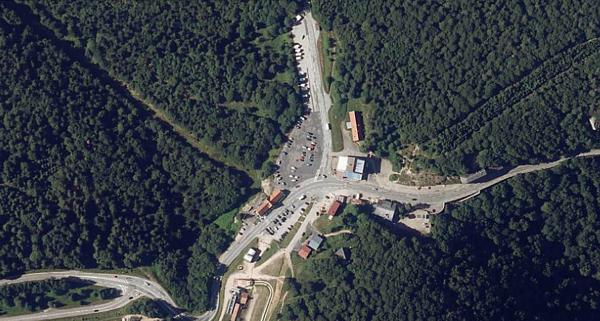
The modern Route des Crêtes, as announced on modern maps and signs, starts at the Col de la Schlucht and runs southward.
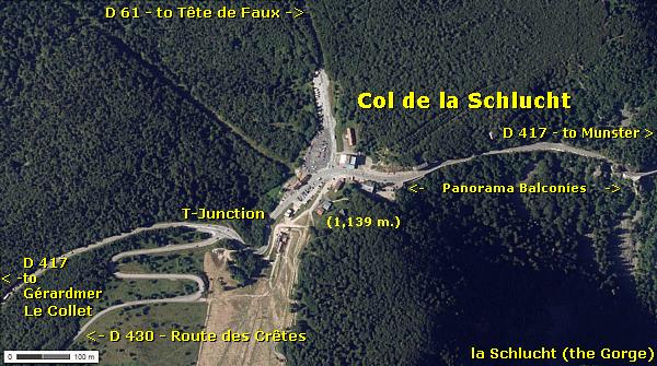
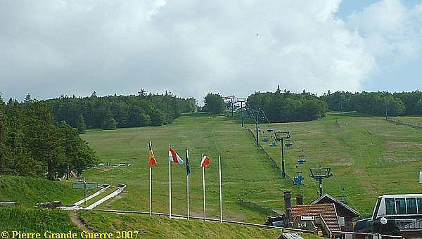
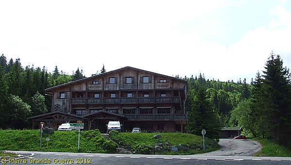
We start at the touristic Col de la Schlucht , which is now also a modern winter sports resort .
The ski cable car line follows the track of the former Honeck Tramway.
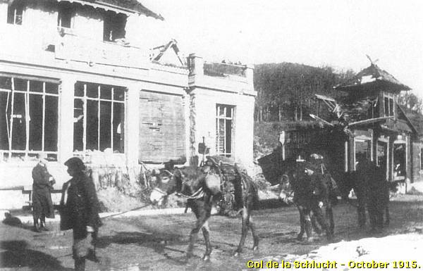
The Col de la Schlucht, "Schluchtpass", before the war
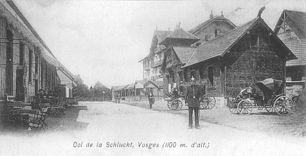
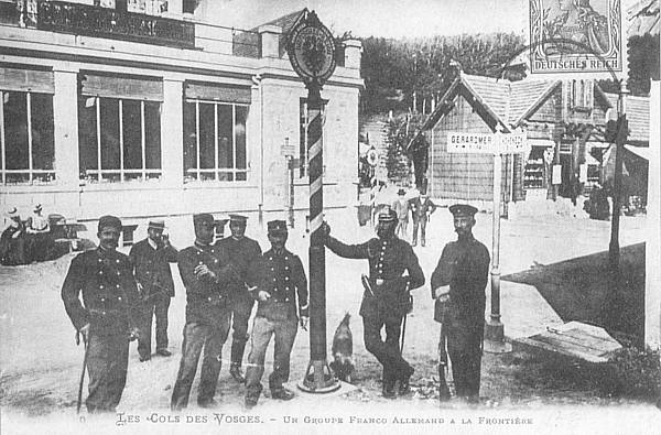
The Col de la Schlucht, or in German the "Schluchtpass", was a border checkpoint (1871-1918) half way between German Munster and and French Gérardmer.
The Col de la Schlucht, during the Great War. Left the station of the Hohneck Tramway.
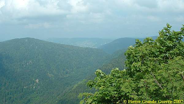
View from the Col de la Schlucht over the former "German side of the front ", eastward; the Valley of Munster.
View from the Col de la Schlucht westward, to the "French side" of the ridge. The Col de la Schlucht was also the target area of the German artillery bombardments of 12 - 19 February 1915 at the Col itself and at nearby Gérardmer.
Gérardmer (on the right) was a very important place during the war, being a French supply station for men, materials, weapons, and ammunitions.
Retreat on the Road of the Ridges
The unsuccessful French advance on Colmar and Munster and the French temporary success of the capture of Mulhouse on 18 August 1914, created also a weakness in the French Alsace Front. It created a gap between the 1st Army of General Dubail and the 2nd Army of General Castelnau. Dubail recognized this weakness and planned to attack the Germans on the 20th to close the gap and remake the connection with the 2nd Army.
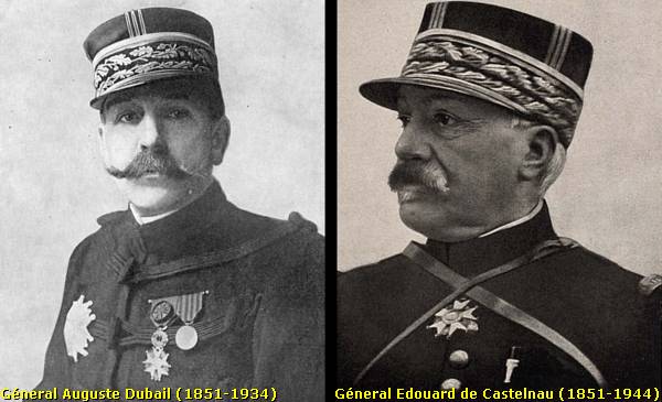
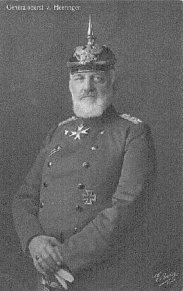
During the night of 19 to 20 August Von Heeringen’s 7th Army surprised Dubail’s night attack and killed it with a huge counter offensive in cooperation with Crown Prinz Rupprecht's 6th Army against the French 2nd Army. The German artillery bombardments and infantry attacks were very successful.
On 23 August 1914 Joffre ordered Dubail and Castelnau to retreat. Castelnau had to retreat to Nancy and the Grand Couronné. Dubail was ordered to retreat west and behind the Road of the Ridges to Epinal and to occupy such ridges and passes along the Route des Crêtes as they were able to hold.
After January 1916 the Road and it' Ridges formed with some exceptions the French lines in the Vosges front sector.
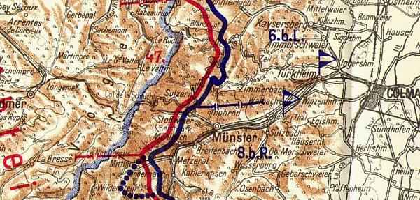
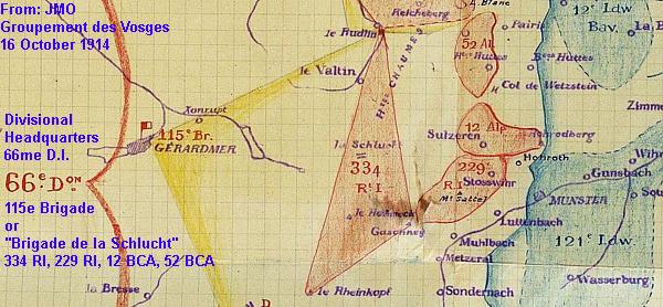
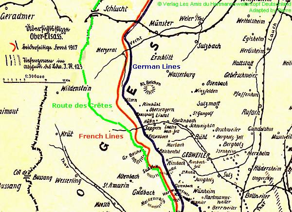
The Route des Crêtes, projected on a L.I.R. 173 sketch of 1917 of the front line between the Schlucht and the Hartmannswillerkopf.
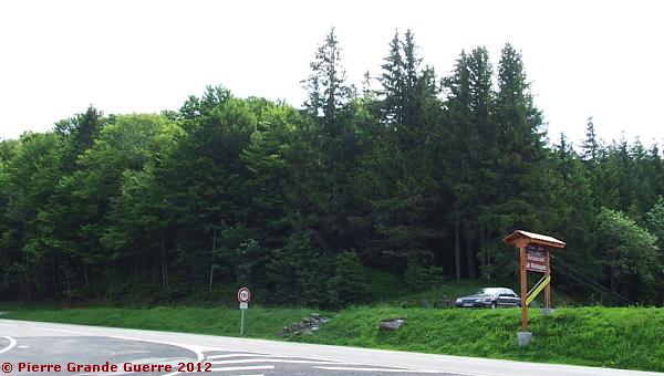
Before we start our route southward to the Hohneck, we make a short detour of 2 km. south-westward to a location ...
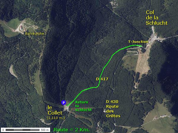
... called le Collet .
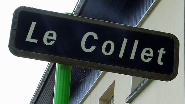
Le Collet has an interesting history being the former location ...
... of the military Camp du Collet.
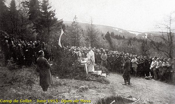
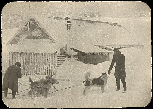
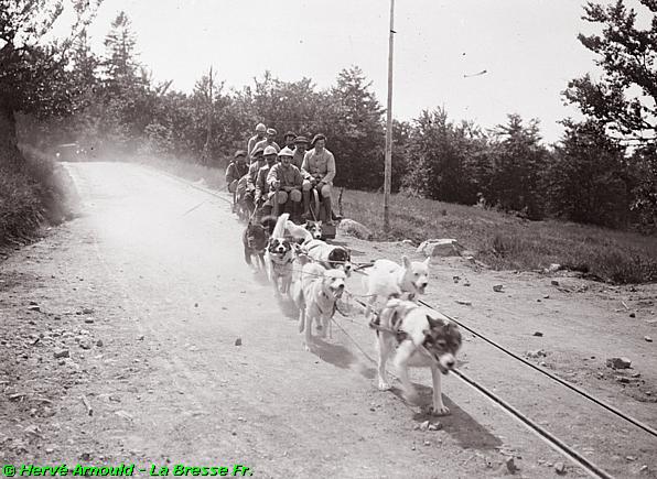
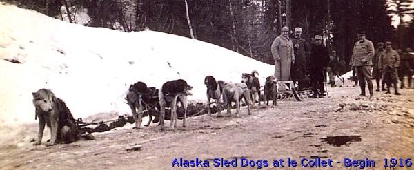
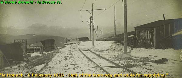
It was this period photo of my friend, Monsieur Hervé Arnould of nearby la Bresse, Vosges, which made me visit this location. The handwritten caption especially made me curious:
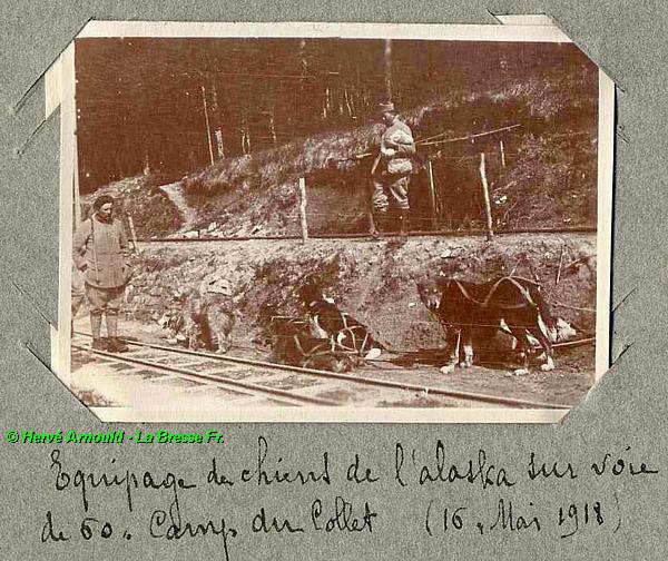
The "Haas & Moufflet"-project: the import of Alaska Sled dogs
The winter in the Vosges of 1914-1915 was most rigorous. On the Vosges peaks the snow sometimes reached two metres high. Snow accumulation made the transport of the wounded and of supplies difficult; not only for men, but also for mules and dogs. Soldiers were often forced to shovel to clear the way for them. Their work rapidly became ineffective.
Capitaine Louis Moufflet and Lieutenant René Haas
In June 1915, Captain Louis Moufflet of the 62e Bataillon de Chasseurs Alpins (a Reserve Battalion of the 22e B.C.A.) and infantry Lieutenant René Haas were received at the headquarters of the Vosges Army Group.
Since both men had lived before the war in Alaska, they were experienced in the difficulties of life and transport in extremely cold circumstances. Based on their experiences in Alaska and inspired by the practices of handling dogs over there, they suggested that General Maud’huy should use Alaska sled dogs for transporting supplies. In France other types of dogs were already used for draught activity or for "pack" activity, but the use of pulling a sled with cargo was then virtually unknown.
During this meeting, Moufflet and Haas proposed to General Maud’huy a plan to buy and import a large group of sled dogs in Alaska to deploy them later in the Vosges.
September 1915: the "Haas & Moufflet"-project is official
In September 1915 General Maud'huy approves of the "Haas & Moufflet"-project to acquire a group comprising 400 Alaska sled dogs and 40 draught dogs. The General sends Captain Moufflet and Lieutenant Haas on a secret mission to Alaska to buy more than 400 dogs, sleds and harnesses, as well as specific provisions of food. On 7 August 1915 Mr. Millerand, Minister of War, approves officially the project.
Upon receiving the news of the order, the two officers embark immediately for Canada. Their crossing of the Atlantic Ocean by steam ship lasts 15 days.

The Captain, still seriously wounded during fighting some days before his journey, stays in Montréal to organize the reception of the dogs and their transport from Canada to France. His deputy, Lieutenant Haas continues on his way westward by train via Seattle and from there northward to Nome, Alaska.
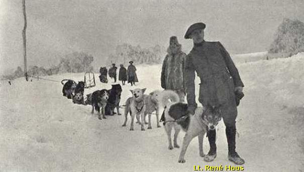
René Haas and Scotty Allan

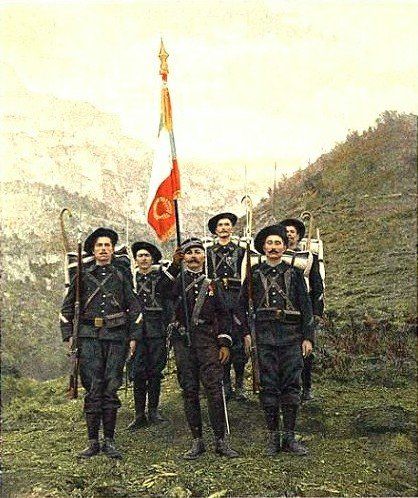
In anticipation of General Maud’huy’s expected order, Rene Haas had already wired some weeks before a message to Nome. He telegraphed one of the most famous breeders and conductors of Alaska sled dogs, the musher, Allan Alexander “Scotty” Allan, to seek his support, expertise and assistance. Scotty Allan is a naturalized American, born in Scotland.
Before the arrival of Haas in Canada and Alaska, Scotty has already begun touring the Inuit villages with the utmost discretion, letting it be understood that he was searching for new dogs for his kennel. During and in between the arrivals of 106 new sled dogs Scotty conscientiously stored several tons of dried salmon, sleds, hundreds of harnesses, ropes and lines.
When Lieutenant Haas arrives some weeks later in Nome, the dogs with their sleds, harnesses, and their 2 tons of dried salmon are ready for transport by ship.
Against his wife’s and family’s wishes, Scotty Allan decides to embark too and to volunteer to serve with the Chasseurs Alpins in France. Although American neutrality forbids him to take part in the conflict, he volunteers. This was not uncommon, because the French army deployed already dozens of U.S. citizens, "volunteers on their own", for instance the American ambulance drivers .
Transport from Nome to Quebec
The transport by ship from Nome to Seattle lasts 9 days without incident. The next stage of the transport is the journey by train of 5,000 km. from Seattle to Quebec.
In Quebec, Scotty Allan and Lieutenant Haas meet Captain Moufflet again, who is still looking for a transport steamer. Before their arrival, the Captain managed to collect some 300 dogs from La Belle Province and from Labrador together with the necessary harnesses and sleds. In all Haas and Moufflet collected 436 dogs with harnesses and 70 new sleds.
Baptism of fire
The dogs are gathered in a park near the Munitions Test Centre of the Canadian Army. The cannonade of the test centre is almost constant and the earth trembles all day long. After two days of exposure to the noise, the dogs become accustomed to it. This baptism of fire teaches the dogs to respond only to the yelling of their musher's voice, and it manages to silence them gradually.
Transport from Quebec to le Havre
A steamer, the Pomeranian, leaves Quebec with its cargo via the St. Lawrence river to cross the Atlantic, infested with German submarines, to France. After 15 days the Pomeranian arrives at le Havre.
Arrival and deployment in the Vosges
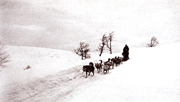
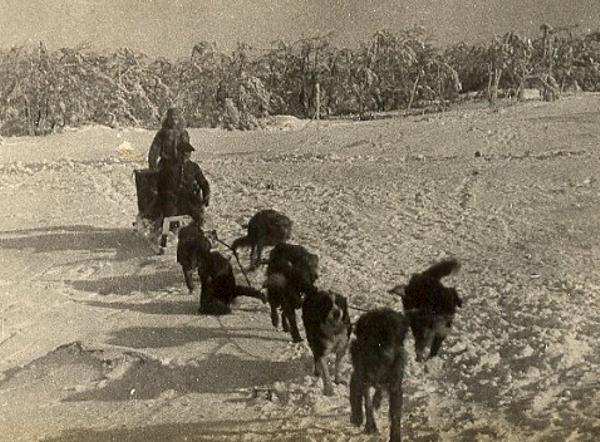
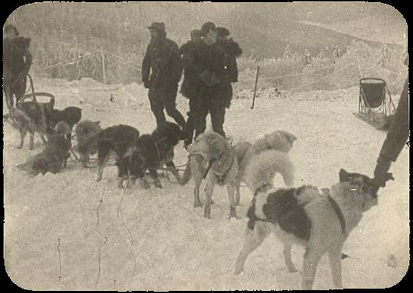
Fourteen months later after the departure of Moufflet and Haas, on 15 December 1916, the dogs arrive in the Vosges for their deployment at the front sectors of le Tanet, the Col de la Schlucht, le Collet, and the Breitfirst. Later the dogs would be deployed also in other Vosges front sectors like the Linge.
During the summer months the dogs pulled 60 cm. railway cars or cars with rubber tyres. Being trained by Lt. Haas and Scotty Allan, the Chasseur Alpins handling the dogs proved to be good drivers.

Following the example of the deployment of Alaska dogs, French dogs with similar qualities, like the Labrit des Pyrenées, were deployed in other French units as draught animals.
By 18 July 1918 the “Section d'Equipages Canins d'Alaska” (Section of Alaska dog teams) had lost 187 of the 436 Alaska dogs. Three Alaska dogs were awarded the Croix de Guerre.
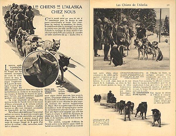
Source a.o.: " Les équipages de chiens d'Alaska dans l'armée française durant la Première Guerre Mondiale ”, and the television documentary "Poilus d'Alaska".
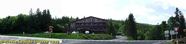
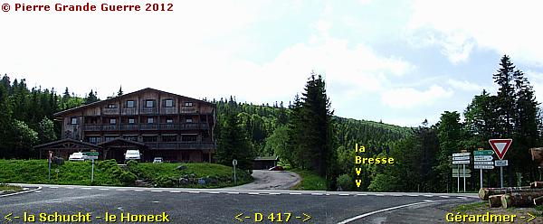
The period photo of my friend Hervé ...
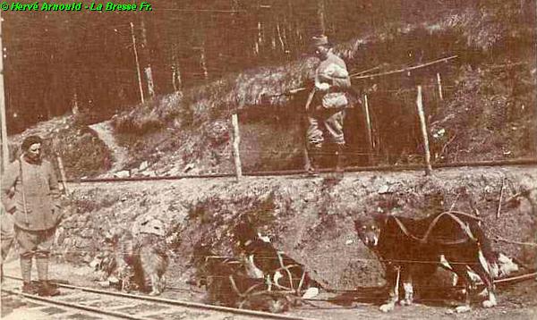
... has been made ...
... on this spot, left on the photo.
Since 1905 le Collet was a halt of the Hohneck Tramway. Later I will tell you more details about the military significance of the Hohneck tramway.
We leave le Collet with its interesting history ...
... to return to the Col de la Schlucht to continue via the Route des Crêtes to the Hohneck mountain.
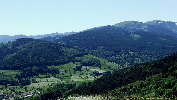
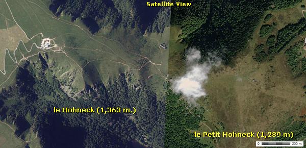
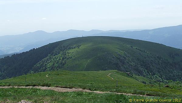
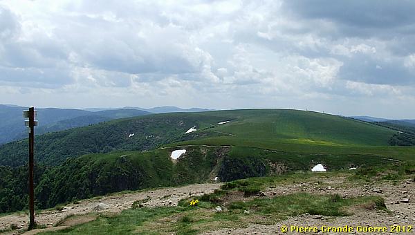
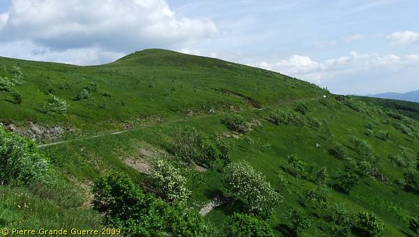
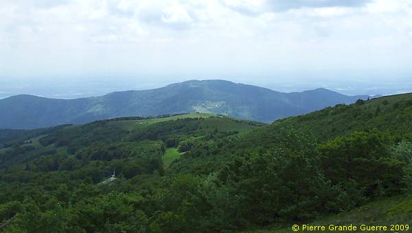
View from the D 430 at the Hohneck.
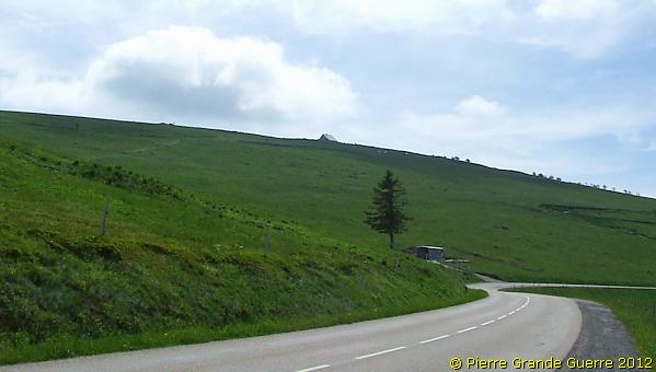
Via the zig-zagging road upward ...
... we arrive at the summit to park our car.

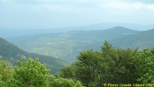
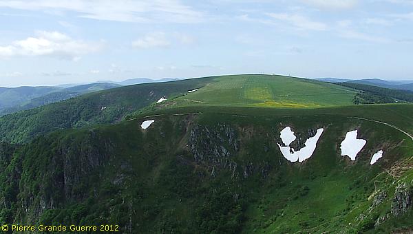
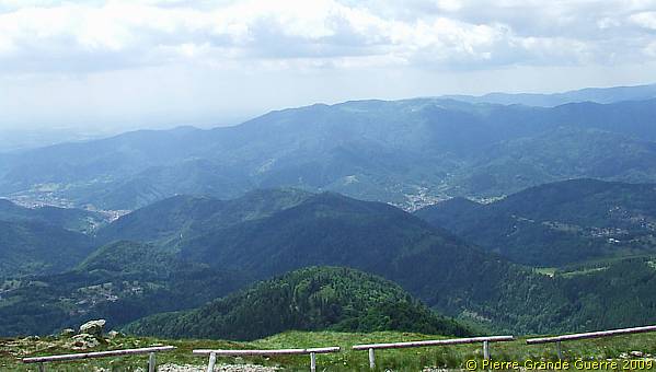
The summit of the Hohneck offers a full 360 degrees panorama westward to "French" territory and eastward to "German" territory.
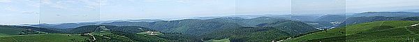
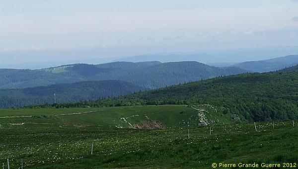
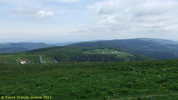
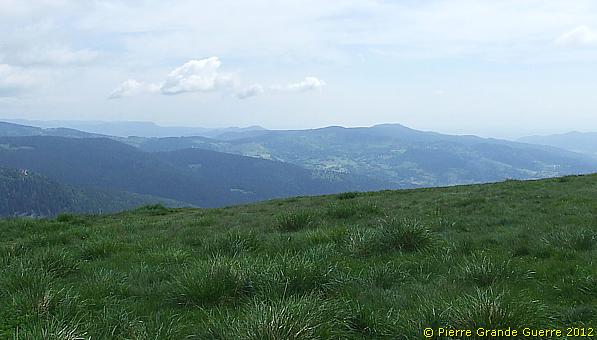
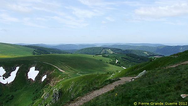
From the summit of the Honeck I present to you this panorama westward in overlapping steps, going clockwise from south to north.
From left to right...
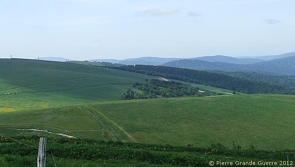
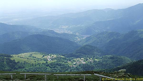
View in the direction of la Bresse.
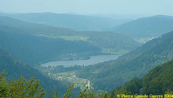
View at the Lac de Longuemer and Xonrupt-Longuemer, ...
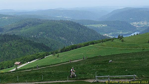
... and Gérardmer.
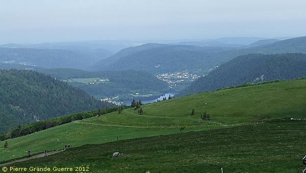
Tele view.

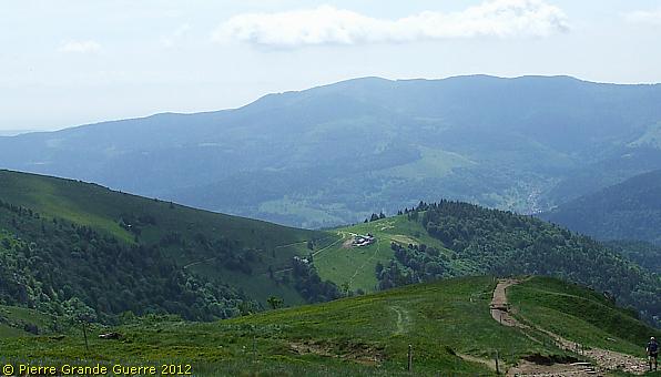
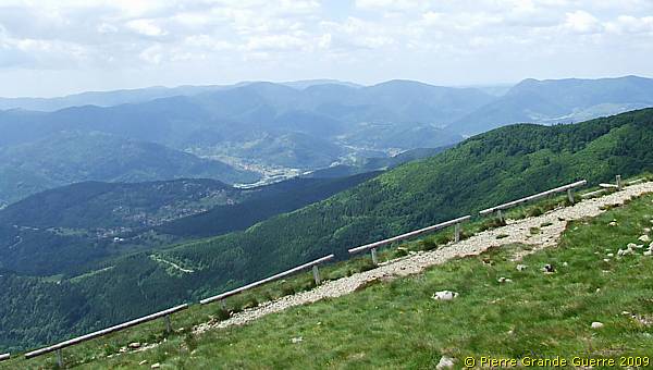
We continue this panorama north-westward.
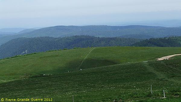
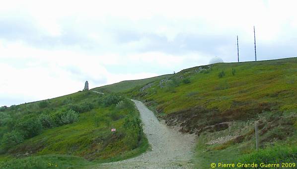
The sandy path marks the former location of the track of the Hohneck Tramway.
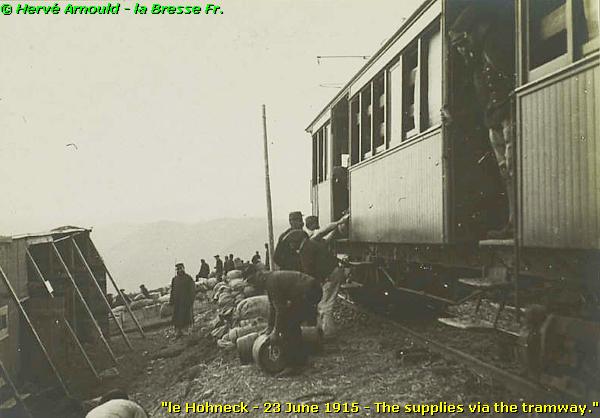
In this frame below I tell you some background information about the military importance of the Hohneck Tramway.
|
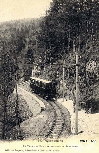
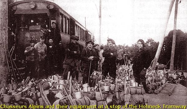
The Hohneck Tramway |
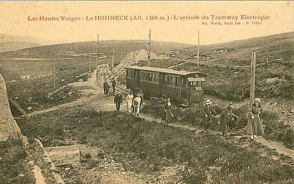
The Hohneck Tramway was not just an ordinary tram, but a real mountain train.
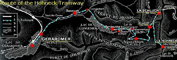
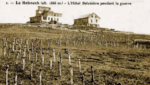
The line of only 20 km. started at Gérardmer at 621 m. for a westward climb to the Col de la Schlucht (1,200 m.) to continue southward to the Hohneck (1,366 m).
The service started in 1905. In 1908 the line was extended to Munster, then a German border town with a time difference of one hour (Berlin time). It took the tram 1 hour to cover the distance of 10 km. from the Col de la Schlucht to Munster. After August 1914 the service to Munster stopped and it would never be exploited again.
The Hohneck Tramway in wartime
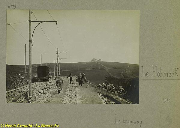
From the start of the war the civilian function of the tramway changed.
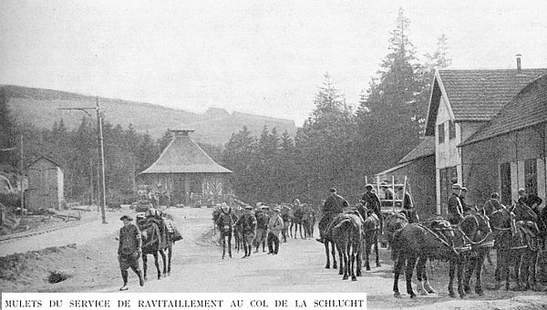
Instead of civilians the tram now transported only soldiers and military supplies to the front line.
On its return the tram transported wounded men back to the hospitals in Gérardmer.
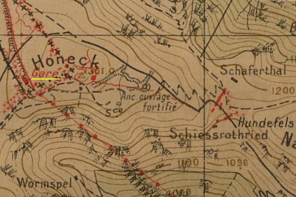
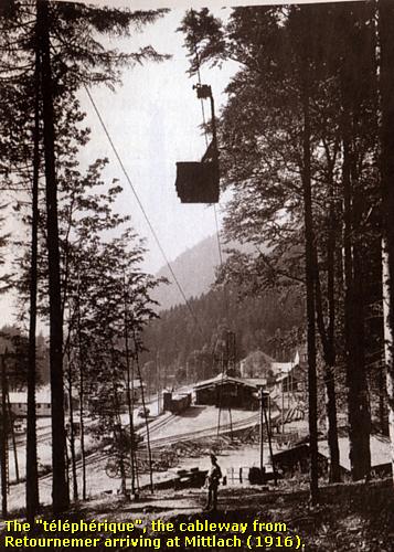
In 1916 the French engineers also constructed a cable car line starting at the Lake of Retournemer, passing the Hohneck and Lake Schiessrothrieth, to the conquered village of Mittlach in the Fecht valley.
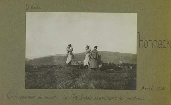
In April 1915 Géneral Dubail himself arrived via the tramway at the summit of the Hohneck to inspect the front line and the German positions on the slopes of the other side of the Fecht valley.
Some period photos in this frame and all Honeck Tramway information: courtesy of Monsieur Hervé Arnould of La Bresse, Vosges, an expert on historic French railways. Merci, Hervé!
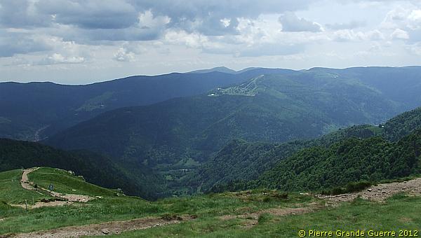
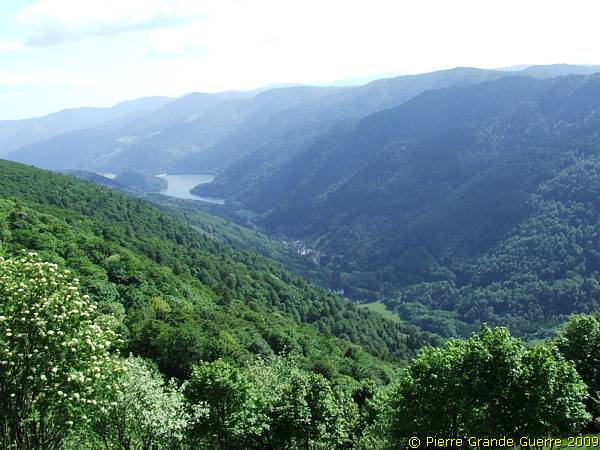
After this intermezzo we continue our panoramic views northward. View in the direction of the Schlucht (the Gorge).
View at the Col de la Schlucht.
View at the Munster Valley.
With the Petit Honeck in the background Bobby the Trenchdog marks the spot, ...
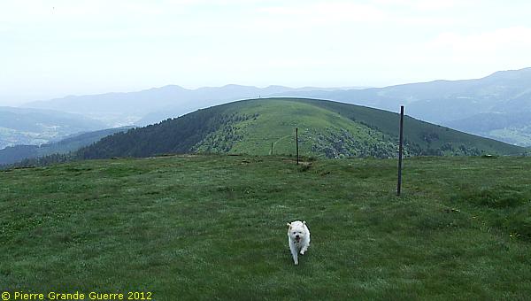
... where General Dubail inspected in April 1915 the German positions on the east side of the Fecht valley.
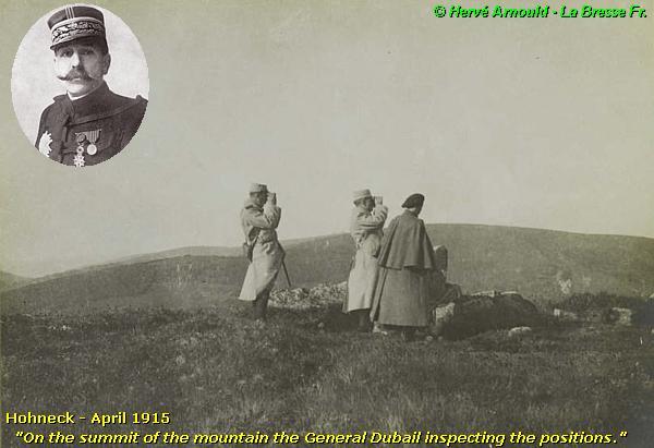
This panorama must have been most interesting for the General.
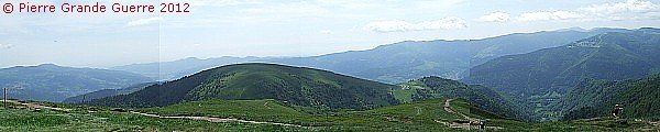
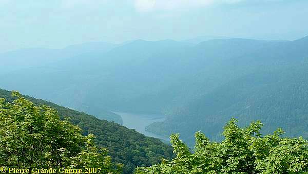
From the summit of the Hohneck I present to you this panorama eastward in overlapping steps, going clockwise from north to south.
View at left: the Altenberg, le Tanet and the Bichtstein. Right: the Valley of Munster, in the background the ridges of the Lingekopf front sector.

The summit of the Petit Hohneck, conquered by the French.
The winter sports village of le Gaschney and the Sattel, right of the Sattel, the Reichackerkopf.
Extreme left: the Reichackerkopf. In the Fecht valley: Mittlach, conquered by the French. Centre right on the mountain: Schnepfenried, "German" territory, ...
... and the Petit Ballon right behind it.
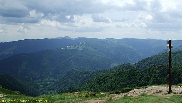
View southward at the Kastelberg.
And so we have arrived back at our first panoramic view southward.
Our company leaves the summit of the Honeck...

... to continue our route along the Road of the Ridges southward.

A view from the Rainkopf westward.
We pass the Rothenbachkopf.
View from the Rothenbachkopf at Wildenstein.
View from the Col du Herrenberg at the Grand Ventron.
View from the Jungfraukopf at Kruth.
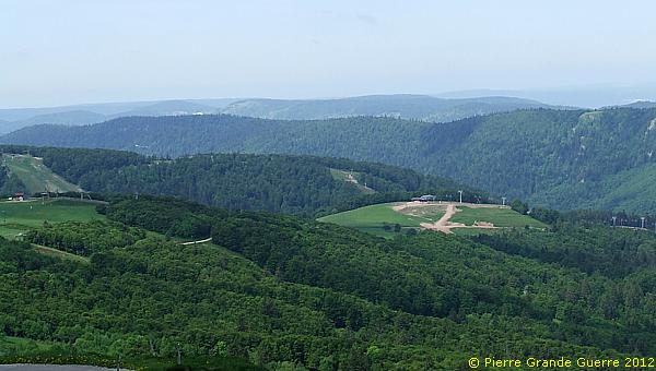
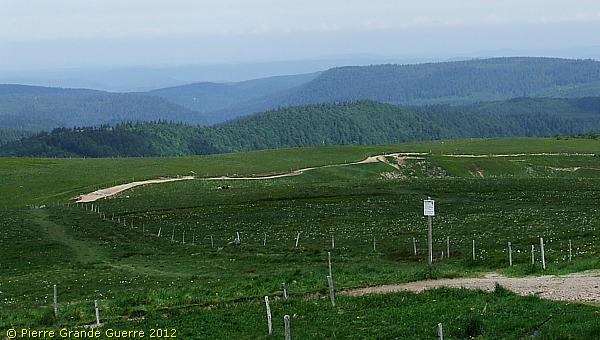
Near the Breitfirst we follow the D 27 eastward for a short detour of about 1 km. View from the Breitfirst westward. Notice the 2 shell holes.
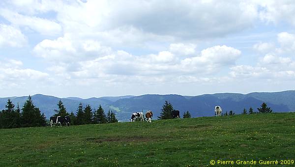
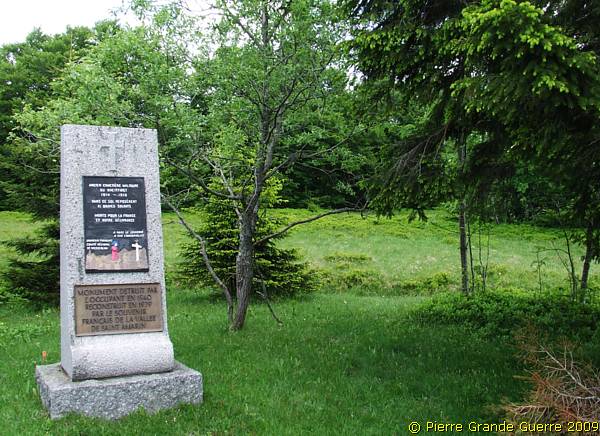
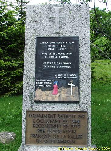
At the Breitfirst there used to be a French wartime cemetery.
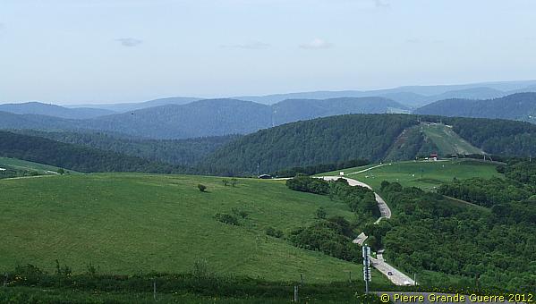
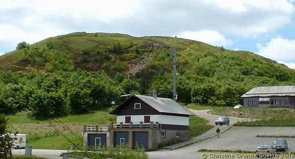
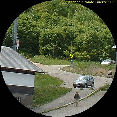
We arrive at the junction of the winter sports resort of the Markstein, here photographed from the south.
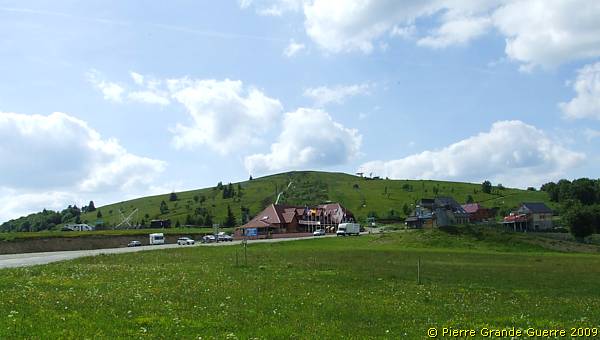
At the junction at the Markstein the road numbers change, from the D 430 into the D 431. We continue to follow the road along the D 431.
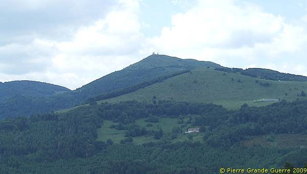
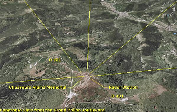
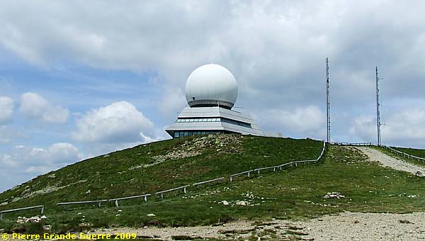
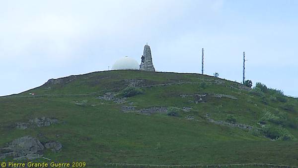
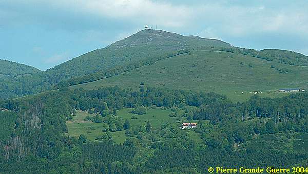
The Grand Ballon (1.424 m.) from the south, a landmark with its ball shaped, radar weather station.
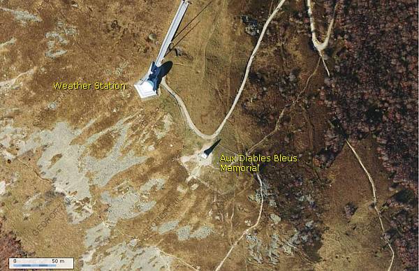
Two autumn satellite views of the Grand Ballon.
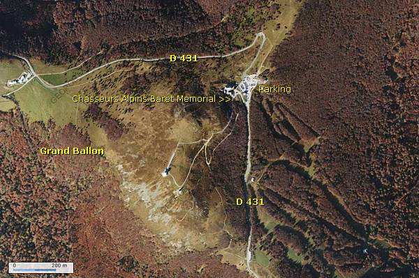
Near the pass, at the foot of the summit ...
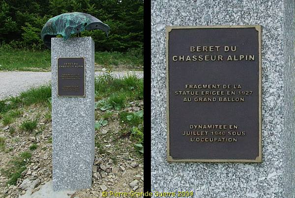
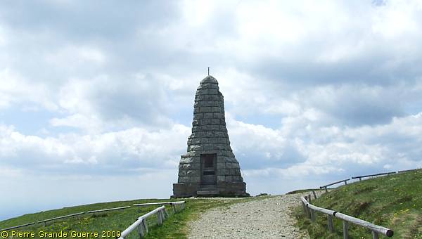
... stands a modest memorial.
This memorial with the typical oversized beret is dedicated to its bearers: the elite mountain infantry of the Chasseur Alpins. But the fragment also remembers the original 1927 memorial for the Chasseurs Alpins of the sculptors, Vermare and Moreau Vautier, on the summit.
From the memorial I climb the path upward to the summit.
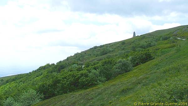
View to my left, eastward.
When I near the summit, I can see the outlines of the memorial.
I arrive at the rear side of the memorial, showing two plaques in a niche.
The first plaque tells about the persons, present at the inauguration on 25 September 1927.
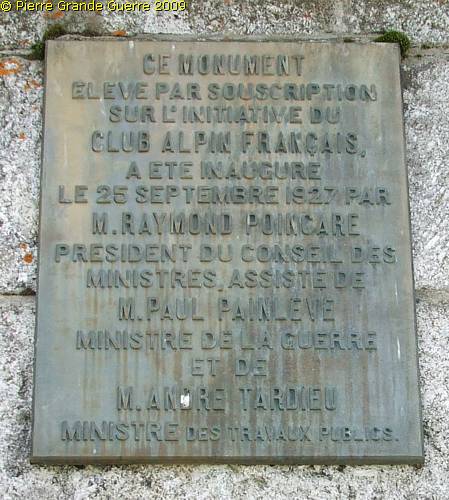
And a rather political inscription:
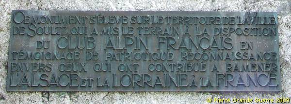
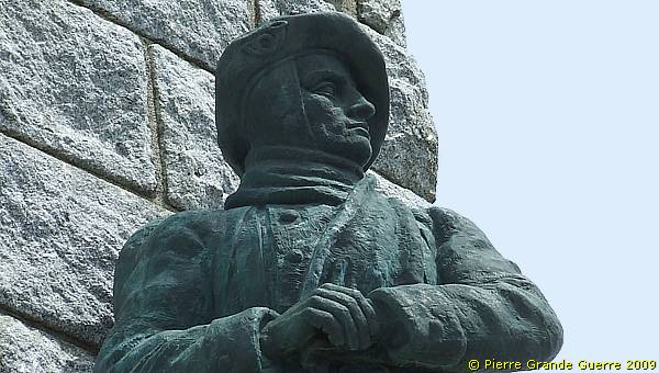
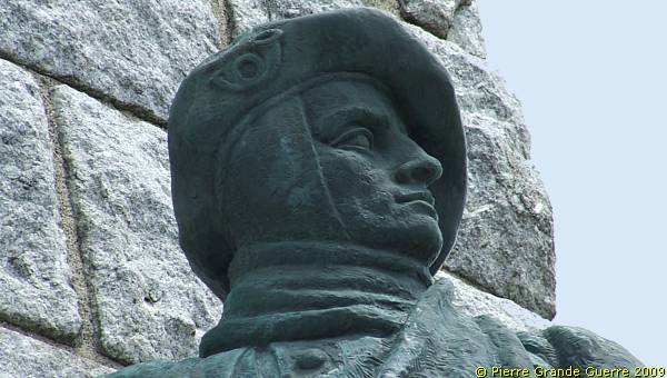
The front side of the Chasseurs Alpins Memorial at the Grand Ballon: "AUX DIABLES BLEUS", TO THE BLUE DEVILS; the nickname of the Chasseurs Alpins.
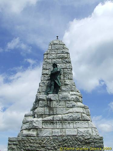
It is a copy of the dynamited 1927 statue, made by Pierre Bouret, and replaced here in October 1960. The bronze statute represents a Chasseur Alpin in winter outfit.
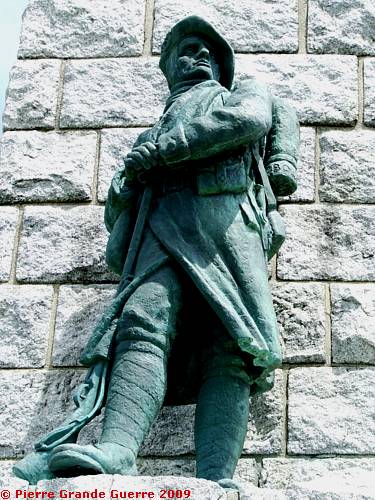
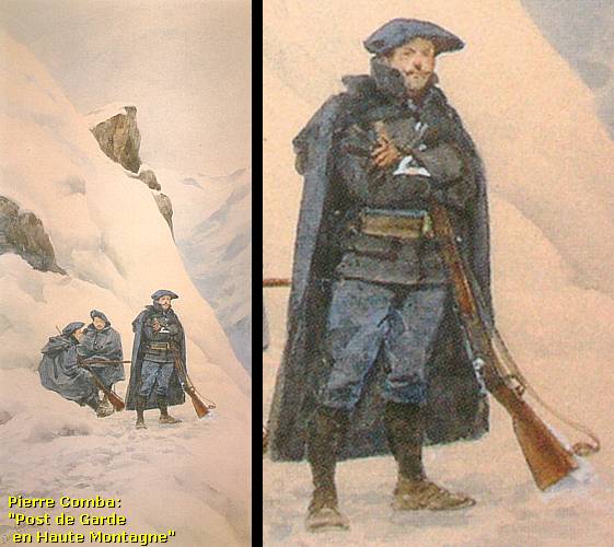
The statue made me think of Pierre Comba's realistic painting, "Sentinel post in the high mountains".
The face of the Chasseur overlooks a wide panorama.
Following the view of the Chasseur Alpin southward, in 4 overlapping panorama photos.
From left to right:
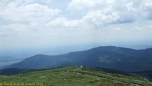
Southeast.
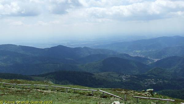
South.
Southwest.
And of course, on the summit: the landmark of the futuristic radar and weather station.
Tele view southward at the valley of Goldenbach and Thann.
View from the east at the Grand Ballon.
Tip for Dutch Readers . Read my more detailed lecture about the Chasseurs Alpins: " De Blauwe Duivels in de Vogezen - Chasseurs Alpins " .
Bearing these Blue Devils in mind we leave the Grand Ballon, ...
... continuing southward along the D 431.
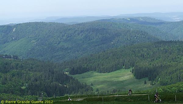
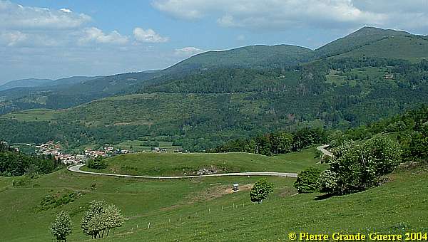
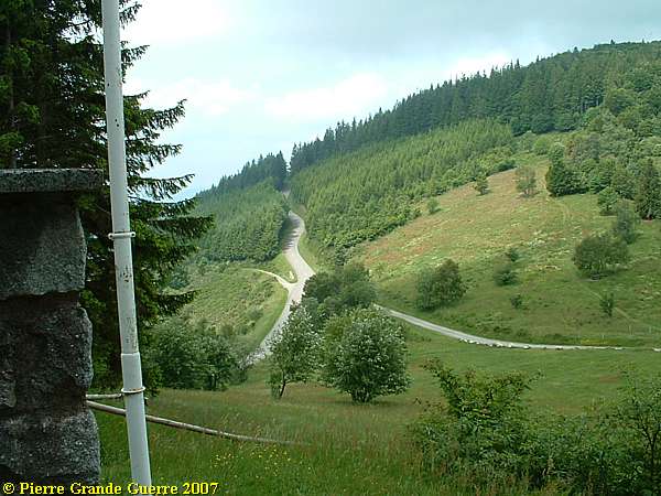
View from the northern slope of the Sudelkopf or le Sudel over the meandering D 431 to the Grand Ballon.
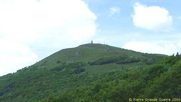
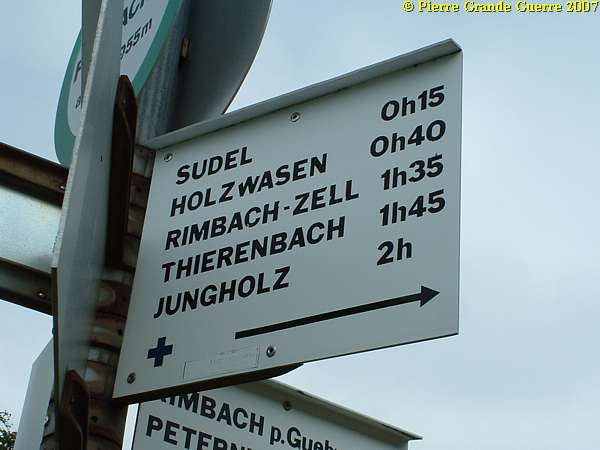
A junction to various hikers paths. We climb the Sudel .
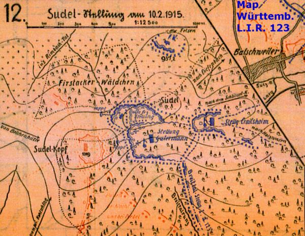
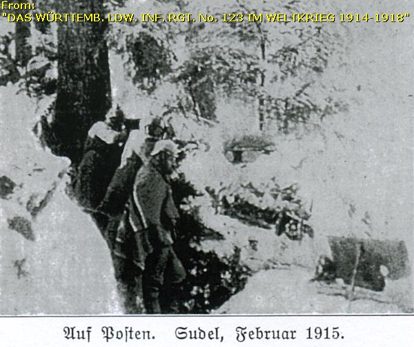
The Sudel or Sudelkopf
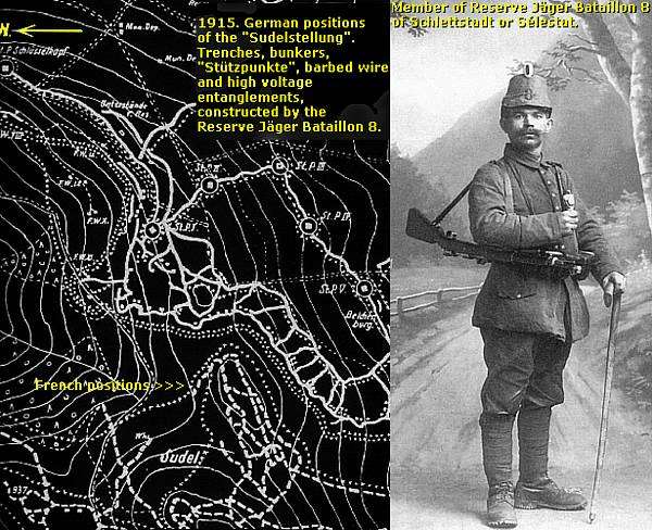
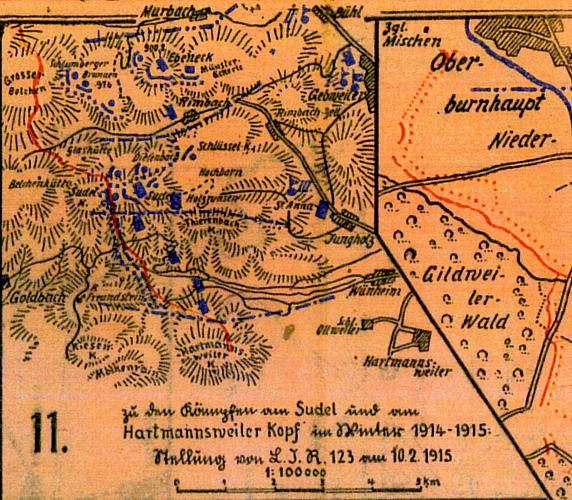
From December 1914 the French occupied the summit of the Grand Ballon, west of the Valley of Guebwiller. But at the Sudel or Sudelkopf the frontline trenches of the Germans and the French were closing in on the slopes of the mountain. The distance between the first lines of barbed wire and high voltage entanglements was at some points not more than 100 m. The French 7th Infantry Regiment (7e R.I.) and the 5th Battalion of Chasseurs Alpins (5e BCA) were occupying the summit. The German Reserve Jäger Bataillon 8 was positioned on the southern slopes of the Sudel. From the Sudel the front line was meandering towards and over the nearby and infamous Hartmannswillerkopf or le Vieil Armand.

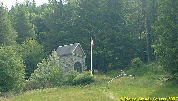
On the ridge of the Sudelkopf is nowadays a small French National Memorial Chapel.
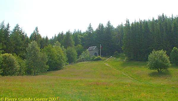
The chapel has been built on the location of a French observation and machine gun post.

Through the gate of the chapel I made these pictures of the small interior.
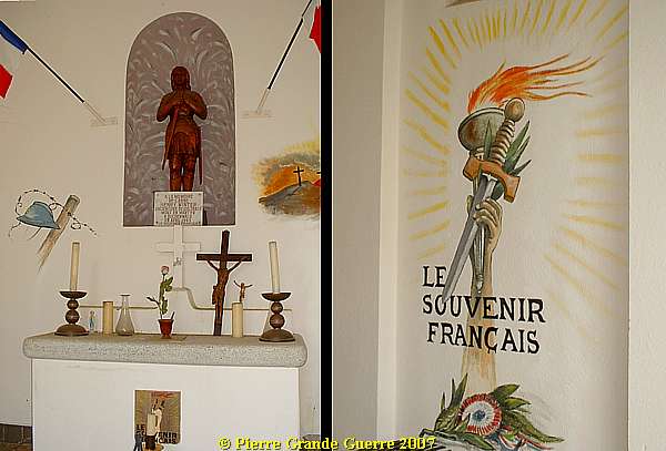
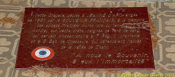
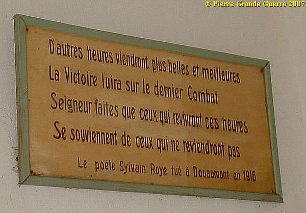
Some plagues in the chapel:
View from the chapel and the former observation post guarding "the access to the valley of Thann".
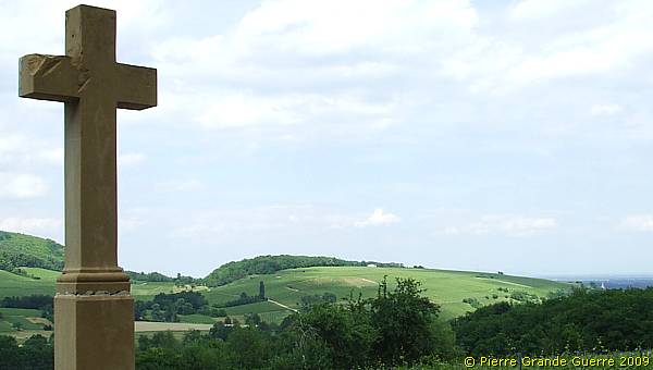
With a last view of the chapel we continue to the Col Amic.
After the war the French renamed the pass under the Kohlschlag the Col Amic (828 m.).
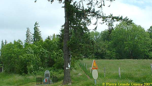
Under a tree on the Col is a small memorial, ...
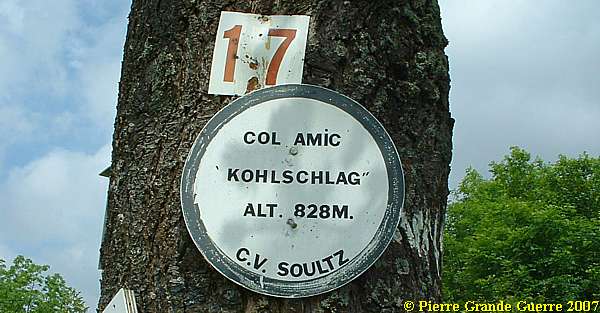
... commemorating the heroic Captain Paul Amic.
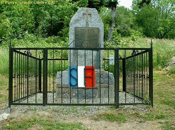
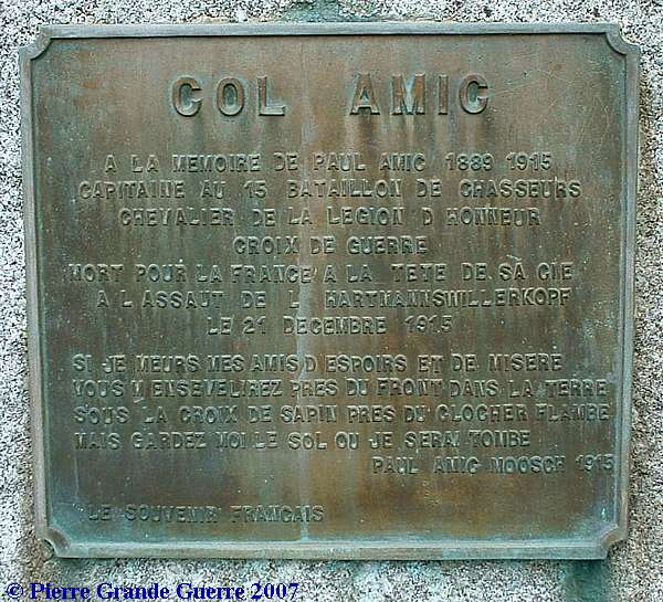
Capitaine Paul Amic was killed during an attack at the Rehfelsen and the Sandgrubenkopf near the Hartmannswillerkopf "at the head of his second platoon". His mortal remains are buried in the M oosch Nécropole Nationale .
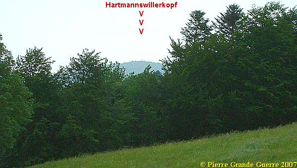
A view from the Memorial for Paul Amic to the nearby Hartmanswillerkopf .
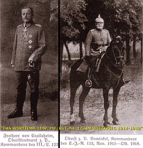
From the Col Amic we enter "German territory". From 13 September 1914 until the end of the war the Württemberger Landwehr Infanterie Regiment 123 guarded this front sector. Other Württemberger regiments like L.I.R. 40 served here also.
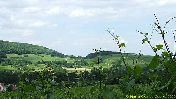
From the Col Amic we make a detour of about 8 km. eastward over a numberless road in the direction of Wuenheim, but still an asphalted road, meandering along the southern slopes of the Sudel down into the gorge of the Wuenheimerbach. Christine drives at a slow pace to give us the chance to detect relics of the former German positions. At the end of this detour, at the eastern foot of the Hartmannswillerkopf, we will return back to the D 431 along this same road.
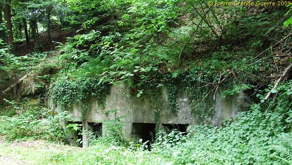
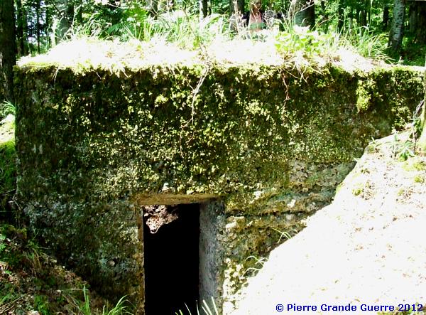
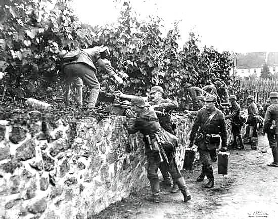
At the Kohlschlag, at the northern side of the road, we detect this twin bunker.
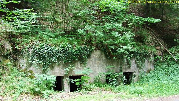
The constructors proudly left their mark:

Of course I had to enter the twin bunkers, first the left one.
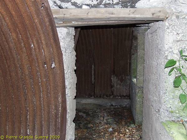
The interior of the right bunker.
With this last view of the L.I.R. 40 bunkers we continue westward.
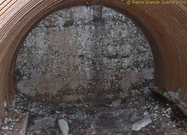
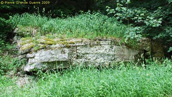
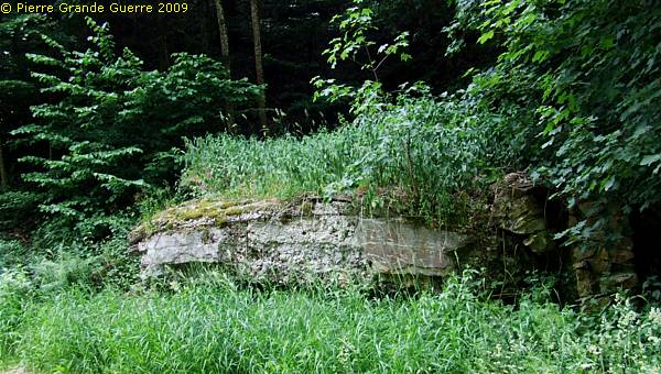
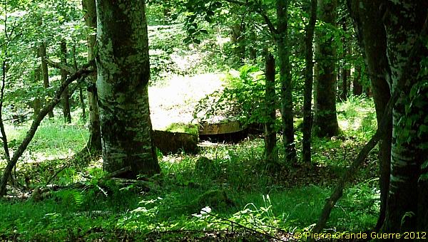
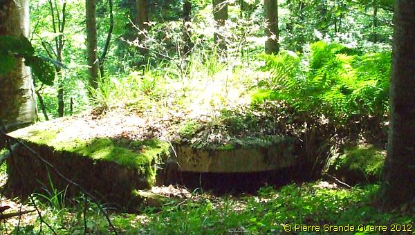
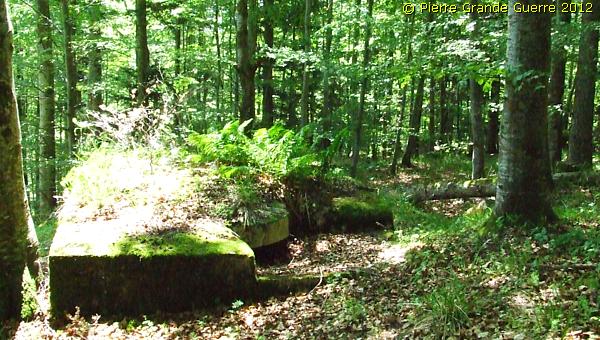
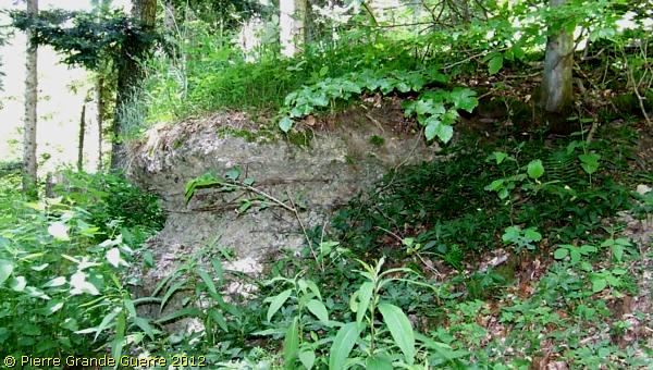
At the southern foot of the Sudel we detect this damaged bunker.
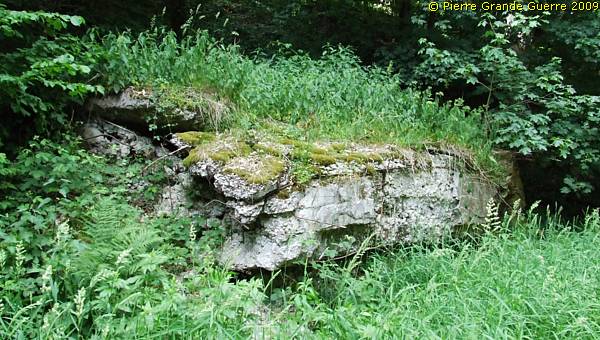
The roof has collapsed.
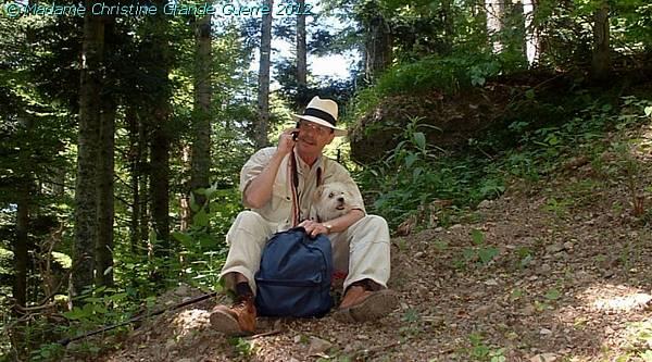
On a hot day in June 2012 we parked our car south ...
... of the summit of the Sudelkopf in an attempt to reach by ...
... foot the summit looking for concrete relics of the German positions.

We follow a foresters' track upward.
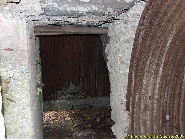
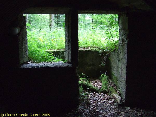
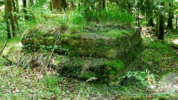
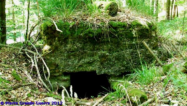
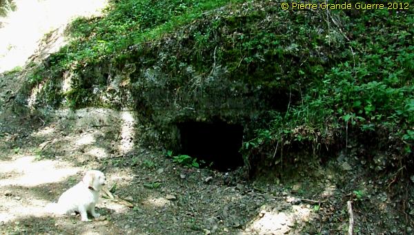
This well preserved machine gun bunker has two entrances.
The left entrance.
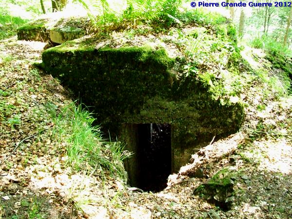
The right entrance.
At first you would expect that the bunker guards the road down in the gorge of the Wuenheimerbach. During the war this track upward to the German 1st front line at the Sudelkopf was of more importance than the relatively safer road below.
In case of a French break-through from above or from below, this machine-gun bunker would defend the path.

In the heat we climb further on a difficult, ...
... steep path of 45 degrees with loose pebbles.
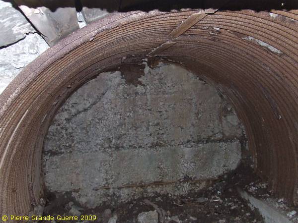
Along the path we detect two bunkers opposite each other.
My health condition and the warm weather did not allow me to climb further from here the steep slopes of the Sudelkopf.
We return to our car and continue our route eastward down in the gorge of the Wuenheimerbach.
We pass the landmark "Croix Zimmermann" in the gorge of the Wuenheimerbach. The road follows the southern bank of the brook.

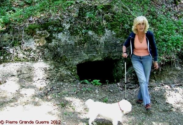
As you can see, the slow driving pays off.
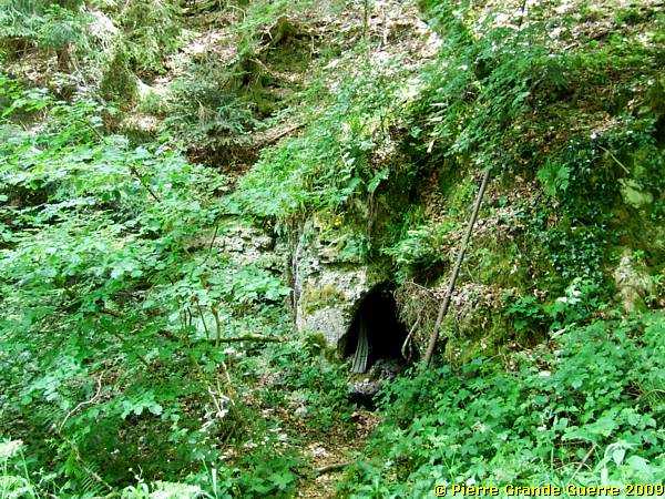
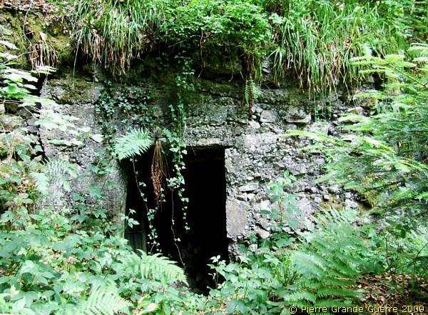
Otherwise we would surely have missed this well hidden entrance to a tunnel system.
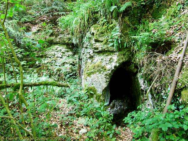
There are two entrances, there's another one on the left.
The other entrance.

The tunnels behind these entrances are blocked.
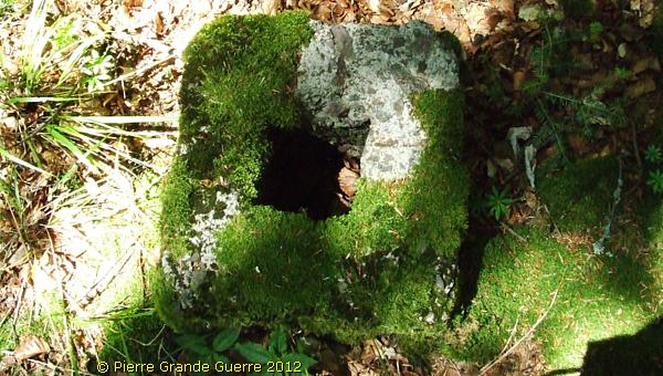
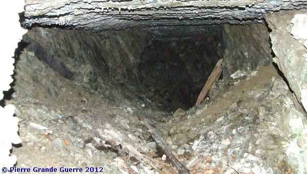
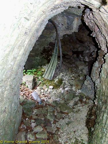
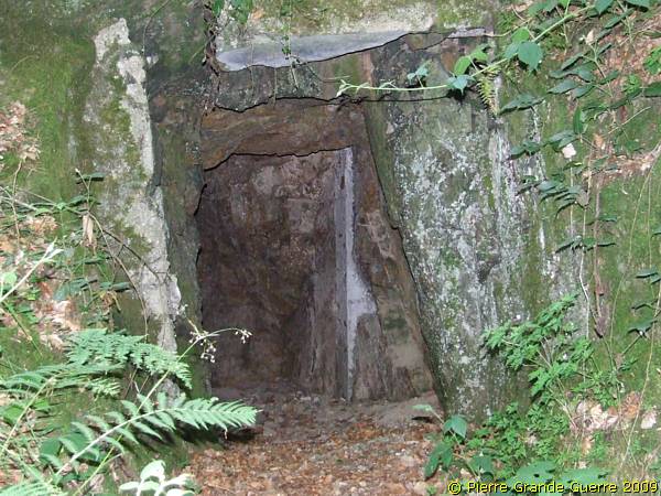
Some 35 metres westward I detected this entrance in the slope.

I decide to enter the tunnel inside.
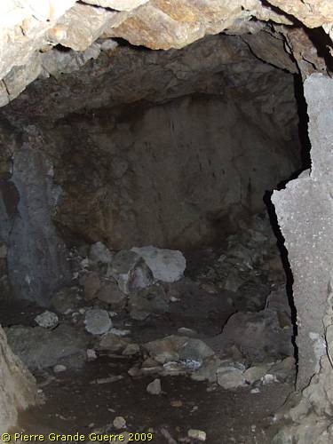
At a caved dug-out, a "Stollen", there is another side tunnel.
This partly blocked tunnel leads to the other eastward entrances.
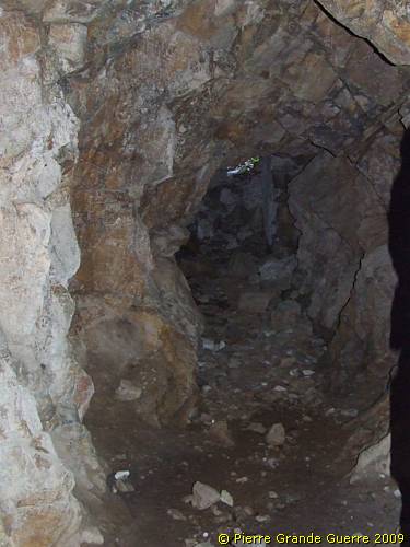
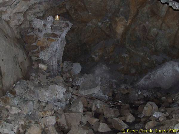
I continue following the tunnel, running inside the slope. These tunnels are barely higher than 1.60 m.
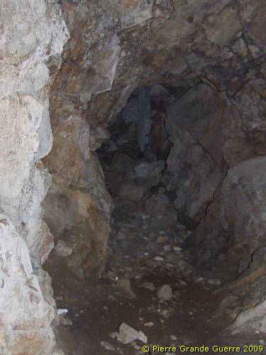
After some 70 m. this tunnel is filled in.
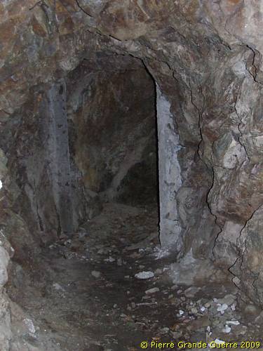
I return and leave the tunnel.
We continue by car to the junction, south of the hamlet of Thierenbach.
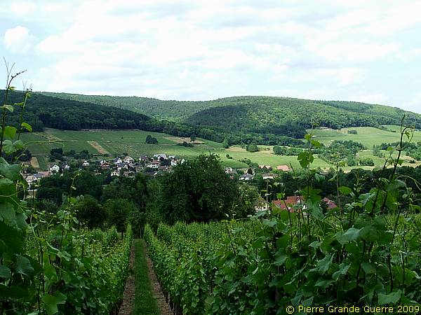
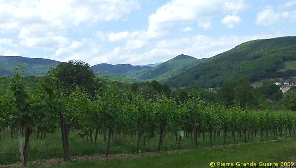
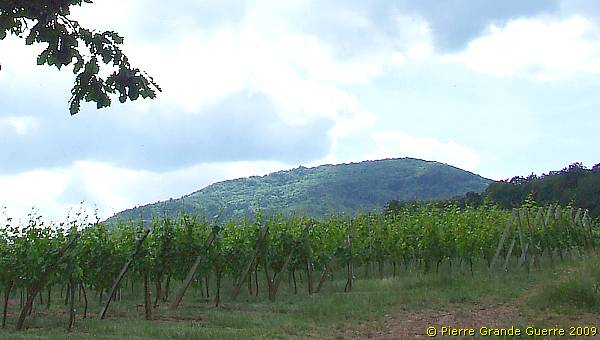
Views north-eastward over the vine branches of the Alsatian Gewurztraminer wine.
We go right, southward,following a country road from Thierenbach to the village of Hartmannswiller.
At our right we see the Vieil Armand or the Hartmannswillerkopf.
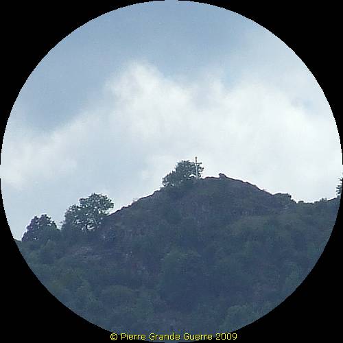
Tele view at the crucifix of the summit of the Hartmannswillerkopf.
From this location we turn back along the same route to the D 431. We continue along the D 431 over the last summit before the Hartmannswillerkopf, the Riesenkopf.
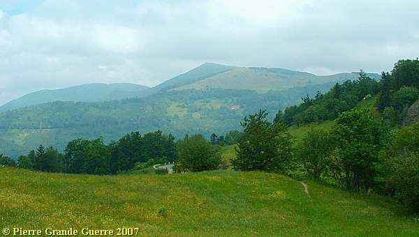
With this last view from the Riesenkopf to the Grand Ballon we will continue on the next page to visit the Cemetery of the Col du Silberloch, and the most impressive battlefield at the summit of the Hartmannswillerkopf, or Vieil Armand, with its many relics of trenches and well preserved German bunkers.
Continue to : " Hartmannswillerkopf - Vieil Armand "


