
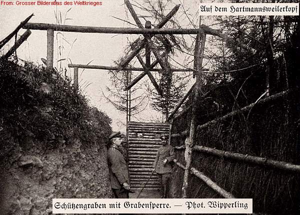
ALSACE VOSGES - Hartmannswillerkopf - Vieil Armand
Year of visit: 2004, 2007, 2010, 2014
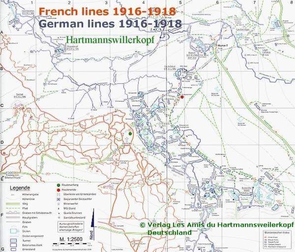
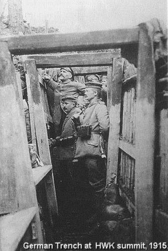
Le Vieil Armand or the Hartmannswillerkopf , an important mountain , which controls the Rhine Valley. We make a walking tour from the Crypt at the Col du Silberloch , downwards to the French lines , then upwards to the Sermet peak and the summit of le Vieil Armand (956 m.), crossing the narrow Noman’s Land into the German Lines, and the concrete fortifications around the Aussichtsfelsen , then again downwards to the trenches of the 2nd French line on the southern slope .
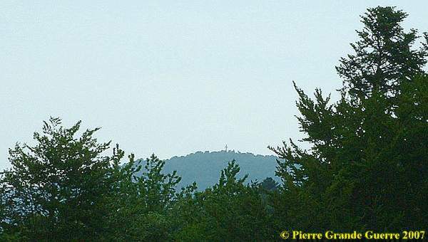
From the Col Amic we could already spot the Crucifix on the summit of the Hartmannswillerkopf - Vieil Armand.
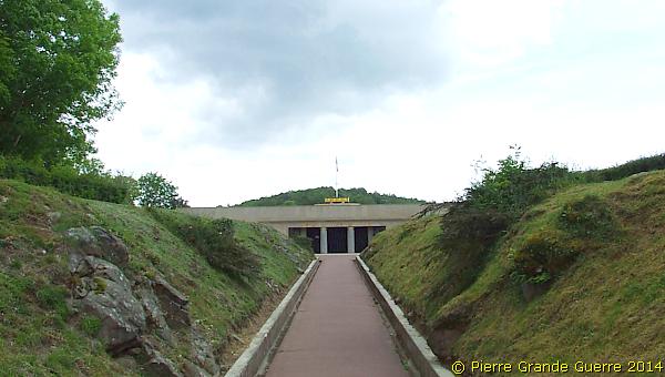
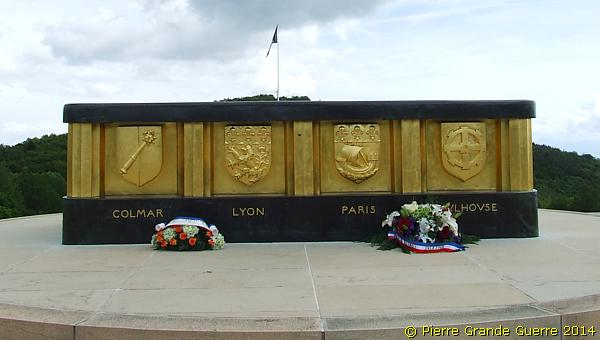
Along the "Route des Crêtes ", the D 431, we stop at the Col du Silberloch, at the French National Cemetery of le Vieil Armand and it's Crypt.
Recently the Crypt has been renovated awaiting the visit of the Presidents of Germany ( Gauck ) and France (Hollande) for the official Centenary commemorations of 3 August 2014.
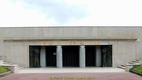
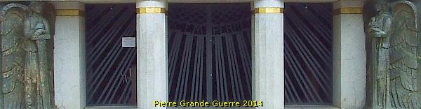
During our visit on 5 June 2014 the interior of the Crypt was still closed for the public due to this restoration works.
The top construction of the Crypt.
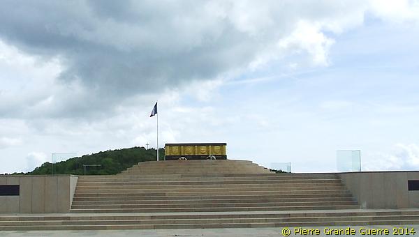
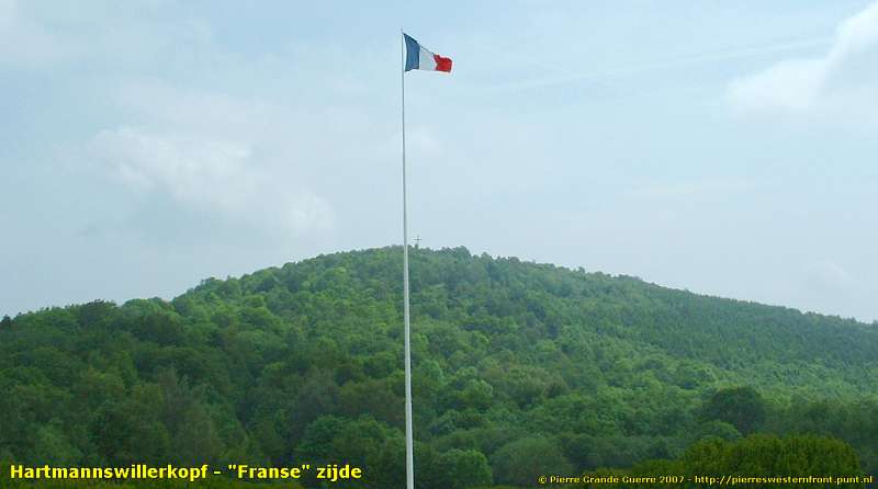
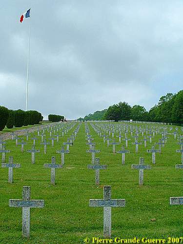
A view from the flagpole in the centre of the cemetery , in the direction of the nowadays wooded slopes of the Vieil Armand or the Hartmannswillerkopf.
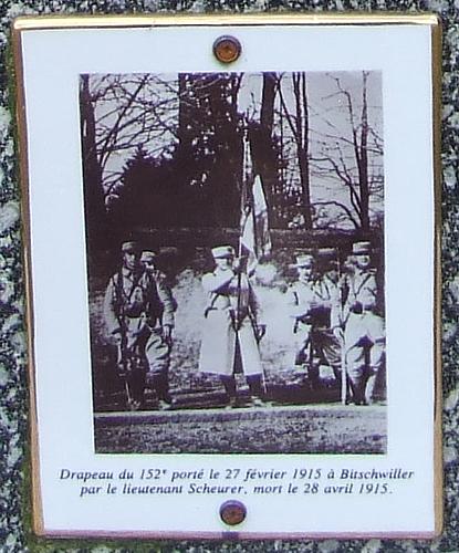
Nowadays the Crypt and the cemetery are located on the spot of the former French military camp on the Col du Silberloch with the period name of "Camp Scheurer". On the right, southern, side of the Crypt stands a memorial for the Camp and for Pierre Scheurer.
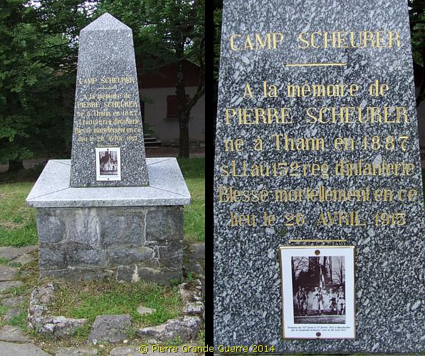
Pierre Scheurer died two days later.
( Dutch readers : for more info, read my book , “ De Rode Duivels in de Vogezen 1914-1915 – Een geïllustreerde reconstructie van de krijgsverrichtingen van het 152e Régiment d’Infanterie ”.)
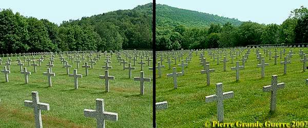
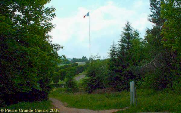
Some images of the c emetery.
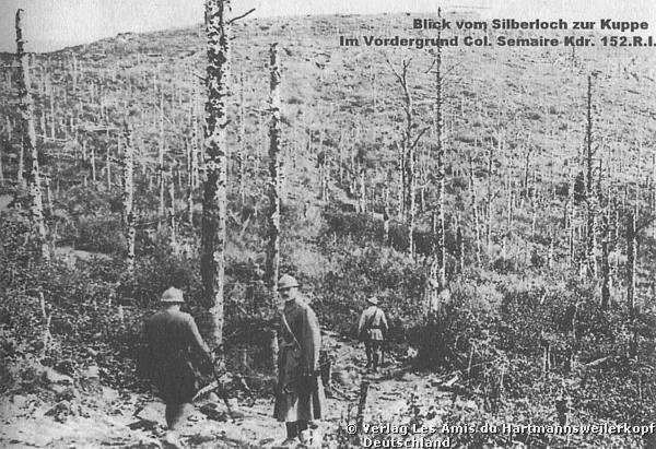
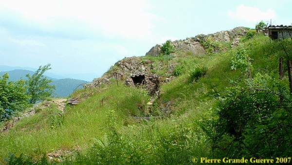
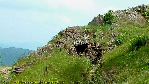
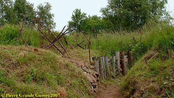
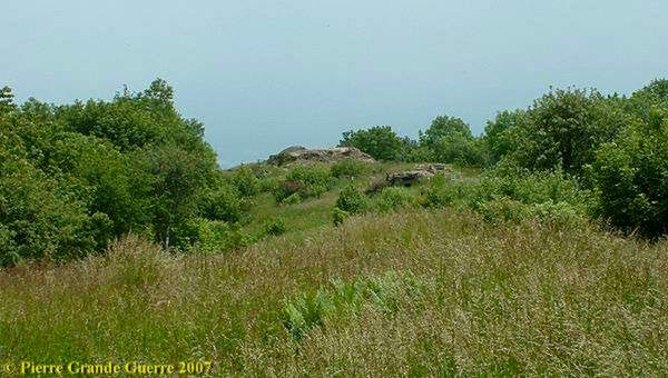
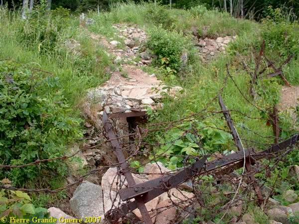
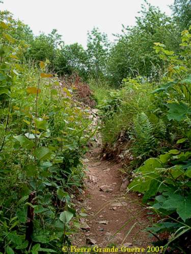
Down the foot of the Col du Silberloch and the cemetery , you can enter the woods of the Hartmannswillerkopf,...
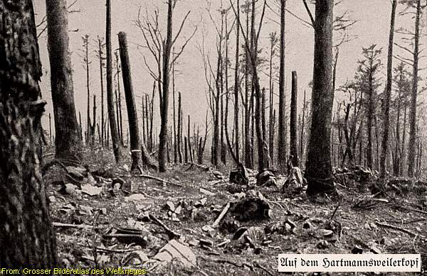
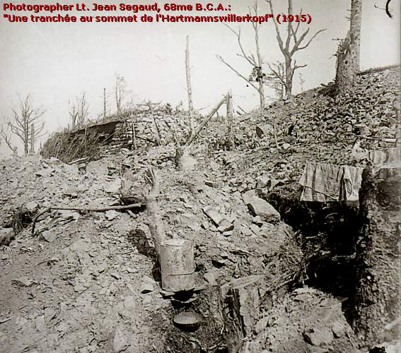
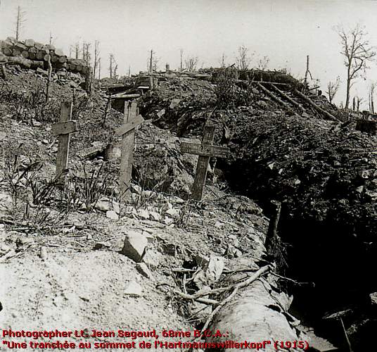
... and climb the difficult paths upwards to the summit. Before we enter the former French trenches of 1915-1918, some concise information about what has happened on this mountain.
The Battles of the Hartmannswillerkopf
In December 1914 the French 28e Bataillon Chasseurs Alpins took possession of the Silberloch Plateau after having spotted German Infantry troops of the 69th I.R. at the summit.
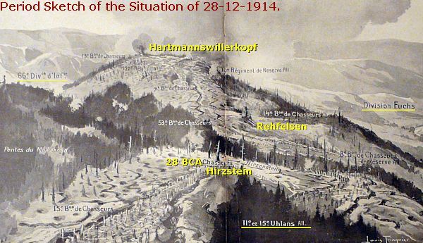
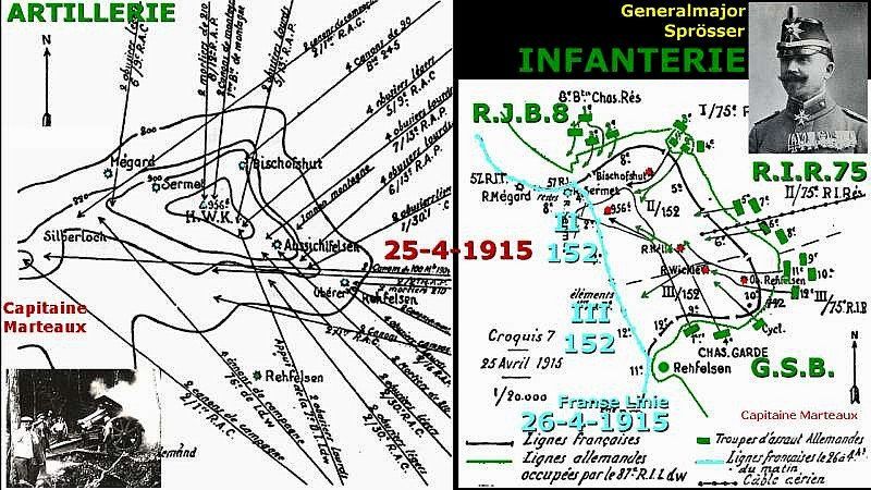
From 28 December 1914 there were heavy fights on the summit for the eastern rock of the Aussichtsfelsen . For both parties the possession of the summit was of extreme importance . The party who could get control over the mountain , controlled also the road from the “ Crêtes ", the summits of the Vosges , to the Rhine Valley and the valley itself .
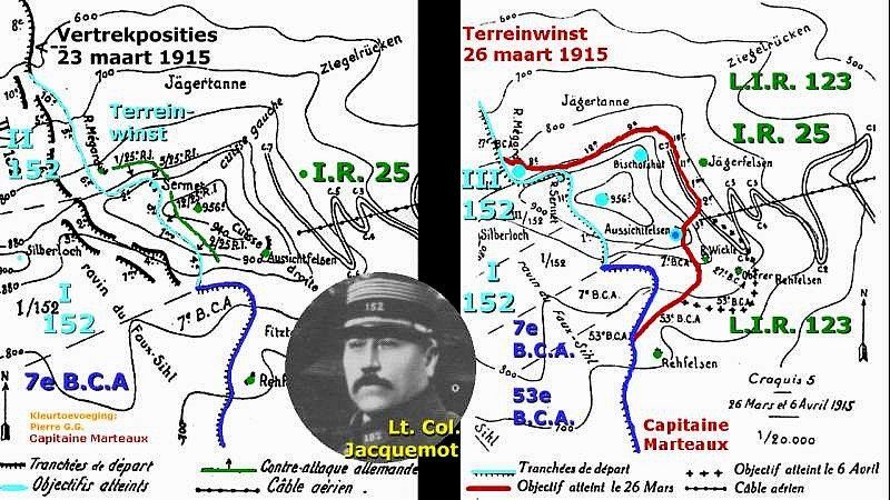
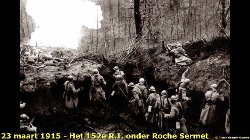
From January until April 1915 the French under General Serret with his special mountain troops of the Chasseurs Alpins and infantry regiments tried to capture the summit several times .

They captured the western slope of the mountain and a stroke of land at the summit on 26 March 1915.
But on 25 April 1915 the German
14th Jägerbataillon knew to consolidate their position on the summit in the former lost French 1st line
trench. They renamed it the “Johann Albrecht Graben”, and the Germans
would keep this position until 1918. In
September and October
1915 the Germans, who only controlled
¾ of the summit, would try to
capture the total summit again with use of flamethrowers
and toxic gas.
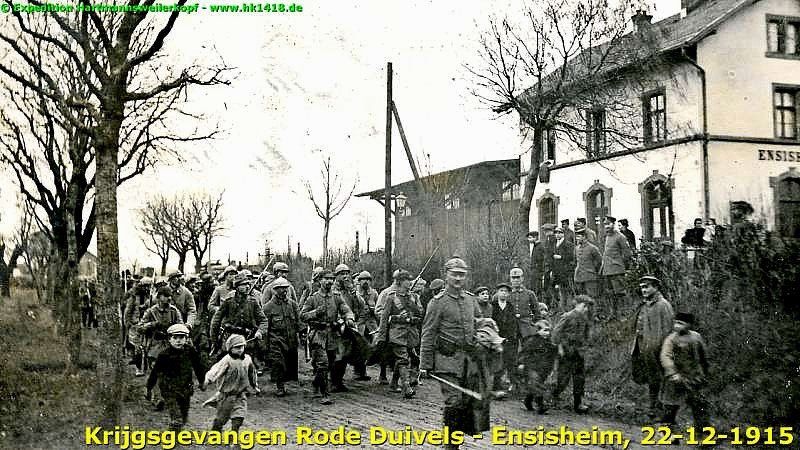
1915 - The Christmas Battles - "Weinachtskämpfe”
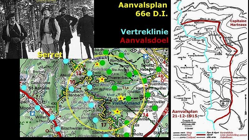
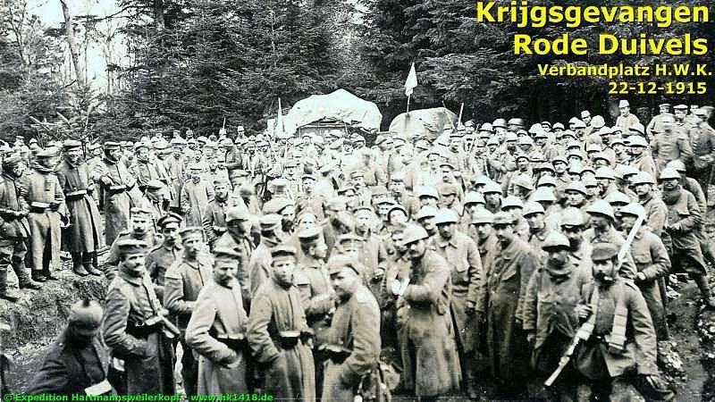
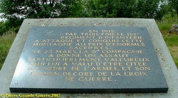
On 21 December 1915 the 152e R.I. on their turn succeeded to capture the fortifications of the second German line on the Aussichtsfelsen a.o. with use of flamethrowers. During this battle even the French General Serret was severely wounded on the 29th, to die later, on 6 January 1916, of the consequences of his injuries at the Moosch Military Hospital. During these “Weinachtskämpfe” (Christmas battles) the French successes lasted only for one day.
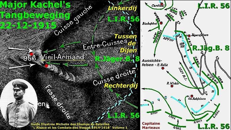
Only the next day they were at their turn chased down the rock by the Germans. With the German capture of the nearby Hirzstein on 8 January 1916, the big battles on the Hartmannswillerkopf petered out. Only in September 1916 the French did make two attempts to recapture the summit without success.
Patrols , artillery attacks, also with mortars and “ Lufttorpedo’s ”, attacks from German special forces , French fierce hand grenade attacks, and hand to hand fighting would still go on around the summit until 1918. From the end of January 1916 the frontline would not change much from the situation until 1918. The French lines on the west side of the mountain until the Sermet peak were only captured by the French in March 1915. Most German concrete bunkers and fortifications on the east side of the mountain were buildings from April 1915 until 1918. Let us go for a climb through the German / French lines to the Sermet Peak.
DUTCH Readers , Lees voor veel meer details over de veldslagen op de Hartmannswillerkopf elders op deze website mijn lezing: De Rode Duivels op de Hartmannswillerkopf - 1915
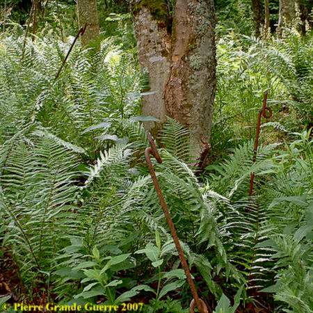
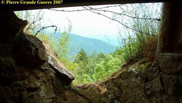
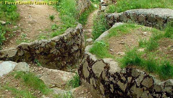
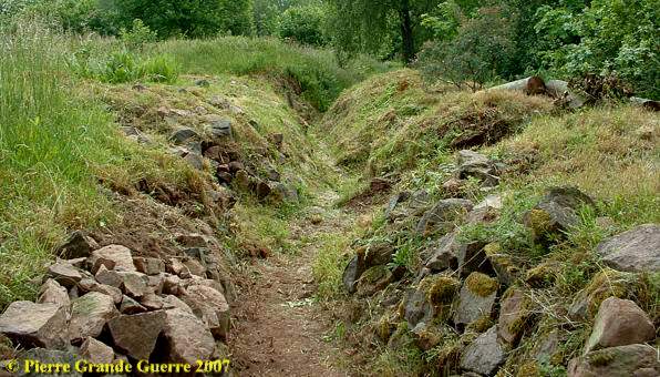
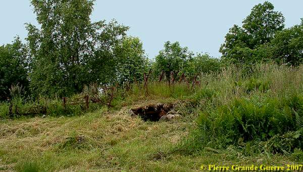
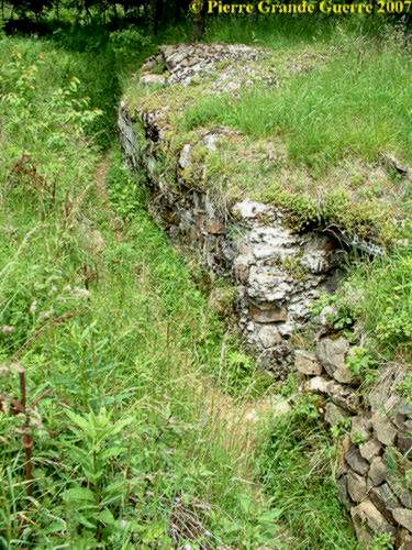
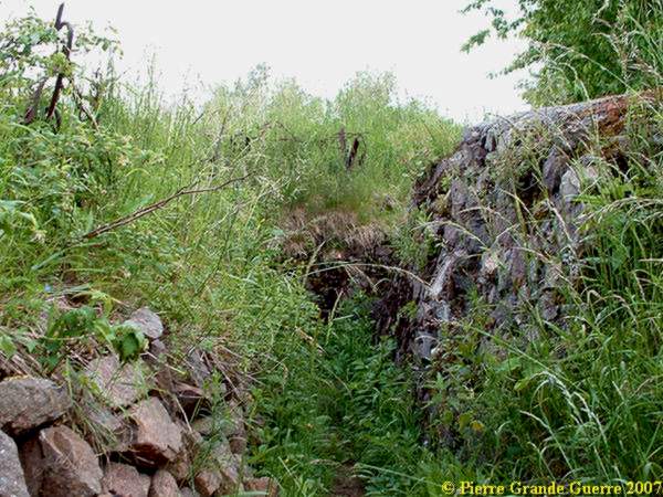
As we make our way through the vegetation of the former German "Eierstellung" until March 1915, we already spot some shellholes and barbed wire poles.
We tried to find our way through zigzagging German / French trenches to Sermet Peak.
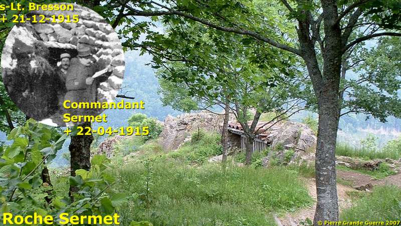
Sermet Peak is on the northern slope of le Vieil Armand at a height of 910 m.

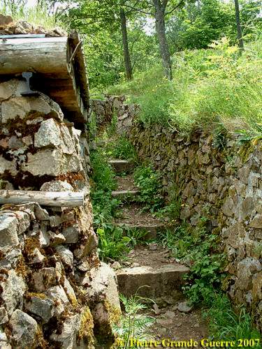
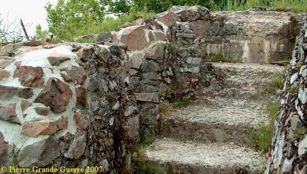
We climbed this rough staircase to study the observation post.
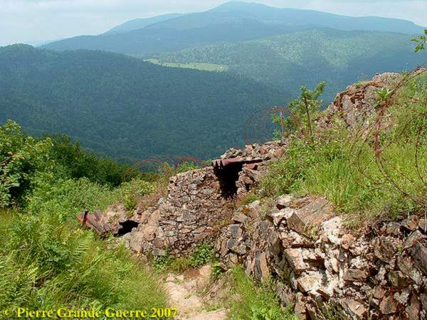
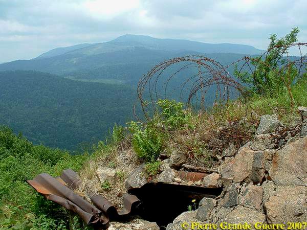
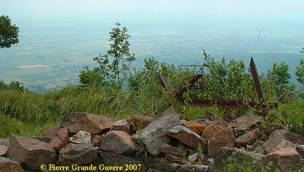
The position of the Sermet peak gives a panoramic view at the Sudelkopf (left), the Col Amic and the Grand Ballon.
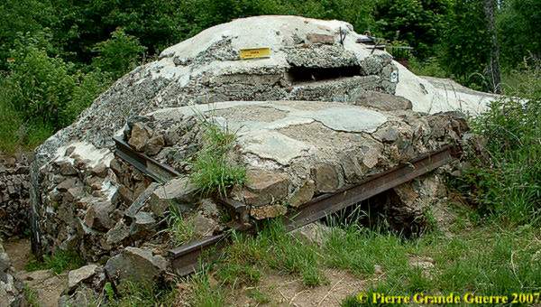
A French shelter bunker and observation post , ...
... partly cut out in the rock.
The panorama at the Grand Ballon again of this strategic French line position.
We could have gone from this bunker more easily...
... and directly upward to the highest point of Sermet.
But I preferred to go back downwards first, and follow another trench to the highest point of the Sermet, ...
almost in the traces of General Serret's 28e Bataillon Chasseurs Alpins and his 152nd Infantry Regiment during the days of March 1915.
A view from this machine gun post northeast ; you could hardly call it a bunker or shelter.
These trenches at Sermet Peak would stay in French possession until 1918.
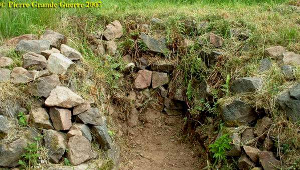
At Sermet Peak is a crossing of trenches , coming from below and leading more upward to the Summit.
Half way above Sermet Peak...
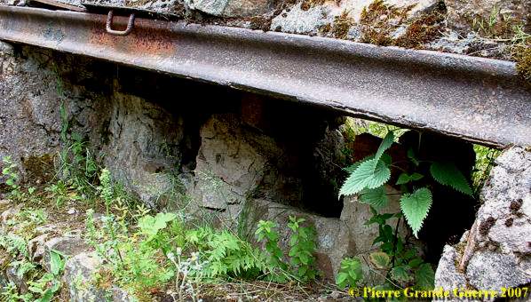
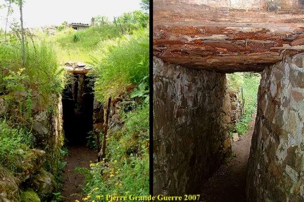
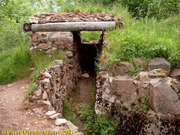
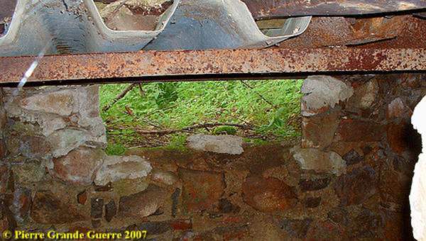
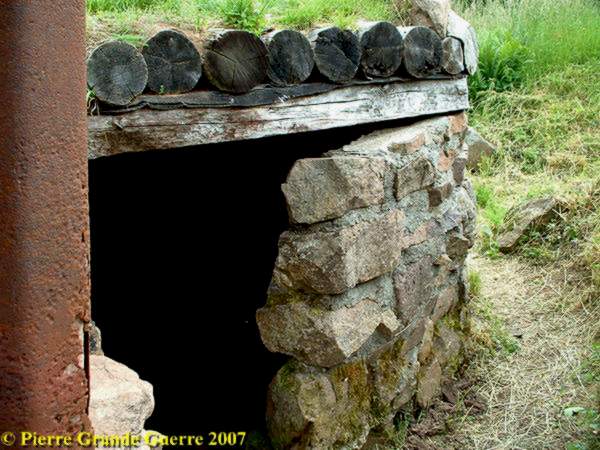
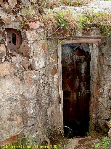
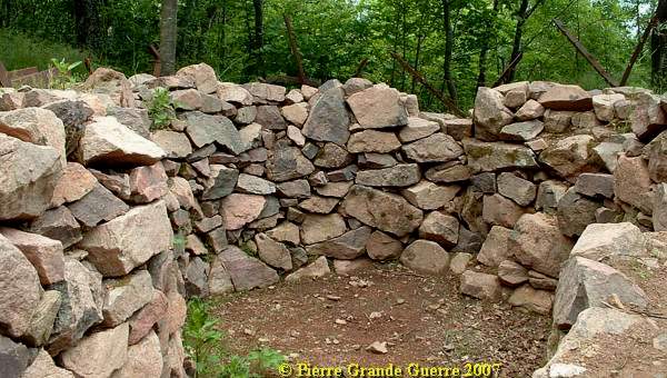
... we follow the trench upward to find this typical French advanced post bunker, ...
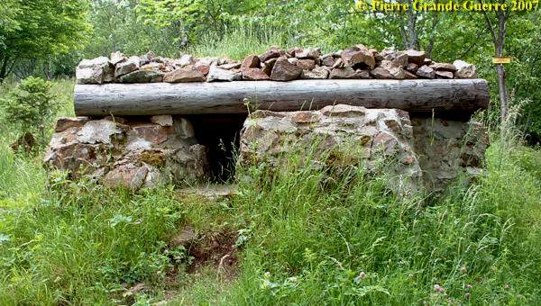
... made of natural materials; mostly wooden beams, mountain rock's, and some steel H Bars.
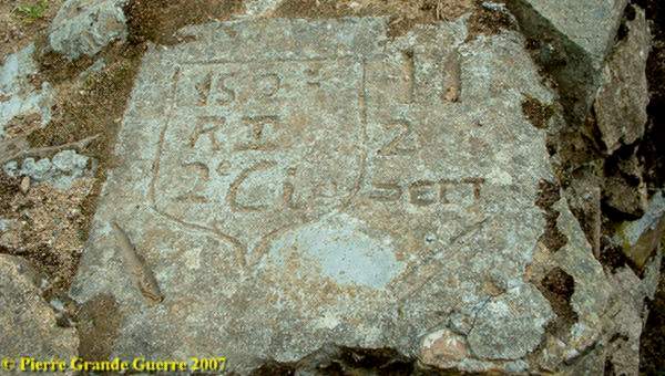
"The 2nd Company of the 152nd Infantry Regiment" of the French Army builded this trench and bunker in April 1915.
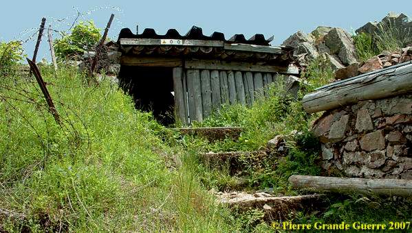
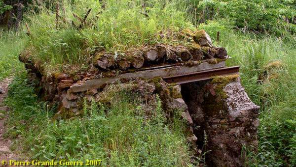
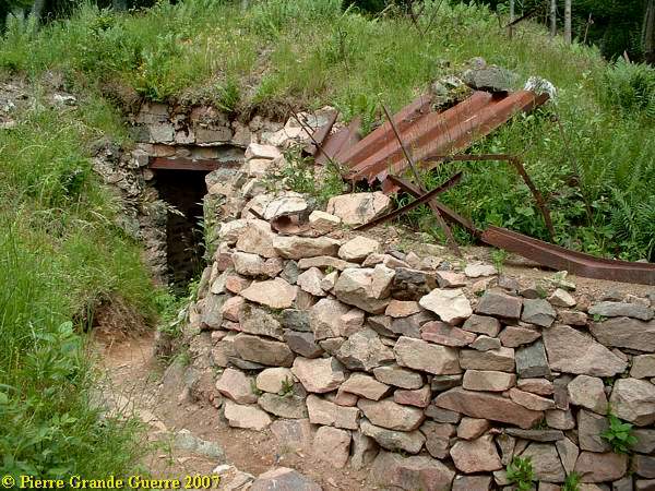
We still climb upwards passing this shelter, ...
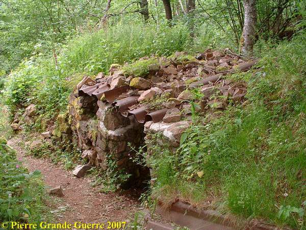
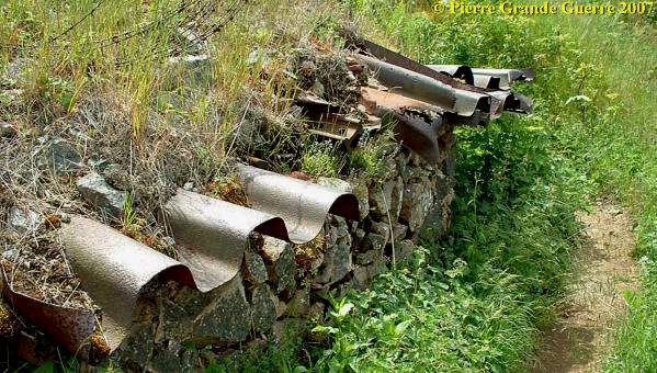
... again of natural materials , stone and wood , and some iron corrugated boards and steel U bars.
A machine gun post opposite a lower lying ( invisible ) German sap with relics of the barbed wire obstacles.
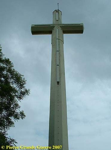
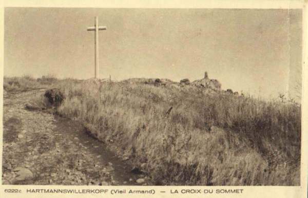
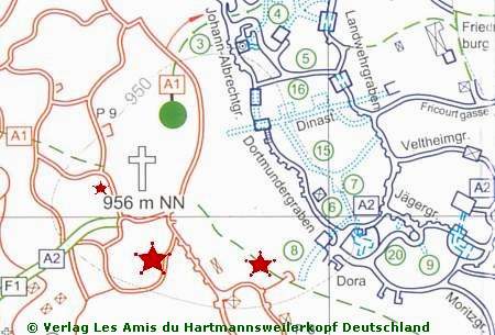
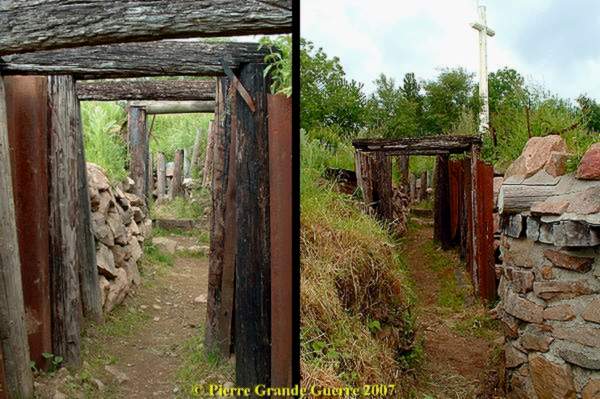
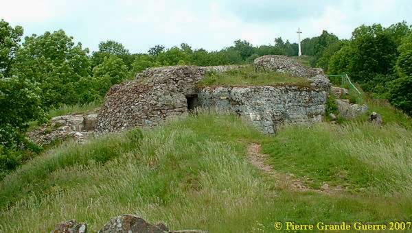
Just before we enter the open spot on the summit , "le Roche du Sommet", with its 29 m. high Crucifix, standing in the centre of the former, rather narrow No Man's land on the 956 m. high summit.
We are standing right next to the cross in the last French first line, opposite the Johann Albrechtgraben, and the Dortmundergraben.
This vandalised after war demarcation stone faces over the western slope the Molkenrain at the horizon.

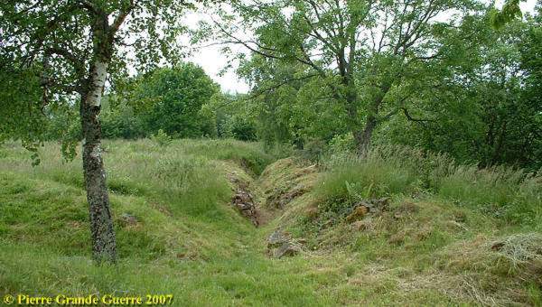
The 1st French front line trench , opposite the Dortmundergraben.
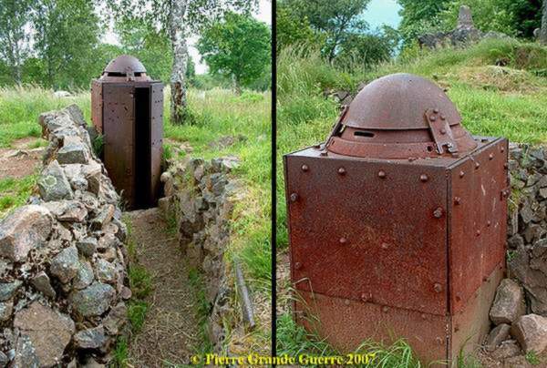
Facing the Johann Albrechtgraben , and the Dortmundergraben , a French steel observation post.
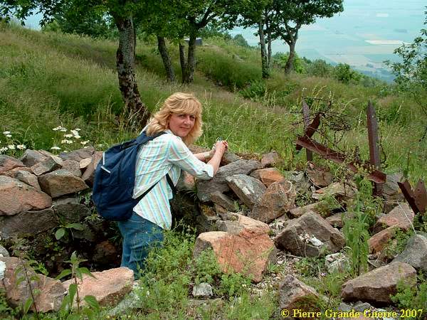
Christine walking in the French 1st front line, with saps of rocks on both sides.
A view standing in the trenches.
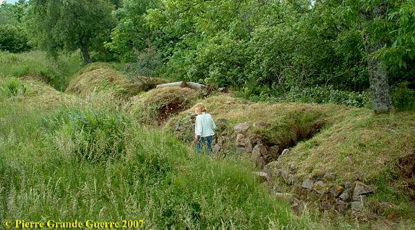
One of the many saps.
A small shelter.
The trench bends eastward, ...
... zigg-zagging , ...
... as we were passing some armoured rifle holes ...
... to the end of the trench , so near the Cross, marking the No Man's Land ...
... to this most forward French machine-gun post.
This monument stands in No Man's Land just in front of this trench, and in front of the German Dortmundergraben, commemorating the most advanced point of the French 28e Bataillon Chasseurs Alpins in January 1915:
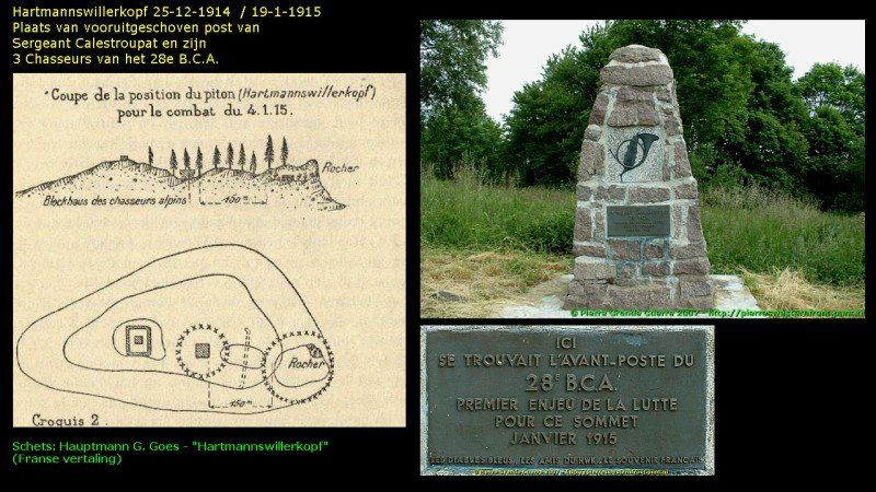

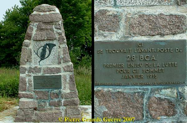
Some 10 m. further to the south also in No Man's Land a plaque, commemorating the 3 assaults of March 1915 by the French 152nd Infantry Regiment or 152e R.I.
A view of the same machine gun bunker in the 1st French line over No Man's land, ...
... seen from the opposite position of this German 1915 "Dora Feste" fortification.
Next we cross over the former No Man's land to the German lines.
We cross the No Man's Land to the German Johann Albrechtgraben , the former most extreme French line, which the Germans captured on the French on 1 April 1915.
The German units on the Hartmannswillerkopf
Most of the German army units, deployed on the Hartmannswillerkop (HWK), were “ Jäger-Bataillonen ” and “ Gardeschützen-Bataillonen ” from several “ Reichsländer ”, not only from Berlin and Potsdam, but also from Alsacian towns like Schlettstadt ( nowadays “ Sélestat ”) and Kolmar ( nowadays “Colmar”).
Some of these units were deployed several times at the HWK.
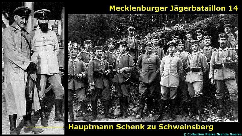
For instance , the Mecklenburger Jäger-Bataillon nr. 14 was fighting for the summit in the winter of 1914-1915. On 1 April 1915 this Jäger-Bataillon , under Major Freiherr Schenk zu Schweinsberg , drove the French from their 1st line trench , the later called Johann Albrechtgraben .
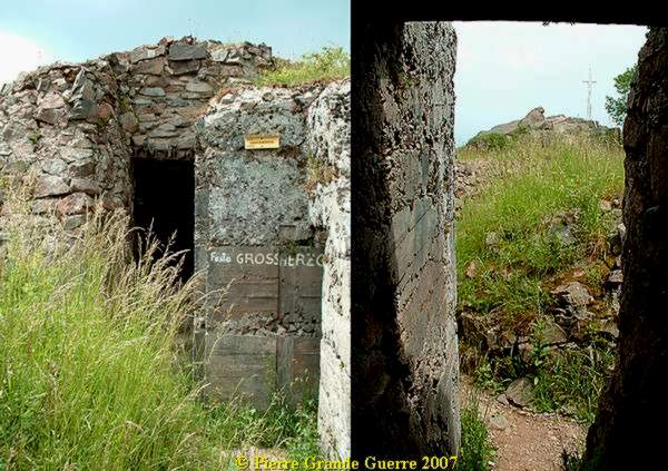
This Jäger-Bataillon nr. 14 fought the French down from the summit at 9 September 1915. During the “ Weinachtskämpfen ” (Christmas Battle) of 21 December 1915, the French annihilated this Battalion of their Commander in Honour , Grossherzog Johann Albrecht von Mecklenburg , on the Aussichtsfelsen (“Panorama Rock”).
Only the Major and 80 of his soldiers survived . The next day , on the 22nd, the Reserve Jäger Battailon nr. 8, and the 80 man of Schenk zu Schweinsberg re-captu red the Aussichtsfelsen and drove the French back to their lines down the western slope .
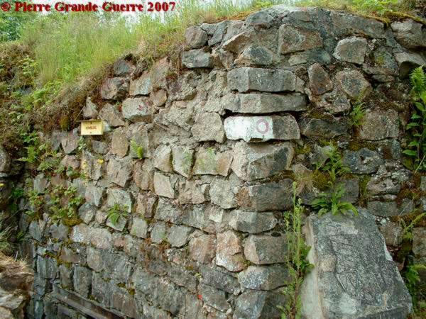
Some of the trenches , fortifications , and bunkers, are named after German officers and commanders fighting at the HWK.
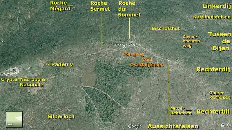
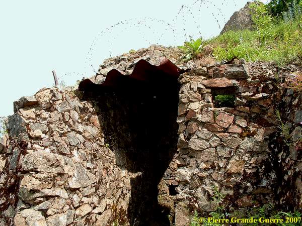
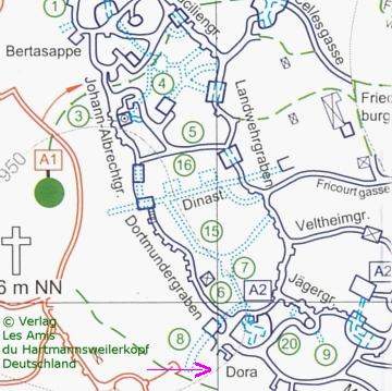
Dinastollen or Dina cave entrance , on the connection of the Johann Albrechtgraben and the Dortmundergraben.
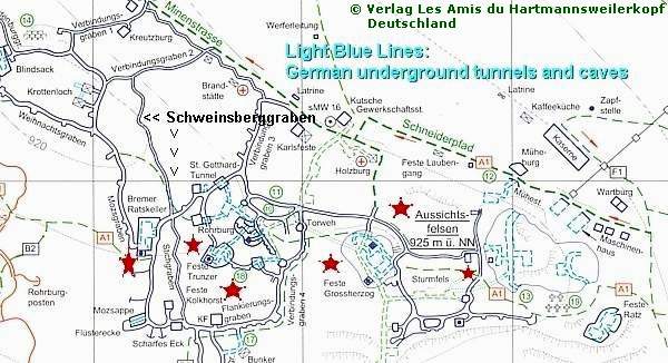
Like Feste Dora (below) it was the entrance to a large underground tunnel system. (Watch the light blue dotted lines on the maps!)
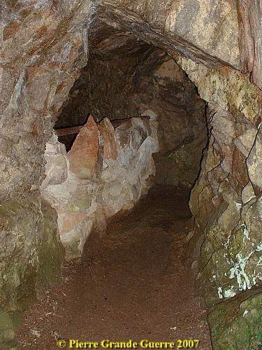
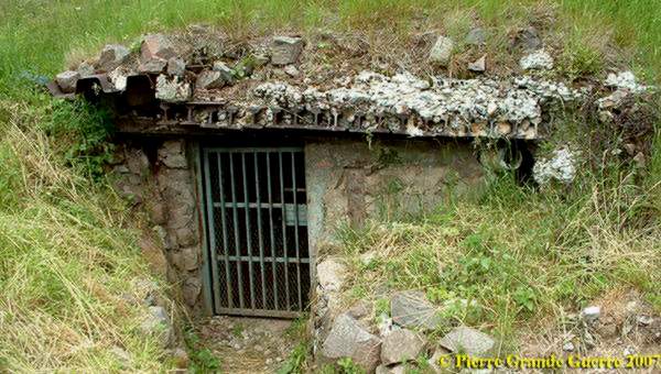
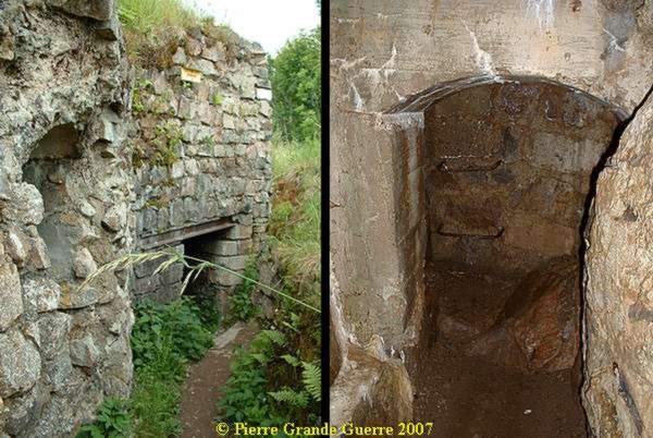
The entrance left in Feste Dora leads to the man made caves beneath it.
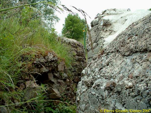
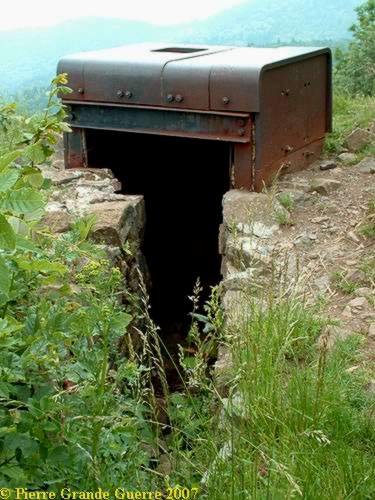
The entrance to the Dora Feste Bunker,...
... a combination of an observation post and a machine gun bunker, facing the opposite 1st French line.
Major von Hadeln and Major Kachel: architects of the German trenches and bunkers

Major Kachel of the Reserve Jäger Battailon nr. 8 and, Major Freiherr Heinrich von Hadeln, of the Gardenschützen Bataillon were mainly responsible for building this huge fortress on the summit and eastern slopes of the Hartmannswillerkopf.
From April 1915 they started building and digging into the rock. Until 1918 they extended the fortress furthermore. Besides digging trenches, and building bunkers, fortifications ("Festen"), and observation posts, the Germans excavated a huge underground tunnel system, connecting “Stollen”, man made caves, which were sometimes also enlarged.
Many of the bunkers gave a direct entrance to this tunnel system and caves.
In these caves were also telephone posts (the Germans even listened to the French telephone conversations!), and rooms for producing electricity for lights.
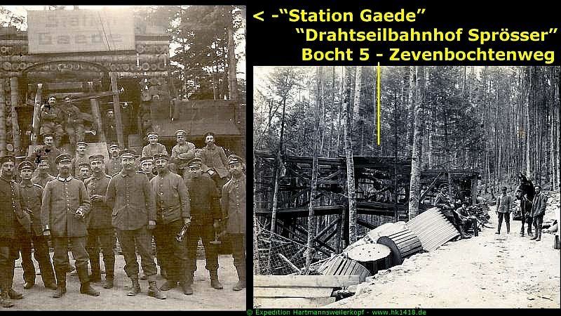
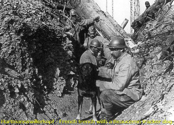
The Germans built also a cable car line with 3 stations on the eastern slope to import new building materials, ammunition, weapons, and food, from the valley below. For exchanging messages the Germans used beside telephones also mountain dogs.
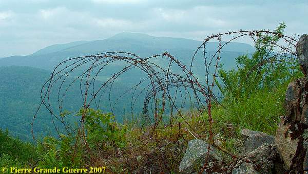
In No Man’s Land, and in between the trenches, there were vast barbed wire obstacles, also fortified with high voltage electrical wires, powered by aggregates in the “Machinenraum”- caves.
Remember that many times these extension constructions were made during battles.
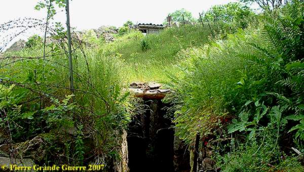
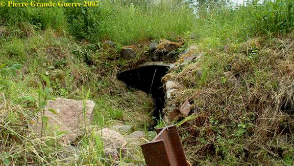
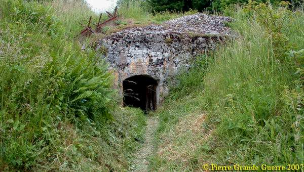
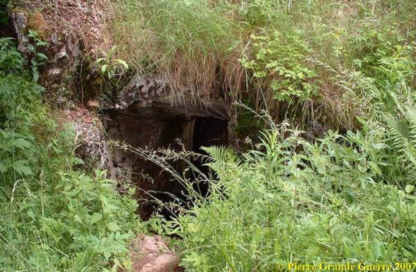
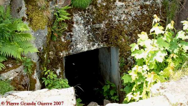
From Feste Dora we follow the Moritzgraben to...
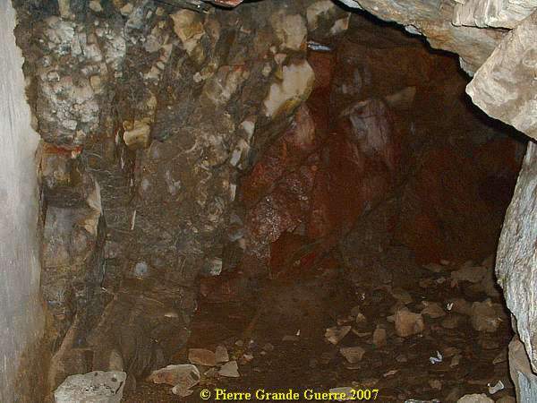
... the entrance of the Blindsack , a cave and tunnel system.
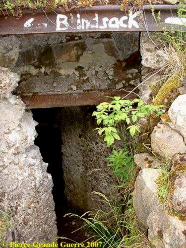
I only entered it for a few meters.
The observation post at the Blindsack is also the start of the Weinachtsgraben.
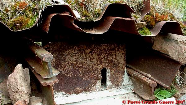
A sentry post bunker of the Weinachtsgraben.
The Weinachtsgraben leads to the 2 bunkers and entrances of...
... the Krötenloch ; "Wo die Soldaten liegen wie Kröten im Loch". The southern bunker.
Steel rifle shields along the trench , in front of the Krötenloch bunker.
Krötenloch , the northern parallel entrance of the bunker.
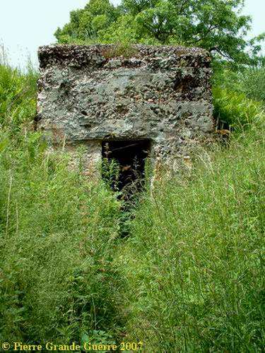
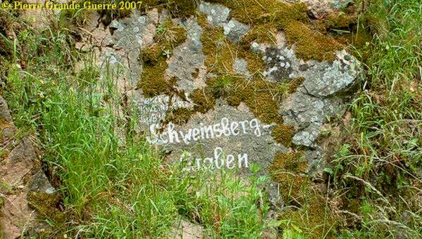
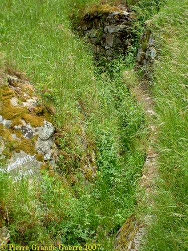
From the Krötenloch we follow the Schweinsberggraben , named after Major Freiherr Schenk zu Schweinsberg .
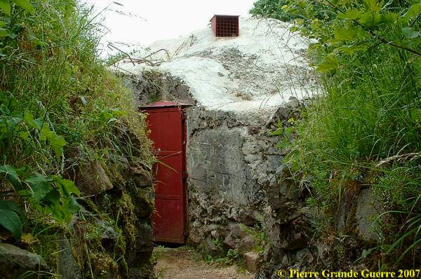
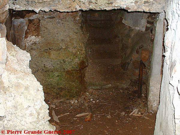
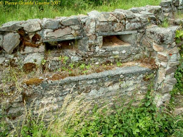
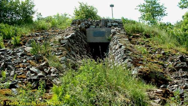
At the south western end of Schweinsberggraben we arrive at the Bremer Ratskeller, a 1st line Stollen.
The Bremer Ratskeller has 2 entrances...
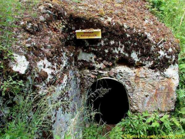
... to it's underground man made cave , ...
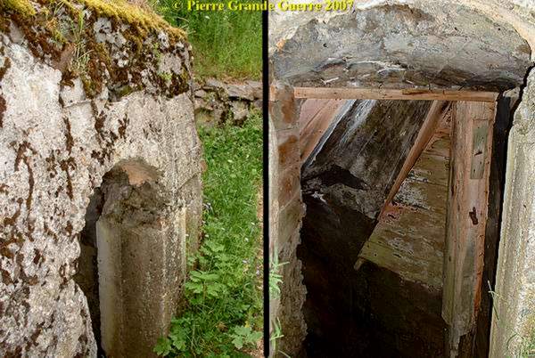
... and an opening for a machine gun, facing the 1st French lines.
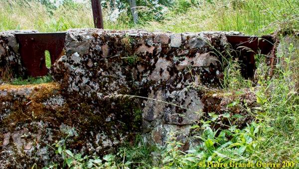
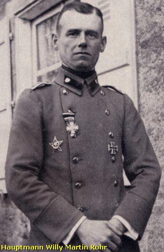
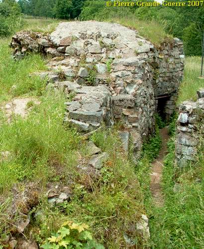
The Feste Rohrburg was named after...
... Hauptmann Rohr of the 3rd Gardenschützen Bataillon, the "inventor" of the German storm trooper tactics.
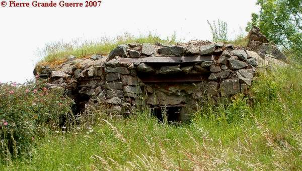
It is a rather large bunker, especially downstairs , ...
... where the Rohrburg is connected by tunnels to the 2nd line, ...
... and the Stollen bunkers of the Feste Grossherzog , Feste Mengelbier, and the Aussichtsfelsen. Passing these fire holes, ...
... we leave the Rohrburg , ....
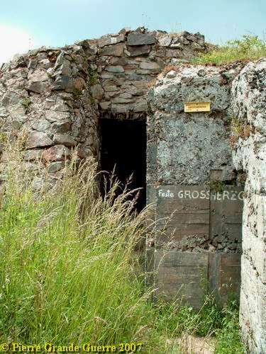
.... climb a little upward to Feste Grossherzog.
Feste Grossherzog formed together with Feste Mengelbier and Aussichtsfelsen "Stützpunkt XI".
This 2nd line bunker lies on a height of 940 m. The Feste has been built in 1916 by the Badische Pioniere Bataillon nr. 14 (engineers), under supervision of Oberleutnant Ratz. It got it's name after Grossherzog Friedrich II of Baden.
We could have gone many more steps downstairs to explore highly unreliable tunnels, ...
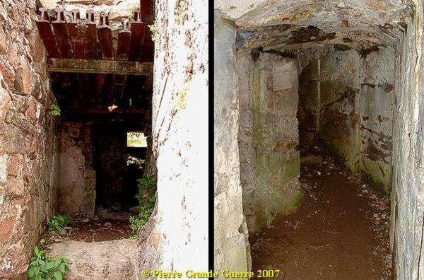
... but we preferred to stay on a rather safe level to take a look inside the Feste Grossherzog.
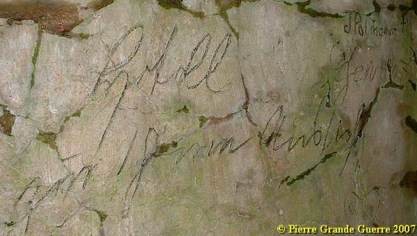
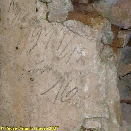
My late wife, Chris (+ 08-05-2018) spotted these samples of soldier's grafitti of the period inside the Feste: "Hotell zum schönen Aussicht".
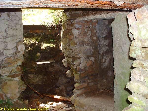
View from the entrance and another view from this entrance in the direction of the Aussichtsfelsen.
Next to the bunker is a staircase , ....
... leading south-west to an observation post ...
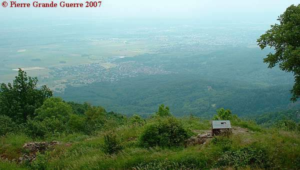
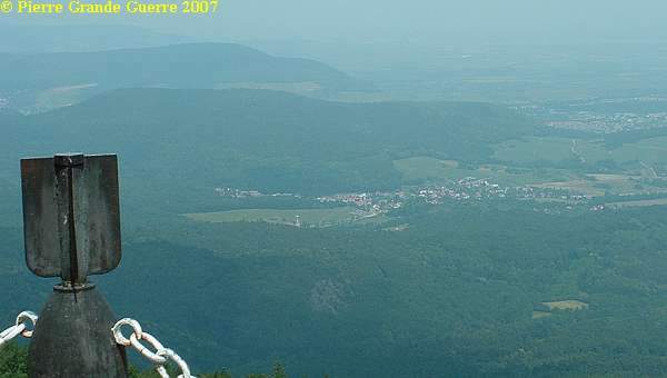
...with this marvellous view over the valley of Guebwiller.
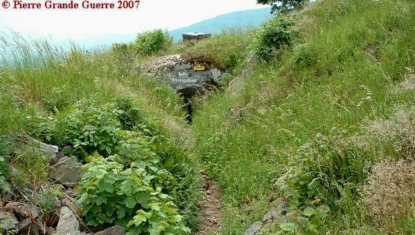
Some 50 m. south west, more down the slope , but still belonging to Feste Grossherzog, ...
... is the Feste Mengelbier or Bastion Mengelbier.
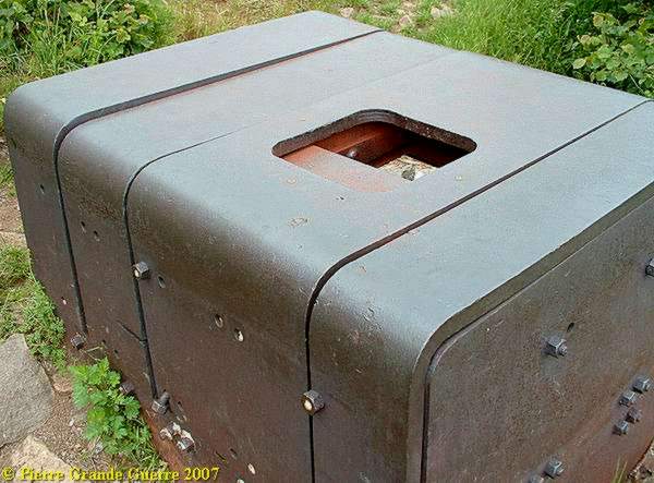
Behind and upward the bunker entrance Chris located this observation post.
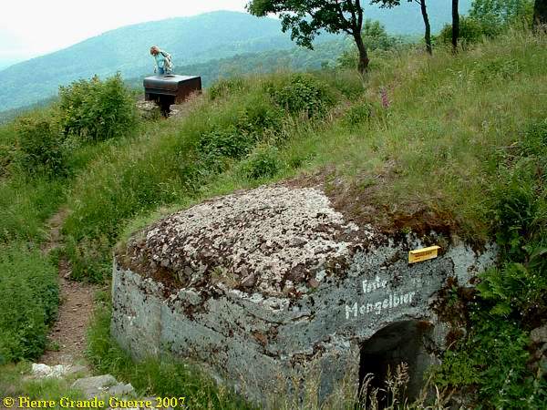
It is an armoured observation post, fit for use of a "scissor shaped" binocular periscope.
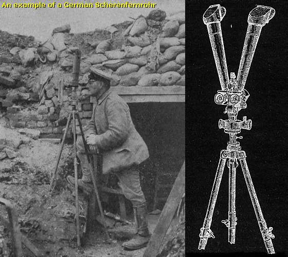
Only the top of the binoculars would stick out.
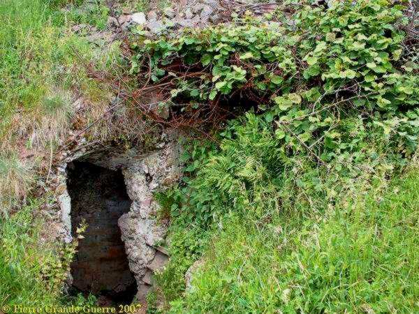
We left the Feste Grossherzog in search of a Minenwerfer bunker.
In this bunker Leutnant Killian and his crew installed and deployed the first Minenwerfer (trench mortars) on the Hartmannswillerkopf.
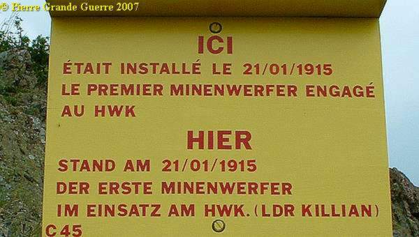

Of course many more Minenwerfer were deployed on the HWK. The Germans on the HWK even had their "Minenwerferstrasse", a street of mortar pits. But this is, what is left of this bunker on the north west side of the Aussichtsfelsen.
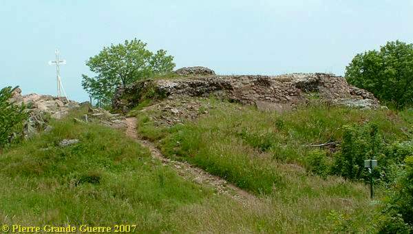
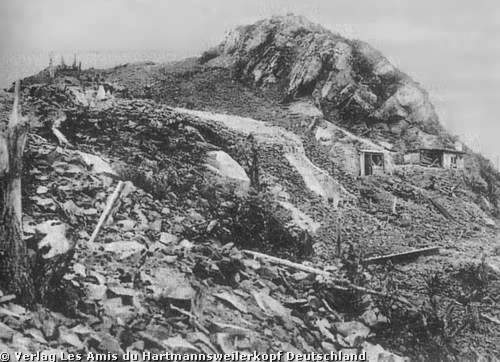
The 940 m. high Aussichtsfelsen from the south- eastern slope. From 28 december 1914 this rock was for the Germans the most important point on the summit.

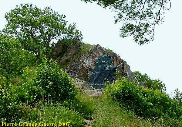
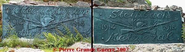
Since 1922 the French Government installed this huge monument in bronze on the Aussichtsfelsen, commemorating the heroic acts of the French "15-2 Regiment" (152e R.I.)....
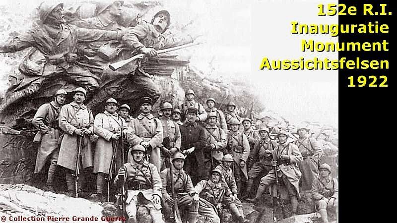
... in March 1915, the " Weihnachtskämpfe " of 1915, and their actions at nearby Munster and Metzeral.

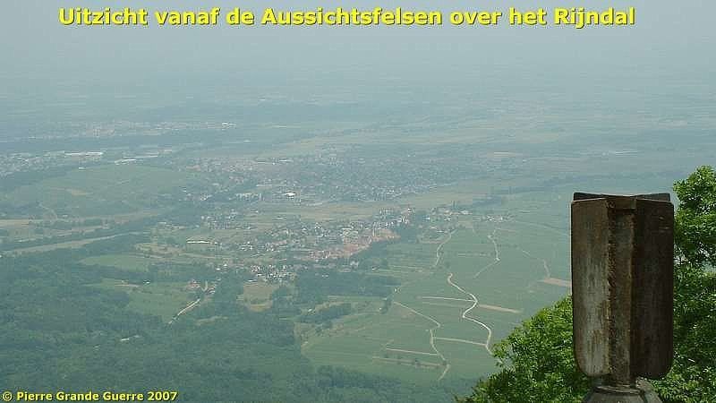
This breathtaking panorama over the valley of Cernay tells us why this summit was so important for the Germans and the French. During the short occupation of the Aussichtsfelsen the French immediately started to bombard the German supply routes and positions in the Rhine valley.
Just under the memorial I went inside the Aussichtsfelsen.
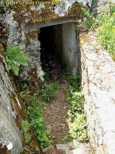
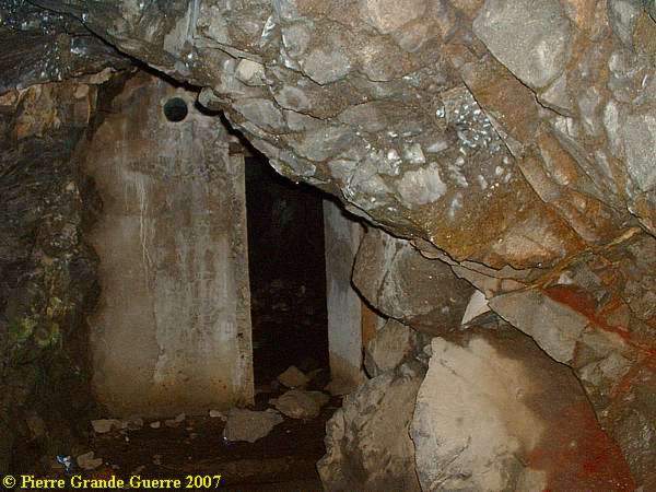
I did not dare to go too far inside the bending tunnels.
After a short time I used the other exit under the memorial.
From the other exit another view at the extreme wide panorama from the narrow ridge of the Aussichtsfelsen.
Via Feste Ratz we went back down the southern slope , into the 2nd French lines.
We left the Feste Ratz to go back to the Bremer Ratskeller. Here we crossed the No Man's Land into the French lines.
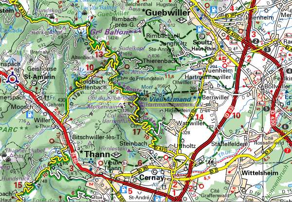
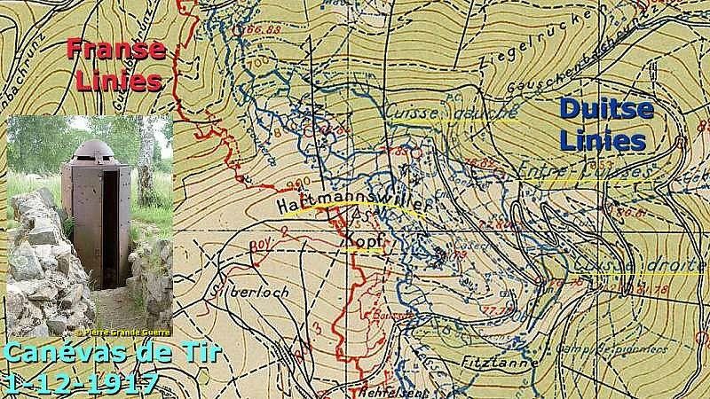
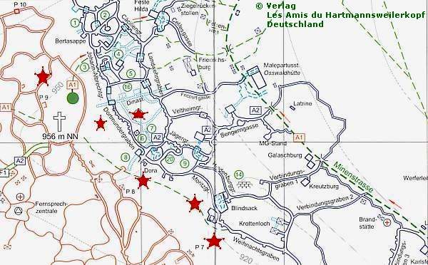
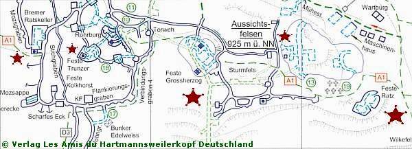
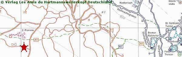
We follow path A1 on the map below westward.
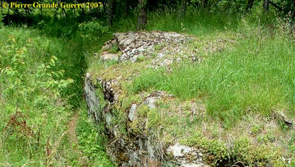
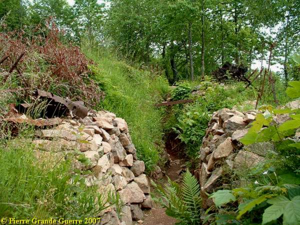
After 200 m. going westward down the slope we arrived at this second line sap, ...
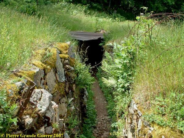
... connected by a trench , which also leads to the entrance of a French tunnel system.
As you probably notice , the tunnel is nowadays filled in with debris and chalk soil.
Following this French 2nd line trench inside , I modestly came to the conclusion, ...
... that sometimes you can see more of the shape of a trench from above, from the parapet, than from the inside.
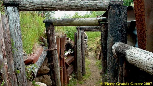
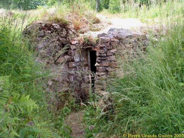
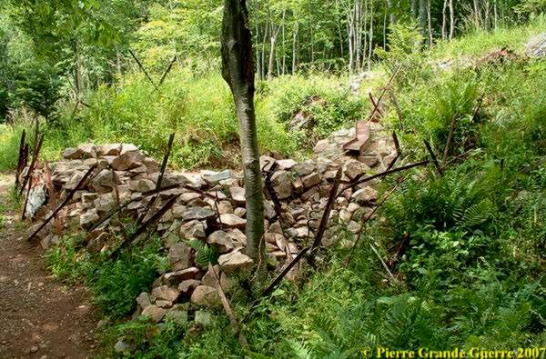
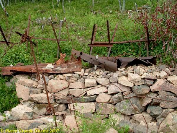
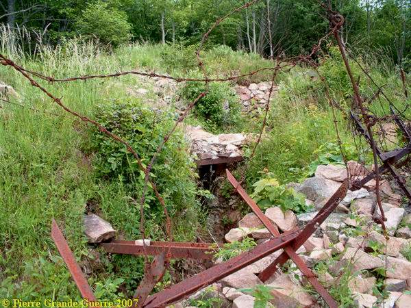
Here we find a lot of relics, reminding us of the many barbed wire obstacles between the trenches.
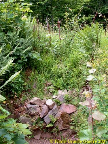
This shelter bunker is so small, that I suppose , it served as a guard room.
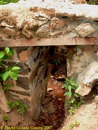
From this bunker we follow inside the trench our way to...
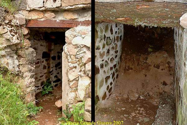
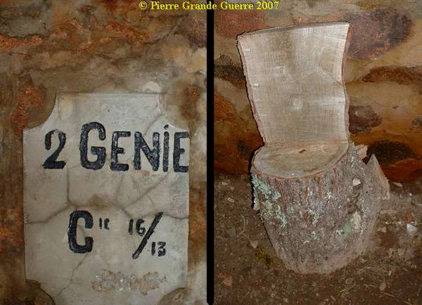
... the shelter bunker of the 2nd Company Génie, French engineers.
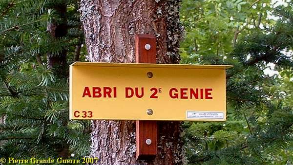
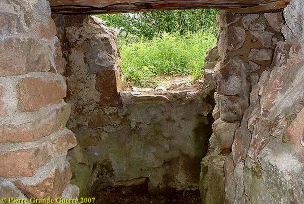
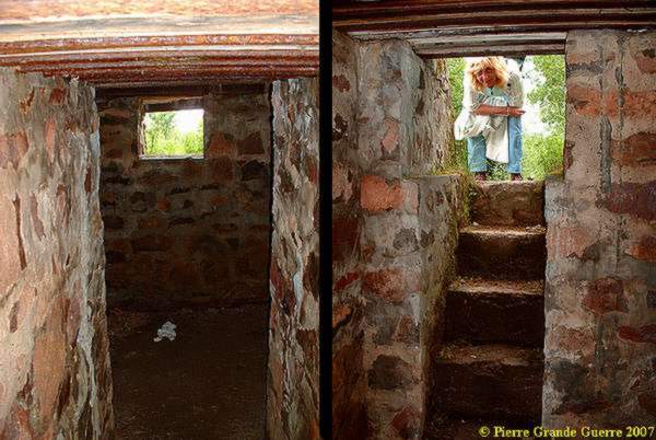
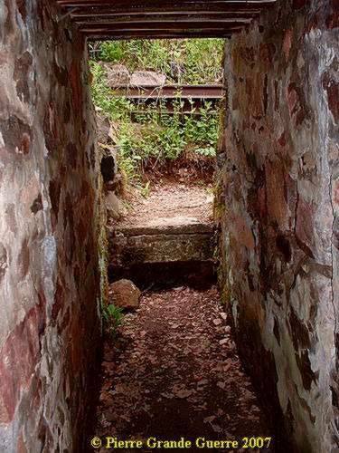
As in all French bunkers on the Vieil Armand the entrance is very low ...
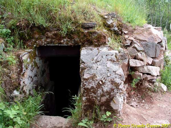
... and the room downstairs is only 1.50 m. high, and it measures not more than 2 x 2 m.
Some last relics , remembering of the presence of the 2nd "Compagnie du Génie".
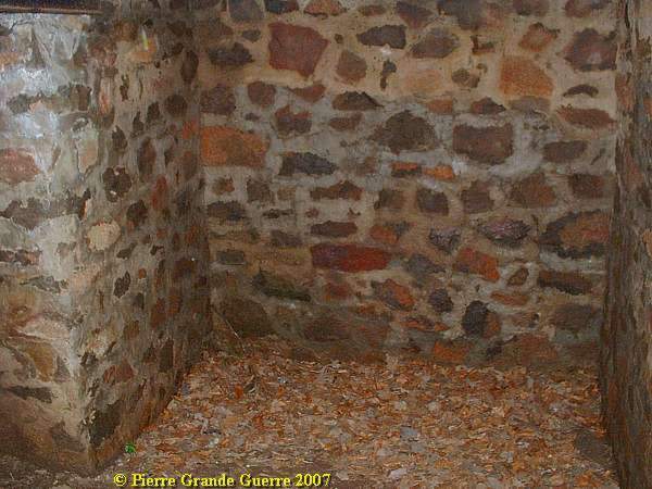
After all that undestructable , German steel and concrete, it is again amazing to see, ...
... how the French environmentalists " avant la lettre" built their "abri's" of mostly natural materials.
We left the trench and the small shelter bunker of the 2nd.Cie du Genie....
... to the foot of the French National Cemetery at the Col du Silberloch, which we had to climb again to the road to return to our point of departure.
We got our car , parked near the Cemetery at the Col du Silberloch, ...
Casualties
Both parties at the Vieil Armand, the Germans and the French, had each around 6,000 men killed. The estimations of the total of casualties on each belligerent side -, men killed, wounded, missed in action, or taken prisoner of war,- has been counted at around 30,000 men.
In some publications about the Hartmannswillerkopf you will find the death toll of 60,000 men. This is a persistent misunderstanding, by changing the number for casualties into a number for the presumed death toll. For instance: during all the fights and battles in the front sector of the whole Alsace in 1914-1918, the death toll of the Germans was a total of 22,278 men, and not even the 60,000 dead men on the HWK mentioned before in those publications.
So, both belligerent parties at the Hartmannswillerkopf, the French and the Germans,shared a total of around 60,000 casualties and of which around 12,000 men were killed.
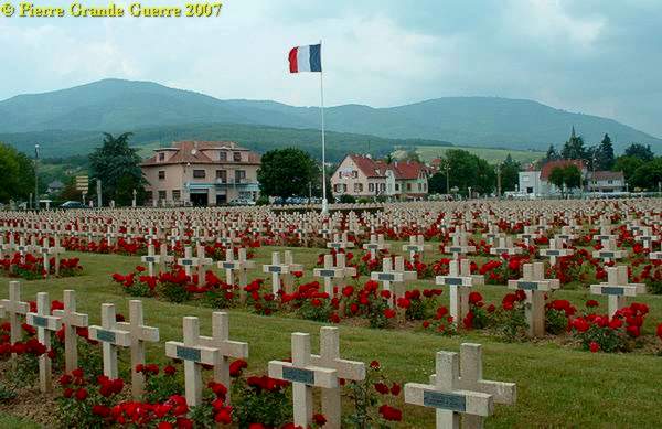
Cernay : The French National Cemetery. On the horizon the mountains, which witnessed these destructive and bloody battles.
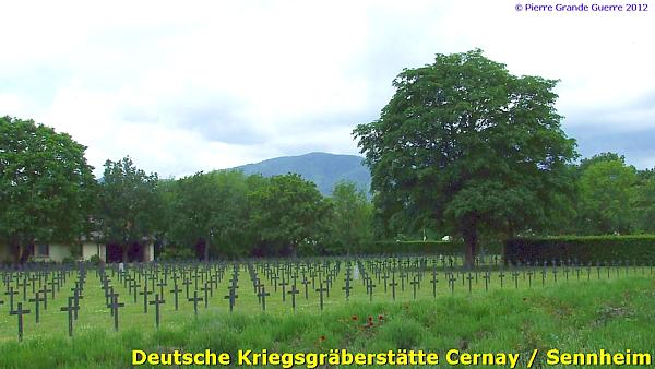
Cernay : The German War Cemetery with the Hartmannswillerkopf on the horizon..
Continue to the next chapter : " Guebwiller - Rimbach - Hirzstein ".


