
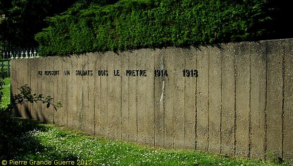
St. MIHIEL SALIENT - Bois le Prêtre / Priesterwald - Fey-en-Haye Destroyed Village - Kühlewein Brunnen - Vilcey-sur-Trey
Year of visit: 2012
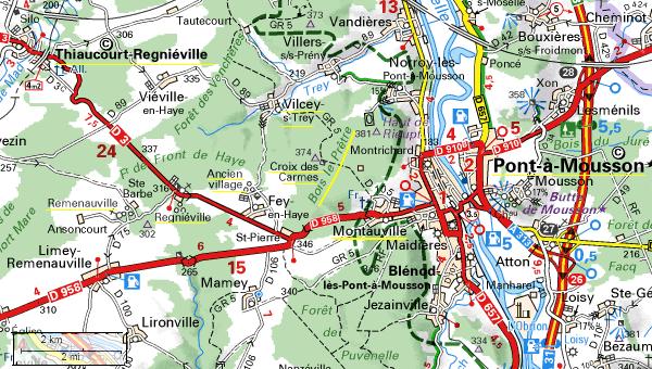
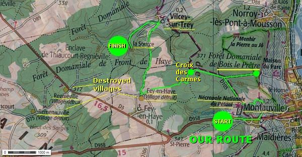
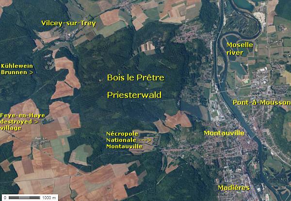
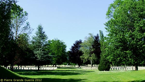
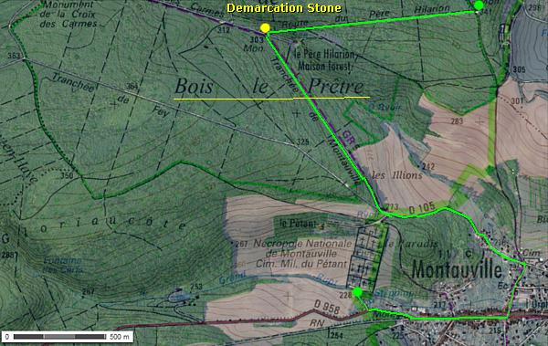
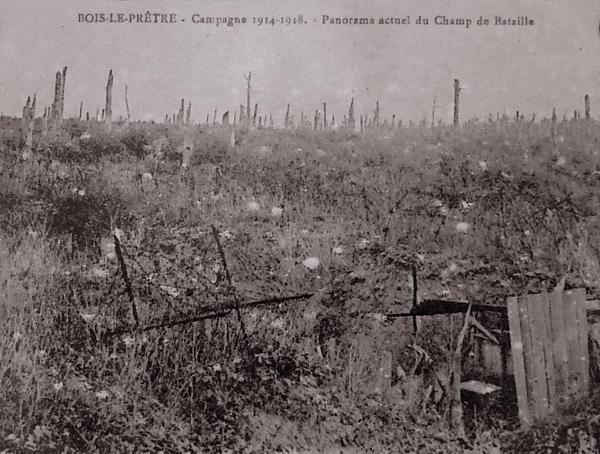
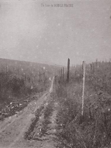
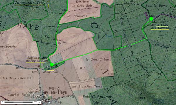
East of the destroyed villages of Rémenauvilleand Regniéville, west of Pont-à-Mousson, and on the opposite west bank of the Moselle river, northeast of Montauville, we visit the south-east corner of the Saint Mihiel Salient, the “Bois le Prêtre” or “Der Priesterwald”, the Priest’s Wood. This wood formed the centre point of many battles and combats from September 1914 until November 1915.
We start with some distant panoramic views of the wood. Next we shall visit to the French Montauville Nécropole Nationale and the Cimetière du Pétant. From there we shall enter the now densely vegetated battlefield of the Bois le Prêtre, visiting memorials and relics of trenches and dug-outs. After the walk into the wood, we drive to the sparse ruins of the Destroyed Village of Fey-en Haye. From there we shall cross the former front line northward into “German territory” to finish our tour at the “Kühlewein Brunnen” source near Vilcey-sur-Trey.
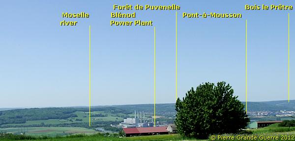
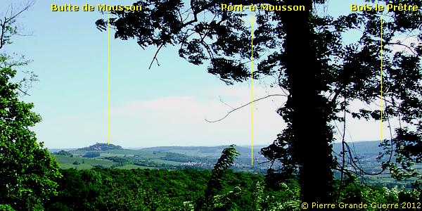
We start with two distant panoramic views, both from the east bank of the Moselle river showing Pont-à- Mousson , Montauville and the Bois le Prêtre. From one of the “crowning heights” around Nancy, the Côte de Ste. Géneviève. During the war, this was the location of a French artillery base. This first panorama shows a north-westward view over the Moselle valley.
We see the second panorama south-westward from “ German territory ” on the Froidmont near Bouxières -sous- Froidmont.
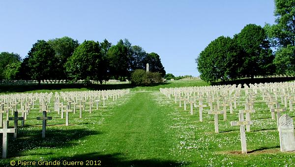
We cross the Moselle at Pont-à- Mousson to arrive on the west bank at Montauville to visit on the western outskirts of the town,the Nécropole Nationale de Montauville and in particular the larger half, the plot of the Cimetière Militaire du Pétant .
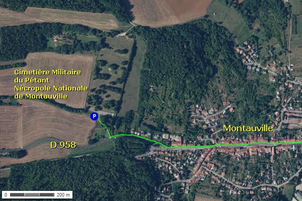
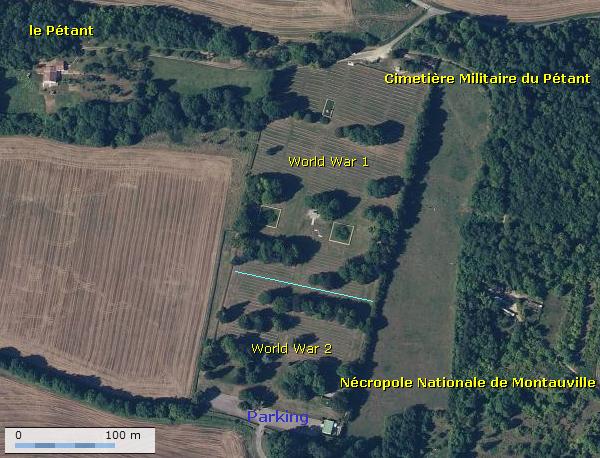
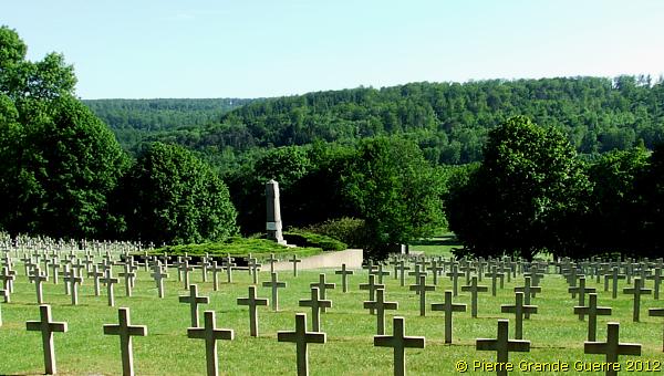
The Nécropole Nationale de Montauville lies on a rather steep slope ( from 228 m. to 273 m. over 500 m. ), touching a south-eastern edge of the Bois le Prêtre , near le Pétant farm. This cemetery has two large plots. The first plot at the official entrance contains graves of victims of the Second World War. You will pass this plot to enter the second plot with Great War graves, the Cimetière Militaire du Pétant . There is also an unofficial entrance on the northern side of the cemetery with less parking space , which you can approach via the D 105 into the wood.
The first plot of the Nécropole Nationale de Montauville , at the foot of the slope , contains 4 ossuairies and the graves of 8,317 French soldiers , 105 Soviet Russians , and 12 Polish soldiers , who died during the Second World War.
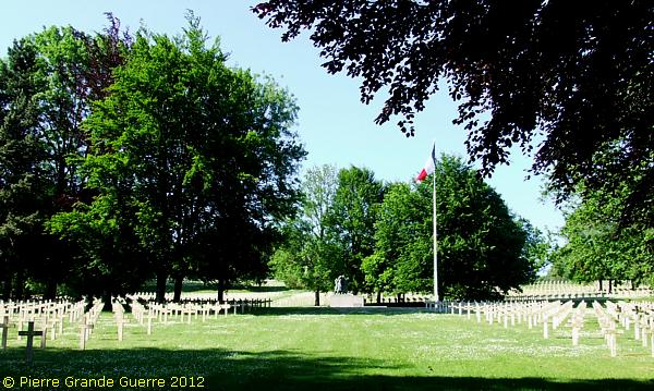
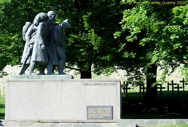
Behind this impressive memorial commemorating the Prisoners of War, who died in captivity during the Second World War, starts the cemetery for the Great War.
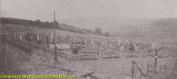
Cimetière Militaire du Pétant
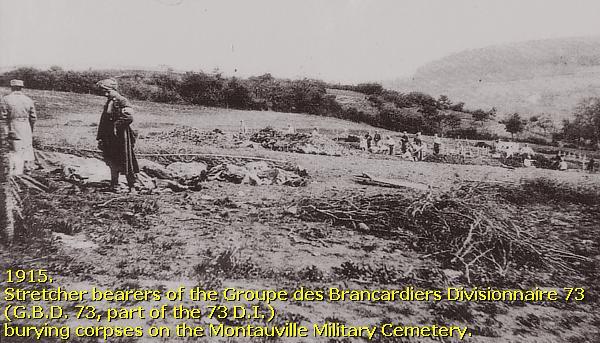
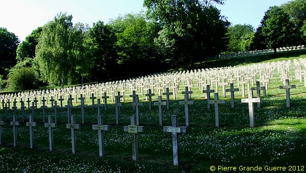
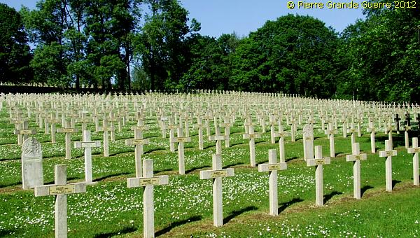
Stretcher bearers of the 73e Groupe des Brancardiers Divisionnaire created in October 1914 the Military Cemetery of le Pétant , which contains the graves of 5,199 French officers and soldiers and one Serbian soldier , who died in the Bois le Prêtre . There are several communal graves and one large ossuary , containing the mortal remains of 1,014 soldiers .
Casualty numbers of thousands, being enormous, carry the risk that they can be seen merely as abstract numbers. Before you visit any battlefield, there is only one right way to visualize these incredibly high numbers of killed soldiers: visit the nearest cemetery where they now rest .
We will
visit now only the graves of French soldiers, who did
find at least a grave. Some two thousand
of them, and as many German soldiers,
disappeared or were atomised on the battlefield in the Bois
le Prêtre
.
Some five thousand German soldiers out of 7.000, who were killed in the Bois le Prêtre, are buried in the “Deutscher Soldatenfriedhof Thiaucourt-Regniéville”, which lies outside the geographical range of the subject of this photo impression.
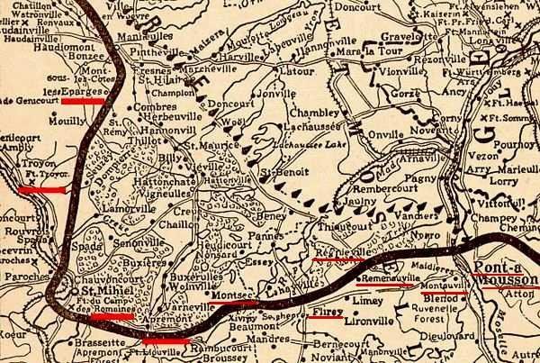
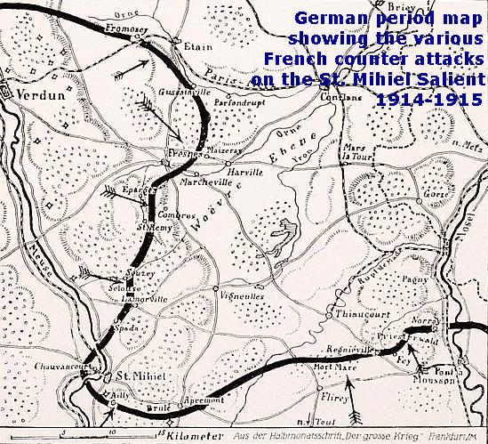
The Saint Mihiel Salient

In September 1914 the German tried to capture Verdun from the south side. On 22 September 1914, the Germans occupied all ridges dominating the Plain of Woëvre . The city of St. Mihiel would fall only 3 days later, on the 25th. And so the Germans created the Saint Mihiel Salient .
The frontline went from Les Eparges , St. Mihiel , Apremont , to the Bois le Prêtre on the west bank of the Moselle and north of Pont-a- Mousson on the east bank.
The Salient would never be recaptured until 13 September 1918. As you can read in my Photo Impression of the Butte de Montsec , American troops made a big difference during this last Franco-American offensive .
Before the definite capture of the salient in 1918, the French Army tried to retake the salient many times !
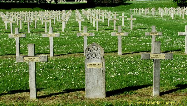
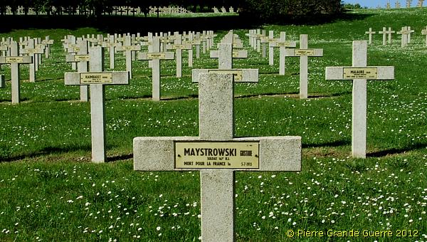
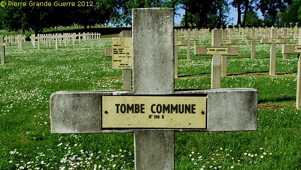
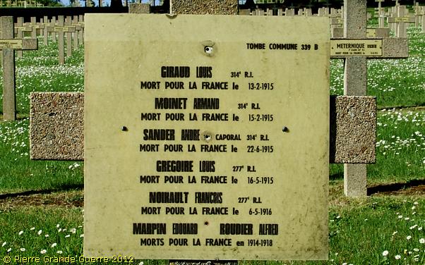
One of the many communal graves with an unknown number of burials.
Other communal graves contain the corpses of various numbers...
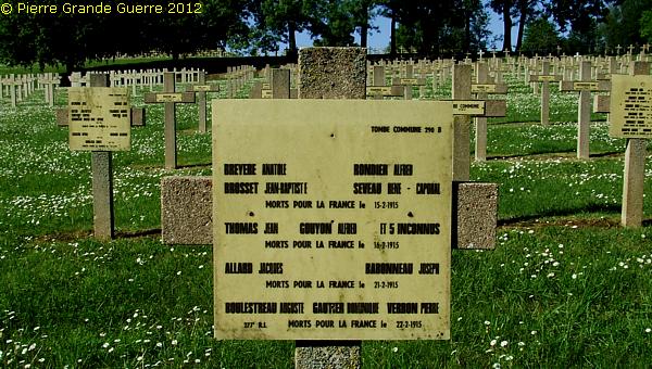
... of soldiers , mentioning their names and date of death.
We approach the large ossuary...
... towering over the cemetery.
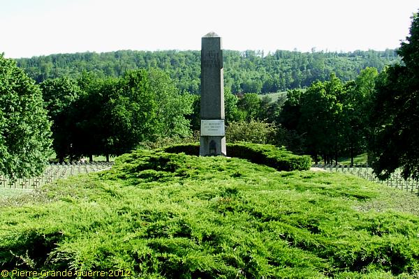
View southward over the cemetery at the Forêt de Puvenelle.
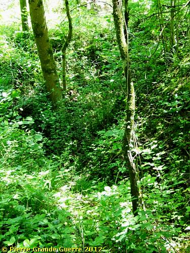
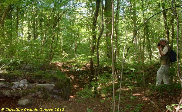
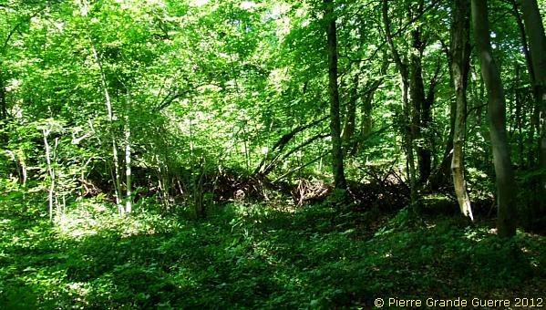
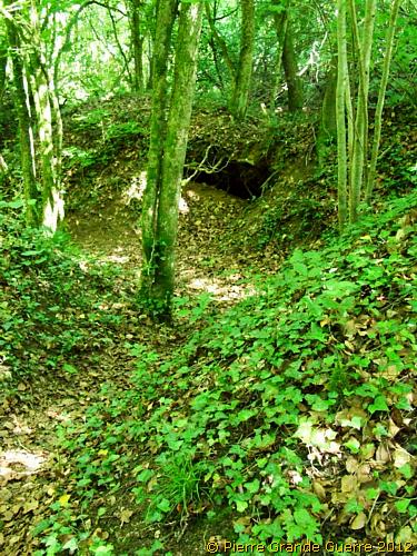
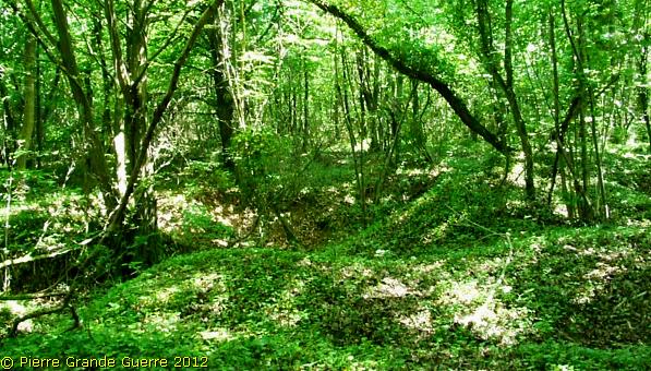
We leave the cemetery. Via the D 105 we continue northward and enter the Bois le Prêtre.
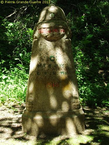
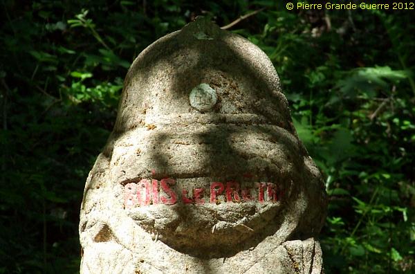
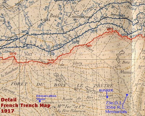
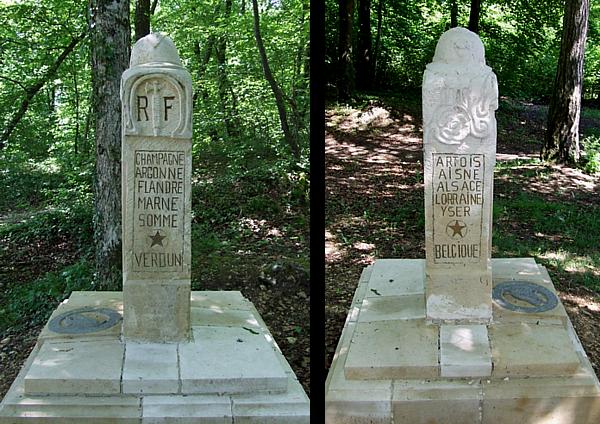
At the T- junction we stop at this post-war demarcation stone , which symbolizes the farthermost point of advance of the Germans.
French attempts to recapture the Saint Mihiel Salient
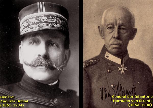
During the period from October 1914 until November 1915 General Joffre ordered General Dubail and his First Army several times to recapture the salient on the troops of the Army Detachment , the “Armee Abteilung ” of General der Infanterie von Strantz , which formed the left wing of the German 5th Army .
In February 1915 Dubail is promoted to be the commander of the “Groupe d'Armée de l'Est ”. From then on Dubail intensifies his attempts to break through the German lines and to recapture the Woëvre Plain .
The German journalists of the period called these series of French offensives and pincer movement attacks at the salient the “ Joffrezänge ”, " Joffre's pincers ".
French attempts to recapture the Bois le Prêtre
It was the task of the German 8. Ersatz Division of Generalleutnant Hermann Kosch to defend this sector of the Saint Mihiel Salient in and around the “Priesterwald”.
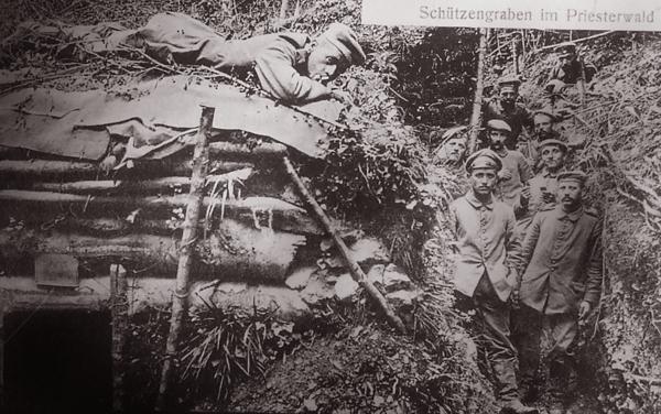
The division was a composite division , formed around 12 brigade replacement battalions (Brigade-Ersatz- Bataillone ) from the Kingdom of Württemberg , the Grand Duchy of Hesse, the Rhine Province and the Province of Hesse-Nassau.
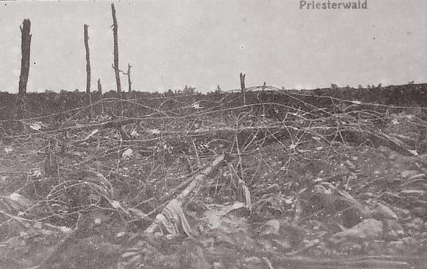
Although the French troops contested the German occupation of the Bois le Prêtre from October 1914, the battles in the wood culminated during the period from February to October 1915.
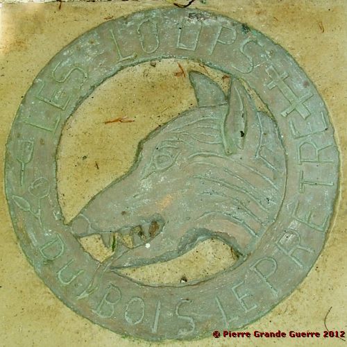
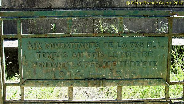
The 73e Division d’Infanterie de Réserve from Toul of Général Henry Lebocq was supported by the “Brigade Mixte”, later baptised the 128e D.I . , of Général Riberpray . The troops of these Divisions earned in the Bois le Prêtre their proud nickname , “Les Loupes du Bois le Prêtre ”, the Wolves of the Priest’s Wood.

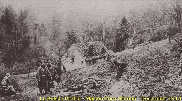
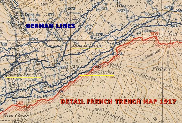
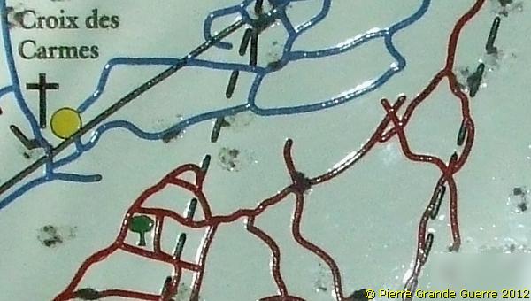
On 29 October 1915 the 73e Division d’Infanterie succeeded to capture the location of the Croix des Carmes , about 1 km. from here, and which we will visit later. The Croix des Carmes , part of the “ Quart en Réserve” front sector and the height of the “ Patte d’Oie ” (Goose Foot) in the “ Pére Hilarion ” front sector formed the farthermost points in the wood , which the French would recapture .
We continue eastward to the height of the " Patte d'Oie " (341 m.), Goose Foot.
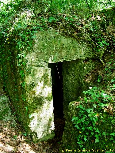
Some 100 m. before we reach the summit I detect , hidden in the northern verge of the sandy road, a bunker.
The entrance is on the east side and...
.. the loop hole is directed westward , overseeing the road.
After 100 m. we arrive at the " Patte d'Oie ", where we find two memorials.
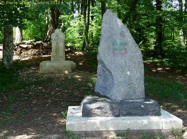
The memorial in the front commemorates the fallen soldiers of the 356e R.I. of Colonel Dehaye, a part of the 145e Brigade d'Infanterie of the 73e D.I.

The first success of the 73e D.I.
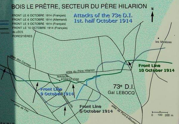
In October 1914 the 73e D.I. made one of the first attempts here in the Père Hilarion front sector to gain some terrain from the Germans . Between 6 October and 10 October 1914 the unit succeeded in gaining only some 300 m.
Left and behind the 356e R.I. memorial stands the "Monument aux Morts" of the 73e D.I.


The emblem of the 73e D.I. , “The Wolves of the Bois le Prêtre ”.
The flanks of the memorial bear the names of all the front sectors, where the 73e D.I. fought during the Great War.
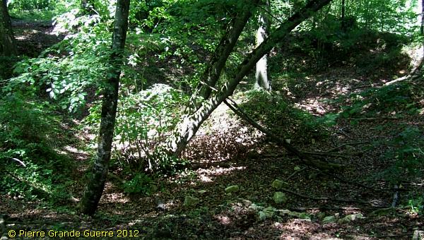
Some 5 m. behind the memorials you will find large craters and shell holes.
We return along the same road , we pass the demarcation stone , ...
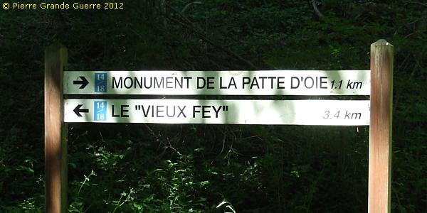
... and we continue westward in the direction of “Le Vieux Fey”.
By car it takes a few minutes to arrive at the Croix de Carmes and its memorial.
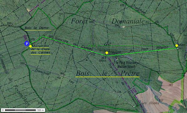
Some 100 m. before we arrive at the location of the Croix des Carmes , and some 100 m. further , there are two large information signs on the northern side of the D 105, which you cannot miss.
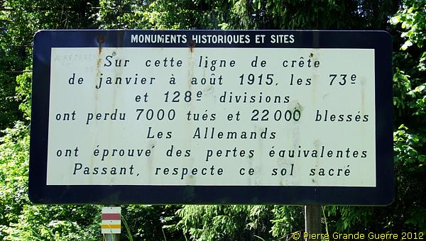
“On this line of ridges from January to August 1915 the 73e and 128e Divisions have lost 7,000 dead and 22,000 wounded .
The Germans have experienced equivalent losses .
Passer- by , Respect this sacred soil .”
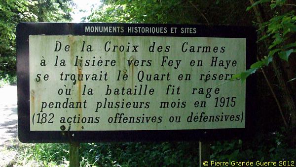
| “ From the Croix des Carmes to the edge towards Fey -en-Haye was located the Quart en Réserve, where the battle raged on during several months in 1915 ( 182 offensive or defensive actions ).” |
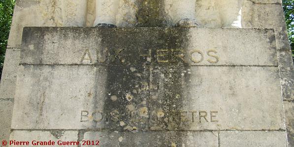
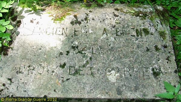
Opposite the Memorial of the Croix des Carmes we stop.
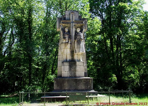
The memorial stands 5 m. from the location of the original wooden Croix des Carmes.
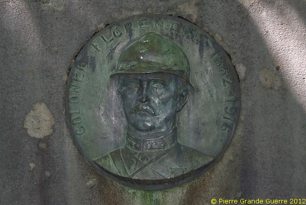
On the rear side of the memorial is a bronze plaque with a portrait of Colonel Florentin , Commander of the 367e R.I. (part of the 146e B.I.), who would fall later in 1916 in the Tavannes front sectornear Verdun.
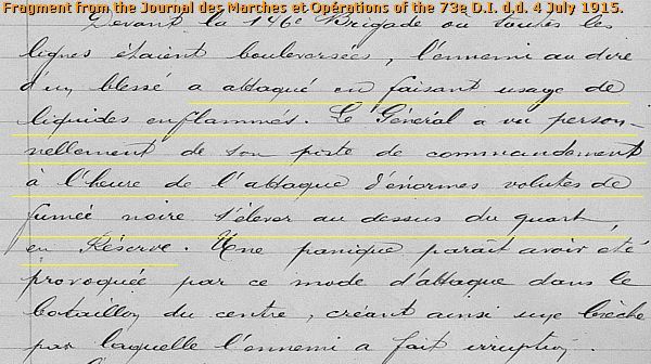
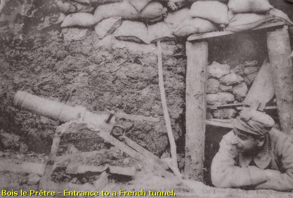
4 July 1915 - The 8. Ersatz- Division attacks with flamethrowers

On 2 July 1915 the support unit of the 73 D.I., 128e D.I., is replaced by the 31e Brigade Coloniale . Two days after the arrival of the Colonial troops , on the 4th, the 8. Ersatz- Division launched one of the fiercest attacks in the sector of Quart en Réserve and Gros Chêne on the 146e B.I . using among others a new weapon , flamethrowers .
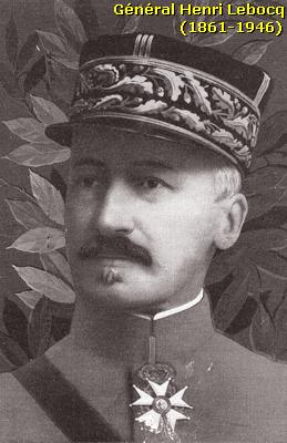
Général Lebocq observed from his Command Post near the Croix des Carmes this new phenomenon of flamethrowers attacking the 146e B.I. The flames and black smoke of this weapon , previously unknown to the French, caused panic among them and one battalion fled from its position leaving a gap in the French lines for the Germans to break through .
On that day , 4 July , the 8. Ersatz- Division conquered almost all the ground recently secured by the French troops . The battles in the wood would continue.
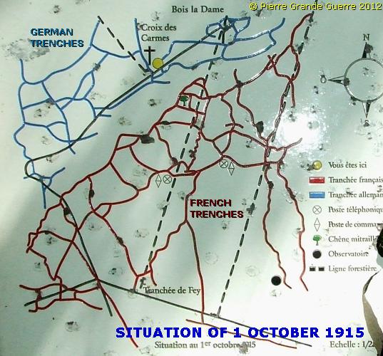
Near the memorial stands an information panel showing among...
... others a sketch of the local front situation of 1 October 1915 .
Although the 73e D.I. succeeded on 29 October 1915 to conquer the German 1st and 2nd lines and the Croix des Carmes itself , some days later the front would consolidate in the situation of 1 October 1915.
Left and behind the memorial starts a confusing path , which leads you to the first lines east of the Croix des Carmes
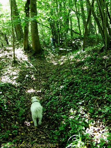
Our company of Christine, Bobby and I will try to follow this path , which starts at this slab, representing the location of the original wooden Croix des Carmes.
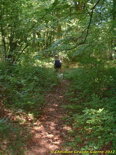
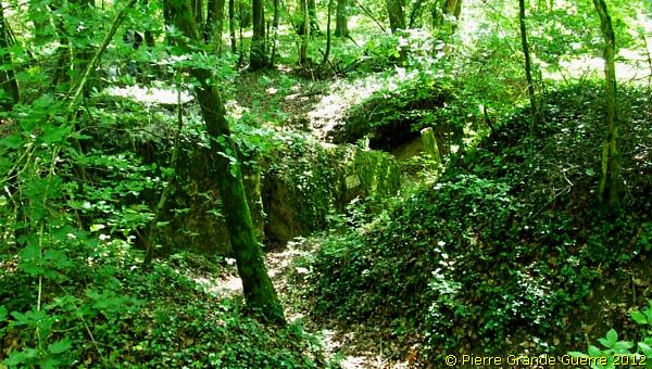
The narrow path follows the meandering pattern of a section of ...
... a French first line trench eastward into the densely vegetated wood.
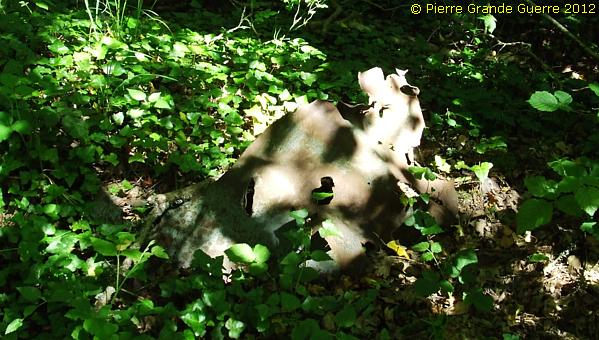
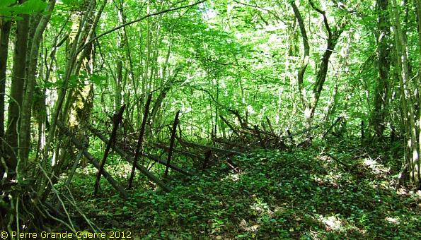
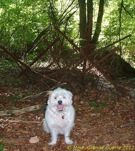
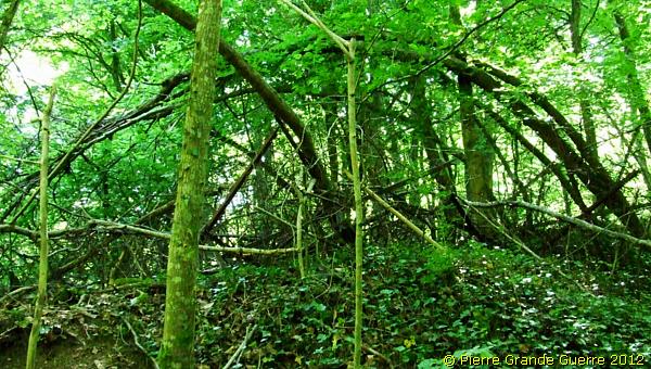
Here and there you will find some unidentifiable rusty objects.
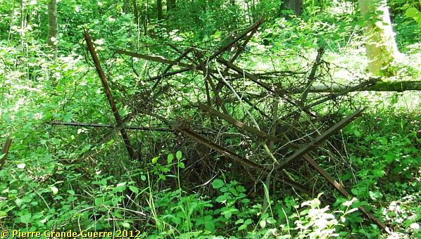
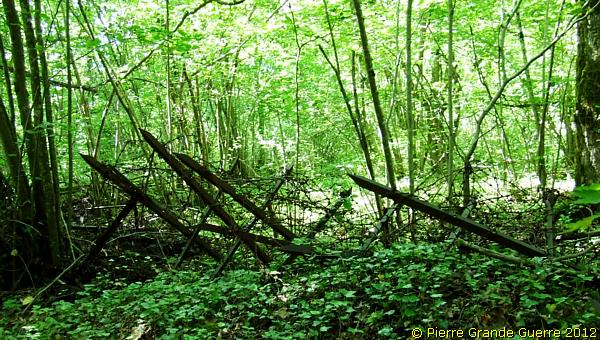
On the northern side of the path and the trench we see Friesian Horses with rusty barbed wire.
A small forward sap made of bricks.
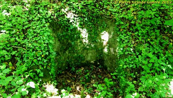
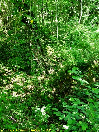
Sometimes the path follows through the trench in a more shallow section.
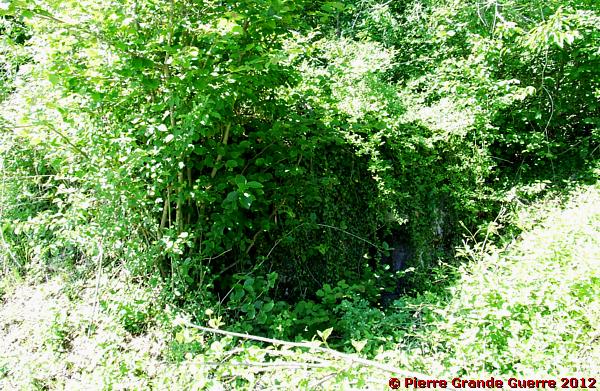
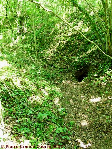
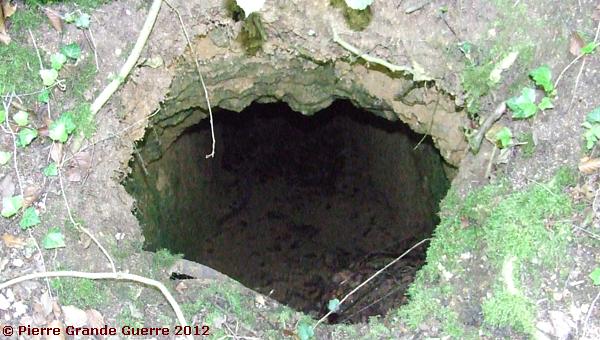
If it wasn't for this large information panel, ...
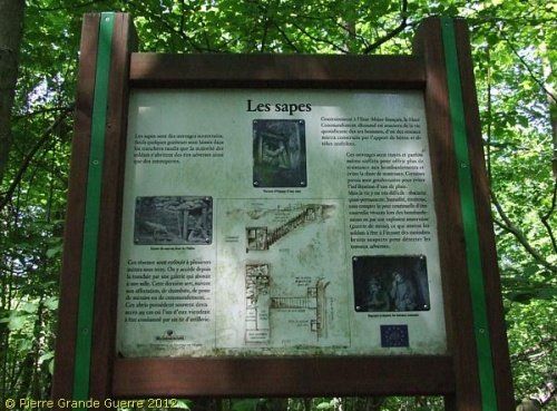
... I would probably have passed this entrance to a dug-out unnoticed , thinking it is a natural fox-hole.

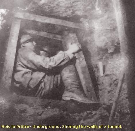
The relative safety of underground dug-outs
In short, the illustrated information panel tells the story about how the French soldiers were forced to dig staircases leading underground to deep tunnels and to narrow quarters , the only way to be safe from the German artillery .
I will show this cross section sketches in more detail in a moment.

Notice the stooping attitude of the soldier ascending the stairs . The tunnels and corridors were often not higher than 80 cm.
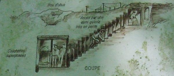
The soldiers rested and slept in bunk beds with a sentry above them at the entrance of the staircase .

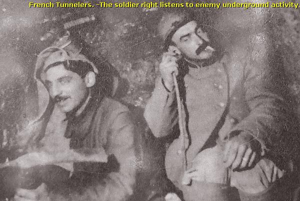
Mine Warfare
On
both
sides of
the
front
line
sappers
were
constantly
active
to
dig
tunnels
for
mine
warfare
.
During
the
period
of 1914
and
1915
both
sides
exploded
several
mines in
the
wood
. On
some
of
the
maps
shown
here
you
will
find
the
locations
of these mine
craters
.
Some 25 m. to the east my late wife, Chris ( + 08-05-2018), caught me photographing a French observation post.
I decide to leave the "French" path and to continue northward to look for the No Man's land and the German lines.
We have to find an opening in two lines of barbed wire entanglements.
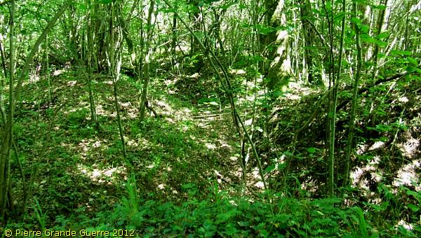
Distracted by the sight of a fox I become rather disoriented. I only know that we have entered an open spot and that we walk northward.
After not more than 50 m. we see in front of us again two lines of barbed wire behind each other. We are indeed in the narrow No Man's Land.
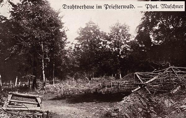
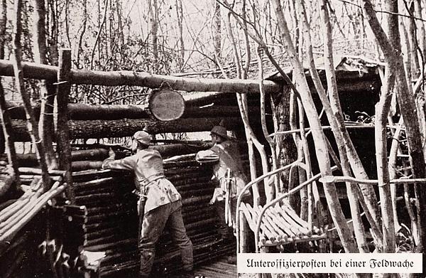
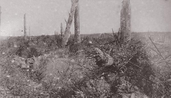
As I always walk over the battlefields with some period photos in my memory, this spot reminded me immediately of this period photo of the " Grosser Bilderatlas des Weltkrieges ".
Disoriented or not , in one way or another we seem to have ...
... succeeded in reaching the German first line.
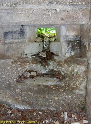
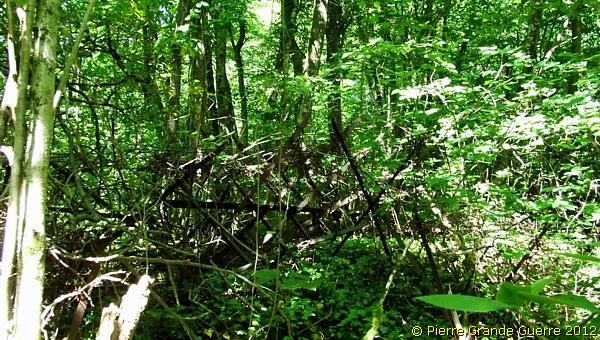
Soon we detect another Friesian Horse, a trench and a concrete observation post.
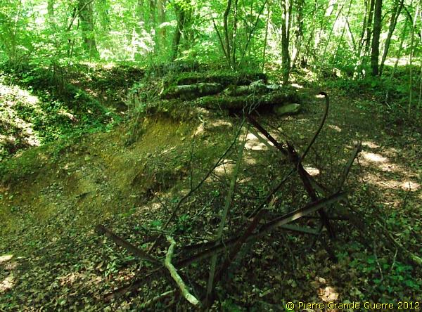
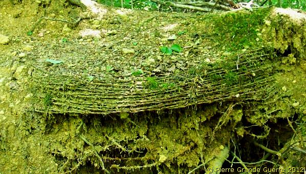
A complete roll of barbed wire has solidified over time.
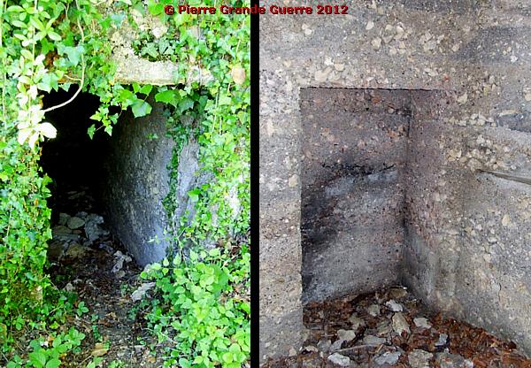
We follow the trench a few metres northward passing the concrete top of a dug-out.
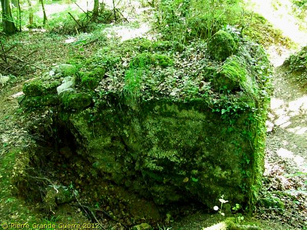
A few metres north of this concrete top, we find a trench running north-south with two dug-out entrances.
Except for the risk of an exploding mine, ...
... staying underground as often as possible formed also for the Germans the main way to survive.
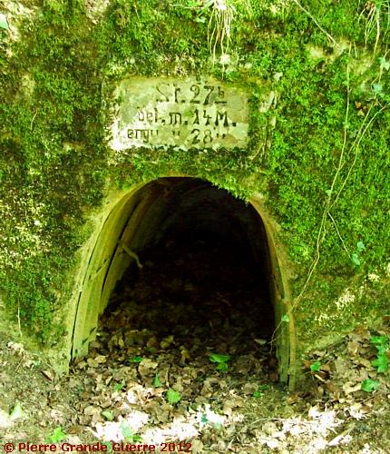
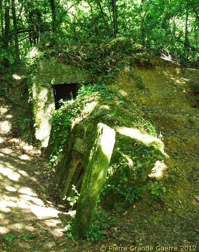
“ Stützpunkt 27b “ - Stronghold 27b
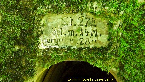
I walk on northward.
View southward to “ Stützpunkt 27b“.
Via German barbed wire , ...
... the No Man's Land and French barbed wire we return to the French lines.
We now deviate slightly to the east , ...
... where we find this French observation post.
From here we go southward to the second line finding...
... more “fox-hole“ entrances to French dug-outs.
Our interesting walk in the wood took more of our time, than I had originally planned for this day.
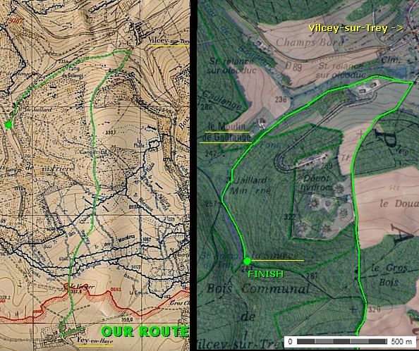
So , for now we have to return to our car to continue some 2 km. westward to the Destroyed Village of Fey-en Haye .
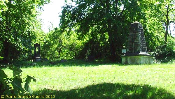
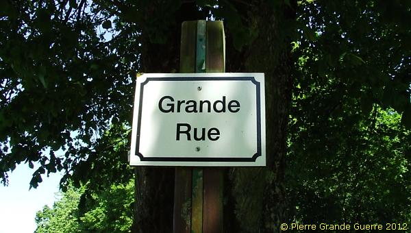
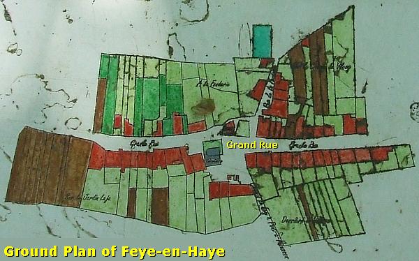
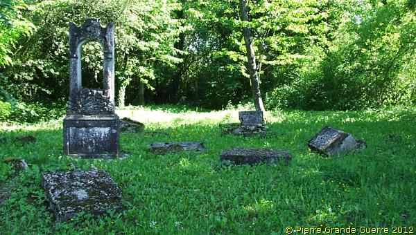
This is all that is left of the village of Fey -en-Haye: some memorials of the former churchyard in the Grande Rue, the only street of the hamlet.
The village of Fey-en Hay during 1914-1918
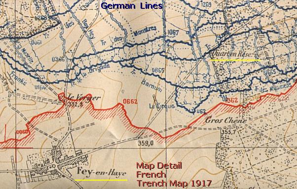
Like the neighbouring destroyed villages of Rémenauville and Regniéville , west of Fey -en-Haye, the village was often disputed and later during the war it formed a part of the French lines . (See the French trench map above .)
The presence of the French troops in the ruins of these villages made them a target for continuous artillery bombardment and attacks.
In 1914 the “Grande Rue ” formed the only street of the hamlet of Fey -en-Haye, which had almost 150 inhabitants .
On 3 September 1914 the 368e R.I. chased away a group of German Uhlanen cavalrymen and installed itself in the villages of Rémenauville , Regniéville and Fey -en-Haye. But already by 5 September, units of the 8. Ersatz- Division forced the French to withdraw .
During the days of 23 to 25 September 1914 the 73 D.I. recaptured these villages except for Fey-en Haye. On 30 September 1914 the French troops reached the outskirts of the village , where the Germans had set up defensive positions . Because of the German presence , the French artillery destroyed the village .
During the early morning of 1 April 1915 the 169e R.I. finally retook the village . Thereafter , it would be the target of continuous German artillery bombardment . On 7 April 1917 the Germans attacked with poison gas.
Supported by French units the U.S. 90th Infantry Division conquered the Bois le Prêtre front sector on 13 September 1918.
In 1920 the survivors of the hamlet constructed a new village with the same name some 500 m. to the south .
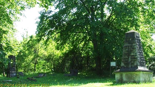
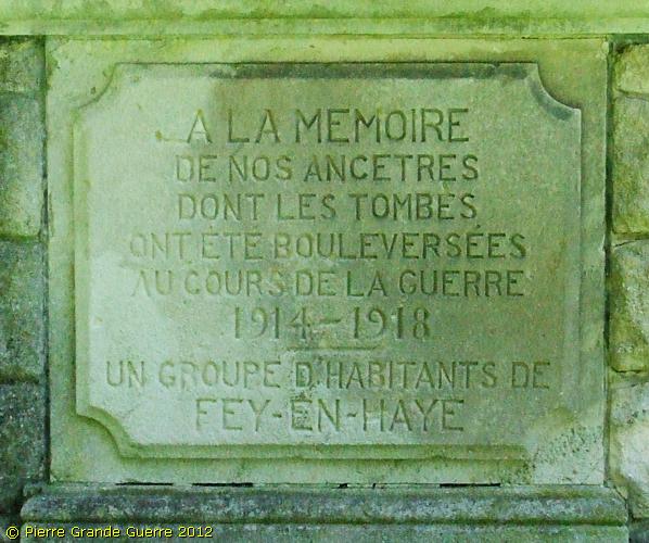
An inscription at the base of the memorial obelisk tells us : …
“ IN MEMORY OF OUR ANCESTORS
WHOSE GRAVES HAVE BEEN DISTURBED
DURING THE WAR 1914 – 1918.
A GROUP OF INHABITANTS OF FEY-EN-HAYE ”
On 13 September 1918 the U.S. 90th Infantry Division conquered the Bois le Prêtre front sector.
From Fey-en Haye we continue northward to our last stop, crossing the front line to the former German lines.
We have run out of time, but I would like to end the day with a sample of a German concrete relic , which I have often watched in my digital period photo collection.
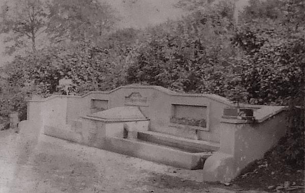
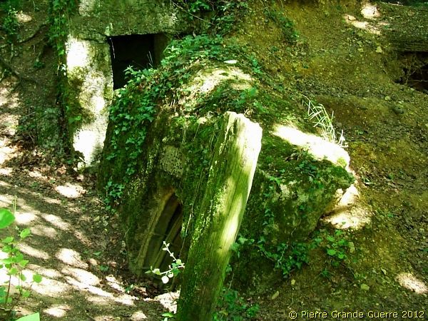
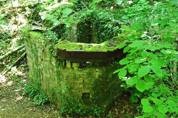
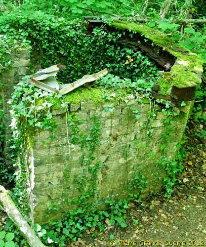
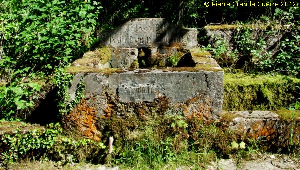
Just before entering the village of Vilcey-sur-Trey we follow a sign to “Ferme de Gaulange ” along the small stream of the Trey. Here we arrive at the last silent witness of the German presence, which we will visit today, the concrete source of the “Kühlewein Brunnen” .
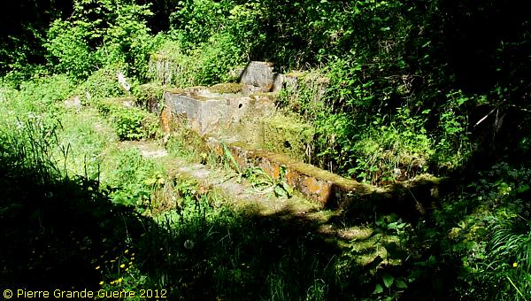
German troops of the Brigade Ersatz-Bataillon 80 constructed this concrete fountain in 1915. It did not serve to “cool the wine”, as the name may suggest, but the source has been named after Oberleutnant von Kühlewein of B.E.B. 80, who served here from September 1914 until the spring of 1917.
( Source: Markus Klauer, “Militärgeschichtligen Reiseführer Lothringen und Elsaẞ”. )
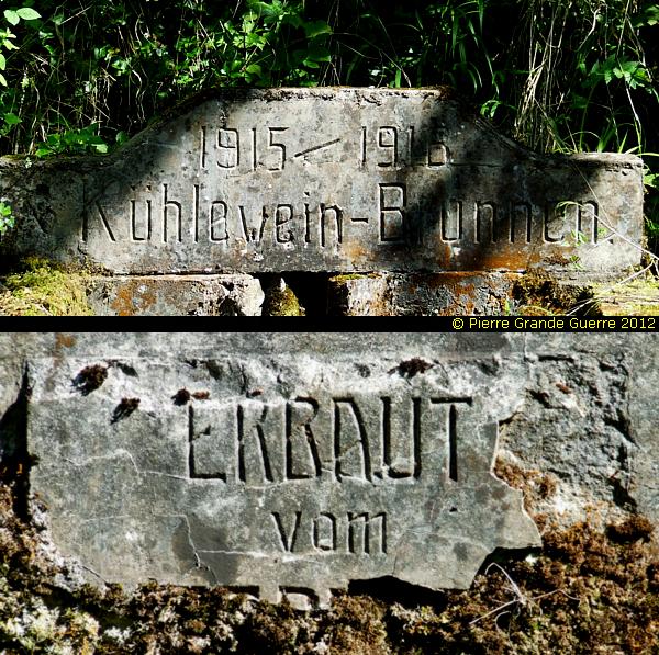
The inscription mentioning the German constructors has been damaged.
At the “ Kühlewein Brunnen we finish our first acquaintance with the front sector of the Bois le Prêtre. I do realise , that we have only covered a small part of this wood , and that there must be more relics to be found in other sectors of the wood , for instance in the Bois la Dame. I hope that one day in the future we will be able to continue our explorations in other parts of the Bois le Prêtre.
Suggestion to continue. You could continue with the “ Somme Introduction ”, the first chapter of my Somme Photo Impressions, explaining the 1916 Battle of the Somme.


