
ALSACE VOSGES - Munster Valley - Petit Ballon
Year of visit: 2004, 2007, 2008, 2009, 2010
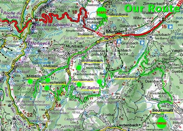
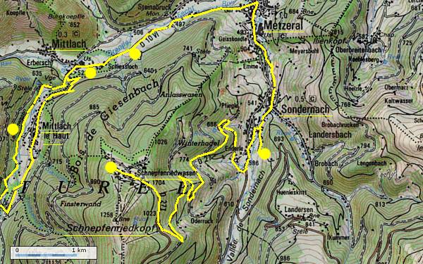
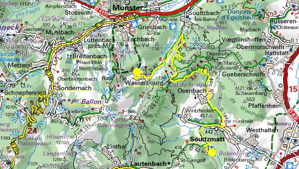
From the Hohrodberg we continue for a trip along some cemeteries in the Vallée de Munster and the valley of the Fecht-river, around the villages of Breitenbach, Metzeral, Mittlach, and Sondernach. Next on this page we will visit the marvellous view from the Schnepfenried, some interesting German bunkers and traces of trenches on the summit of the Petit Ballon. Via Wasserbourg we will finish this tour with the Romanian Prisoners of War Cemetery at Soultzmatt.
From the Hohrodberg Memorial we descend along the D5 B1 southward.
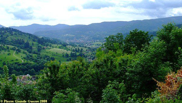
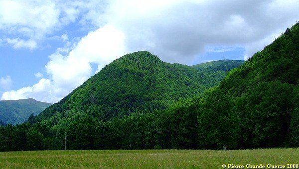
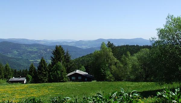
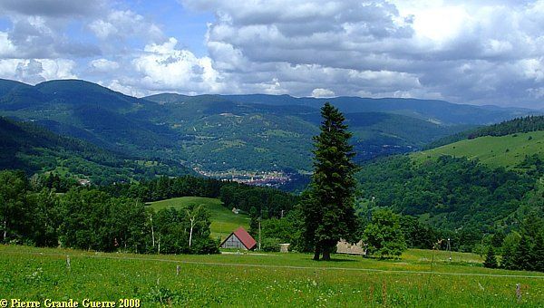
View from the Hohrodberg, some levels below the memorial, southward, over the Vallée de Munster in the direction of Soultzeren, Stosswihr, and Munster.
Some historic background information.
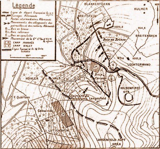
The Valley of Munster 1914-1915
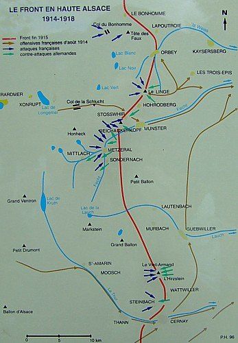
Red line: front in 1915 - Brown arrows: French offensives August 1914 - Blue arrows: French attacks - Green arrows: German counter attacks.
This map, which you will often find on
French cemeteries in the region, forms also a concise reminder, about
how we are continuing our explorations southward along the frontline in
this sector between the Col du Bonhomme and the Vieil Armand.
General Bataille's 81st Brigade

General Bataille's 81st Brigade, consisting of the 152e R.I and the 5e and 15e Bataillons Chasseurs à Pied attacked Munster on 15 August 1914, assisted by the 13e Bataillon Chasseurs Alpins in the south. They occupied Munster and a part of the Valley of the Fecht on 18 August 1914.
Munster would attract of course several counter-attacks of the Germans. From the end of August it would remain in German possession almost until the end of the war.
The Battle for Munster -
February 1915
On 19 February 1915 General Gaede launched the Battle for Munster with Bavarian Landwehr Infanterie Regiment 1, B.L.I.R 2, B.L.I.R, 3, B.L.I.R 12 , the B.F.A.R 8 (Bavarian Field Artillery Regiment 8) and other Bavarian units. On the last day of the battle, at the 22nd, the Germans knew to recapture Munster and the area around it.
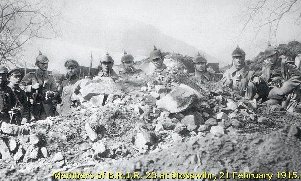
But still the battles would go on for the villages around Munster and for the mountain tops around the Vallée de Munster from March until August 1915.
Along the D 417, between the neighbouring villages of Soultzeren and Stosswihr, stands a post war demarcation stone, inscripted with "Stosswihr". The inscription is not readable anymore, only "1918". I presume, that it formed the text, that I found before on these stones:
We continue through the Munster valley to the southern outskirts of the village of Breitenbach at the northern foot of the Petit Ballon.

Breitenbach
During the Battle for Munster (19-22 February 1915), Breitenbach and the slopes around it played an important role as a base for the German artillery.
At 6 March 1915, after an opening artillery bombardment, the 11th, 12th, 54th, and 65th Bataillons Chasseurs Alpins tried to conquer Stosswihr and Breitenbach. Although the Chasseurs knew to capture the nearby ridges of the Imberg and the Rebberg, they could not reach Stosswihr and Breitenbach. Breitenbach, as a part of the German defense line at the foot of the Ilienkopf, would stay in German possession.
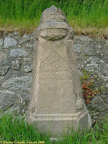
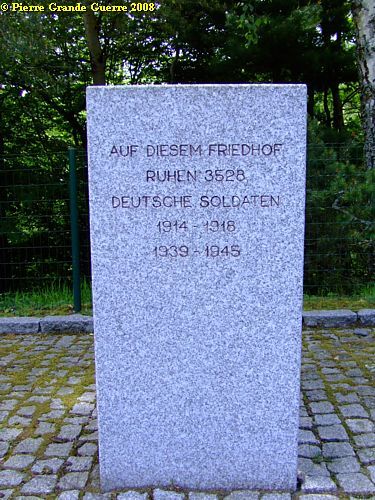
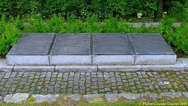
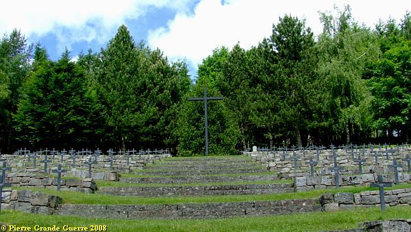
We visit the Deutscher Soldatenfriedhof
Breitenbach
.
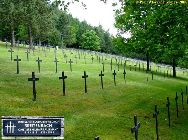
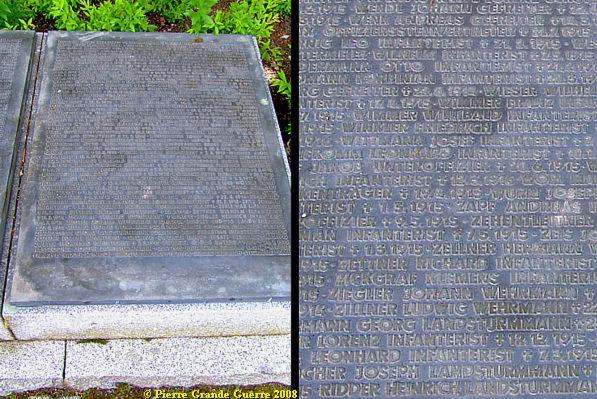
As almost always there is a sober massgrave on the cemetery, ...
... with endless lists of names of fallen soldiers.
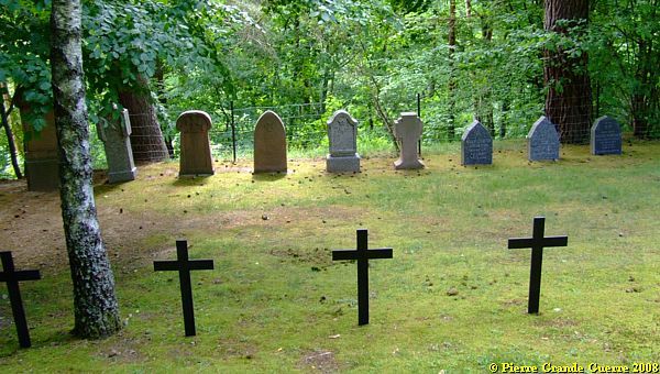
In a corner of the cemetery are some graves of the earliest period of the war, from August until October 1914, but also of 1915 until 1918.
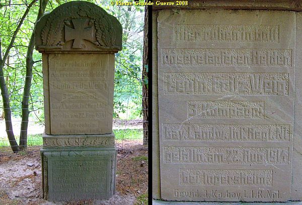
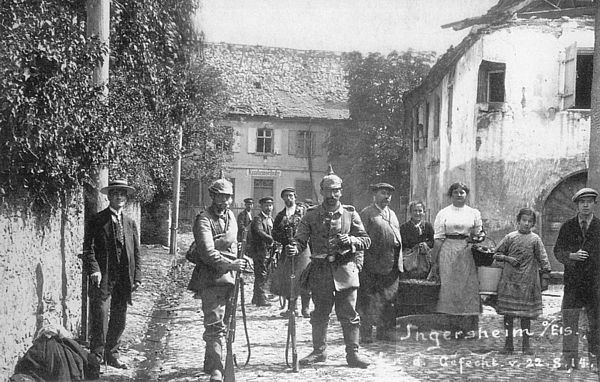
Ingersheim is nowadays a western suburbs of
the modern city of Colmar in the Rhine valley. The grave of Lt. Weig
and the period photograph remind us of how deep the French Army was
infiltrated in the German territory during those early war days in
August 1914, before the Germans forced the French to withdraw on the
ridges of the Vosges.
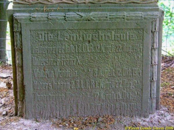
At the base of the monument an inscription with the names of 5 other "Landwehrleute", killed between 22 August and 15 October 1914.
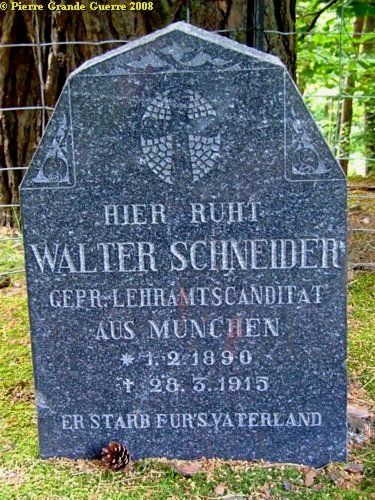
Walter Schneider would never be the teacher, he wished to be.
These 2 "Gefreiters", lance corporals, (left) fell in July 1915 during a Patrol. The "Jäger" on the right was killed in August in 1916.
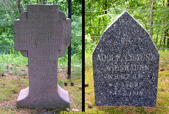
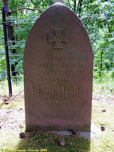
That is was not quiet at all after 1915 along the frozen and forgotten front in the Vosges prove these graves of later war periods. The "Garde Jäger", Adam Moss, had been killed "during the battles for the Fatherland in a patrol mission" in 1918.
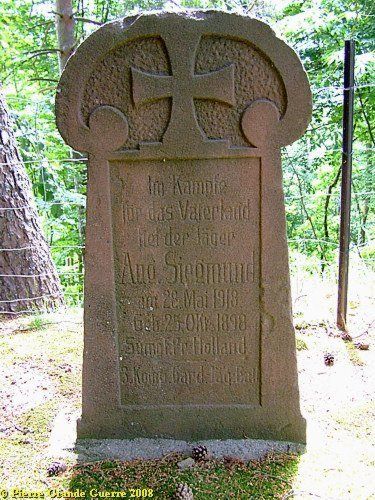
Another member of the 3r Coy. Bayerische Garde Jäger Bataillon, killed in 1918.
We leave the Breitenbach cemetery.
This panorama view is made from the entrance of the cemetery.
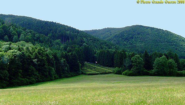
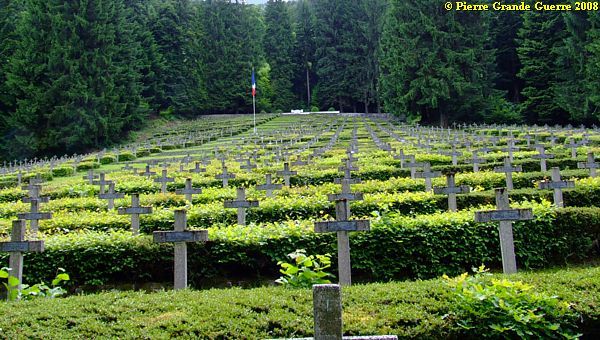
We continue southward to the outskirts of the village of Metzeral .
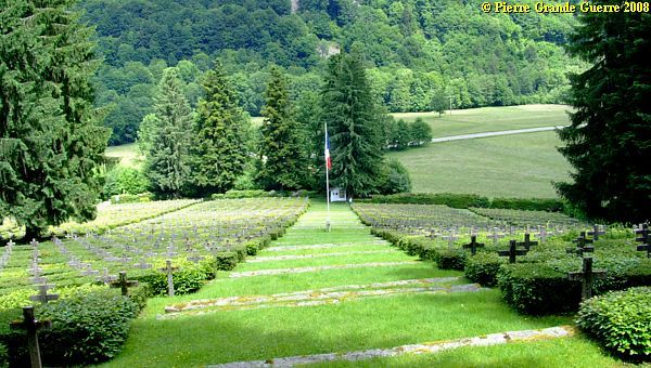
View from the valley of the Fecht to the Chêne Millet Necropole Nationale of Metzeral .
The cemetery lies at the west foot of the Anlasswasen and the Schnepfenriedkopf.
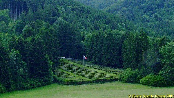
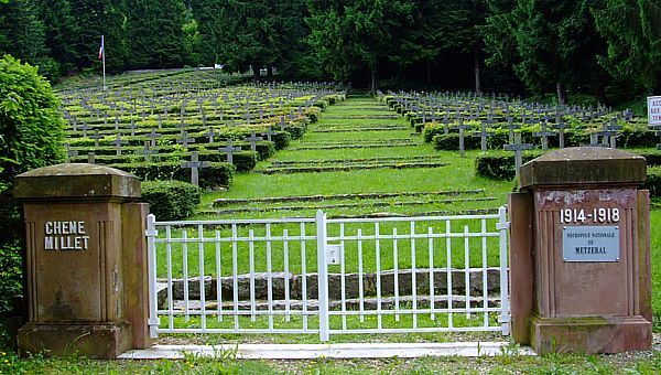
The cemetery contains the graves of 2.630 French soldiers.
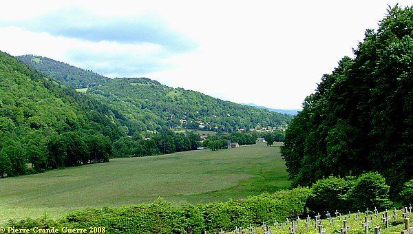
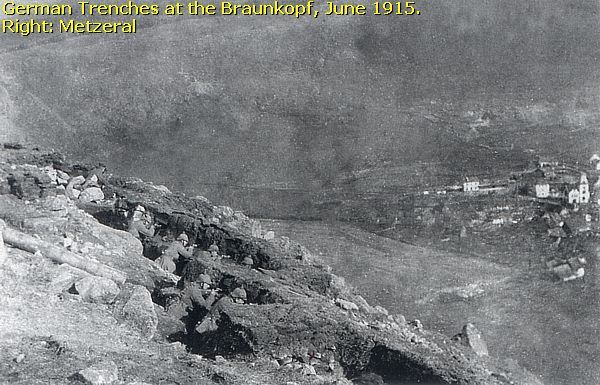
View from the Chêne Millet Cemetery. On the right: Metzeral. Centre: the Braunkopf.
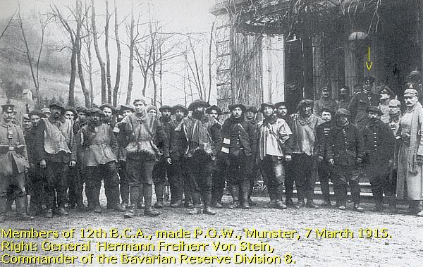
The Battle for Metzeral
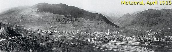
On 5 May and 7 May 1915 the French lauched an artillery bombardment at Metzeral, introducing unsuccesful attacks of the 28th B.C.A. In particular the artillery bombardment of 7 May, which lasted several hours, made many victims under the inhabitants of Metzeral, who were seeking protection in their cellars.
The Germans decided Metzeral had become too dangerous for it's suffering inhabitants, caught in between the fighting, and evacuated the population, quite late, on 9 June.
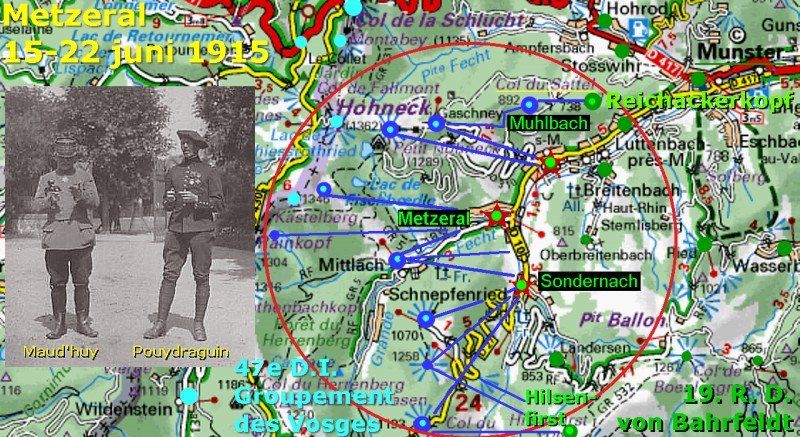
On 15 June 1915, after a heavy artillery bombardment at the German positions around and in Metzeral, the 47e and 66e Infantry Divisions, including Bataillons Chasseurs Alpins, launched an attack from the Altmattkopf in the north southward at the Braunkopf.
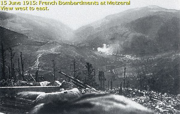
On 16 June units of the 52e B.C.A., 133e R.I., and the 24e B.C.A. advanced rather slowly at Metzeral. On 17 June the 11e and the 22e B.C.A. replaced the 24e. The same day General Pouydraguin ordered to capture the village. The 47e and 66e divisons launched the last assault on Metzeral on 20 June. The battle took place in the village itself with fierce hand-to-hands combats. A German day order of 23 June reported, that two villages, Metzeral and Sondernach, were captured by French troops. At the 24th the Battle for Metzeral was over.
Climbing upward, passing, amongst many others, graves of captains.
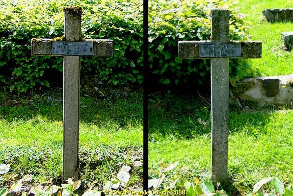
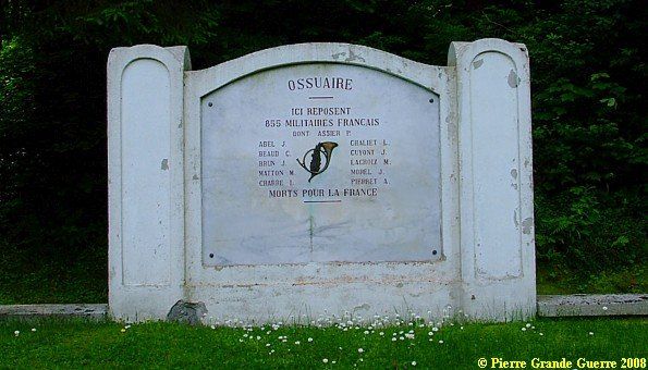
On top of the cemetery rest 855 soldiers in an ossuary.
Three views from the ossuary, because I could not possibly catch the impressive view in one photo shot.
View upward at the Petit Honeck, Riedwald, and the Pfeiferberg. (left to right)
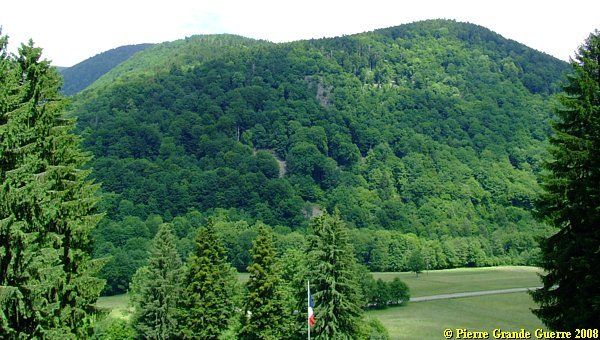
View more northwestward to the Hohneck (1.363 m.) and the Schlucht, in the centre. Left the Seeberg and the Burgkoepfle.

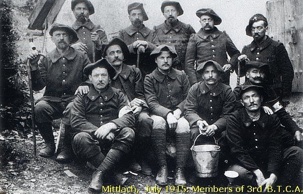
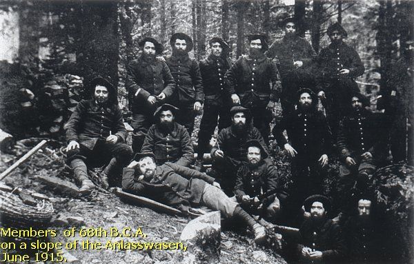
From Metzeral we follow the valley of the Grande Fecht near Mittlach, at the foot of the Schnepfenriedkopf and the Anlasswasen.
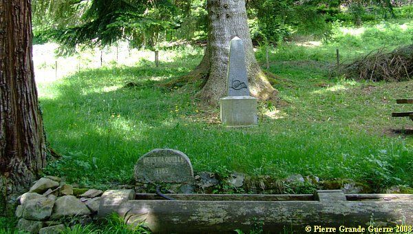
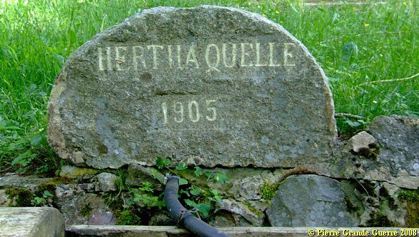
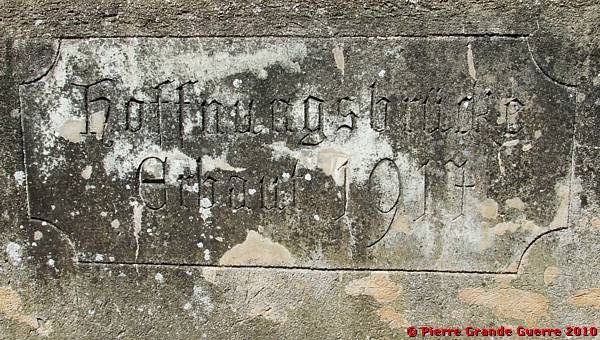
Along the Grande Fecht at the outskirts of the hamlet Mittlach , at the foot of the Schnepfenriedkopf, we find a source and a memorial stèle.
Mittlach - 1915
The Germans occupied the village of Mittlach at 11 March 1915. Between 16 and 26 April 1915 the 47e and 66e Divisions attacked the Schnepfenriedkopf and the Anlasswasen and the village of Mittlach, west and in front of these ridges.
On 20 April 1915 the 28e B.C.A. and the 3e B.Territoriale C.A. occupied the village of Mittlach. The snow storms during 22-26 April forced the battle to an end. But the fights in this area would go on in May and June 1915. The village of Mittlach would stay in French possession until the end of the war.
In German: "Hertha Source 1905". The name and the dating of the source remind us of the times from 1871 until 26 April 1915, when this region was still German territory.
Behind the source is the French memorial stèle:
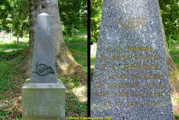
I presume, that the Garde Géneral has been
killed near this spot.
We retun to Metzeral and go southward along the D 10 to Sondernach.
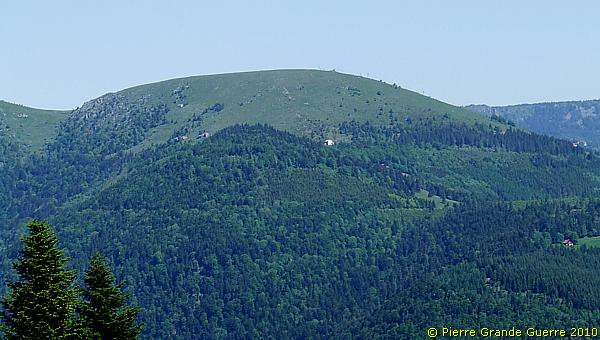
View from Sondernach at a northern slope of the Schepfenriedkopf.
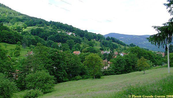
Sondernach - 1915
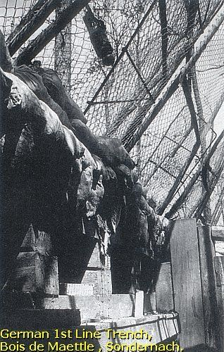
Sondernach was occupied by the French at 23 June 1915. The Bois de Maettle (Wood of Maettle) , which lies along a western slope of the Petit Ballon and close to the village in the southeast, would become the new frontline.
Around this period in the summer the French lost their interest for conquering the slopes and the Petit Ballon itself. They would concentrate their offensives more to the north, on the area around the Linge or the Lingekopf.
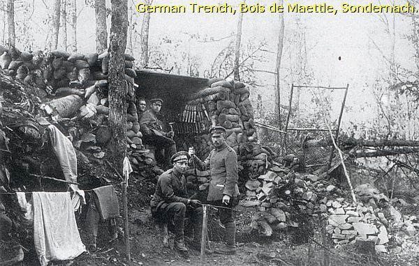
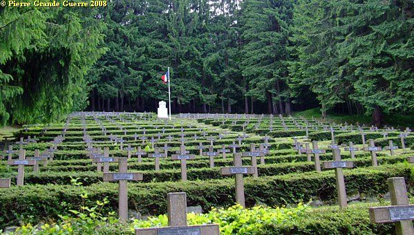
We visit the Cimétière National du Bois de Maettle .
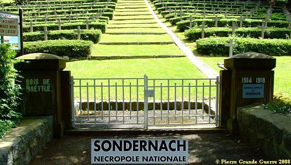
The cemetery contains 373 bodies of French soldiers, fallen in this area.
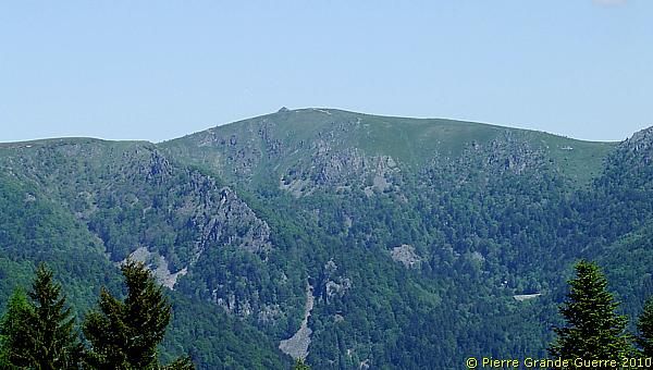
View southwestward from the edge of the cemetery to the Schnepfenriedkopf.
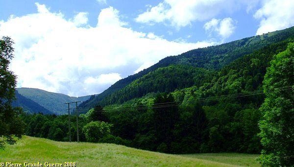
View southward over a rusted elephant shelter into the direction of the Hilsenfirst and the Schnepfenriedkopf (right).
From Sondernach we follow the D 10, next the meandering, dead end D 27 to the hamlet of Schnepfenried at the foot of the Schnepfenriedkopf.
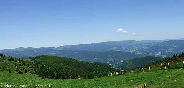
View from Schnepfenried north-eastward over the Munster Valley.
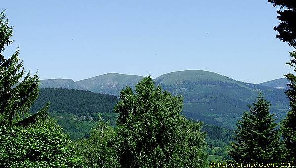
View from Schnepfenried north-westward to the Hohneck .

During the war, after 1915, the Germans still ccupied Schnepfenried and the Schnepfenriedkopf.
The French occupied the Vosges Ridges like the Rainkopf, the Kastelberg and the Hohneck, and below these ridges, the Fecht-valley near Mittlach and Metzeral.
We return almost to Sondernach. At the junction of the D 27 and the D 10 we take a sharp curve over a small bridge, and continue southward.
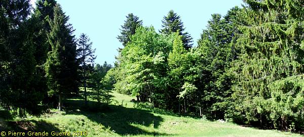
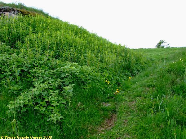
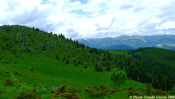
Over the meandering D 10 we climb along a northern slope of the Hilsenfirst to the summit of Le Petit Ballon. A slope of the Hilsenfirst .
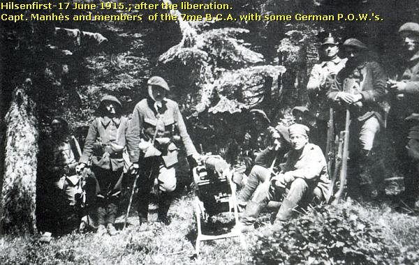
The Hilsenfirst and Sidi-Brahim!
On 14 June 1915 the 6th coy. of the 7e Bataillon Chasseurs Alpins was engaged in heavy fighting at the Hilsenfirst (1.270 m.)

The Chasseurs were almost encircled by German troops of the Württembergische Gebirgs-Kompagnie Nr. 1.

After 3 days, on the 17th, they were liberated from this critical
situation by volunteers of other units of the 7e B.C.A. and 13e
B.C.A. Legend tells that this event was also the occasion, were the
Chasseurs Alpins got their proud nick-name of the “Diables Bleus”, the
Blue Devils. “ Sidi-Brahim!
” would forever stay the battle cry for the
Chasseurs Alpins.
Read more
about the origins of Sidi-Brahim in my next photo impression about le
Tanet
. Dutch readers
, lees mijn geïllustreerde lezing: " De Blauwe Duivels in de Vogezen - Chasseurs Alpins
".
View from the Col du Hilsenfirst at the Honeck.
View from the Col du Hilsenfirst at Metzeral in the Grande Fecht valley.
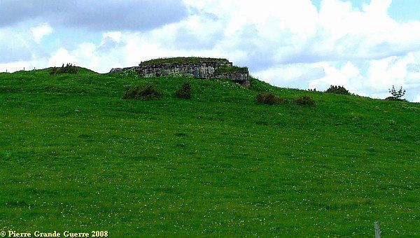
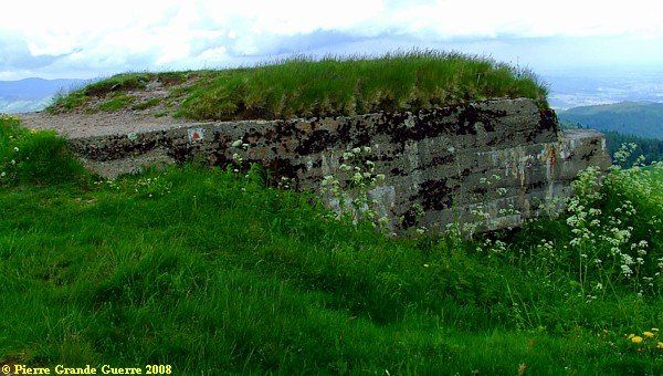
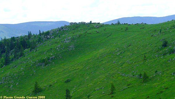
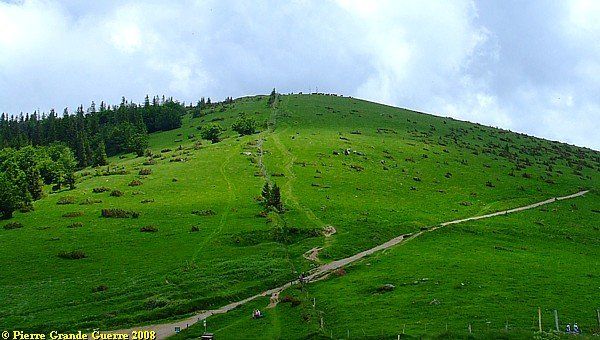
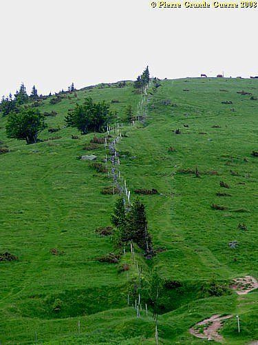
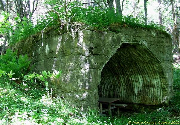
From the Col du Petit Ballon: the summit of the Petit Ballon (1.267m.)
The photo above of the summit of the Petit Ballon was made from this German bunker on the other, nearby, northern subsummit, opposite of it.
Ilienkopf and the Petit Ballon
The Germans fortified the summit and the wooded slopes of the nearby Ilienkopf and the Petit Ballon (Kleine Belchen) with lines of trenches and barbed wire obstacles. Positions with machine gun posts and mountain artillery were installed. On and around the summit were observation posts for guiding artillery from the mountain. The German defense line on the Hilsenfirst, the Ilienkopf and the Petit Ballon was so thoroughly organised, that these mountains would stay invincible for the French Divisions until the end of the war. Until 1918 the Germans would keep the line from the Hohrodberg southward to Stosswihr, Munster, Luttenbach, Breitenbach, and the Petit Ballon.
The bunker could have been used as a shelter for observers.
The entrance to the bunker.
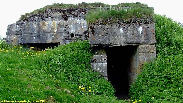
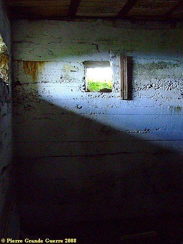
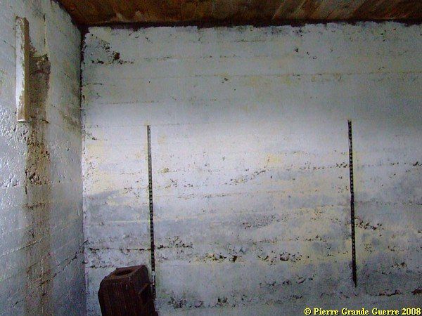
As always, I could not resist to take a look inside the one room bunker.
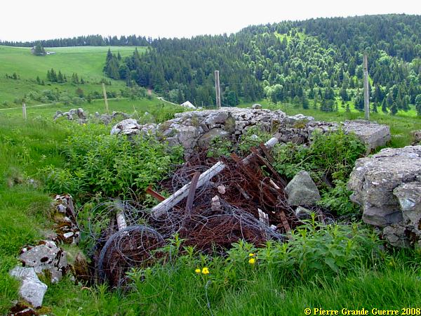
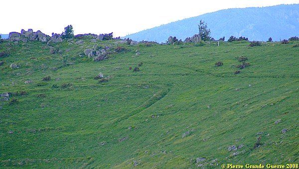
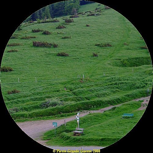
Next to the bunker lie traces of trenches around it.
Farmers use some relics nowadays as fences for their cattle. A former sap, filled with old and modern barbed wire.
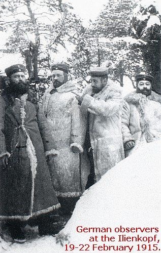
The "Gaede" helmet
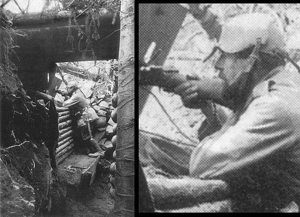
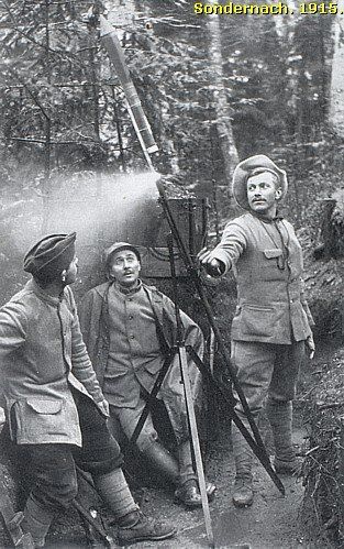
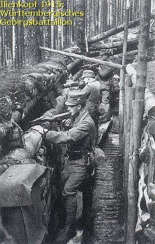
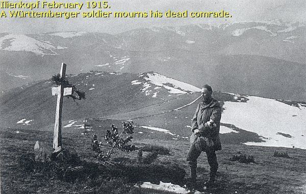
Left: a quite exceptional and most remarkable period picture of a German trench at the nearby Ilienkopf, made in May 1915. Right: a zoomed-in detail of the picture, showing a sentry wearing a steel-foreheadpiece, a "Gaede" helmet .
This Gaede helmet formed the "evolutionary link" between the Pickelhaube and the Stahlhelm. The Gaede M1915 steel headpiece was mounted on a black leather skull cap. The steel plate was 6 mm. thick and the helmet's weight was 2 kilogram.
After waiting for better head protection than the Pickelhaube, the Army Group Gaede's Chief of Staff, Lt.Col. Hesse, ordered the manufacture of 1500 helmets. The helmets were not authorized by the War Ministry, and Hesse almost had to pay for the cost of the helmets himself. So, he stopped the production of the helmets. After the introduction of the M16 Stahlhelm, the Gaede helmets were withdrawn, and most were melted down for their steel.
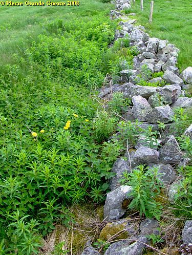
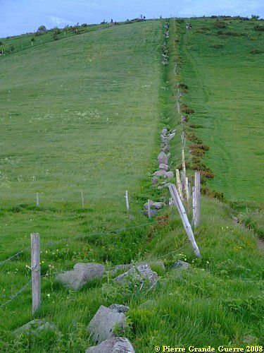
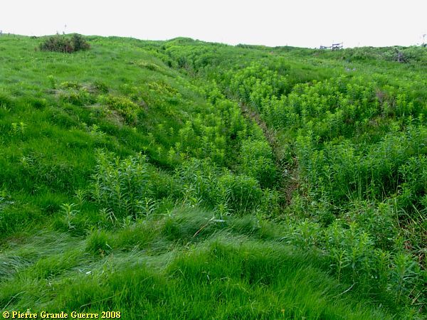
These low, stone walls, follow the trace of a trench, up and downward the slope. This trace goes upward to the north.
Sometimes you will see relics of the barbed wire obstacles of the period.
A panorama view northward.
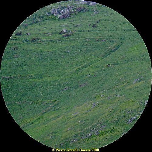
The manmade "grooves" under the rocks on a northwestern slope are traces of trenches.
A tele view to show you these traces even better.
View over the roof of the bunker eastward.
Panorama view more northeastward into the direction of the village of Wasserbourg.

View from north to south. Notice the large shellhole and the "grooves", along the road and upward the slope.
Again some televiews of this location.

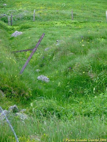
These pictures are made from the ground in these former trenches along the road.

On the southeast corner of the junction, these trenches made a sharp bend eastward.
View northward from the "parapet" of this trench, overlooking three large shellholes.
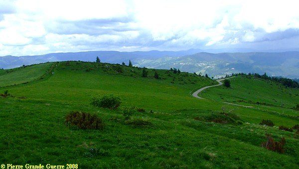
Two panorama views of the breathtaking beauty of the mountain landscape. View into the direction of the Schlucht, le Tanet, and la Gazon du Faing.
Panorama view north-westward into the direction of Munster.
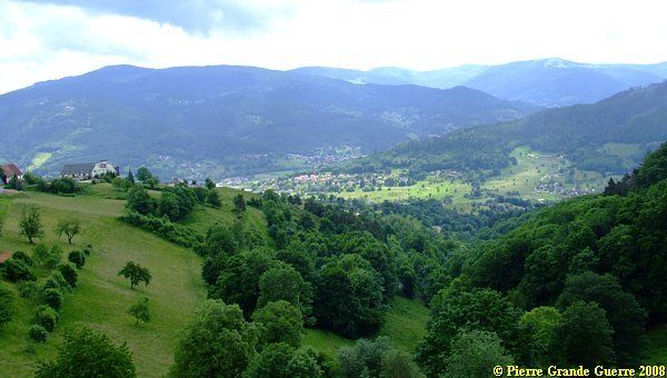
A view over the valley of the Krebsbach and Wasserbourg.
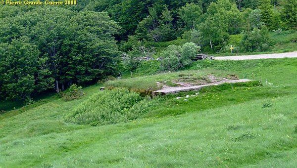
We continue via the D 10 downward to Wasserbourg. After some 2 km. we park our car at a junction of forest roads, where we follow the sign: "Chemin du Schreiplan".
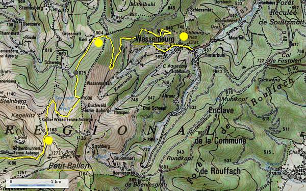
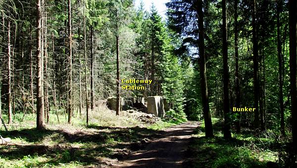
After some 100 m. we find relics of a cableway station and a shelter bunker.
There were three cableway lines running from the village of Wasserbourg to the Petit Ballon - Hilsenfirst sector.
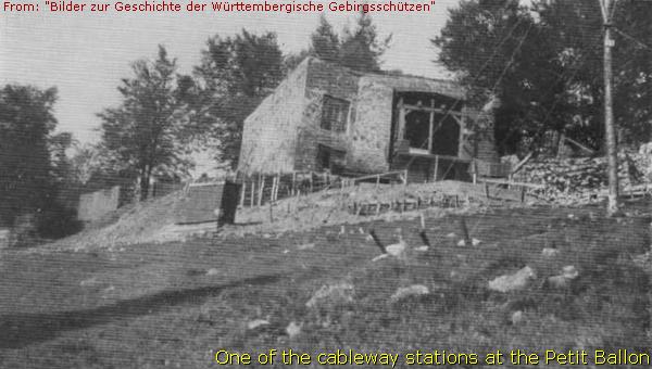
This used to be the second "Seilbahnstation" on a cableway line, ...
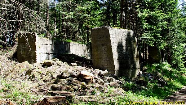
. .. running from Wasserbourg to the Petit Ballon.

At the lower verge of the forest road, opposite this Seilbahnstation, ...
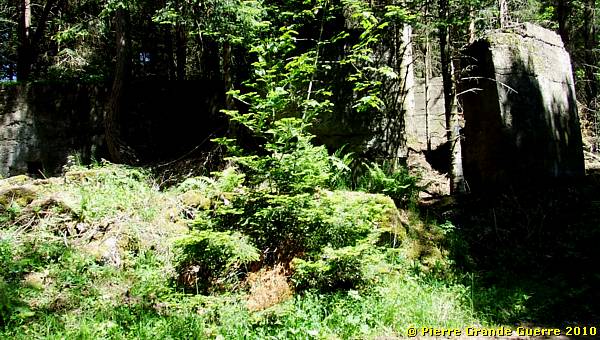
... stands this shelter bunker.
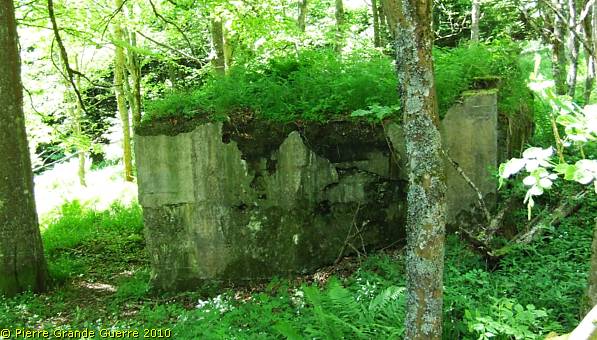
The soldiers of the Armierungsbataillon left their signature:
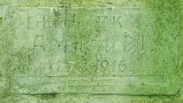
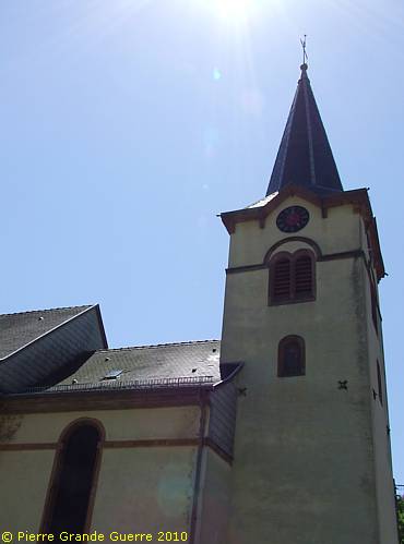
We continue to Wasserbourg . At the entrance of the village we find a small bridge with an interesting, German inscription in the left wall.
Behind this village church used to be the first Seilbahnstation. Nowadays the site is covered by a private villa and garden.
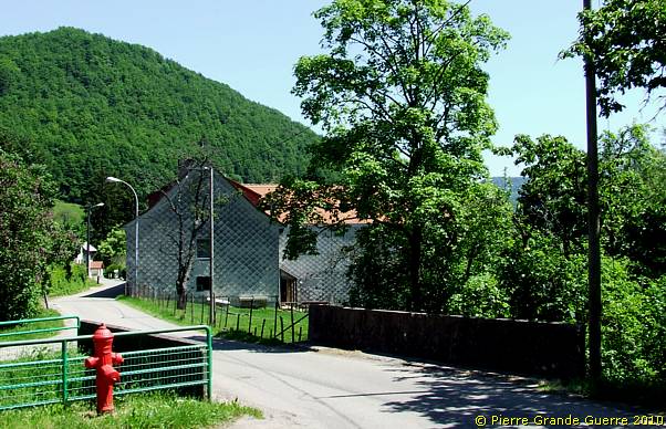
From Wasserbourg we leave via the meandering D 43 northward. Before entering Soultzbach, we go to the right, and we continue southward via the D 40 to Soultzmatt.
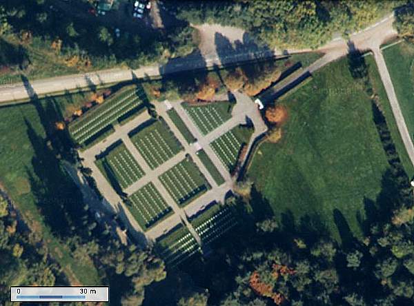
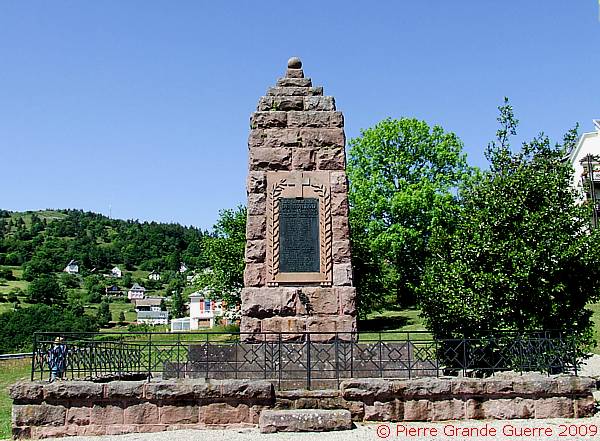
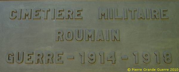
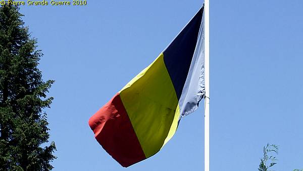
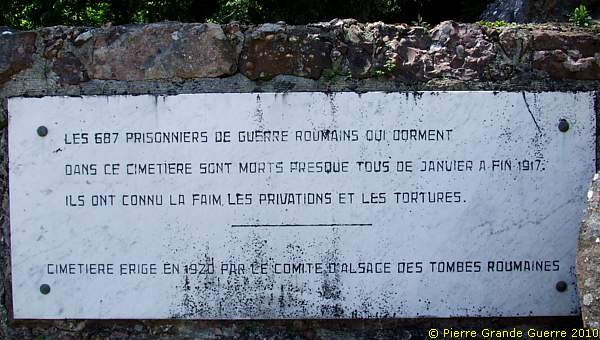
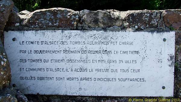
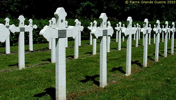
At the western outskirts of Soultzmatt we visit a rather remarkable Military Cemetery: the Romanian Military Cemetery of Soultzmatt .
Of the more than 100.000 Romanian Prisoners of War, ...
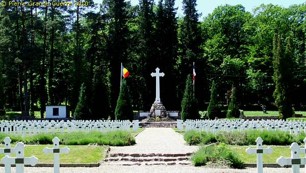
... many Romanian soldiers were transported from Romania to P.O.W. camps in German states like Alsace-Lorraine.
These 687 Romanian soldiers, buried here, were made Prisoner of War during the Romanian Campaign.
The Gauchmatt POW camp at Soultzmatt
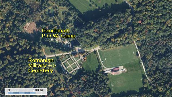
Soultzmatt knew, like other villages in this
region, it's own POW labour camp nearby this location; Gauchmatt. The
Gauchmatt POW camp was situated on the northern side of the D 43,
opposite the cemetery.
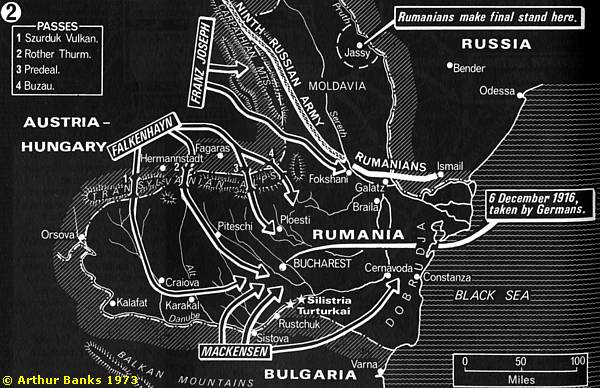
The Romanian Campaign; August - December 1916
Romania attacks Transylvania and parts of
Hungary

On 27 August
1916 Romania declared war at Austria-Hungary and the other Central
Powers of Germany and Bulgary. On the night of 27 August, three
Romanian armies, the First, Second and Northern Army, were deployed
according to the Romanian Campaign Plan (The "Z" Hypothesis).
The armies launched attacks through the Carpathians and into
Transsylvania. Initially the only opposing force was the
Austro-Hungarian First Army, which was steadily pushed back toward
Hungary. However, the rapid Romanian advance alarmed the Central
Powers. Sizable German forces began arriving at the scene. The
Austro-Hungarians also sent four divisions to reinforce their lines,
and by the middle of September, the Romanian offensive was halted. The
Russians loaned them three divisions for operations in the north of
Romania, but otherwise very few supplies.
Counter
Offensive of the Central Powers; the Romanian Campaign
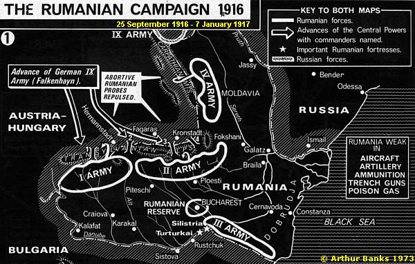
From 25 September the Central Powers launched a successful counter offensive, the Romanian Campaign, over the Carpathians and Transylvanian mountains at Romania, which culminated with the conquest of Bucharest on 6 December 1916. The fights would go on until 7 January 1917.
Romanian Casualties
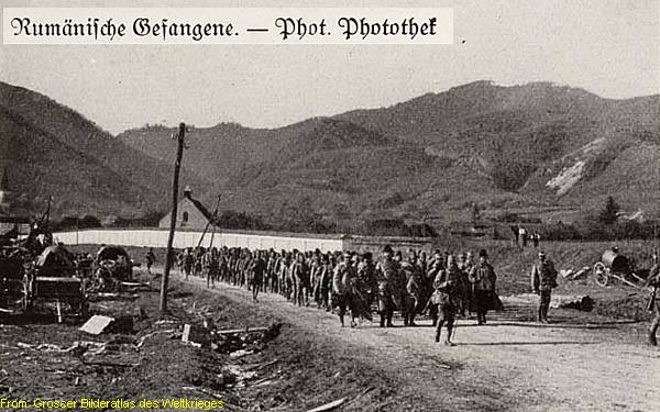
The total of Romanian casualties of this campaign is estimated at 250.000 men.
According to German sources of the period the Romanians lost at least 774 Officers, 107.900 P.O.W.’s , 448 artillery guns, and 186 machine-guns. According to other sources the number of fallen Romanian soldiers is estimated on a number between 75.000 and 100.000 men.
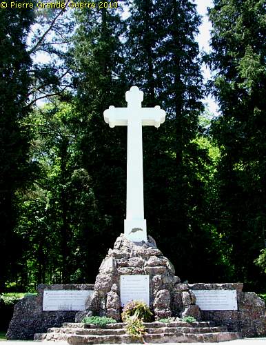
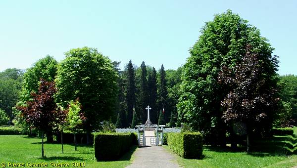
The plaques below this Byzantine Cross tell a tragic story about the historical background of this cemetery.
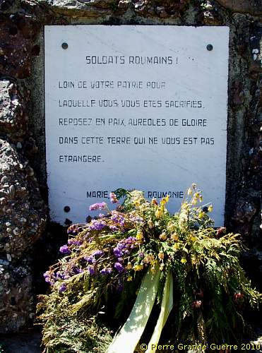

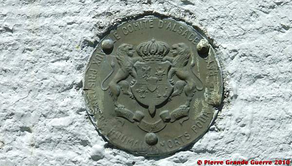
All graves bear this medallion of the Committee of Alsace for the Romanian Graves:
Another victim of 28 January 1917.
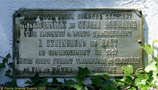
In a communal grave rest here 71 Prisoners of War.
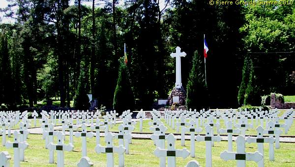
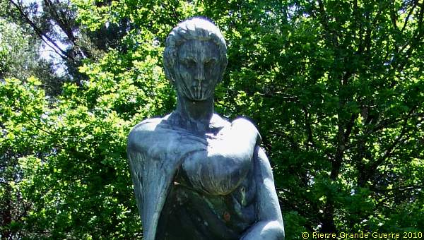
A statue, representing a Romanian, grieving mother, ...
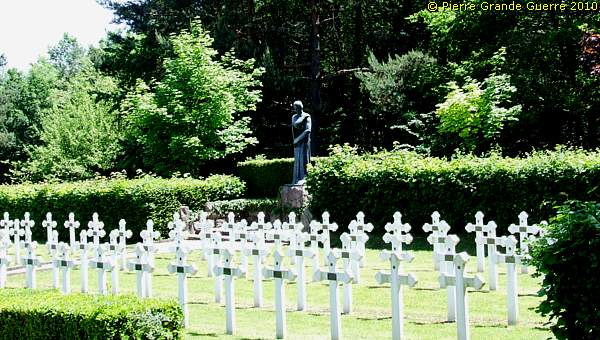
... oversees the southern plot of the cemetery.
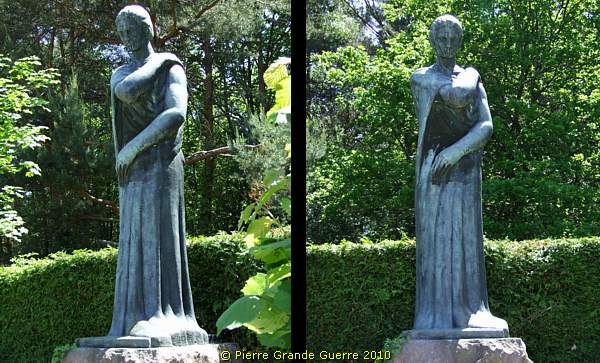
This close-up of this impressive statue forms the last photo of this photo impression about the Munster valley.
Continue to the next chapter: " Le Tanet - Bichtstein - Villa Sidi-Brahim "


