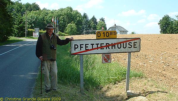
ALSACE SUNDGAU - Zillisheim - Illfurth - Largitzen - Pfetterhouse
Year of visit: 2009, 2010
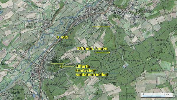
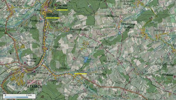
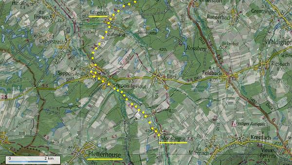
A photo report of our explorations of the front lines in the Sundgau region, Département Haut-Rhin. South of Mulhouse, west of Basel, east of Belfort, the Sundgau forms the most southern sector of the Western Front, which ends in the valley of the Largue river. We make a trip southward from Mulhouse to Pfetterhouse on the Swiss border. We start at Zillisheim to visit it's German 380 mm. artillery base. From there we continue to to the Illfurth Deutscher Soldatenfriedhof. Next we continue to Tagsfort, the "Bismarck" bunker near Largitzen, and to Mooslargue.
From there we make a jump westward to Etupes to visit the grave of Caporal Peugeot, and his Site of Action at Joncherey. This photo impression ends with the last French bunker, "Villa Agathe", near Pfetterhouse and the last German bunkers at the southern end of the Western Front.
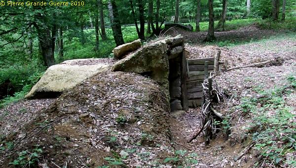
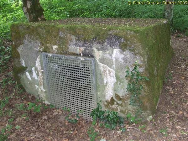
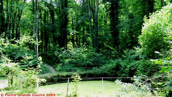
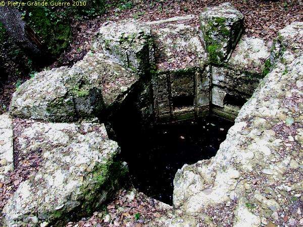
We start our trip at the site of the Zillisheim 380 mm. German Artillery Base. South of Mulhouse and south of the village of Zillisheim, ...

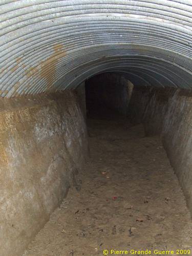
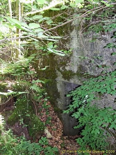
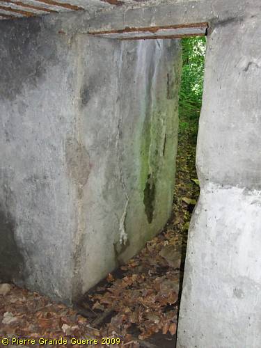
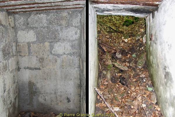
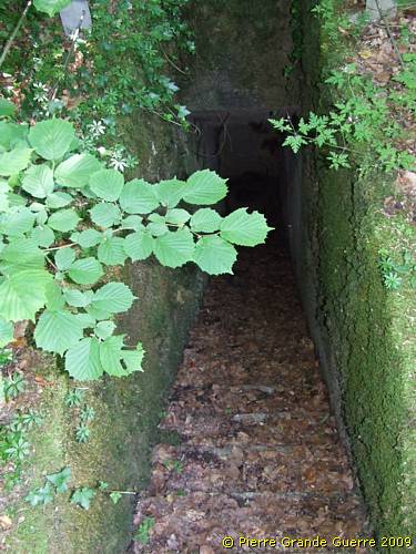
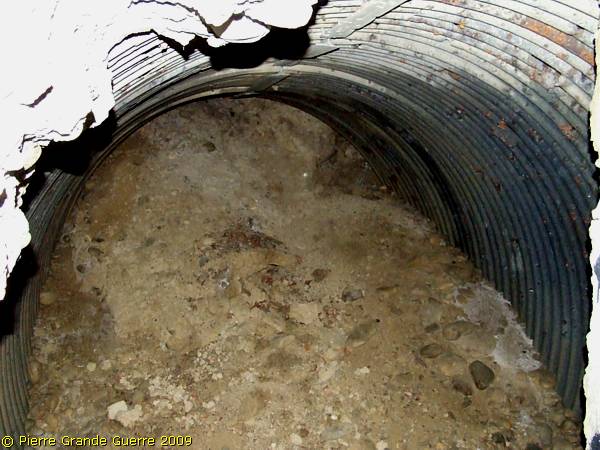
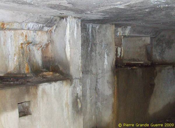
In the wood we walk along entrances of the underground tunnels, ...
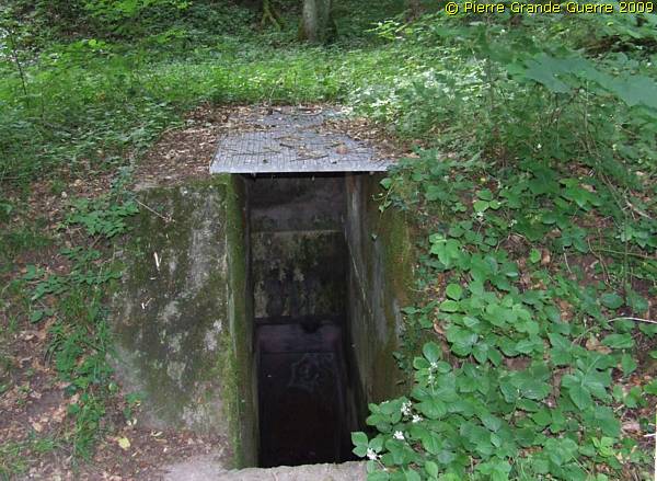
One of the entrances, a staircase leading down to a tunnel.
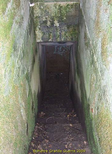
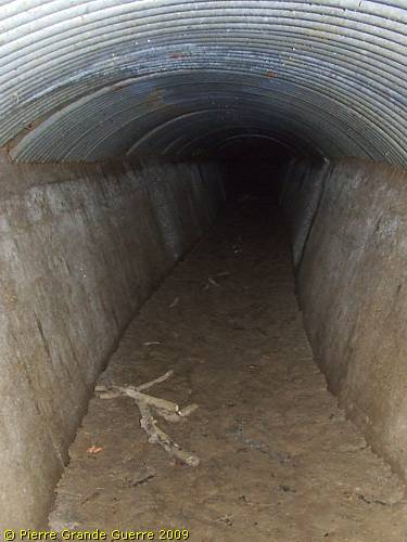
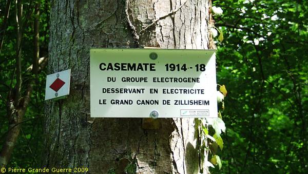
... to the 380 mm. gun.
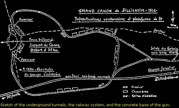
Some details about the 380 mm. artillery gun

Calibre: 380 mm
Barrel length: 19,6 m
Range: 56 Km
Muzzle velocity: 1050 m/s
Weight of Gun in action: 24 Tons
Weight of shell: 495-800 Kg
Rate of fire: 1 round every 4 minutes
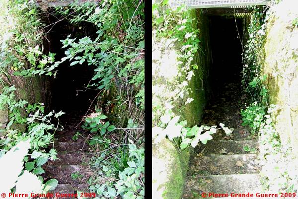
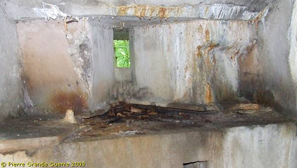
Entrances to the tunnels of the former ammunition elevators.
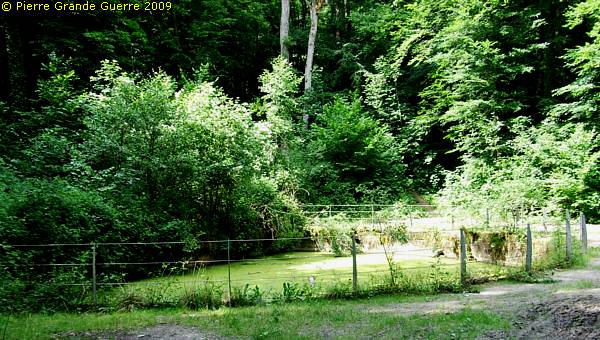
This complex needed of course a lot of power.

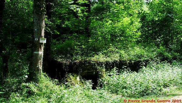
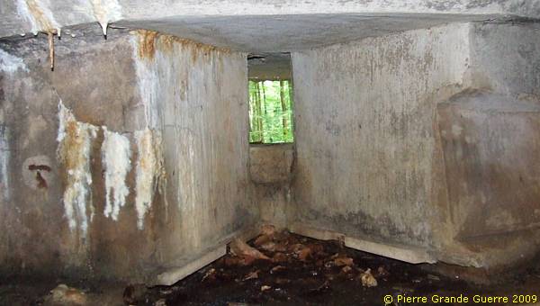
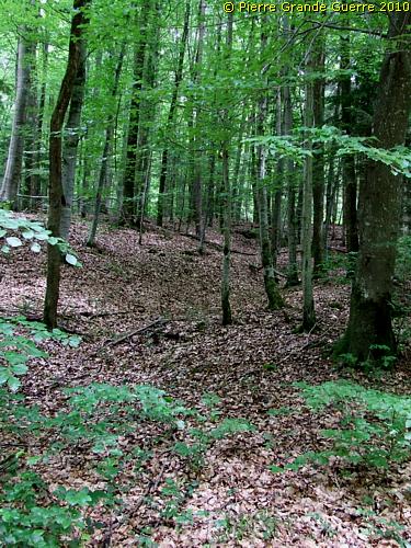
The bunker is densely vegetated, ...
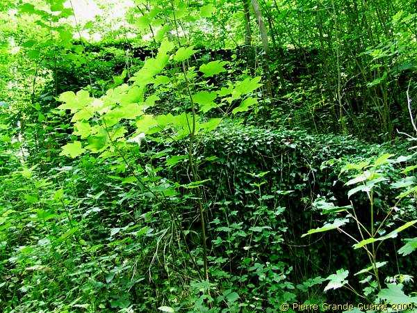
... which makes it difficult to find the entrance.
We leave the bunker via another exit.
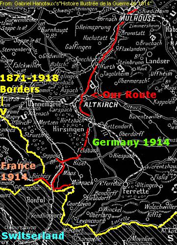
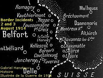
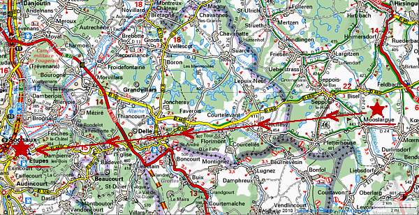
Sundgau - 1914
From 1871 until 1918 the Sundgau belonged officially to the German Empire. This re-edited detail of a 1917 German sketch shows these borders. It also sketches the frontlines formed in the summer and autumn of 1914, and which would stay in this situation until 1918. The border lines of Switzerland, France and Germany came together at one point east of French Réchésy and west of German "Pfetterhausen" or nowadays Pfetterhouse.

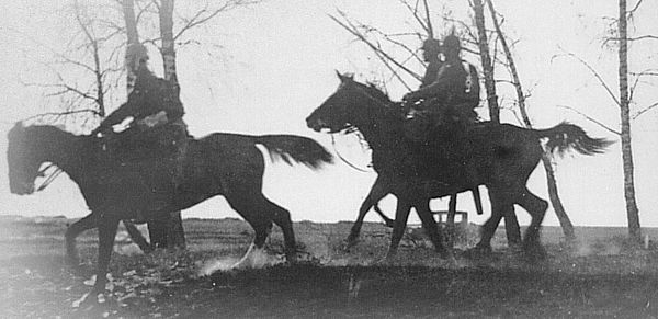
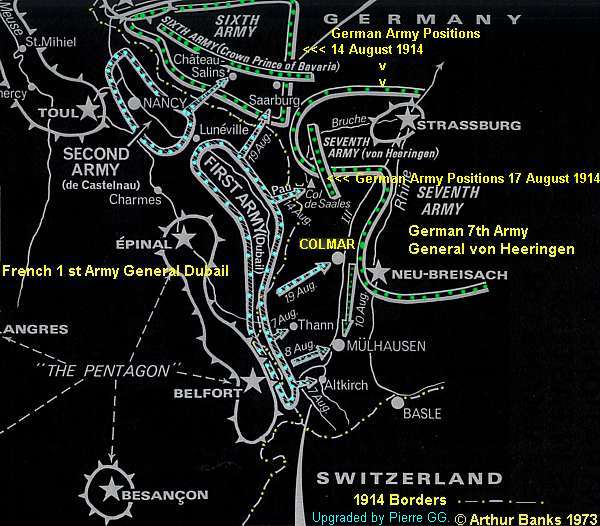
On 31 July 1914 the 142nd Infantry Regiment occupied with outposts the area along the line Cernay (Sennheim), southward to Dannemarie (Dammerkirch), and the Swiss border. The cavalry regiments and mounted riflemen reinforced the customs officials and patrolled in this border area.
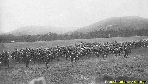
According to the French Plan XVII the original mission of the 7th Army Corps was to cover the mobilization of the fortress of Belfort, the railroads to Paris, and the high passes of the Vosges. Bonneau positioned the 41st Infantry Division in the Northern and Central Vosges, the 14th Infantry Division under command of General Curé between the Vosges mountain chain and the Rhine-Rhône channel, the 8th Cavalry Division plus a battalion of the 44th Infantry Regiment under command of General Aubier between the Rhine-Rhône channel and the Swiss border.
On 7 August 1914 General
Bonneau launched his 7th Army Corps to
attack Altkirch. The next day, on the 8th,
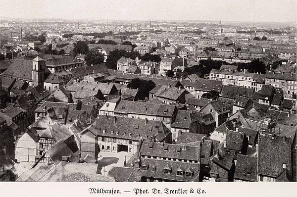
the French attacked and occupied Mulhouse
without any opposition, because the German
troops had left the town before. With the
arrival of German reserves from Strasbourg, the
Germans launched on 9 August a counter-attack at
nearby Cernay. On the same day Bonneau began a
slow withdrawal, forced by the absence of
reserves of his own, and unable to mount a
concentrated defence.
Joffre hastily
despatched a reserve division to reinforce
the defence. The division arrived too late to
save the town from recapture. On 10 August
Bonneau retreated on Belfort in order to escape
German encirclement. Joffre promptly fired
Bonneau of his command and send him to Limoges.
Recognising the high amount of casualties,
Joffre added four more divisions to
the “Army of Alsace”', and placed it under
the command of General Pau.

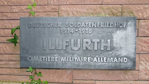
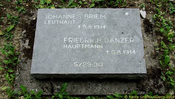
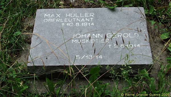
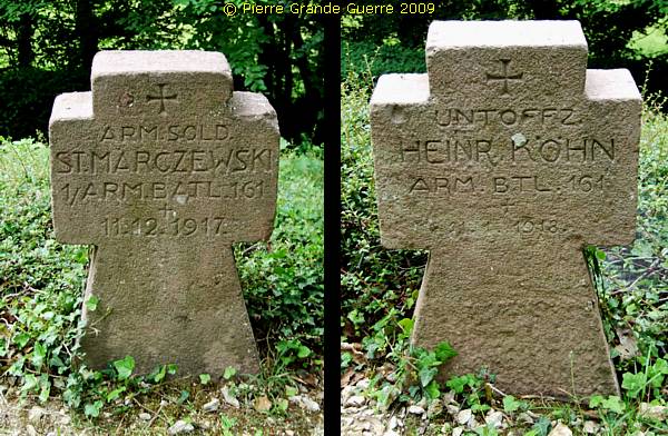
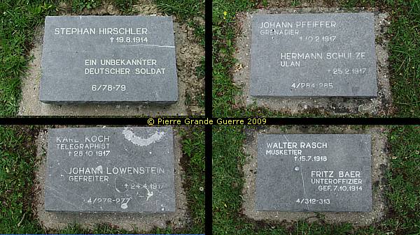
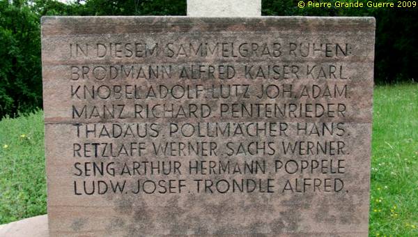
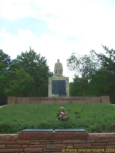
The Illfurth Deutscher Soldatenfriedhof contains the graves of 1.964 German soldiers and officers, fallen during the Great War. 1.426 of these soldiers rest in individual graves, 7 of them are unknown; 539 soldiers rest in a mass grave, of whom 520 are unknown.
The cemetery itself is of April 1920. The soldiers, buried here, were originally buried elsewhere; in 64 other, sometimes improvised, war cemeteries in the Sundgau region. During the years 1920-1924 their corpses have been brought over to Illfurth cemetery.
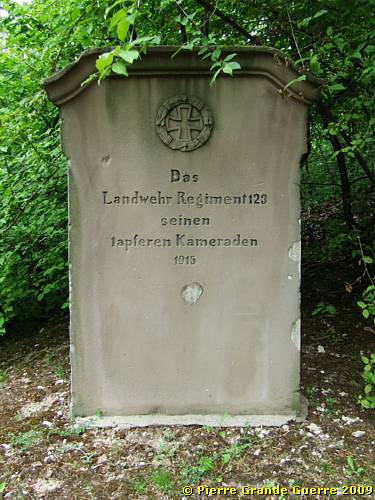
Some of the unit memorials on the cemetery are also transported from former wartime cemeteries.
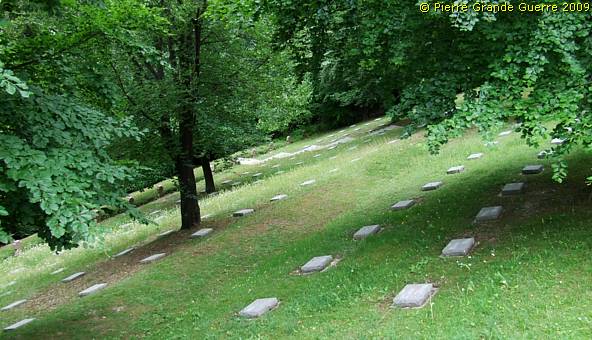
The cemetery is located at a rather steep slope of a hill.
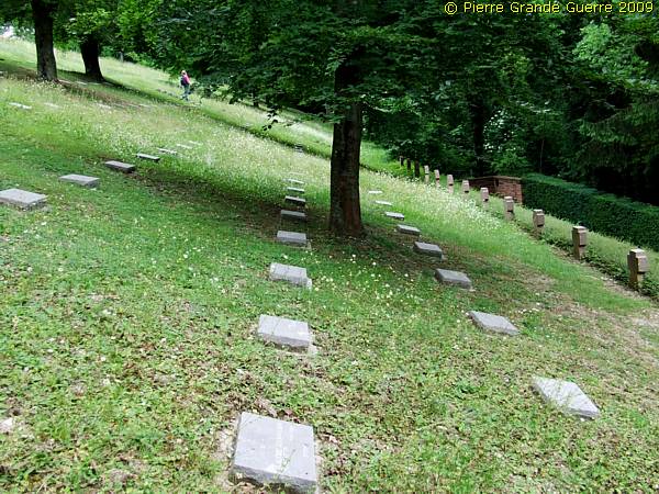
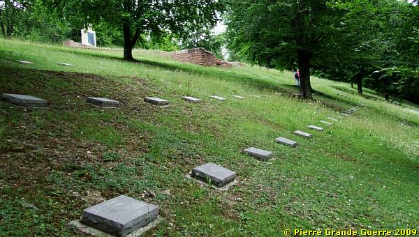
More upward the hill: more graves of 1914 to 1918.
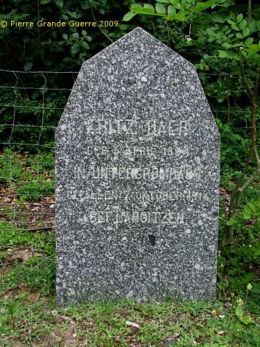
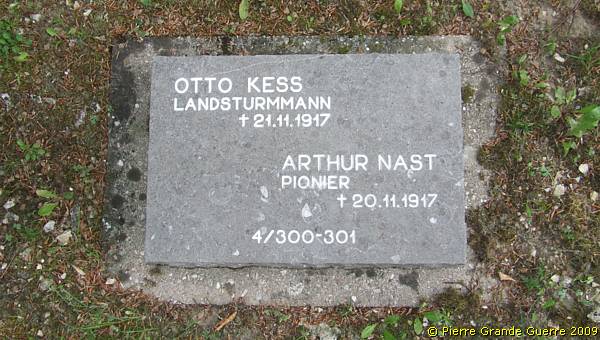
There is also a private memorial for Fritz Baer.
A Pionier and a Landsturmmann share this grave.


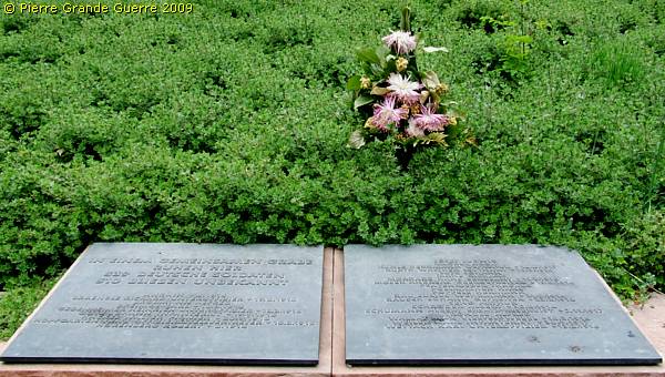
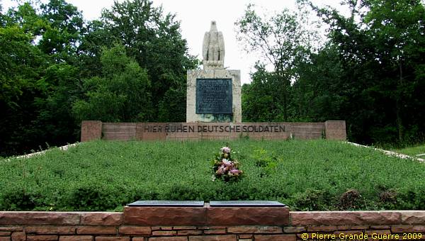
There are only two bronze tiles commemorating 539 soldiers.
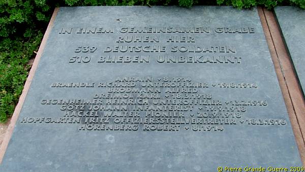
On this mass grave an exceptional short list of 29 names.
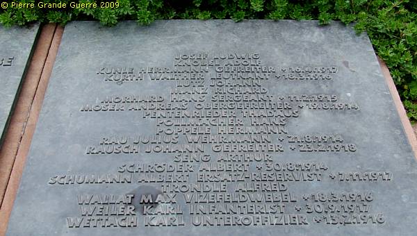
An inscription on the side of the rear wall tells more names.
Near the mass grave lies a quite remarkable grave.


The bronze plaque of the "Illfurth Fliegerdenkmal" tells us:
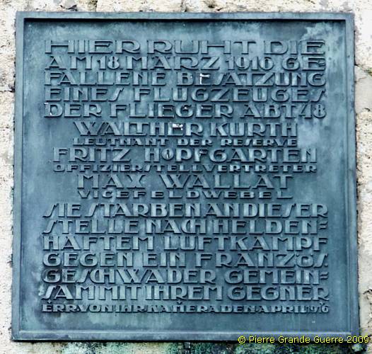
| "HERE REST THE ON 18
MARCH 1916 FALLEN TEAM OF AN AIRPLANE OF THE
"FLIEGER ABTEILUNG 48".
WALTHER KURT - RESERVE SECOND
LIEUTENANT
FRITZ HOPFGARTEN- DEPUTY
OFFICER
MAX WALLAT - STAFF
SERGEANT
THEY DIED ON THIS LOCATION
(
Remember:
Habsheim! )
AFTER A HEROIC AIR COMBAT AGAINST A
FRENCH SQUADRON TOGETHER WITH THEIR
OPPONENTS
ERECTED BY THEIR COMRADES
APRIL
1916"
|
... to continue southward to Tagsdorf .
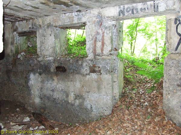
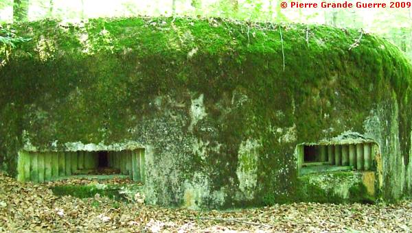
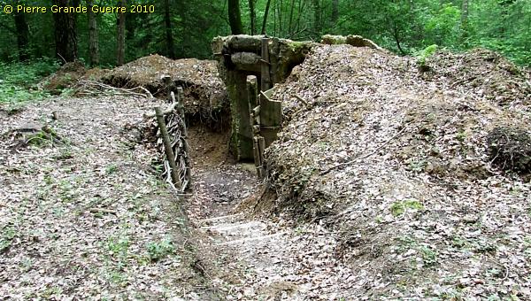
In a private backyard, behind a fence, we locate this third line 1918 Bunker.
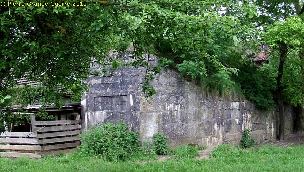
A teleview through the fence tells us more about it's constructors.
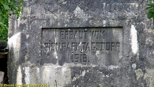
This is the only relic of the "Pionierpark Tagsdorf", ...
... a complex for storage of construction material and explosives.
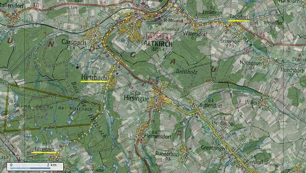
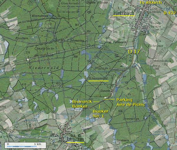
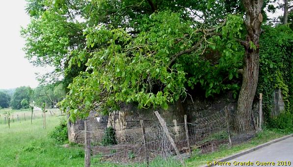
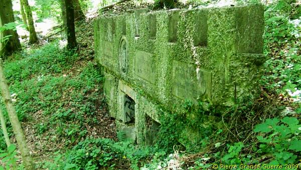
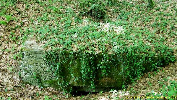
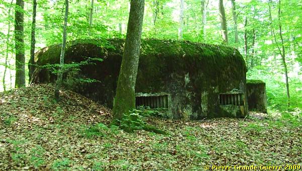
In the "Schutzenwald", about 1.500 m. before we enter the village of Largitzen, we park our car safely at the Aire de Picnic at the west side of the road, ...
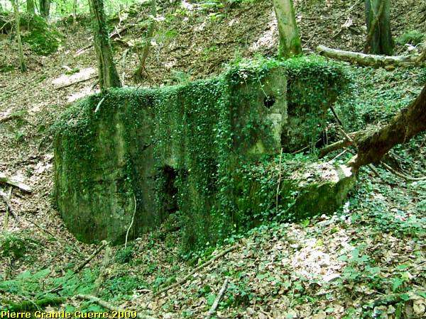
... we walk some 100 m. southward, and we spot at the eastern side of the road this German bunker.
|
Sundgau - August -
September 1914
|
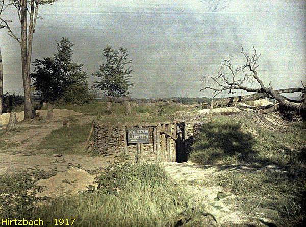
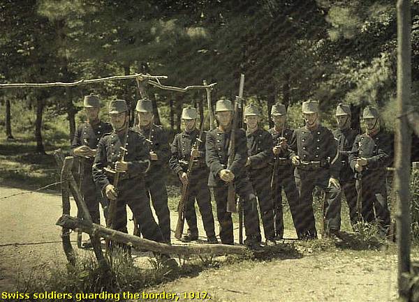
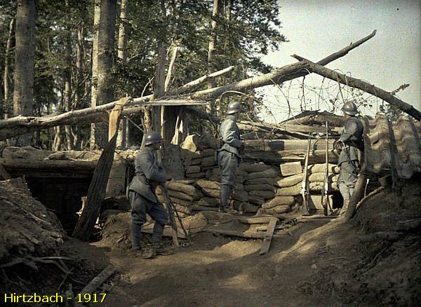
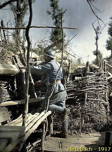
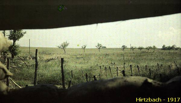
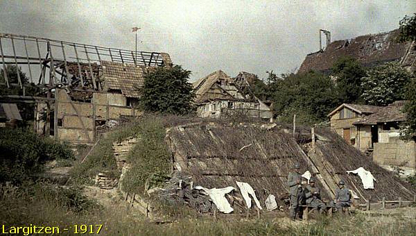
| The French period colour
photos in this frame give us an impression of
the French positions near Hirtzbach and
Largitzen in 1917. We are now only visiting some
bunkers at the German side of the Largue front
between Hirtzbach and Largitzen.
|
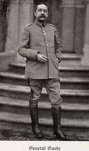
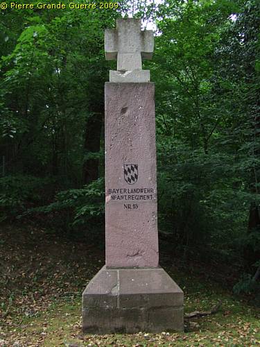
On 14 August 1914 the XIV Army Corps and the XV Army Corps were ordered back to Strasbourg, to be deployed elsewhere with the 7th German Army. These troops were replaced by an “Armeegruppe Gaede” of 5 reserve brigades under command of General Gaede, consisting of 21 infantry battalions, 5 cavalry squadrons, and 10 batteries of artillery .

From 10 August General Pau commanded the 7th Army corps, which consisted of the 8th cavalry division and the 57th reserve division of Belfort, 3 extra reserve divisions, the 58th, 63rd, and 66th division, the 44th infantry division, and 5 battalions of Chasseurs Alpins. In total General Pau commanded about 150.000 men, called the “Armée d’Alsace” or “7th Army”.
The 7th Army was in need of immediate re-enforcements. But at 24 August the “Armée de l’Alsace” had to give up again the town and the surroundings of Mulhouse. Joffre decided that the 7th Army had to give up and to retreat back to the ridges of the Vosges mountains.
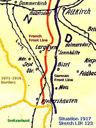
From September 1914 the French troops were staying on German territory along the east bank of the Largue river, between Altkirch, Hirtzbach, Largitzen. Near Seppois the front crosses the Largue and runs southward at Pfetterhouse. From there the French were on the west bank, and the Germans were positioned at the east bank of the Largue. The front in this Largue sector, also called the Largue pocket, would consolidate in this situation until the end of the war.
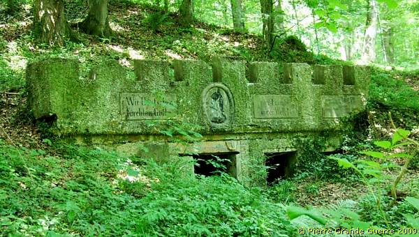
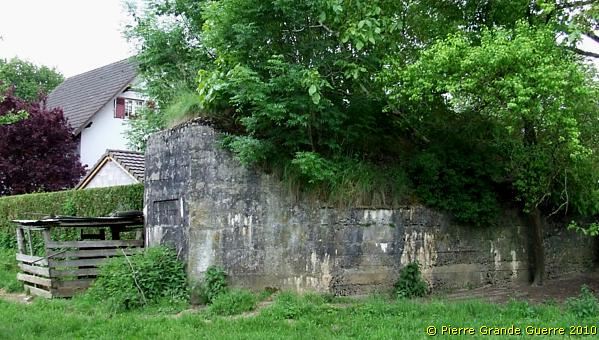
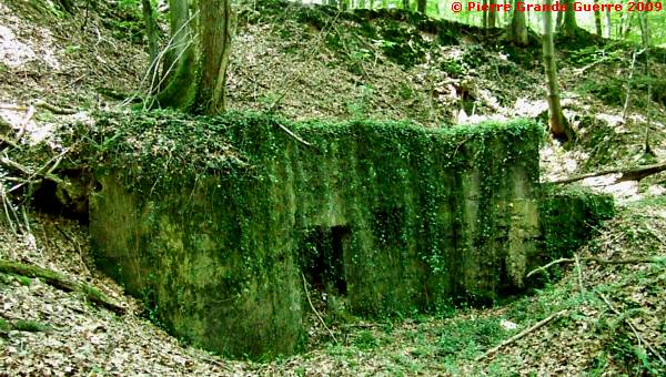
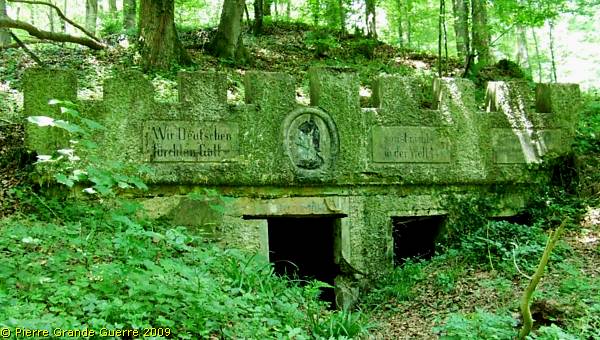
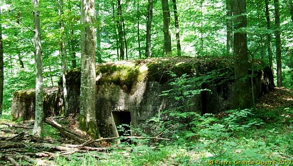
... "The Iron Chancellor", Graf Otto von Bismarck (1815-1898):
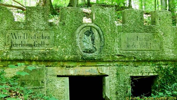
The damaged bas relief in the middle of the two inscriptions represents a portrait of Bismarck.
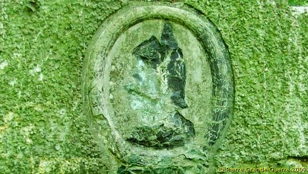
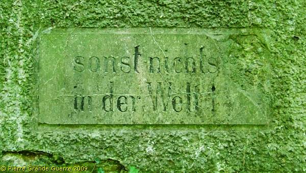
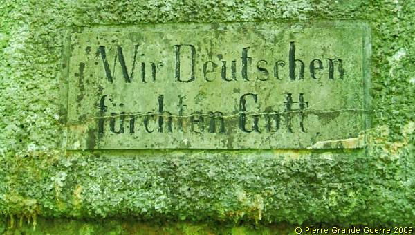
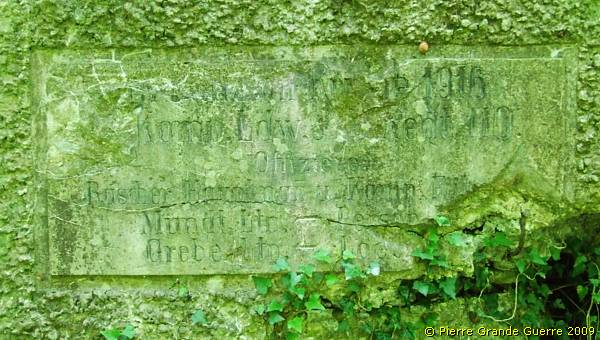
The constructors of the bunker left a damaged inscription:

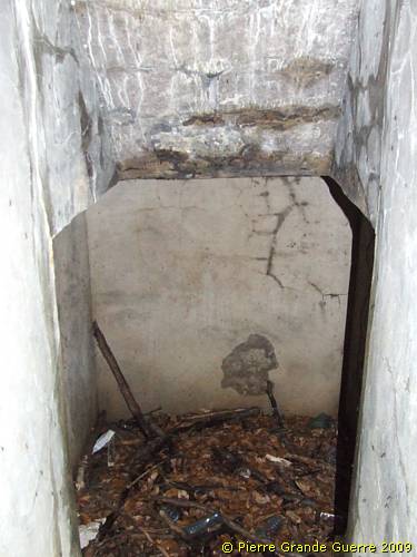
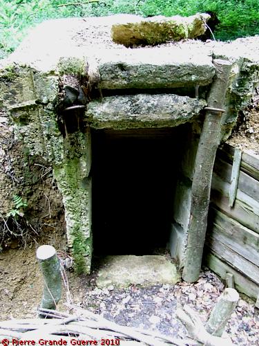
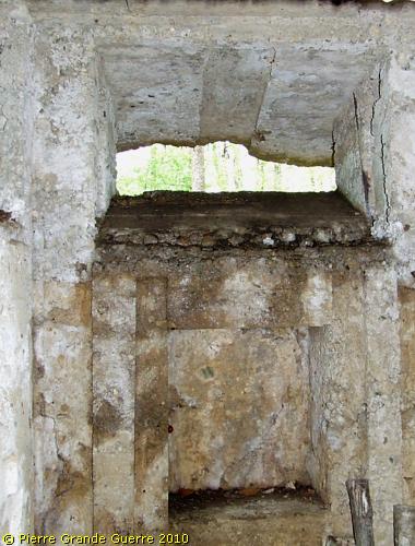
As always, I am curious. So, I enter the bunker.
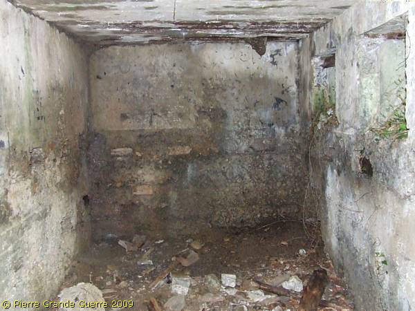
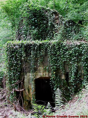
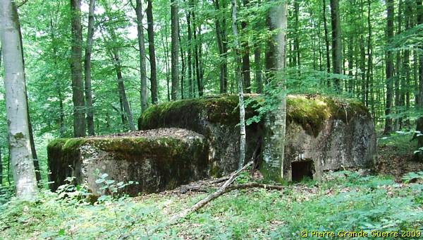
A filled in tunnel to other underground rooms.
View at the windows and the entrance.
The top structure of the bunker is overgrown.
Even trees and their roots grow on top of the Bismarck bunker.
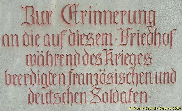
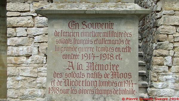
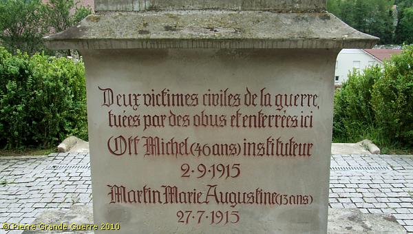
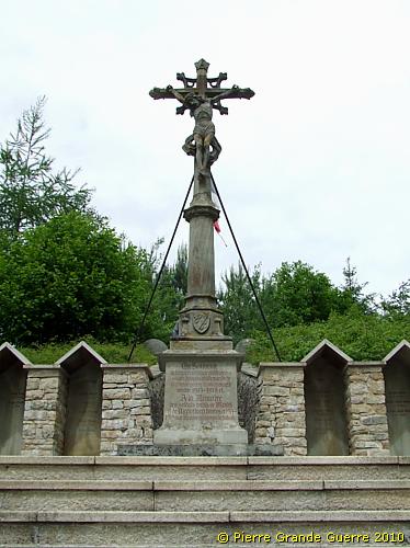
Behind the village church of Mooslargue and the communal grave yard....
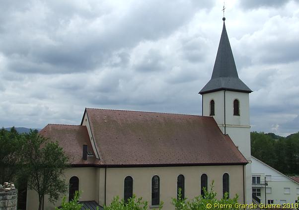
... used to be a wartime Franco-German military cemetery.
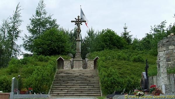
In two languages the base of the crucifix tells us more about this site.
Another side of the base tells in French:

From Mooslargue we make a huge jump westward to Etupes...
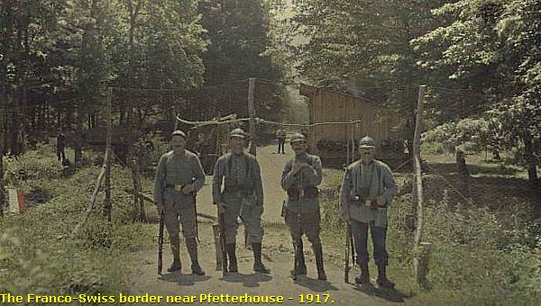
... to follow next the Franco-Swiss border back to the east.
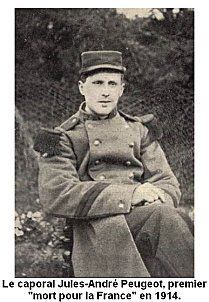
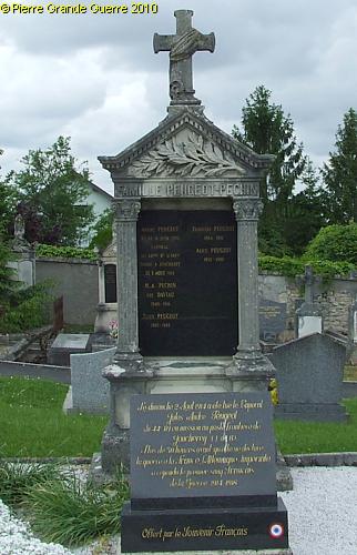
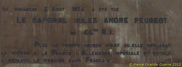
Caporal Jules André Peugeot
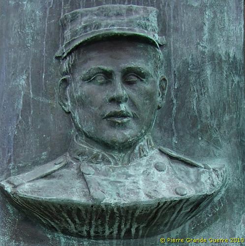
Next we will visit three sites, which are connected to the death of Caporal Peugeot, opponent of Leutnant Mayer, and the first killed French soldier of the Great War. We will visit his grave at Etupes, his memorial at Joncherey, and the site of the killing, as I have concluded it from my sources.
Etupes
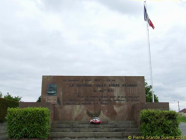
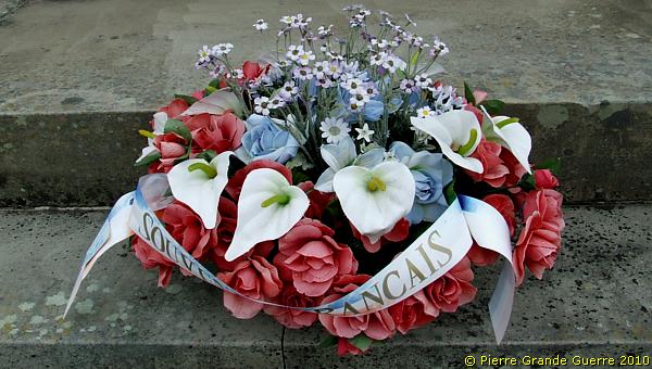
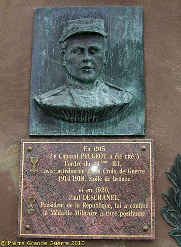
At the communal cemetery of Etupes we visit at the modest military plot the grave Caporal Peugeot.

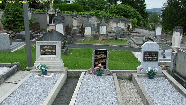
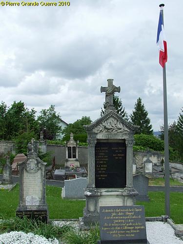
Plot 4, grave 181.

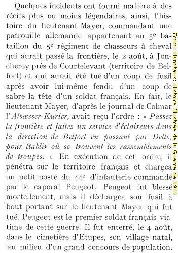
Did Caporal Peugeot really kill Leutnant Mayer?
The historian Hanotaux and the
war journal of the 2nd Battalion of the 44e R.I.
tell us each a different story about the dead of
Leutnant Mayer and Caporal Peugeot.
According
to Hanotaux’s official French history Leutnant
Mayer was hit by a rifle shot in the head, after
he managed to hit the head of a soldier with his
sword. Mayer and his 7 Jäger zu Pferde of the
3rd Battalion of the Jäger-Regiment zu Pferde
Nr. 5 crossed the border to patrol and to scout
the area. They attacked the post of Caporal
Peugeot. Peugeot was deadly wounded, but he
still managed to fire his rifle "at short range"
and killed Leutnant Mayer. Soon afterwards
Peugeot died himself.
So, in this “official”
version Hanotaux tells us that Caporal Peugot
killed Leutnant Mayer.
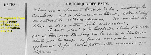
Caporal Peugeot is killed by a revolver shot by the chief of the patrol, on whom he fired, but did miss. The (men of the) post and also the post next to it did hear the rifle shots, and start to fire at the horsemen, who try to spread out, and they kill the Lieutenant, chief of the patrol, and 2 horses. One horseman is wounded and two others are made prisoner. The post, which was set up at a barricade at the east exit of the village of Joncherey along the route to Faverois, opens, alarmed by the rifle shots at this post, equally fire at the enemy patrol, which disappears.”
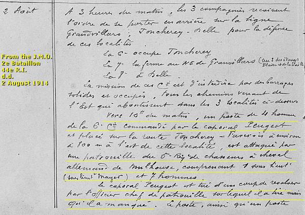
In the version of this French
war journal Peugeot fired a shot at Mayer, but
missed.
It was Leutnant Mayer, who
killed Caporal Peugeot with a revolver shot.
Other soldiers of the 44e R.I. killed
some moments later Mayer.
Peugeot was the
first soldier, killed in the Great War. Mayer
was the second soldier, but still being the
first killed
German
soldier.
Anyway, French after war mythology or not,
Caporal Peugeot still shares the disputable
honour of the German Leutnant Mayer to be the
first and
French
fallen soldier
of the Great War.

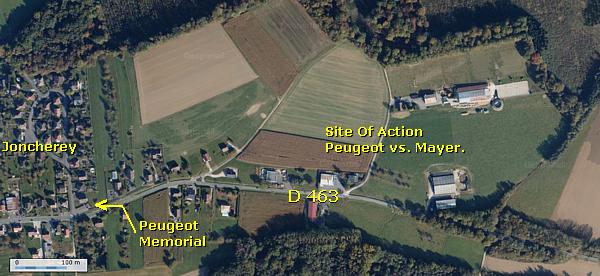
From Peugeot's grave we continue eastward to Joncherey ...
... to visit his memorial and the site of action.
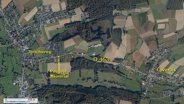
First we visit the Caporal Peugeot Memorial .
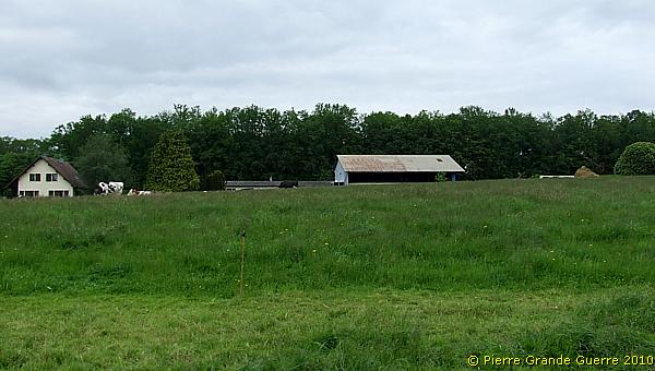
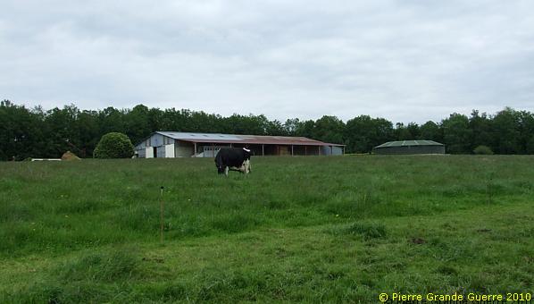
Site of Action - Peugeot versus Mayer
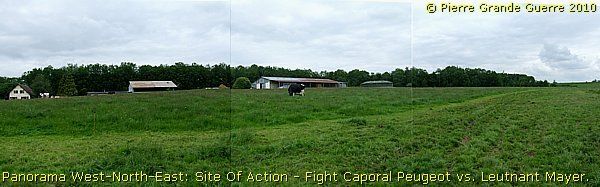
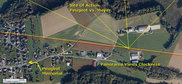
Five overlapping photos of the Site of Action of the fight of Peugeot and Mayer.

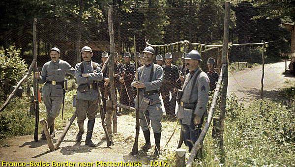
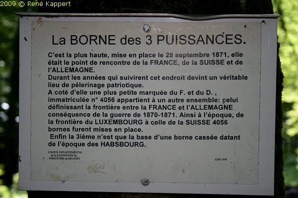
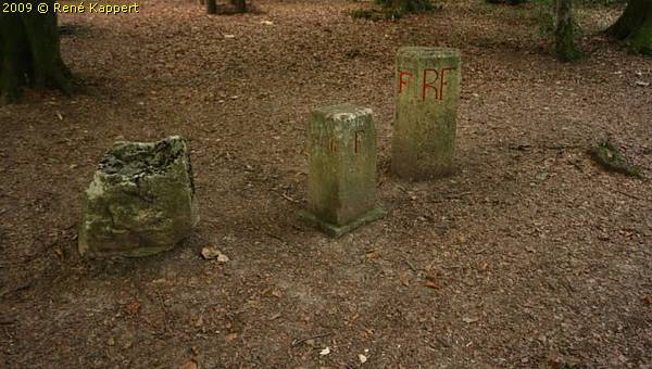
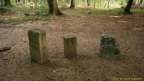
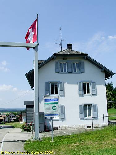
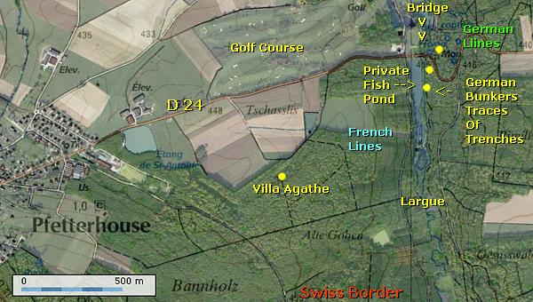
From Joncherey we continue via Réchésy to the location, where the former borders of three states met each other.
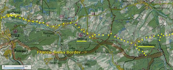
| In the area close
to the Swiss border we will visit the
" Borne des Trois Puissances
" (Boundary Stone of
the Three Powers), the Franco-Swiss border
post, the last French bunker of the Western
Front, the " Villa Agathe
", and on the eastern
bank of the Largue river, the Last German
trenches
and bunkers, which are all a few
hundred meters away from the Swiss
border.
To complete the impression of
the border area my Dutch friend, René Kappert
,
came to my assistance and did provide me
with some of his photo's of the "Borne des Trois
Puissances". René also let me use some
carefully self-made maps of the Villa Agathe
Bunker. Thanks, René!
|
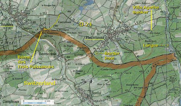
The village of Réchésy.
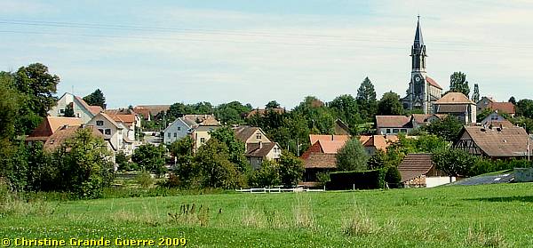
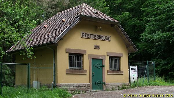
Réchésy and Pfetterhouse

Before August 1914 Réchésy was
a French village, and Pfetterhouse was a
German village; Pfetterhausen. The Franco-German
border lied in between these villages. The three
borders of Switzerland, Germany, and France did
meet together half way Réchésy and
Pfetterhausen.
Réchésy - The
intelligence service of Pierre
Bucher
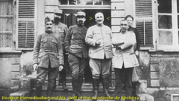
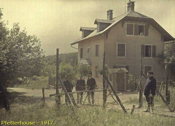
Docteur Pierre Bucher set up a military intelligence centre in a villa at the outskirts of the village of Réchésy, called the “Académy de Réchésy”, a few hundred meters away from the three borders location. Bucher’s staff observed and reported not only the military operations and troop movements of the German army units, but they also eagerly collected intelligence about the movements of the Swiss army units along the border. Pierre Bucher was awarded for his services with the decoration of the Légion d’Honneur.

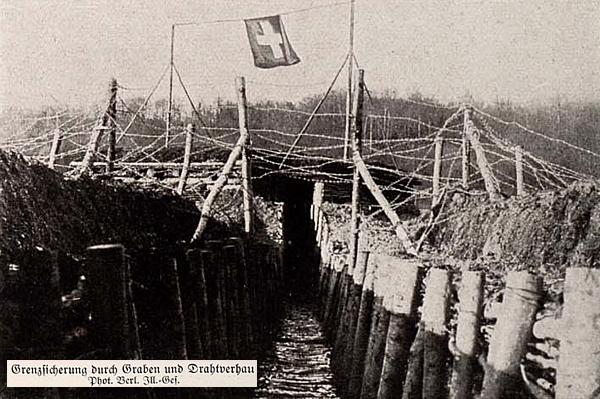
Already on 7 August 1914, during General Bonneau’s first attack on Mulhouse, about 400 infantry and cavalry soldiers under command of Dragoon Sergeant Grünfelder attacked successfully the German units at Pfetterhouse. That day the French counted four dead. The Swiss authorities immediately closed down the frontier.
In spite of two following retreats the French were later able to hold the position east of Pfetterhouse on to the west bank of the Largue river. From October 1914 the 55e Régiment d’Infanterie Territoriale (55e R.I.T.) under command of Commandant Fleutiaux occupied the area around Pfetterhouse. From the end of December 1914 the 55e R.I.T. mainly occupied the west bank of the Largue. The German soldiers were positioned at the east bank of the Largue.
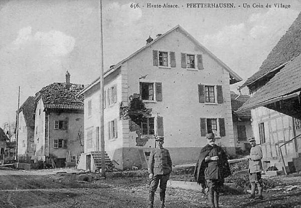
During the war years skirmishes and bombardments would go on in this sector. In February 1916 Pfetterhouse and surroundings even suffered a German artillery bombardment, which lasted for more than a week. During these bombardments the population of the village has been evacuated to Montbéliard. In spite of these violent events the End of Western Front near Pfetterhouse would freeze in the same situation until 1918, as it was in December 1914.
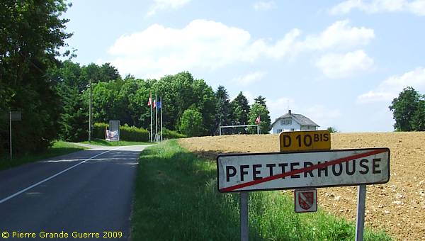
By many this location is considered as the end of the Western Front.
But in fact it is not the exact southern end of the Western Front.
A view from the border to the outskirts of Pfetterhouse.
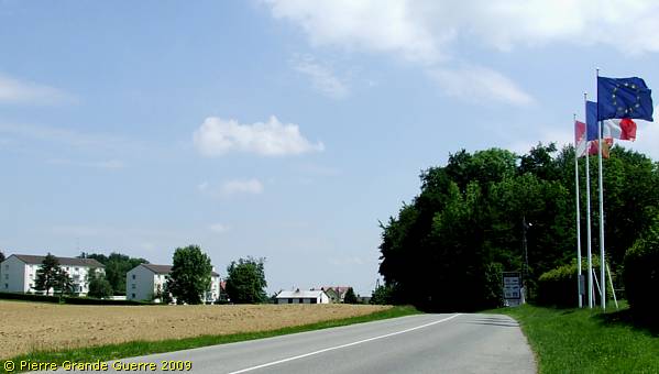
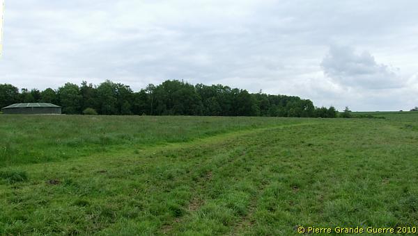
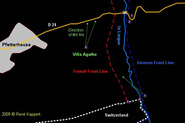
We leave Pfetterhouse and continue eastward along the D 24.
About 500 m. outside the village is a track leading southward.
Just as a reminder: again the situation map.
René measured the bunker precisely and made this ground plan.

The rear side, photographed from the west.
The staircase at the entrance.
The northern wall.
The fire windows facing the north.
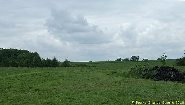
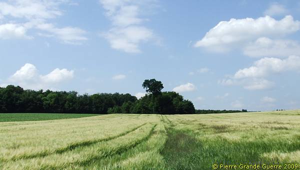
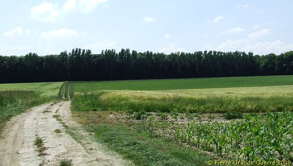
With a last view at the field before the Bannholz wood, ...


We cross the Largue to the German frontline .
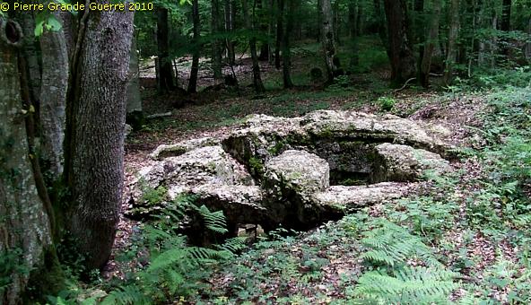
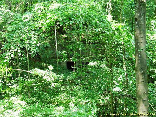
... a German observation bunker,...
... with it's top blown off.
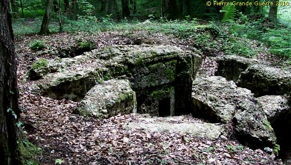
We cross the road and in the wood we detect traces of trenches.
On the southern side of the road, a machine-gun bunker.

We are here only a few hundred meters away from the Swiss border.

The fire openings facing westward across the Largue.

... connected to another machine-gun bunker.
A look inside.
The three fire windows, south-. west-, and northward.
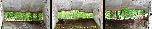
The same bunker, on the outside, facing the west.

On the next photo page we explore another site in the Sundgau: the Bunker Path of Burnhaupt-le-Bas .