YPRES SALIENT - Shrewsbury Forest - Zandvoorde Bunker

  • by Pierre Grande Guerre
  • 15 Mar, 2019

Years of visit: 2005, 2006, 2016

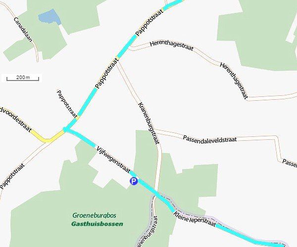
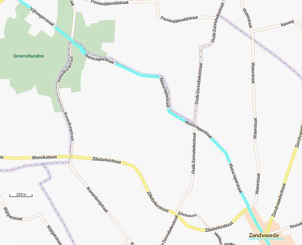
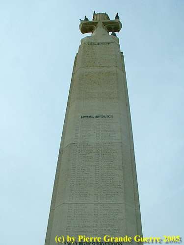
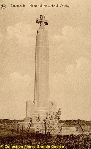
This trip starts south-west of Ypres at the N8, the Menin Road, at Clapham Junction. From Clapham Junction we go southward via the Pappotstraat. We turn left at the Vijfwegenstraat to visit the relics of German bunkers in the Shrewsbury Forest; in Flemish, the Gasthuisbossen or the Groeneburgbos. From there we continue our trip to Zandvoorde. South of the village we will visit first the Memorial for the 1st and 2nd Life Guards and Royal Horse Guards. Next we will visit the German Command Post Bunker of Zandvoorde.

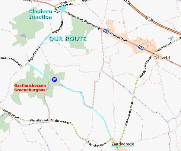
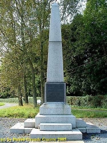
Coming from the direction of Ypres we turn right at the Memorial for the 18th Division at Clapham Junction. Later, in the next photo impression, we will inspect more closely both memorials of Clapham Junction.

For now we continue southward on the Pappotstraat.

A panorama photo from "Mount Sorrel" in the direction of Hill 62 and the Shrewsbury Forest, right on the horizon.
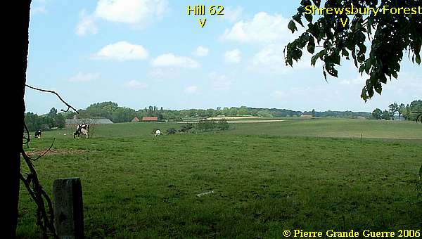
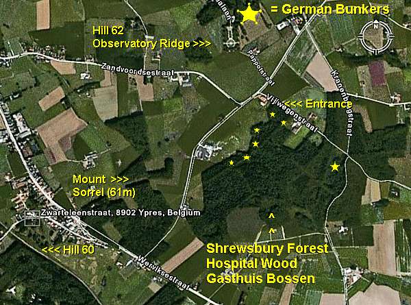
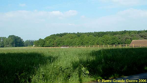
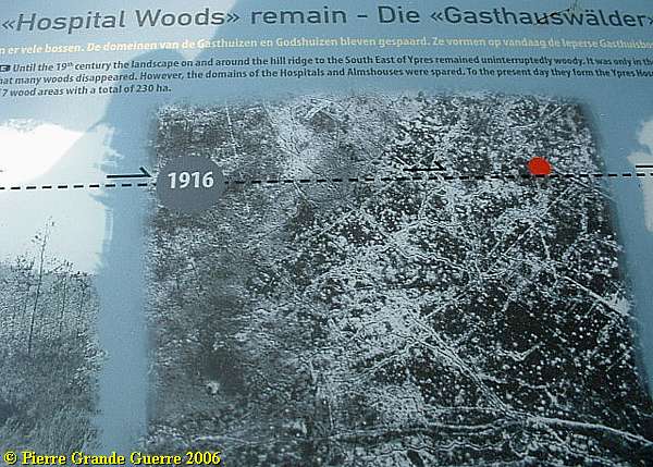
In May 2006 we tried twice to locate some relics of German bunkers in the dense wood of Shrewsbury Forest, nowadays the "Gasthuisbossen" or "Hospital Woods".
Three Trench Map Details of Shrewsbury Forest
This area has been in the eye of the storm during all 4 war years.
As this British trench map of 31 August 1916 shows, ...
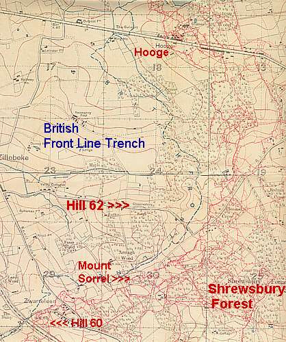
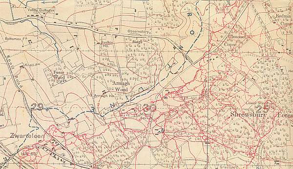
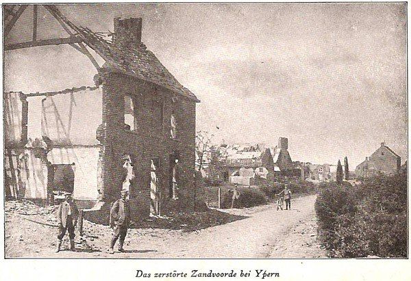
... the Germans had created in this sector of the Ypres Salient, a huge network with barbed wire networks, a maze of trenches, tunnels and dug-outs.
An information panel at the northern entrance of the "Hospital Woods" shows a period aerial photograph of the wood of 1916: zigzagging trenches and many shell holes.
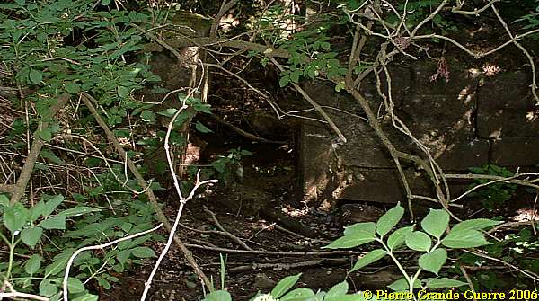
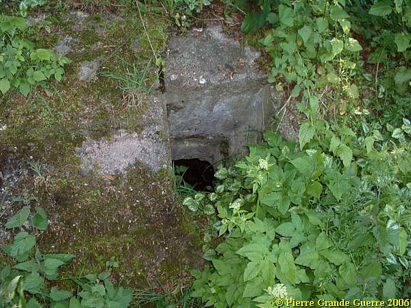
At first we were able to locate only some lumps of unnatural concrete, ....
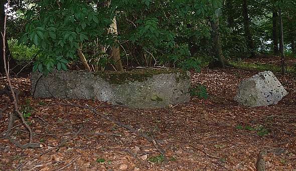
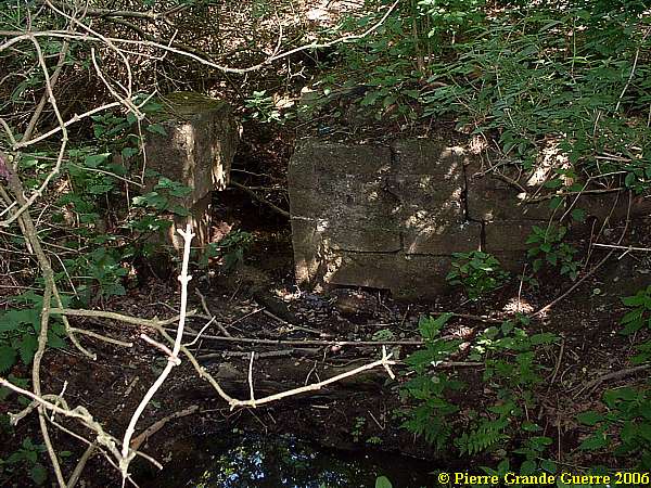
... and then, along the western edge, the foundations of a concrete shelter bunker.
After the war most of these bunkers were blown during clearing operations. 
So, we can only detect the concrete foundation. I try to point out to you the length of this former bunker.
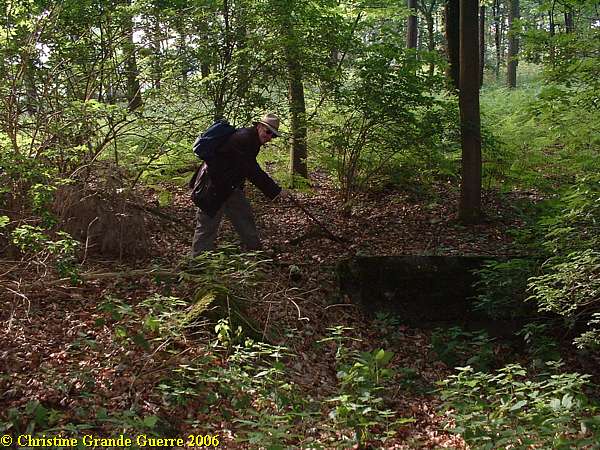
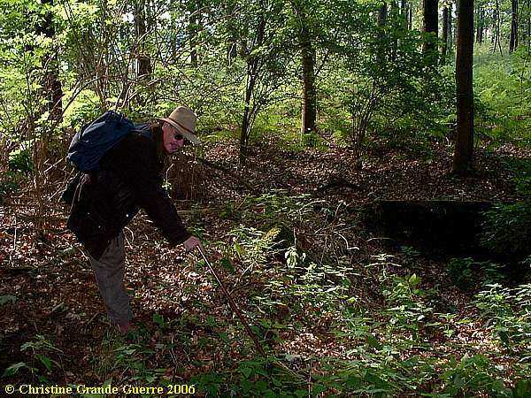
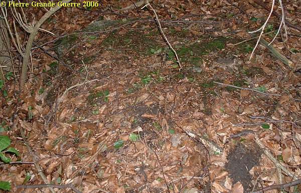
Because of the density of the vegetation and the rough swampy soil, we asked for our second visit the help of a local man with knowledge concerning the war period and the area. Our local guide, who prefers to stay anonymous, showed us some more bunkers.
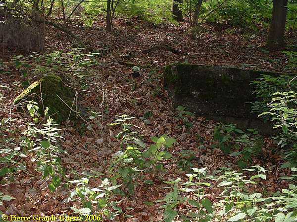
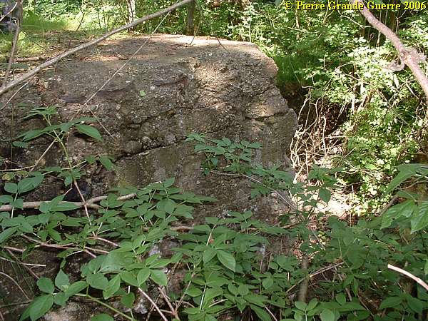
More southward, on the western edge of the forest, an overgrown bunker with its base in a pool of mud.
My wife Chris ( +08-05-2018) made this picture of me in front of another sunken German bunker.
In my hand I try to show you some of the deformed shell fragments, I found scattered on the soil around the bunker.
The same bunker without me. The spot was also too swampy, too overgrown,  and too dangerous to get another picture.
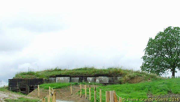
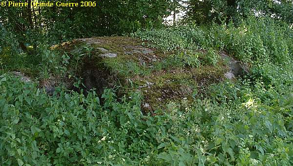
On the eastern edge of the wood our guide showed us this bunker, still rather undamaged.
We leave the Shrewsbury Forest for our next exploration at Zandvoorde.
From Shrewsbury Forest we continue south-eastward via the Kleine Ieperstraat to Zandvoorde.
Just south of the village in the Komenstraat we stop on the right, west side of the road at a green sign, "The Household Cavalry Monument". On foot we follow a track westward, at first between the house and gardens,
to visit the Memorial for the fallen of the Cavalry Regiments,  the 1st and 2nd Life Guards and the Royal Horse Guards
Postcard from 1924
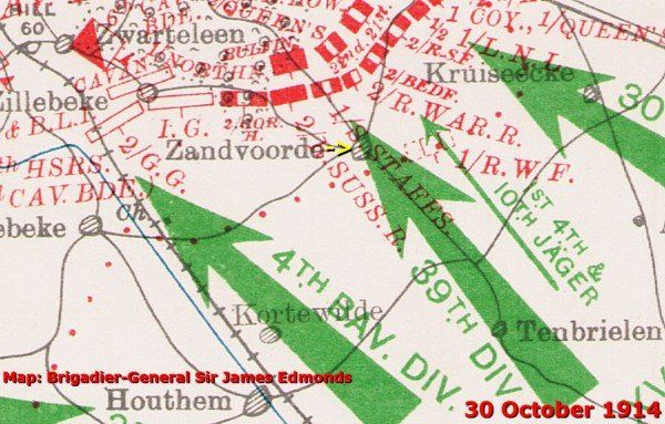
The Battle of Gheluvelt - 28-31 October 1914
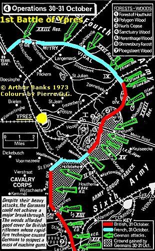
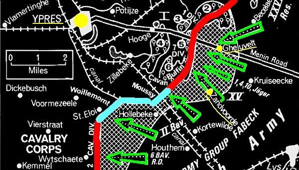
During the last three weeks of mobile warfare of the First Battle of Ypres, there were fought many sub-battles, which would create finally the salient.
The area of Zandvoorde was involved in such a sub-battle, the Battle of Gheluvelt, of 28-31 October 1914 (modern Flemish: Geluveld).
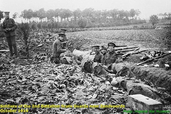
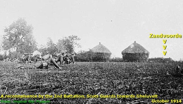
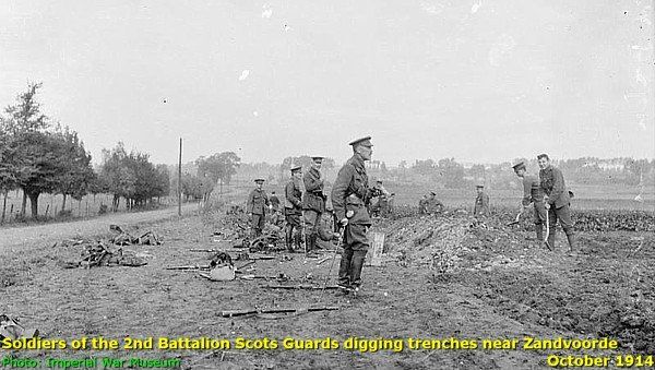
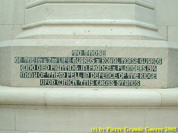
The Household Cavalry - 30-31 October 1914
During the Battle of Gheluvelt the Royal Horse Guards Regiment was operating on 30 October in the zone around the village of Zandvoorde, when troops of the German 39th Division of the Army Group Fabeck attacked.
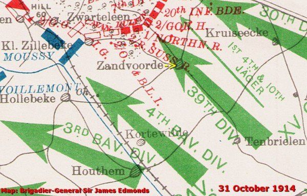
On 31 October the composite Regiment, the 1st and 2nd Life Guards, resisted another attack. Although initially the attacks were repulsed, the British were pushed out of Zandvoorde.
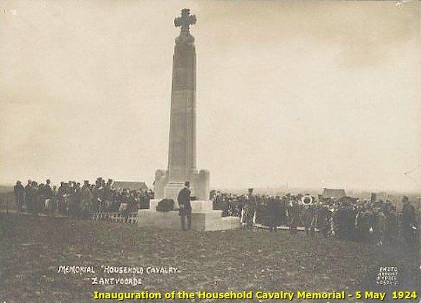
Nowadays the blue tunics of the Royal Horse Guards and the red tunics of the Life Guards are best known for their ceremonial duties in London. 
We return to our car and we continue some 400 m. southward  to the corner of the Komenstraat and the Gaverstraat. 
"The destroyed Zandvoorde near Ypres"
Lieutenant Spikey, our trench dog, leads the way to ...
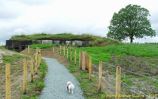
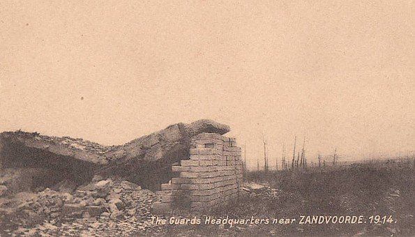
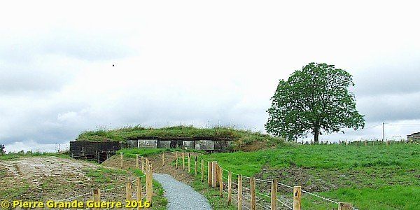
... this 1916 German Command Post Bunker.

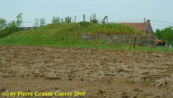
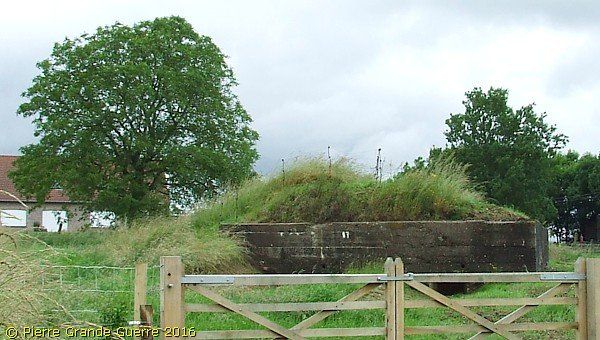
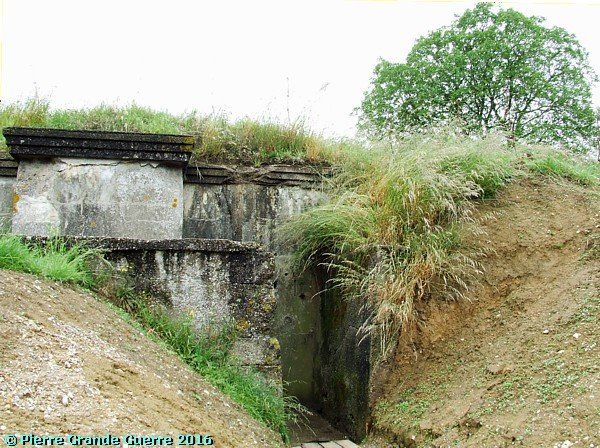
In 2005 we visited this bunker also. We were walking in a bumpy meadow amidst cows. In 2014 the Belgian authorities renovated the site; but to my eyes the site is now too clean.

The west and blind side of the bunker in 2005.

The south side of the bunker in June 2016.

Zandvoorde - 22 December 1917

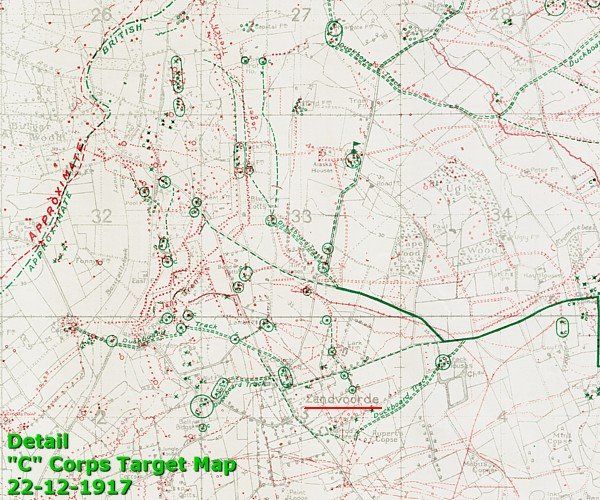
These two details of a British trench map, drawn after the Third Battle of Ypres, show approximately the same area.

The second detail of the trench map below shows the area south of the village of Zandvoorde.

To help you to compare the second trench map detail with the situation today I repeat the satellite photo of 2016. Notice on the right the diagonal, north-south road of the Komenstraat.

Back to the bunker itself, and let us inspect it again in more detail.  

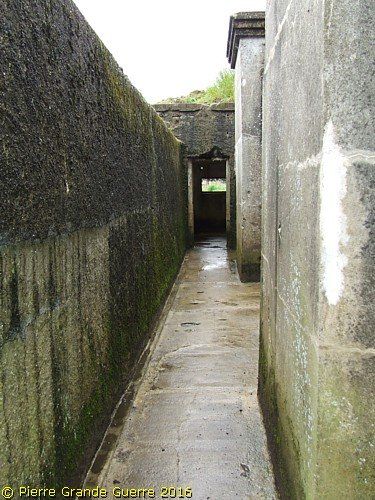
The left or the southern entrance of the bunker.

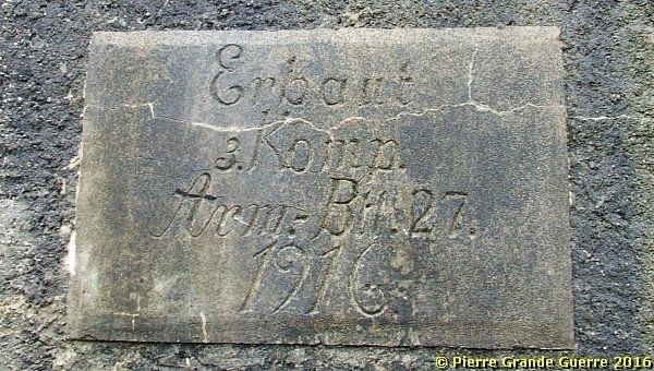
On the left side there is still an inscription on the concrete wall, mentioning the name of the construction company:

 “Built by 3 Company “Armierungs” Batallion 27 - 1916".

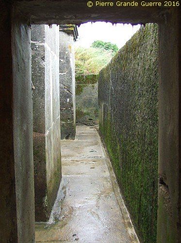
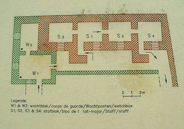
I enter the bunker via Guard Block 1, and to my right I see a concrete breastwork corridor, with entrance to 4 other rooms.

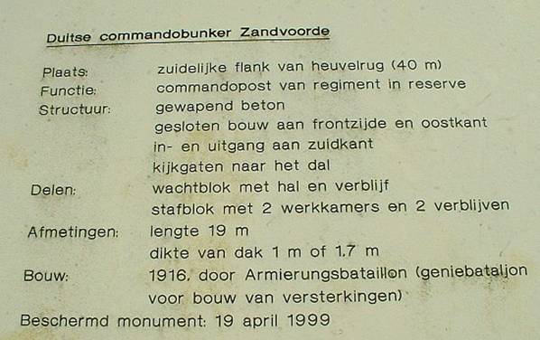
Before I continue with showing the interior of the bunker I show my 2005 photos of the most informative panels, which the authorities decided to remove, alas.

Translation from Dutch:

"German Command Post Bunker Zandvoorde

Location: southern flank of ridge (40 m.)

Function: Reserve Regimental Command Post

Structure: armoured concrete, closed wall front side, east side entrance, exit south side, peepholes in the direction of the valley.

Rooms: guard block with hall and room. Staff accommodation, 2 offices, 2 rooms

Size: length 19 m.

Roof: 1 m. to 1.7 m. thick concrete

Built: 1916 by “Armierungsbataillon” (fortification engineers)

Protected monument 19 April 1999.”

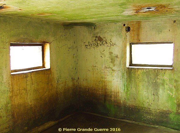
The interior; Guard Block 1, the only room with two windows.
Inside: the four identical staff rooms were connected to each other, in those times separated with doors.  
The interior of a German Command Post Bunker
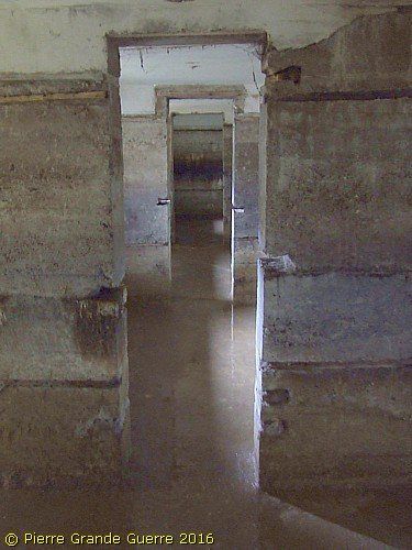
The outside corridor. View from north to south.
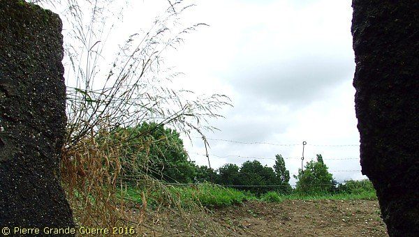
View from the northern exit. The pig-tail barbed wire poles, just around and on the bunker, are original ones.  
The northern exit.
A last view at the Zandvoorde German Command Post Bunker.

We return to Clapham Junction for an inspection of the two memorials there, to continue next to explore the northern side of the Menin Road and Polygon Wood.

 Continue to the next chapter: "Polygon Wood - Zonnebeke"

by Pierre Grande Guerre 29 Nov, 2019
by Pierre Grande Guerre 14 Nov, 2019

Inleiding: Franz Von Papen & Werner Horn; schaker en pion

Onlangs stuitte ik in een oud boek (1) van 1919 op een opmerkelijk verhaal over een Duitse Luitenant, die in begin februari 1915 een half geslaagde bomaanslag pleegt op een spoorbrug over een grensrivier tussen de Verenigde Staten en Canada. Ook al staat de bekentenis van de dader, Werner Horn, deels in het boek te lezen, de naam van zijn opdrachtgever zal Horn blijven verzwijgen. Na wat verder zoeken vond ik ook de naam van Horn’s opdrachtgever, Franz von Papen, een van de aangeklaagden van het latere Neurenberg Proces in 1946.

In een Grote Oorlog als de Eerste Wereldoorlog  is Horn’s aanslag op de brug uiteraard slechts een bescheiden wapenfeit. Toch vermoed ik dat dit relatief onbekende verhaal, dat de geschiedenis is ingegaan als de “ Vanceboro International Bridge Bombing ”, nog interessante kanten kent. Het is onder andere een spionageverhaal over hoe in een groter plan een sluwe schaker zijn naïeve pion offert.  

Beknopte situatieschets Canada en de Verenigde Staten in 1915

by Pierre Grande Guerre 01 Oct, 2019

This trip we start at the Léomont near Vitrimont and we will with some exceptions concentrate on the Battle of Lorraine of August-September 1914 in the area, called, the “Trouée de Charmes”, the Gap of Charmes.

After the Léomont battlefield we continue our explorations to Friscati hill and its Nécropole Nationale. Next we pay a visit to the battlefield of la Tombe to go on to the Château de Lunéville. There we cross the Vezouze to move on southward to the Bayon Nécropole Nationale. At Bayon we cross the Moselle to pass Charmes for the panorama over the battlefield from the Haut du Mont. North-west of Charmes we will visit the British Military Cemetery containing 1918 war victims. From Charmes we go northward to the battlefield of the First French Victory of the Great War, the Battle of Rozelieures of 25 August 1914. North of Rozelieures we will visit the village of Gerbéviller. From there we make a jump northward to visit the ruins of Fort de Manonviller to finish with an interesting French Dressing Station bunker, west of Domjevin.

by Pierre Grande Guerre 18 Sept, 2019
Though we depart from Badonviller in the Northern Vosges , we make a jump northward to the east of Lunéville and Manonviller. We start at Avricourt on the border of Alsace and Lorraine. From the Avricourt Deutscher Soldatenfriedhof we explore the southern Lorraine battlefields ; the mine craters of Leintrey , the Franco- German war cemetery and Côte 303 at Reillon , and some German bunkers near Gondrexon , Montreux , and Parux.
by Pierre Grande Guerre 13 Sept, 2019
We depart from Raon-l’Etape to drive northward via Badonviller to Montreux to visit the  "Circuit du Front Allemand 14-18", the  Montreux German Front Walk 14-18,  with its trenches , breastworks , and at least twenty bunkers.
by Pierre Grande Guerre 08 Sept, 2019
North-east of Nancy, east of Pont-à-Mousson, and south-east of Metz we visit the battlefields of the Battle of Morhange of 14 until 20 August 1914. We follow mainly topographically the route of the French advance eastward over the Franco-German border of 1871-1918.
During this visit, we try to focus on the day that the momentum of the battle switched from the French side to the advantage of the Bavarian side: the day of 20 August 1914, when the Bavarians rapidly re-conquered the territory around Morhange , being also the day of the start of their rather successful “Schlacht in Lothringen”.
We will visit beautiful landscapes of the "Parc Naturel Régional de Lorraine", memorials, ossuaries, and cemeteries. Sometimes we will divert to other periods of the Great War, honouring Russian and Romanian soldiers, who died in this sector. We start our route at the border village of Manhoué, and via Frémery, Oron, Chicourt, Morhange, Riche, Conthil, Lidrezing, Dieuze, Vergaville, Bidestroff, Cutting, Bisping we will finish in Nomeny and Mailly-sur-Seille, where the Germans halted their advance on 20 August 1914, and where they constructed from 1915 some interesting bunkers.
by Pierre Grande Guerre 05 Sept, 2019
South of Manhoué we start this trip at Lanfroicourt along the French side of the Franco-German 1871-1918 border, marked by the meandering Seille river. We visit some French bunkers  in Lanfroicourt, near Array-et-Han and in Moivrons. From there we go northward to the outskirts of Nomeny and the hamlet of Brionne to visit the ( second ) memorial, commemorating the events in Nomeny of 20 August 1914. We continue westward to finish at the Monument du Grand Couronné at the Côte de Géneviève, a former French artillery base, which offers several panoramic views over the battlefield.
by Pierre Grande Guerre 28 Aug, 2019
North of Pont-à-Mousson and south of Metz, we explore the relics of German bunkers and fortifications along the Franco-German 1871-1918 border. We start at Bouxières-sous-Froidmont to visit the nearby height of the Froidmont on the front line. This time we will show only a part of the Froidmont, focusing on its military significance.  From the Froidmont we continue via Longeville-lès-Cheminot and Sillegny to the “Forêt Domaniale de Sillegny” to explore some artillery ammunition bunkers. Next we continue to Marieulles for its three interesting bunkers and to Vezon for its line of ammunition depot bunkers. From Vezon we continue to the “Deutscher Kriegsgräberstätte Fey – Buch”. From Fey we go eastward, passing 6 bunkers near Coin-lès-Cuvry to finish our trip at the top construction of the “Feste Wagner” or “Fort Verny”, north of Verny.
by Pierre Grande Guerre 25 Aug, 2019

From Badonviller or the Col du Donon we continue north-eastward for a visit to an extraordinarily well restored sample of German fortifications:  the Feste Kaiser Wilhelm II, or Fort de Mutzig,  lying on a height, some 8 km. away from the 1871-1918 Franco-German Border.

by Pierre Grande Guerre 23 Aug, 2019
We concentrate on the German side of the front around "Markirch", Sainte Marie-aux-Mines, the so-called "Leber" front sector . We first pay a visit to the Sainte-Marie-aux-Mines Deutscher Soldatenfriedhof, and next to the southern side of the Col de Ste. Marie for the many interesting bunkers of the German positions at the Bernhardstein, at the north-eastern slopes of the Tête du Violu. On the next photo page about the Haut de Faîte we will continue with a visit to the northern side of the pass and the "Leber" sector.
More posts
Share by: