
ARGONNE - Butte de Vauquois
Year of visit: 2005
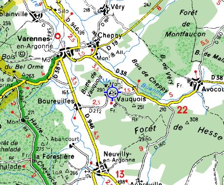
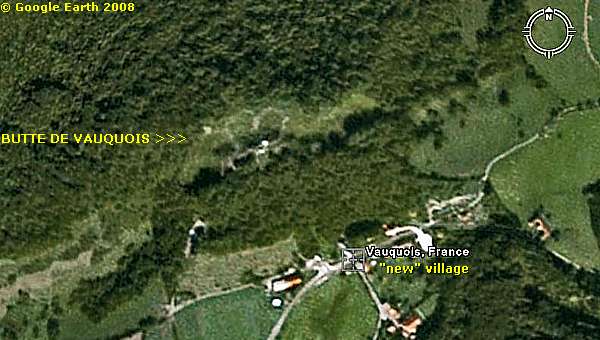
Via Varennes we return to the D 38, to the "Butte de Vauquois", ( Vauquois Hill ), where the front crossed the centre of the former village of Vauquois. Mine warfare destroyed the village and the craters formed a new No Man's Land.
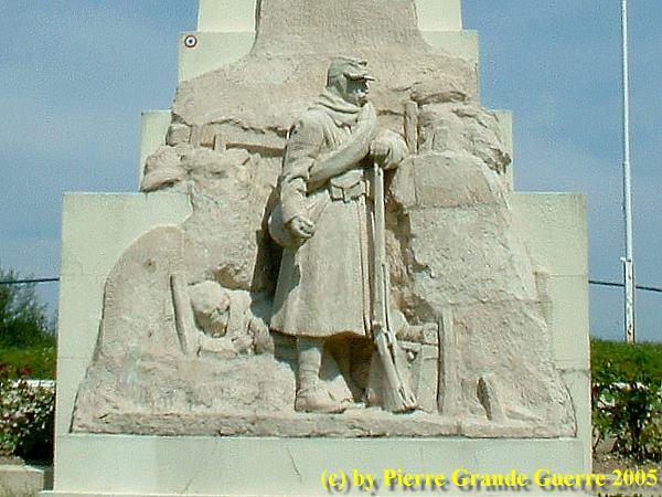
We start at the rebuild village of Vauquois, south and below the former village. This memorial tells us:
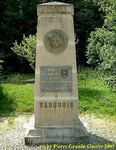
Opposite this monument is the foot of the Butte de Vauquois.
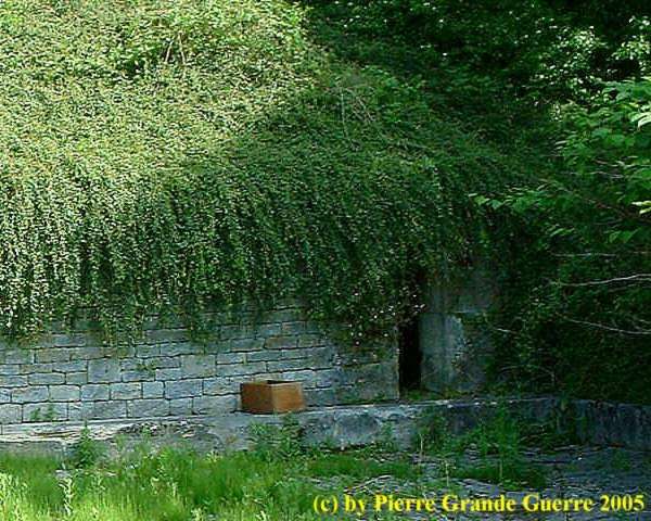
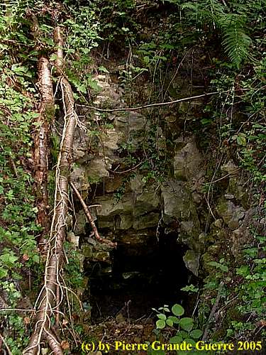
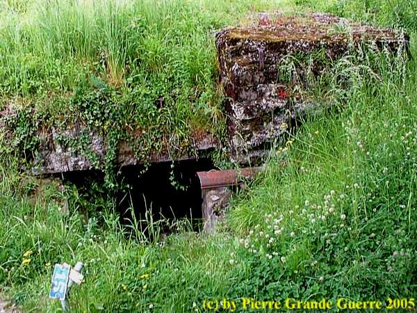
Under the vegetation one can still see the entrances to an underground tunnel system of the French.
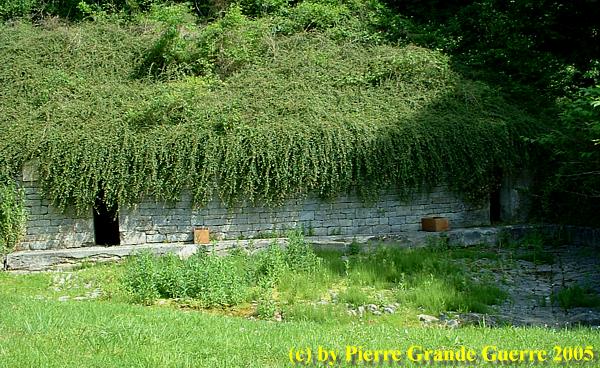
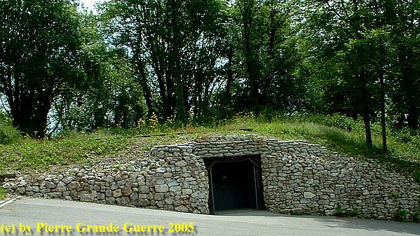
Another French dug-out, dug out in a slope of the hill. Nowadays the dug-out houses a Visitor's Centre, and an informative exposition with period photographs, and battlefield findings of the location.
The French troops used 60 cm mini railways (the Decauville system) to transport ammunition, explosives, and supplies inside the hill. Both belligerent parties carved out caves in the hill to house a military population of about 2.000 men; 800 French troops (150 of them engineers), and on the German side of the underground hill lived and fought 1,200 Germans (with 150 Engineers) .

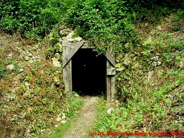
This is one of the tunnel entrances. The height of the corridor is about only 1,5m.
We follow the path upward the hill via the French lines. We pass some elephant shelter boards.
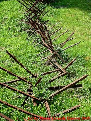
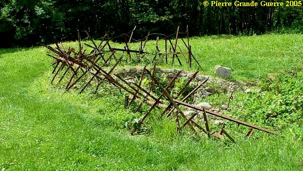
Rusted iron entanglements for barbed wire, also called Friesian Horses.
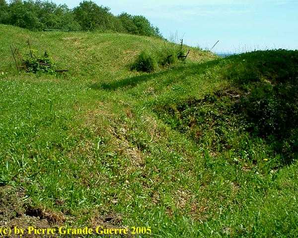
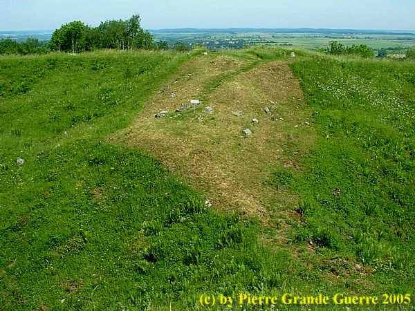
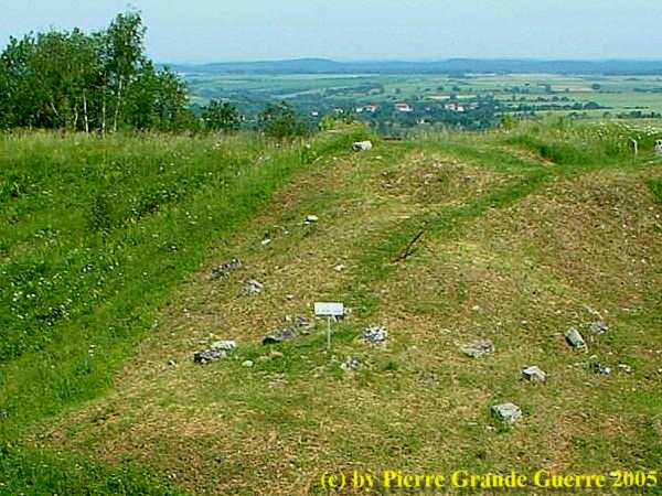
The first French trench line was on the southern side of the top of what used to be the summit of the Vauquois hill.

These ditches used to be the trenches. Notice the barbed wire.
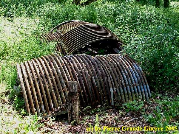
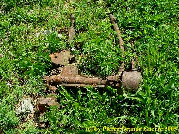
Un unidentifiable steel war relic lies around on the ground.
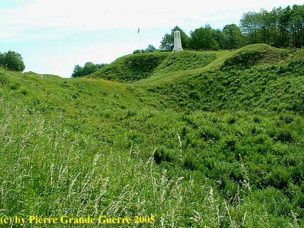
The Memorial for the soldiers and the dead of Vauquois marks the extreme position of the French in February and March 1915.
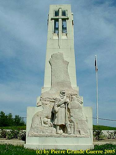
The memorial marks also the location of the former main street of the "old" village of Vauquois.
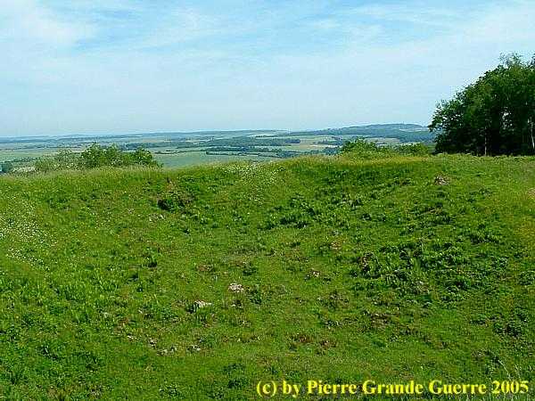
The hill had been blown up by mine warfare. Four large mine craters is all that's left of the "old" village of Vauquois.
The Memorial oversees the 2 eastern craters. The crater lip between the two easten craters. The central one was caused after a German mine explosion of 60 tons of explosives at 14 May 1916.
The white sign marks the former location of the village church.
The most eastern crater, caused by a German mine explosion on 27 February 1917.
Remains of a French sap with barbed wire entanglements.
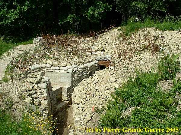
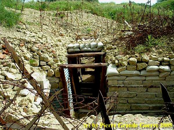
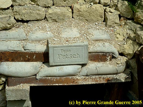
We walk around the lip of the central western crater. On the north side of the crater lip the Germans created their own system of trenches: " Stronghold Petsch ".
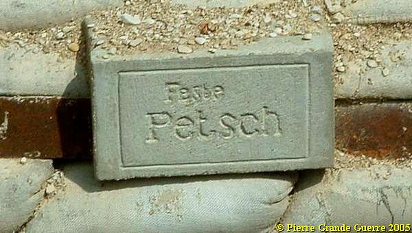
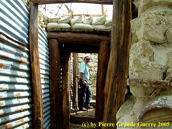
A most carefully restored trench of "Feste Petsch".
Notice the steel curly pig tail shaped poles for barbed wire.
Of course I could not resist to enter the trench.
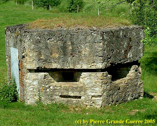
A steel armoured plate with a loop hole for a sniper.
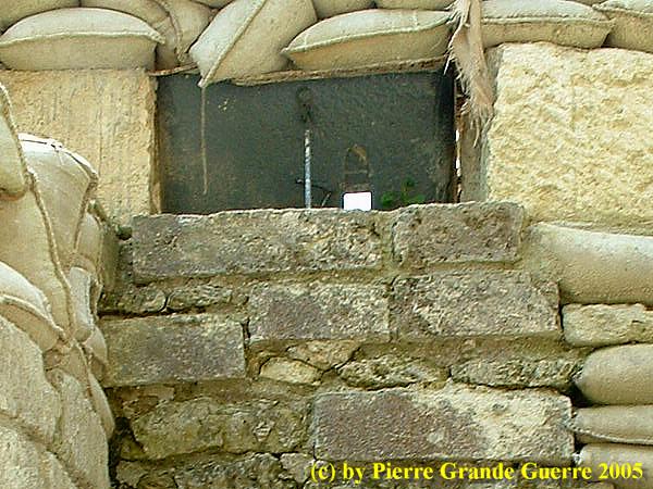
Same spot with the fire step for the sniper.
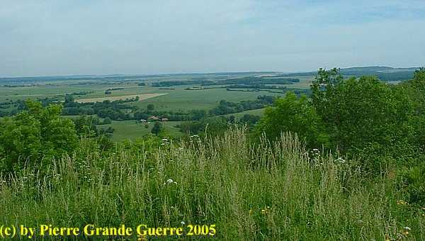
A view of the landscape northward from the "German" side of the crater lip.
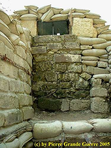
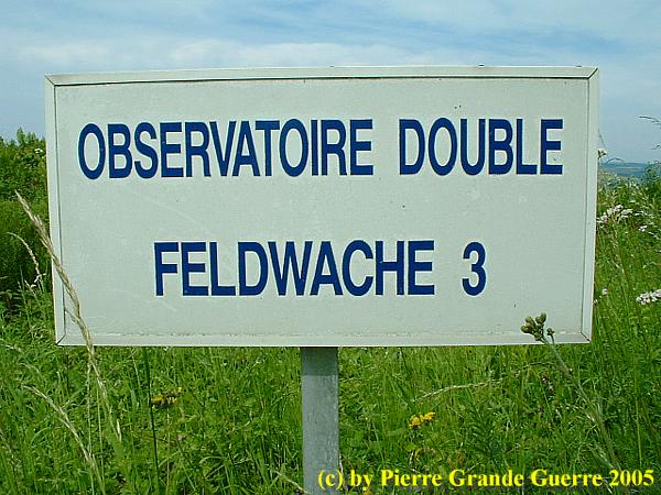
On this spot the Germans had a double observation post.
Relics of the left observation post overseeing the western craters.
Remains of the right observation post overseeing the eastern craters.
A last view from the German trenches at the western crater, over the mine craters to the French Memorial for the soldiers and the dead of Vauquois.
Continue to: " Haute Chevauchée "


